Center for Brooklyn History
Map Collections
Search
About
Othmer Library & Archives
Submit search query
Refine 7 records
Clear filters
3
Location
Fairfield County (Conn.)
5
Long Island (N.Y.)
197
Nassau County (N.Y.)
24
New York (State)
95
Queens (New York, N.Y.)
83
Suffolk County (N.Y.)
43
Westchester County (N.Y.)
11
Subject
Date
20th Century
469
or enter range:
from
to
Genres
Bathymetric maps
94
Topographic maps
70
Sort by:
Date (earliest)
Date (most recent)
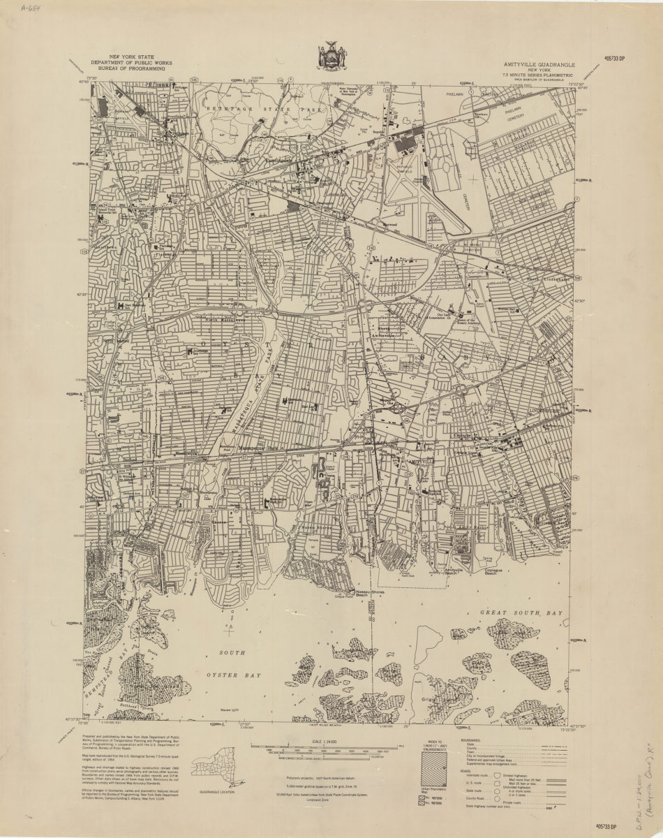
Amityville quadrangle, New York
Amityville quadrangle, New York
[1966]
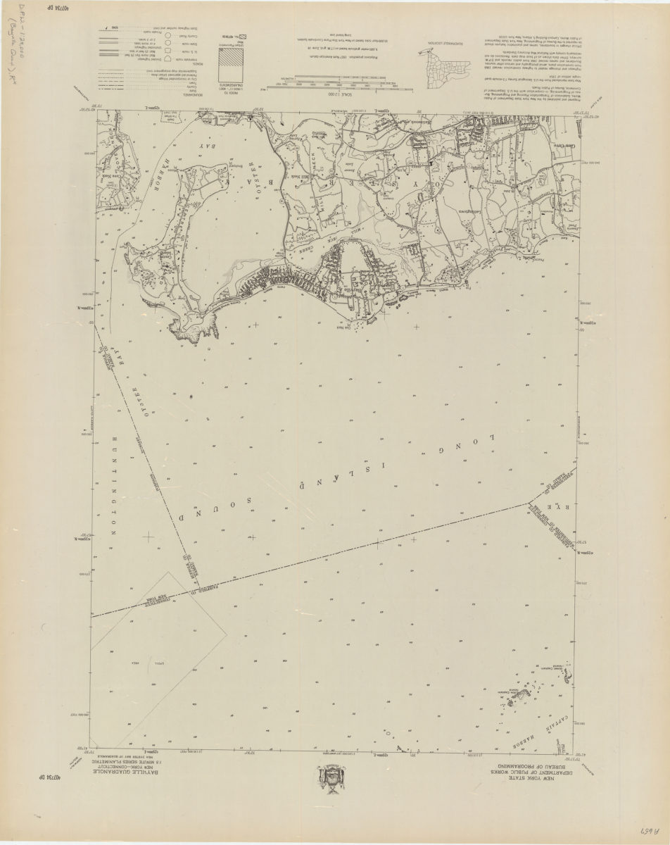
Bayville quadrangle, New York–Connecticut
Bayville quadrangle, New York–Connecticut
[1966]
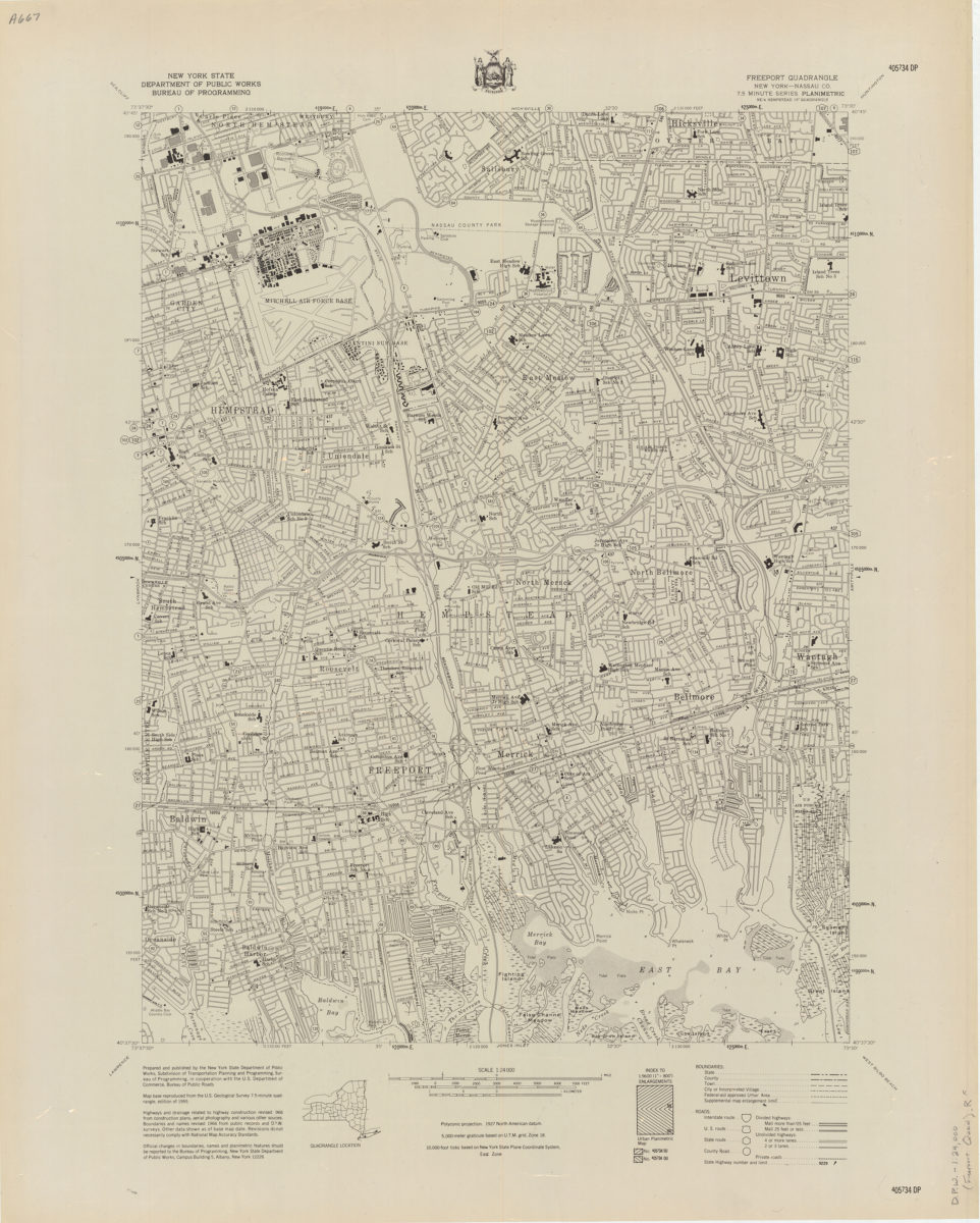
Freeport quadrangle, New York–Nassau Co
Freeport quadrangle, New York–Nassau Co
[1966]
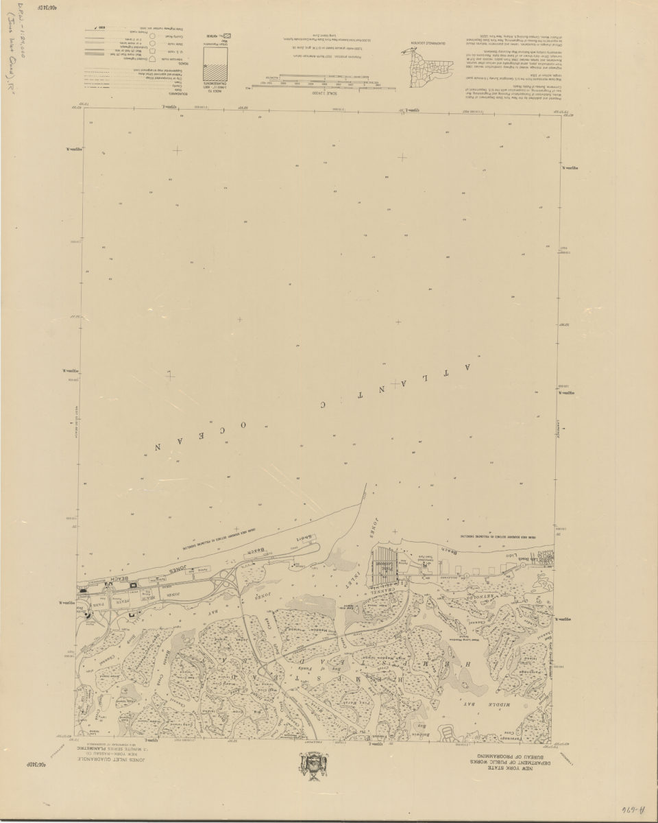
Jones Inlet quadrangle, New York–Nassau Co
Jones Inlet quadrangle, New York–Nassau Co
[1966]
Lawrence quadrangle, New York
Lawrence quadrangle, New York
[1966]
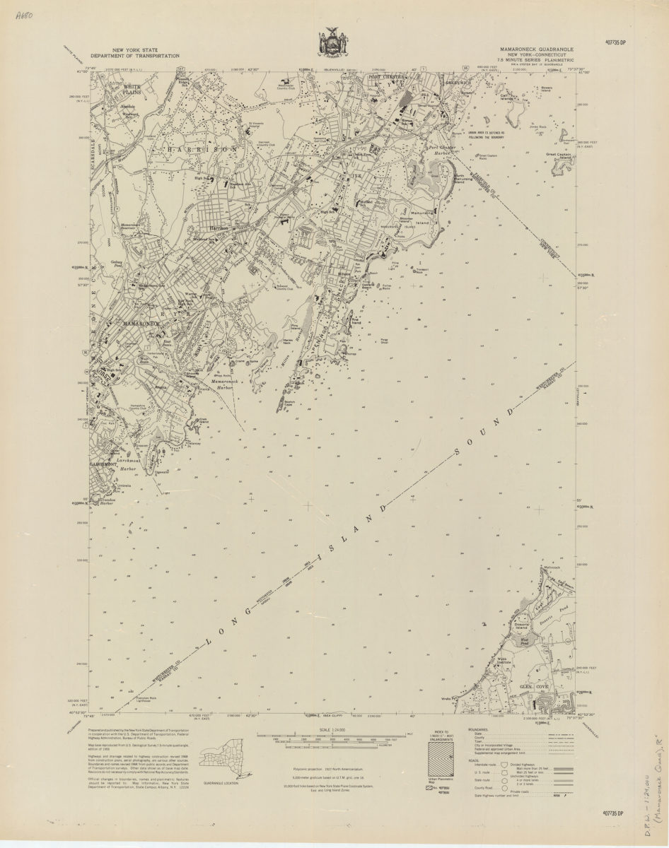
Mamaroneck quadrangle, New York–Connecticut
Mamaroneck quadrangle, New York–Connecticut
[1968]
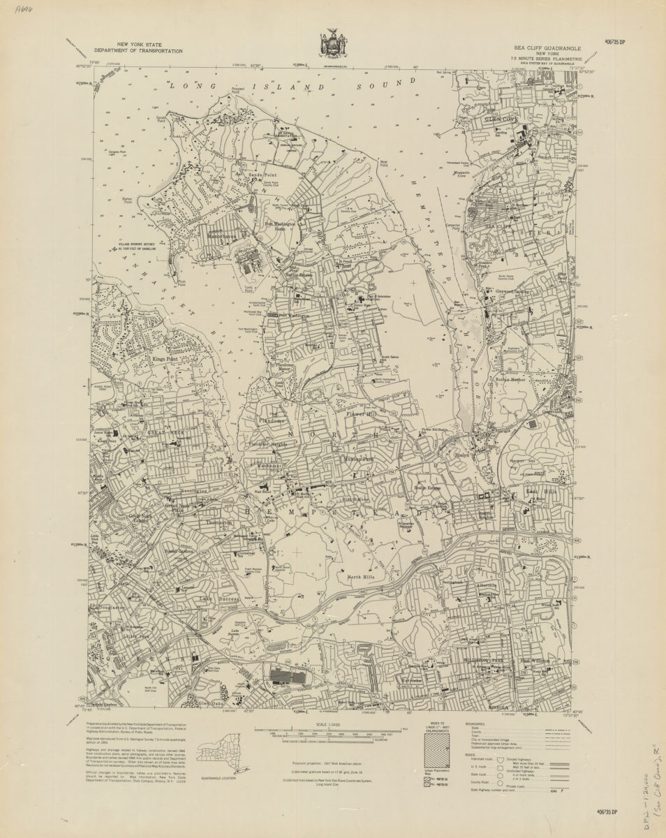
Sea Cliff quadrangle, New York
Sea Cliff quadrangle, New York
[1968]