Center for Brooklyn History
Map Collections
Search
About
Othmer Library & Archives
Submit search query
Refine 4 records
Clear filters
2
Location
Manhattan (New York, N.Y.)
120
New York (N.Y.)
164
Subject
Buildings
12
Landforms
15
Ponds
6
Rivers
16
Wetlands
6
Date
19th Century
945
20th Century
469
or enter range:
from
to
Genres
Bathymetric maps
94
Early maps
35
Pictorial maps
38
Sort by:
Date (earliest)
Date (most recent)
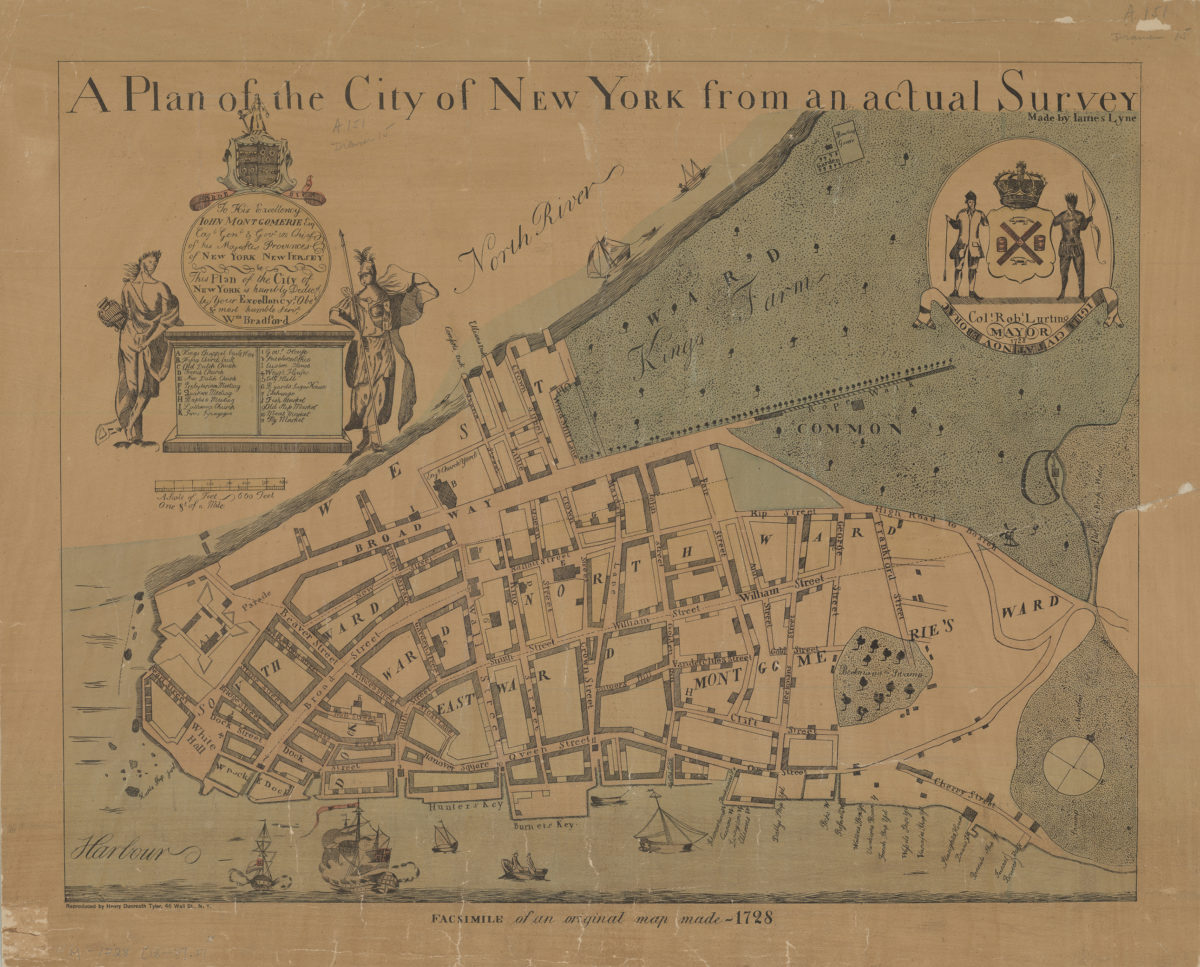
A plan of the city of New York from an actual survey: made by Iames [i.e. James] Lyne
A plan of the city of New York from an actual survey: made by Iames [i.e. James] Lyne
[18??]
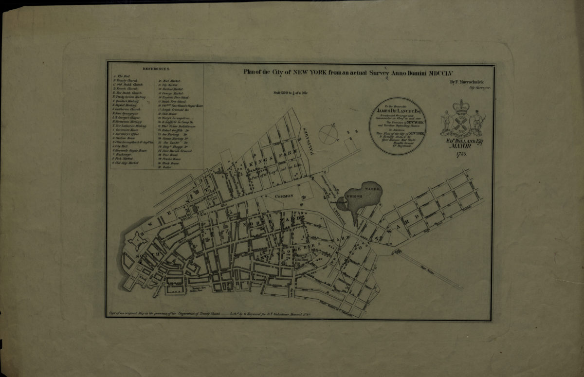
Plan of the city of New York, from an actual survey, anno domini MDCCLV: by F. Maerschalck
Plan of the city of New York, from an actual survey, anno domini MDCCLV: by F. Maerschalck
[1849]
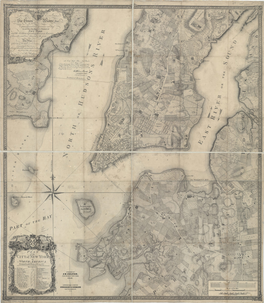
Plan of the city of New York in North America: surveyed in the years 1766 & 1767: B. Ratzer ; Thos. Kitchin sculpt
Plan of the city of New York in North America: surveyed in the years 1766 & 1767: B. Ratzer ; Thos. Kitchin sculpt
1853
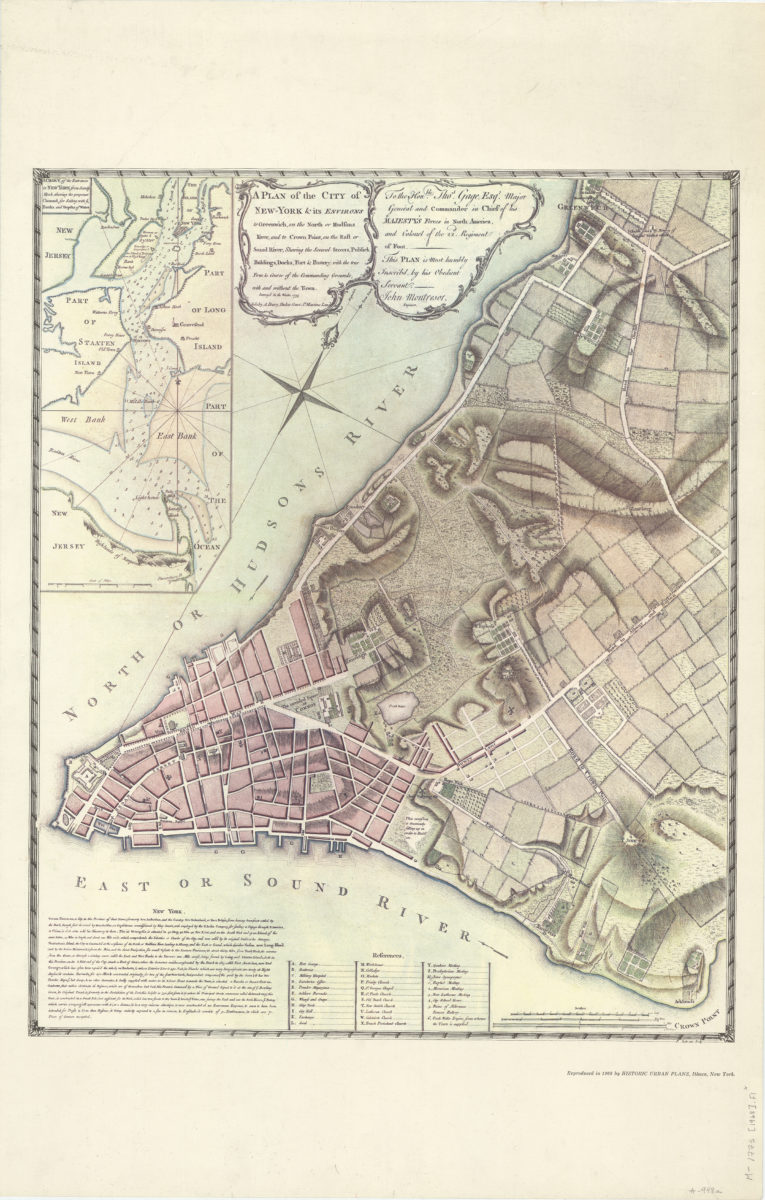
A plan of the city of New-York & its environs: to Greenwich, on the North or Hudsons River, and to Crown Point, on the East or Sound River, shewing [i.e. showing] the several streets, publick [i.e. public] buildings, docks, fort & battery
A plan of the city of New-York & its environs: to Greenwich, on the North or Hudsons River, and to Crown Point, on the East or Sound River, shewing [i.e. showing] the several streets, publick [i.e. public] buildings, docks, fort & battery
1968