Center for Brooklyn History
Map Collections
Search
About
Othmer Library & Archives
Submit search query
Refine 12 records
Clear filters
2
Location
Bronx (New York, N.Y.)
10
Brooklyn (New York, N.Y.)
891
Brooklyn Heights (New York, N.Y.)
76
Buffalo (N.Y.)
3
East River (N.Y.)
3
ferries
1
Long Island (N.Y.)
197
Manhattan (New York, N.Y.)
120
New York (N.Y.)
164
New York (State)
95
New York Metropolitan Area
40
Queens (New York, N.Y.)
83
Westchester County (N.Y.)
11
Subject
Bus lines
20
Bus travel
22
Central business districts
10
Ferry routes
3
Local transit
63
Postal codes
4
Railroads, Elevated
24
Roads
117
Street addresses
11
Street railroads
8
Subways
55
Date
19th Century
945
20th Century
469
21th Century
66
or enter range:
from
to
Genres
Pictorial maps
38
Road maps
83
Tourist maps
55
Transportation maps
120
Zoning maps
55
Sort by:
Date (earliest)
Date (most recent)
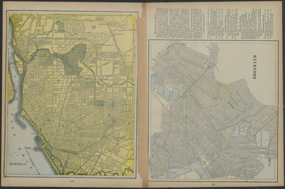
Map of New York and vicinity
Map of New York and vicinity
[1886-1894]
Map showing Brooklyn automobile routes and car lines approved by the Borough President, July 1919
Map showing Brooklyn automobile routes and car lines approved by the Borough President, July 1919
[1919]
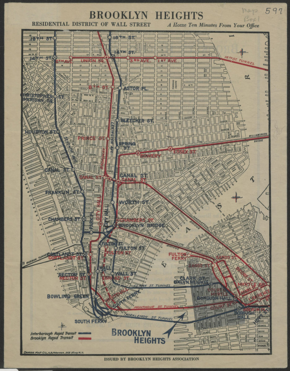
Brooklyn Heights, residential district of Wall Street: a home ten minutes from your office
Brooklyn Heights, residential district of Wall Street: a home ten minutes from your office
[1921]
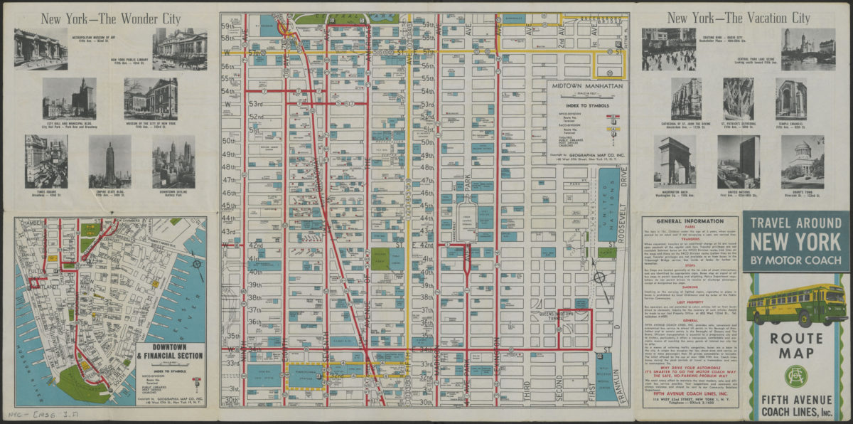
Travel around New York by motorcoach: route map, Fifth Avenue Coach Lines, Inc
Travel around New York by motorcoach: route map, Fifth Avenue Coach Lines, Inc
[1956-1962]
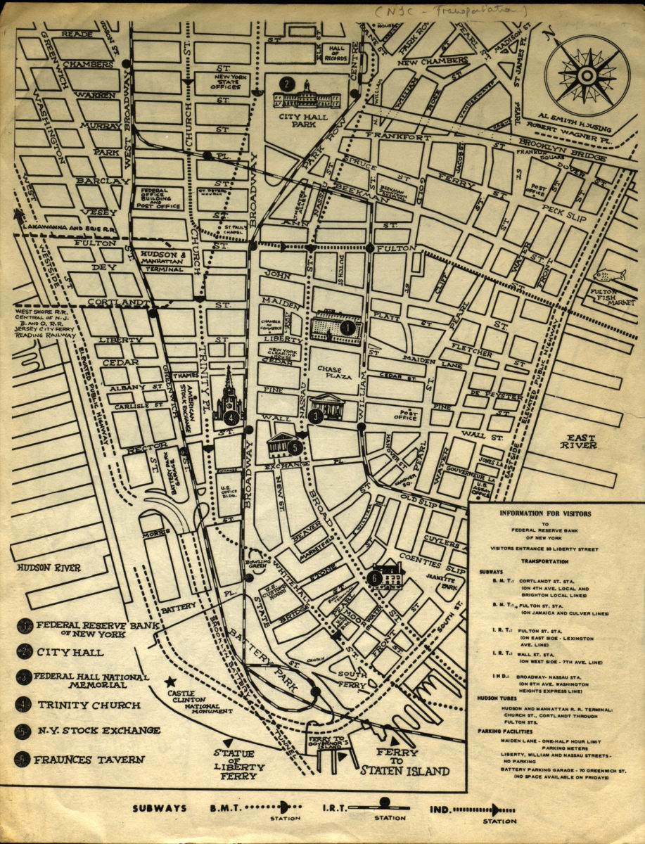
Information for visitors to Federal Reserve Bank of New York
Information for visitors to Federal Reserve Bank of New York
[1956-1966]
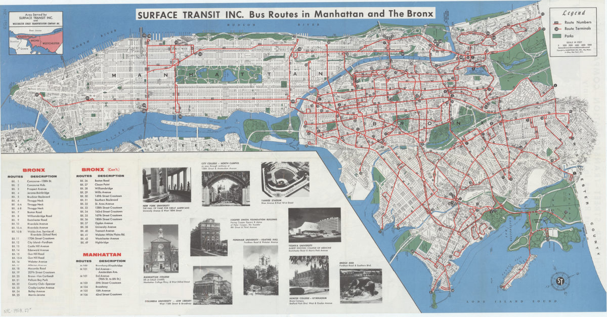
Travel around Manhattan, the Bronx New York City, and Westchester County, New York: route map : Service Transit Inc. and Westchester Street Transportation Company Inc
Travel around Manhattan, the Bronx New York City, and Westchester County, New York: route map : Service Transit Inc. and Westchester Street Transportation Company Inc
[1958]
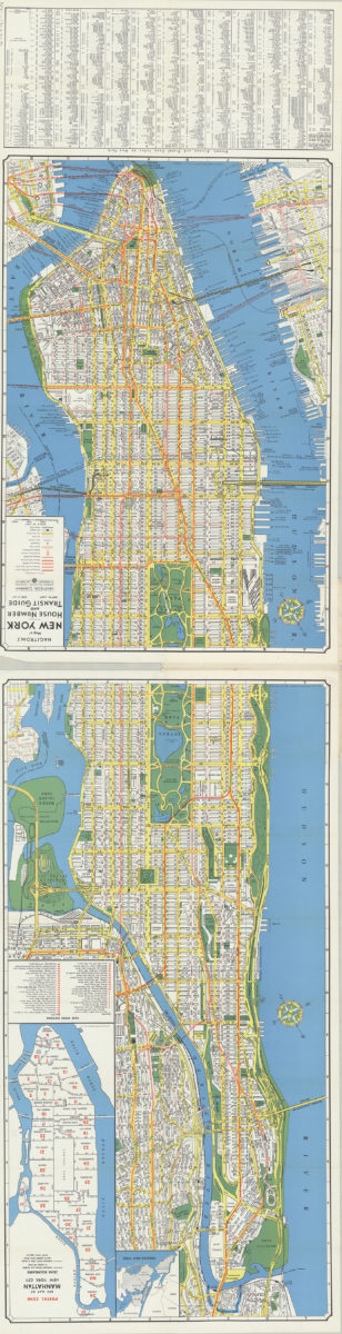
Hagstrom’s map of New York, house number and transit guide: compiled, printed and published by Hagstrom Company Incorporated
Hagstrom’s map of New York, house number and transit guide: compiled, printed and published by Hagstrom Company Incorporated
[1963]
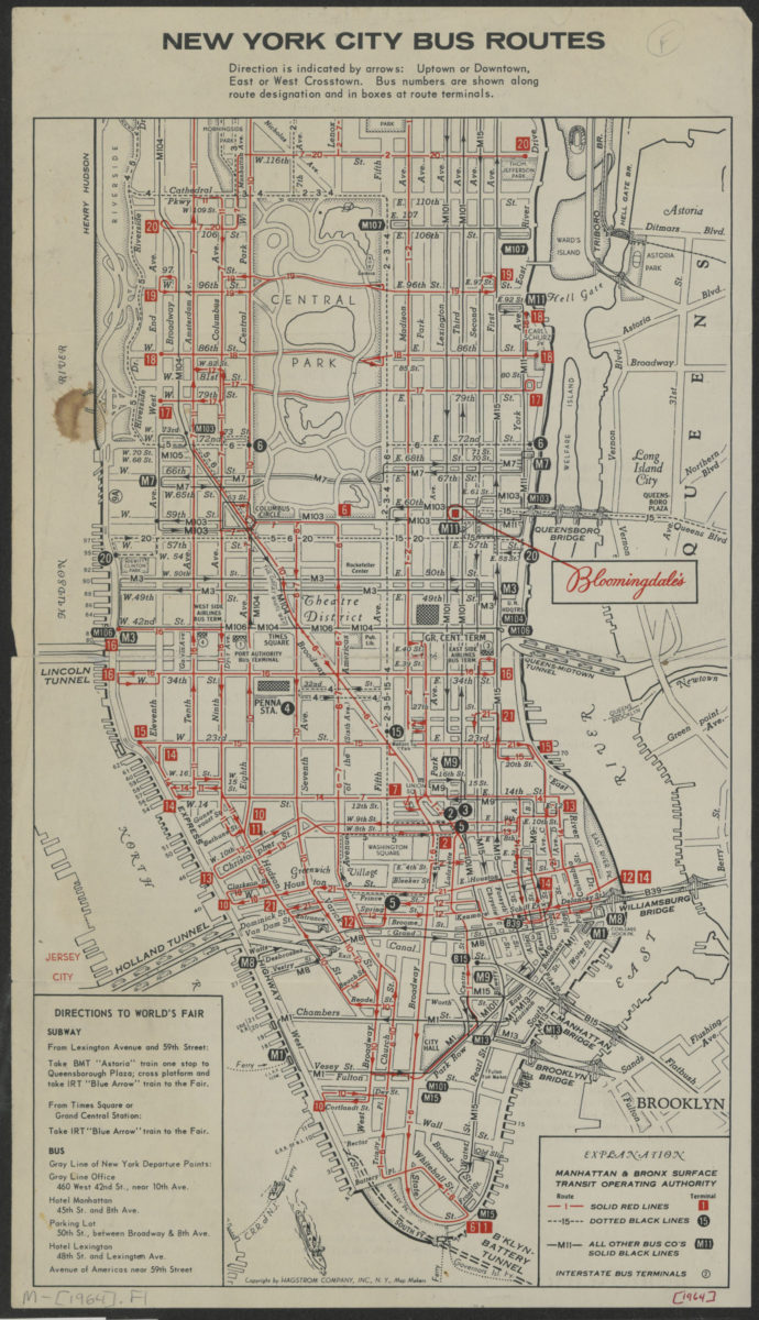
New York City bus routes
New York City bus routes
[1964]
Long Island, New York City & metro area counties: [prepared for] Texaco
Long Island, New York City & metro area counties: [prepared for] Texaco
1975
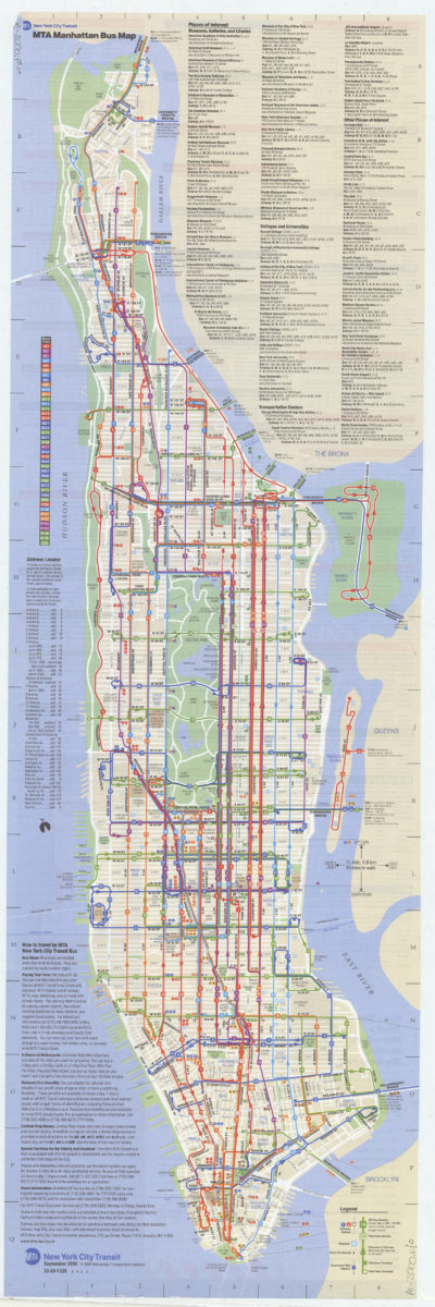
Manhattan bus map: September 2000, free: MTA New York City Transit
Manhattan bus map: September 2000, free: MTA New York City Transit
[ca. 2000]
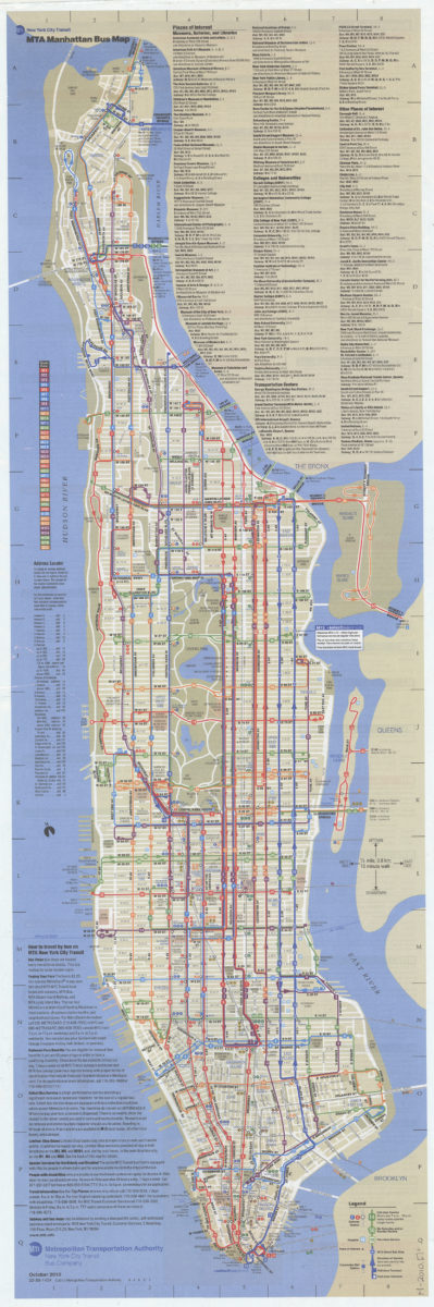
Manhattan bus map: October 2010: MTA
Manhattan bus map: October 2010: MTA
[2010; 2010]
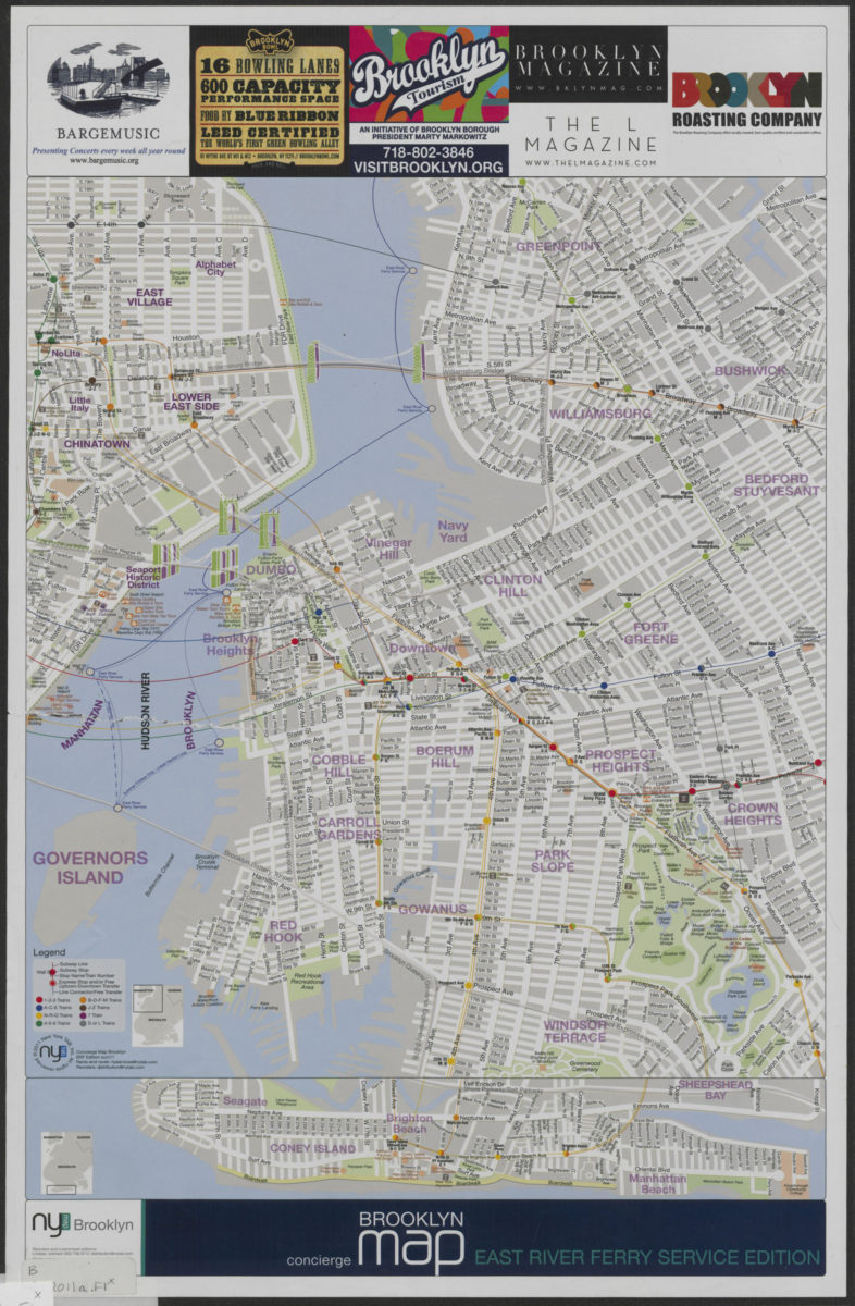
Concierge Brooklyn map: East River Ferry service edition
Concierge Brooklyn map: East River Ferry service edition
[2011; 2011]