Center for Brooklyn History
Map Collections
Search
About
Othmer Library & Archives
Submit search query
Refine 19 records
Clear filters
3
Location
Bergen County (N.J.)
6
Bronx (New York, N.Y.)
10
Brooklyn (New York, N.Y.)
891
ferries
1
Harlem (New York, N.Y.)
1
Hudson County (N.J.)
3
Inwood (New York, N.Y.)
1
Jamaica Bay (N.Y.)
5
Jersey City (N.J.)
4
Long Island (N.Y.)
197
Manhattan (New York, N.Y.)
120
New York (N.Y.)
164
New York (State)
95
New York Metropolitan Area
40
Queens (New York, N.Y.)
83
Staten Island (N.Y.)
10
Upper East Side (New York, N.Y.)
1
Upper West Side (New York, N.Y.)
2
Washington Heights (New York, N.Y.)
2
Subject
Landowners
434
Local transit
63
Postal codes
4
Railroads, Elevated
24
Roads
117
Street addresses
11
Subways
55
Date
20th Century
469
or enter range:
from
to
Genres
Aerial views
15
Bathymetric maps
94
Historical maps
53
Manuscript maps
365
Military maps
23
Physical maps
4
Pictorial maps
38
Road maps
83
Topographic maps
70
Tourist maps
55
Transportation maps
120
Sort by:
Date (earliest)
Date (most recent)
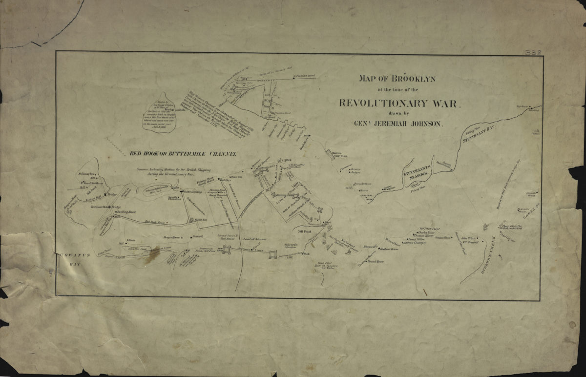
Map of Brooklyn at the time of the Revolutionary War: drawn by Genl. Jeremiah Johnson
Map of Brooklyn at the time of the Revolutionary War: drawn by Genl. Jeremiah Johnson
[19??]
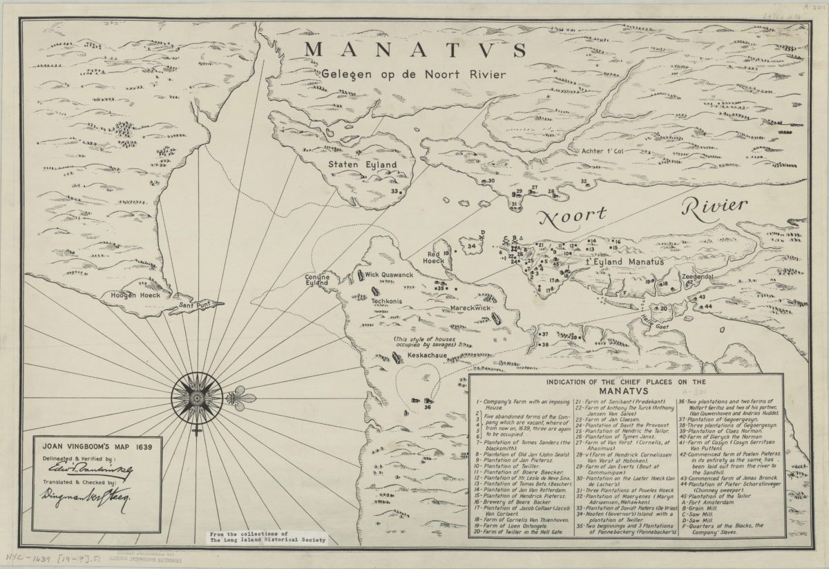
Joan Vingboom’s map 1639
Joan Vingboom’s map 1639
[19??]
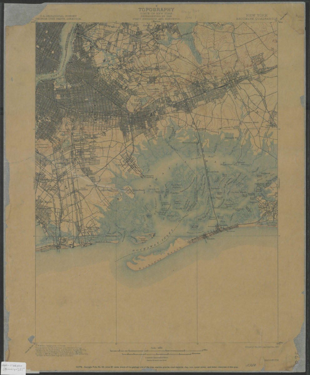
Brooklyn quadrangle, New York: U.S. Geological Survey
Brooklyn quadrangle, New York: U.S. Geological Survey
1900; 1910
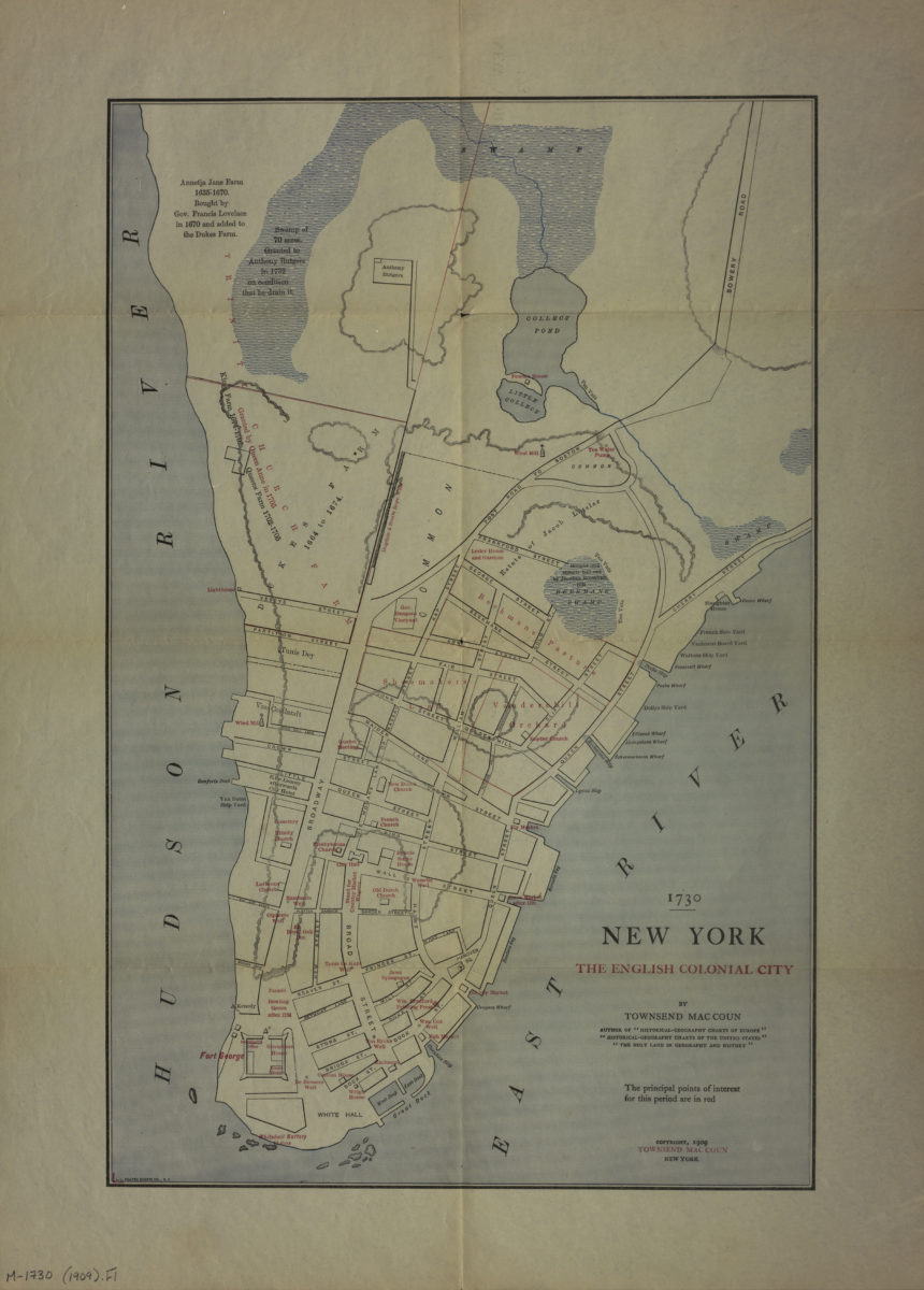
1730 New York, the English colonial city: by Townsend MacCoun
1730 New York, the English colonial city: by Townsend MacCoun
[ca. 1909]
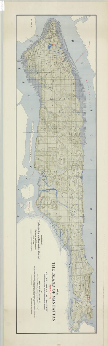
The island of Manhattan (Mannahtin) at the time of its discovery: showing its elevations, water-courses, marshes, and shore line: by Townsend MacCoun ; compliments of Underpinning and Foundation Co., Inc
The island of Manhattan (Mannahtin) at the time of its discovery: showing its elevations, water-courses, marshes, and shore line: by Townsend MacCoun ; compliments of Underpinning and Foundation Co., Inc
[ca. 1909]
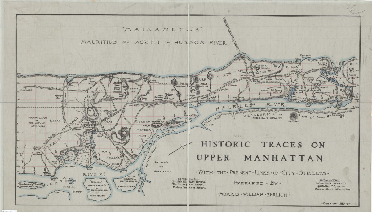
Historic traces on upper Manhattan: with the present lines of city streets: prepared by Morris William Ehrilich
Historic traces on upper Manhattan: with the present lines of city streets: prepared by Morris William Ehrilich
[ca. 1910]
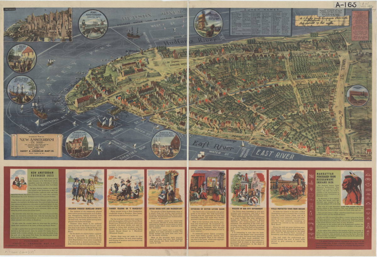
Chandler view of New Amsterdam in 1660: the present southern end of Manhattan Island, New York City
Chandler view of New Amsterdam in 1660: the present southern end of Manhattan Island, New York City
[ca. 1947]
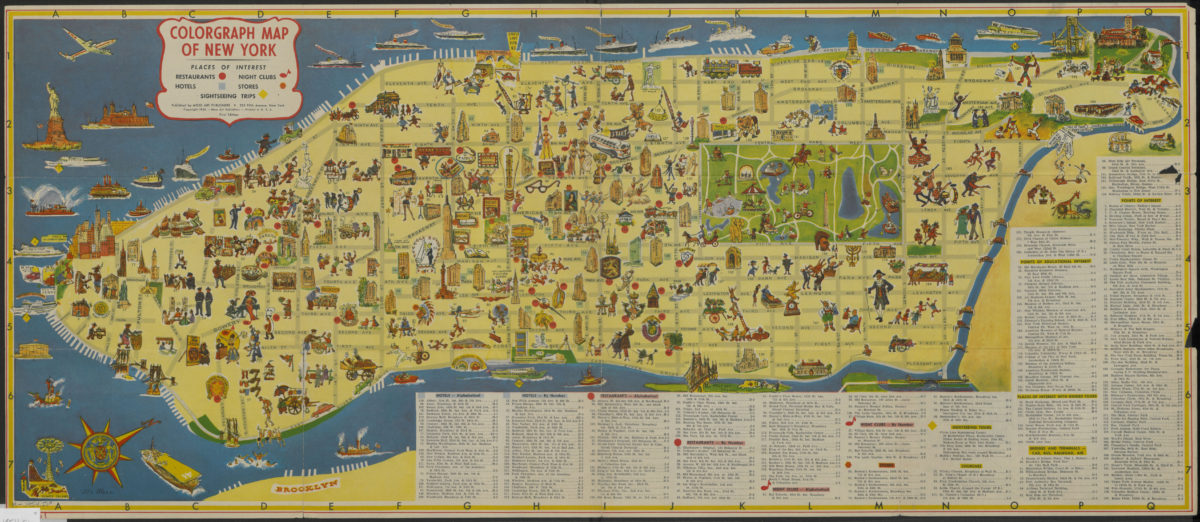
Colorgraph map of New York
Colorgraph map of New York
[ca. 1954]
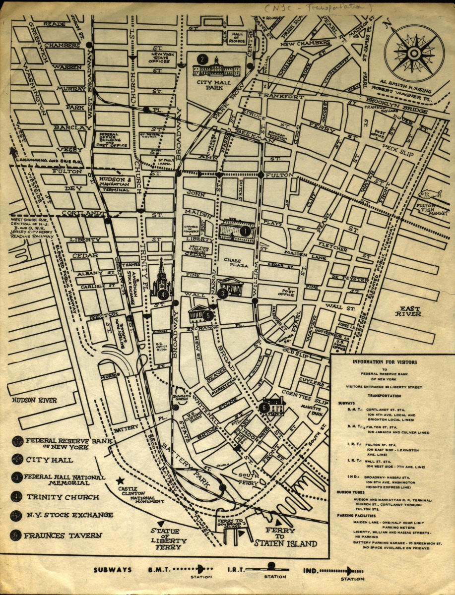
Information for visitors to Federal Reserve Bank of New York
Information for visitors to Federal Reserve Bank of New York
[1956-1966]
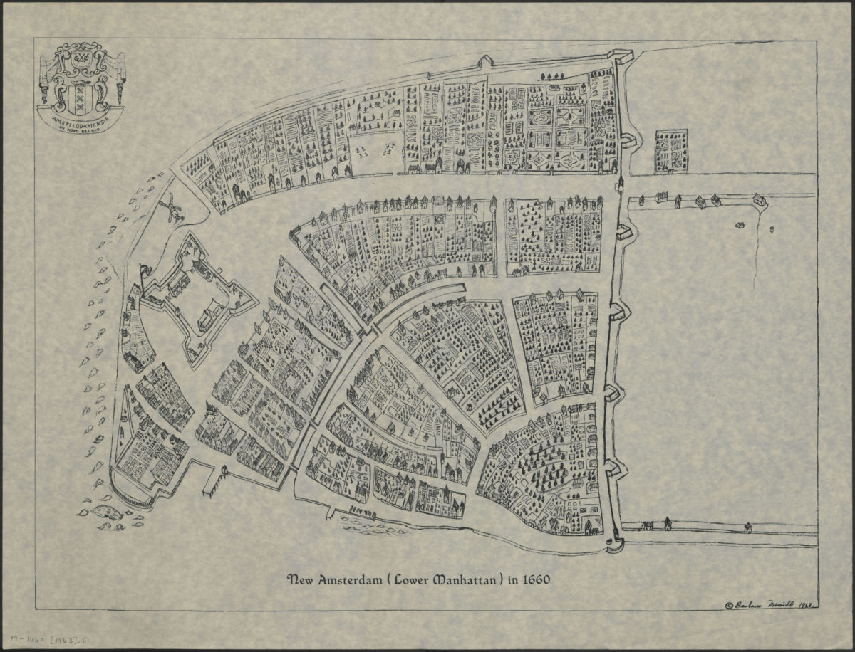
New Amsterdam (Lower Manhattan) in 1660
New Amsterdam (Lower Manhattan) in 1660
[ca. 1963]
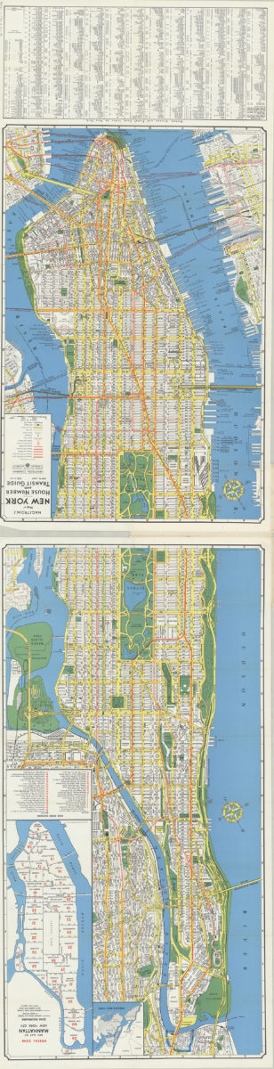
Hagstrom’s map of New York, house number and transit guide: compiled, printed and published by Hagstrom Company Incorporated
Hagstrom’s map of New York, house number and transit guide: compiled, printed and published by Hagstrom Company Incorporated
[1963]
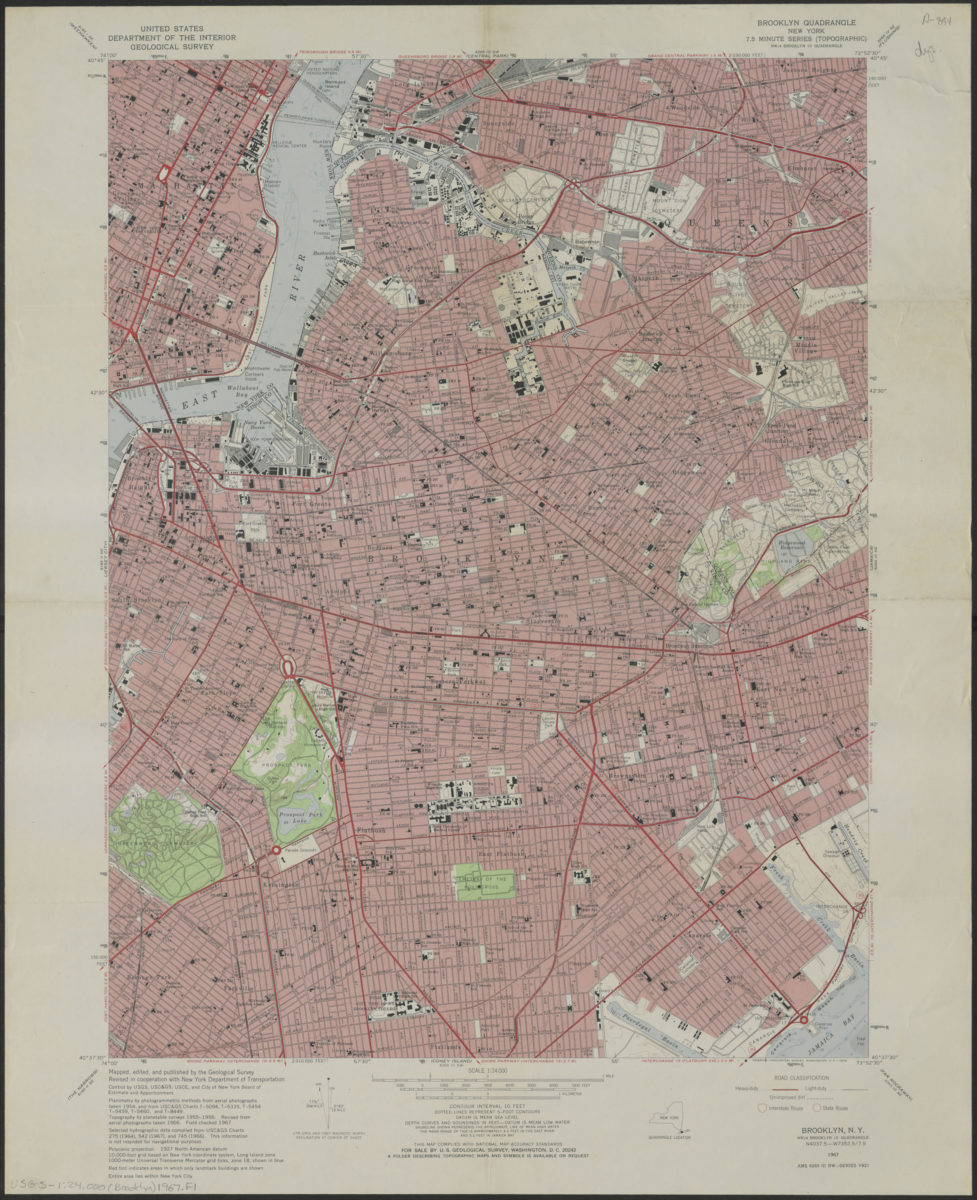
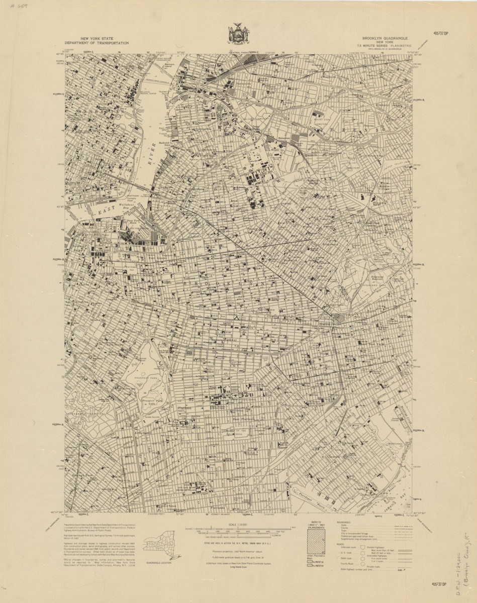
Brooklyn quadrangle, New York
Brooklyn quadrangle, New York
1967
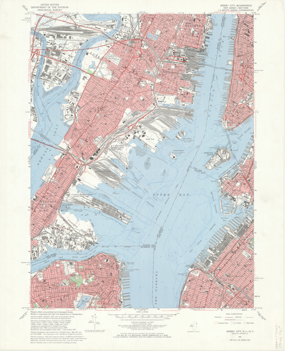
Jersey City quadrangle, New Jersey – New York: mapped, edited, and published by the Geological Survey ; revised in cooperation with New York Dept. of Transportation
Jersey City quadrangle, New Jersey – New York: mapped, edited, and published by the Geological Survey ; revised in cooperation with New York Dept. of Transportation
1967
Brooklyn quadrangle, New York
Brooklyn quadrangle, New York
[1969]
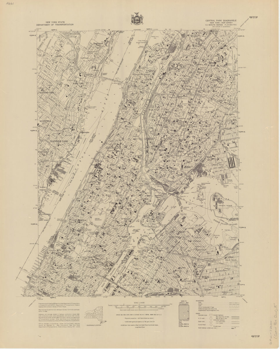
Central Park quadrangle, New York
Central Park quadrangle, New York
[1969]
Long Island, New York City & metro area counties
Long Island, New York City & metro area counties
[1972]
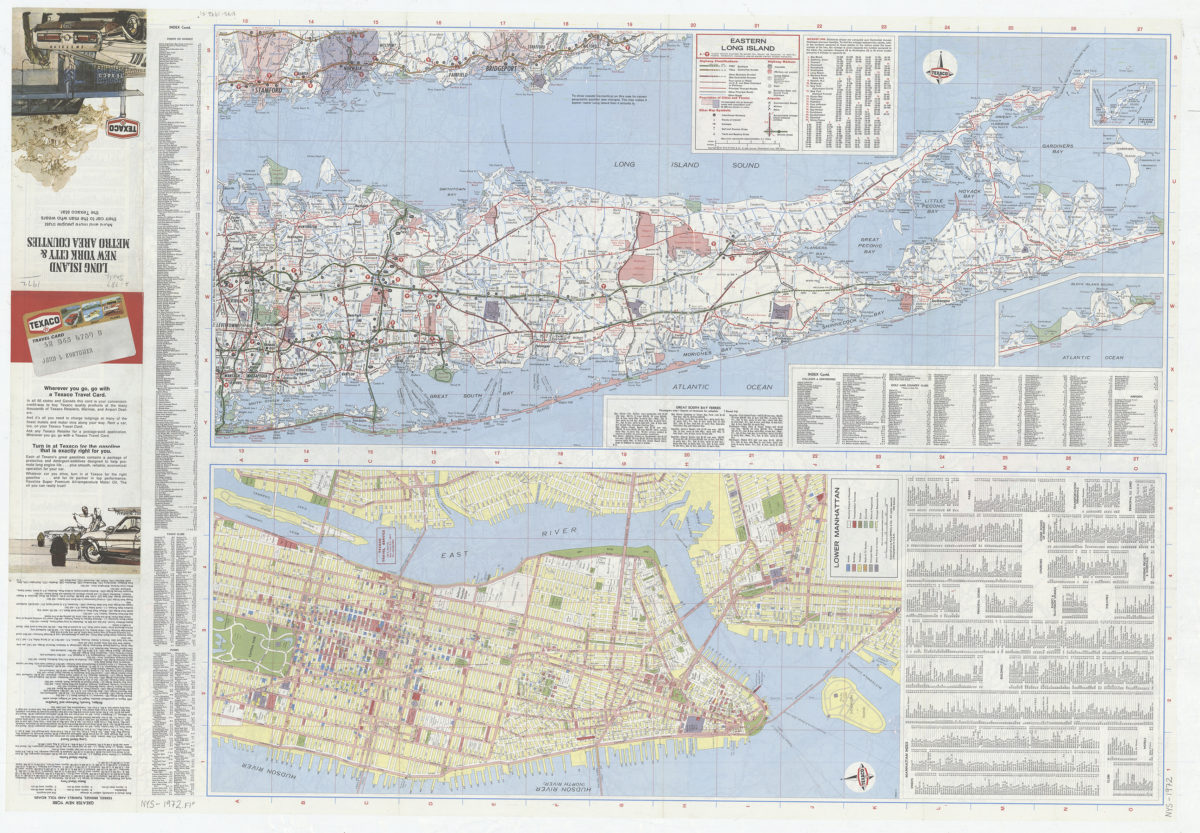
Long Island, New York City & metro area counties: [prepared for] Texaco
Long Island, New York City & metro area counties: [prepared for] Texaco
1975
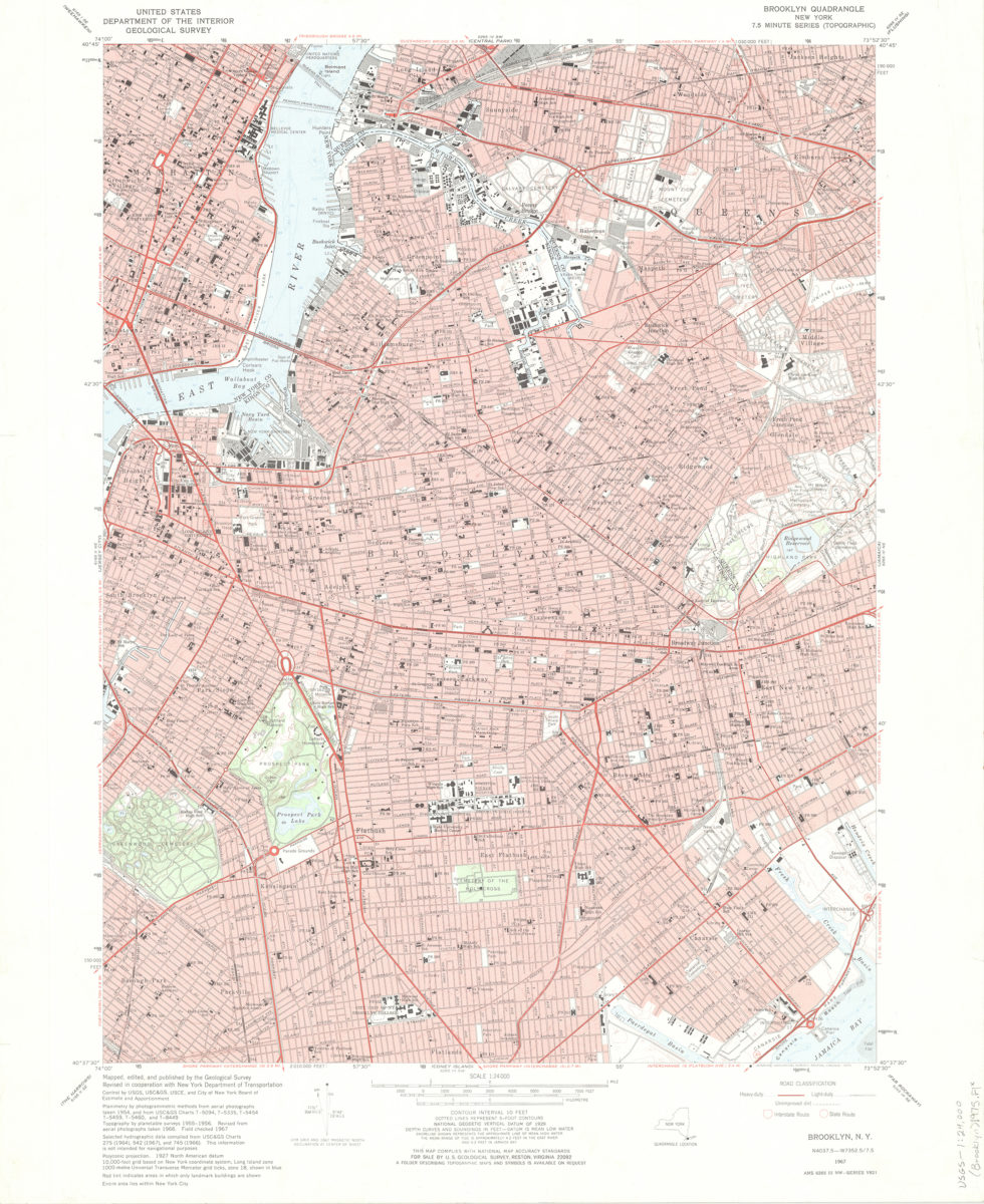
Brooklyn quadrangle, New York: mapped, edited, and published by the Geological Survey ; revised in cooperation with New York Department of Transportation
Brooklyn quadrangle, New York: mapped, edited, and published by the Geological Survey ; revised in cooperation with New York Department of Transportation
1975
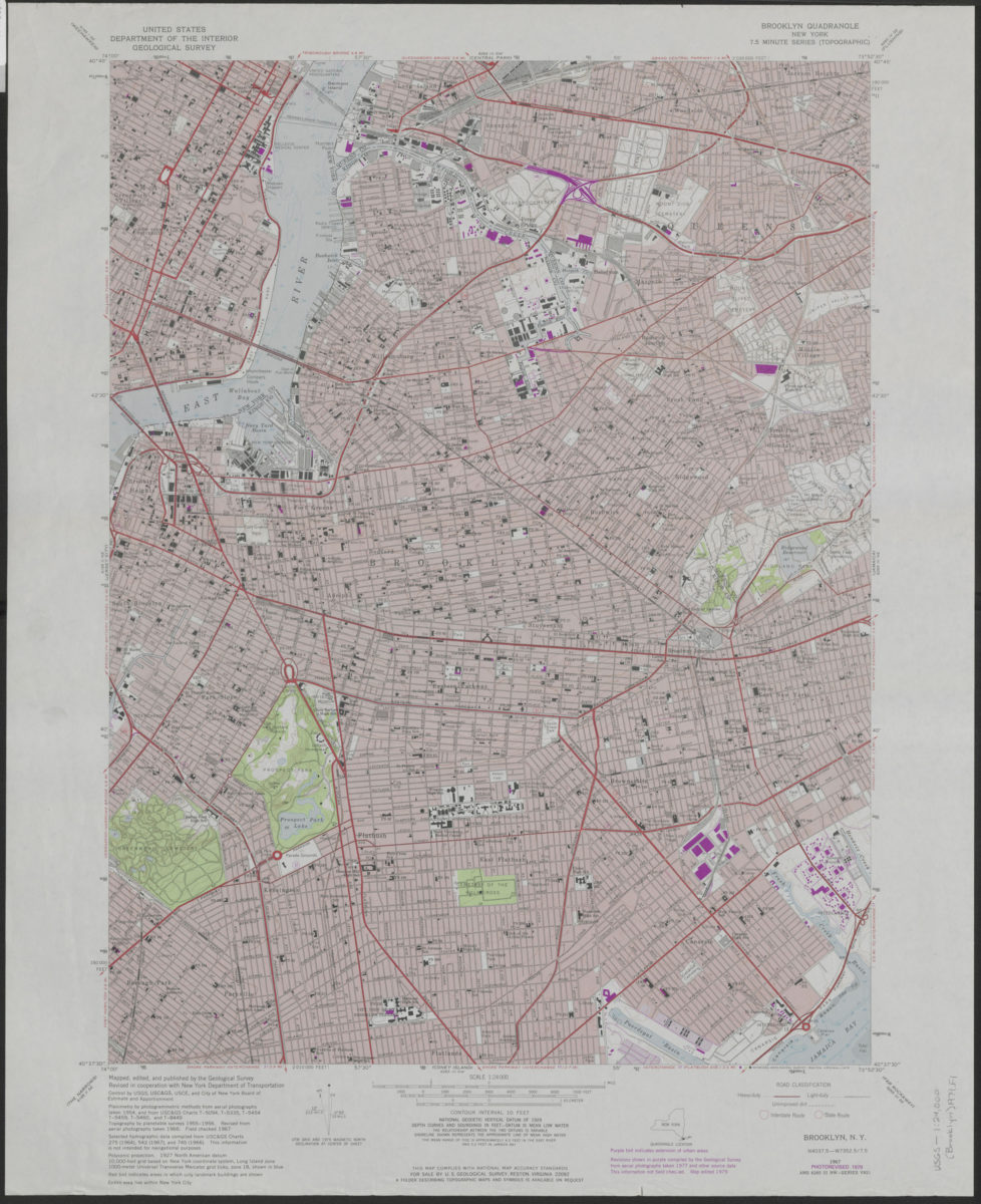
Brooklyn quadrangle, New York: mapped, edited, and published by the Geological Survey ; revised in cooperation with New York Department of Transportation
Brooklyn quadrangle, New York: mapped, edited, and published by the Geological Survey ; revised in cooperation with New York Department of Transportation
1979