Center for Brooklyn History
Map Collections
Search
About
Othmer Library & Archives
Submit search query
Refine 2 records
Clear filters
2
Location
Delaware River Valley (N.Y.-Del. and N.J.)
1
Mohawk River Valley (N.Y.)
3
New York (State)
95
Schoharie Creek Valley (N.Y.)
1
Susquehanna River Valley
1
Subject
Land grants
12
Landowners
434
Real property
619
Date
19th Century
945
20th Century
469
or enter range:
from
to
Genres
Cadastral maps
597
Historical maps
53
Sort by:
Date (earliest)
Date (most recent)
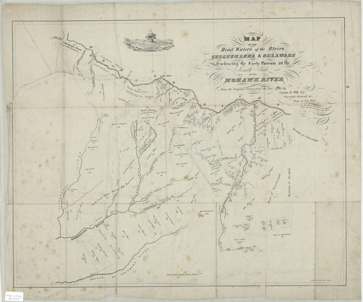
Map of the head waters of the rivers Susquehanna & Delaware: embracing the early patents on the south side of the Mohawk River : from the original, drawn about the year 1790: by Simeon DeWitt, Esq. … ;
Map of the head waters of the rivers Susquehanna & Delaware: embracing the early patents on the south side of the Mohawk River : from the original, drawn about the year 1790: by Simeon DeWitt, Esq. … ;
[18??]
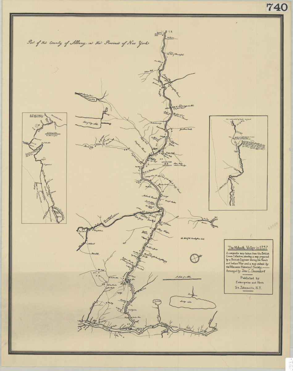
The Mohawk Valley in 1757: a composite map taken from the British Crown Collection, showing a map prepared by a British engineer during the French and Indian War and a map owned by the Wisconsin Historical Society: arranged by John C. Devendorf
The Mohawk Valley in 1757: a composite map taken from the British Crown Collection, showing a map prepared by a British engineer during the French and Indian War and a map owned by the Wisconsin Historical Society: arranged by John C. Devendorf
[19??]