Center for Brooklyn History
Map Collections
Search
About
Othmer Library & Archives
Submit search query
Refine 4 records
Clear filters
2
Location
Maritime Provinces
1
Middle Atlantic States
2
New England
8
New York (State)
95
Subject
Railroads
72
Date
19th Century
945
or enter range:
from
to
Genres
Bathymetric maps
94
Map
191
Transportation maps
120
Sort by:
Date (earliest)
Date (most recent)
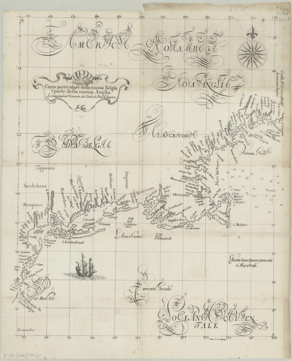
Carta particolare della nuoua Belgia è parte della nuoua Anglia
Carta particolare della nuoua Belgia è parte della nuoua Anglia
[18??]
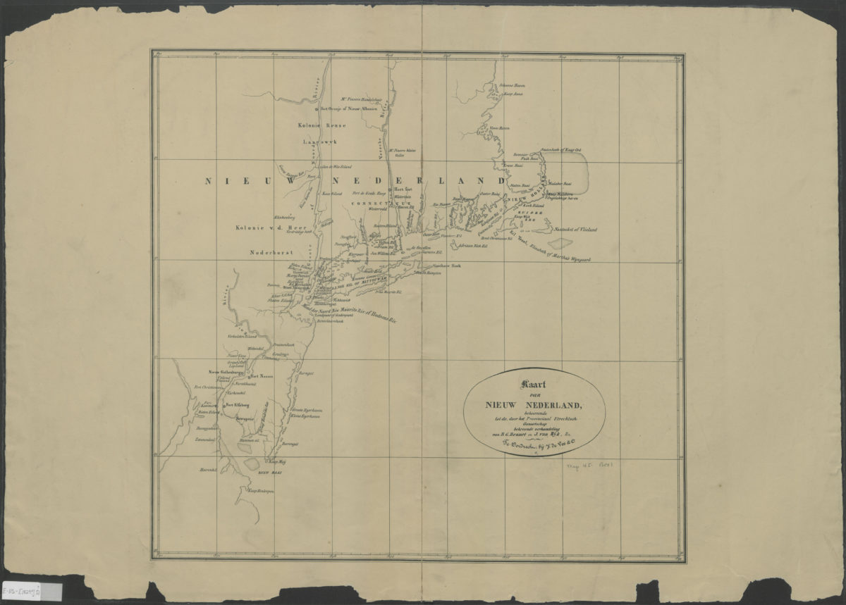
Kaart van Nieuw Nederland: behoorende tot de door het Provinciaal Utrechtsch genootschap bekroonde verhandeling: van R.G. Bennet ; en J. van Wyk, Rz
Kaart van Nieuw Nederland: behoorende tot de door het Provinciaal Utrechtsch genootschap bekroonde verhandeling: van R.G. Bennet ; en J. van Wyk, Rz
[1829]
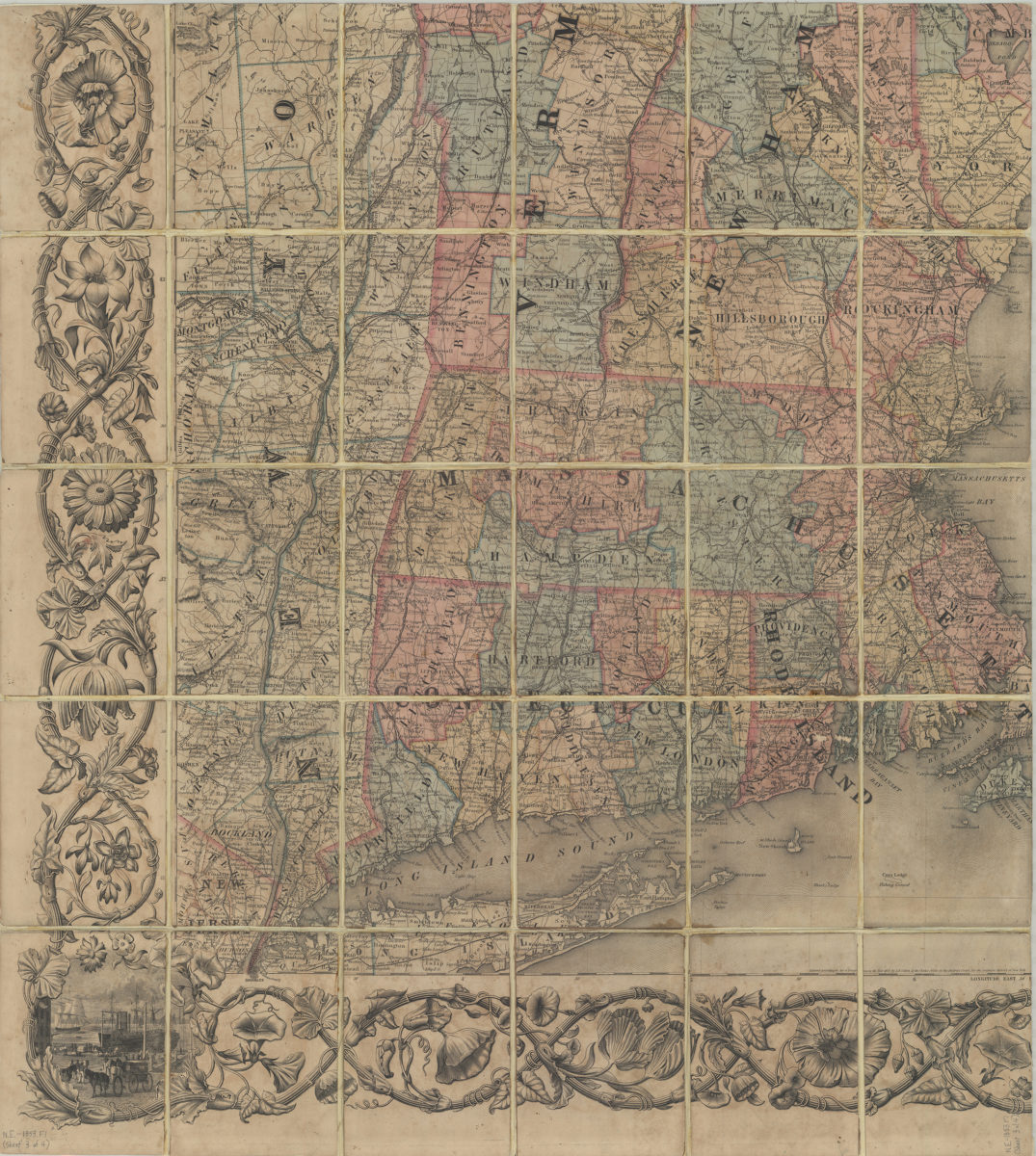
Railroad map of New England & eastern New York compiled from the most authentic sources: by J.H. Goldthwait
Railroad map of New England & eastern New York compiled from the most authentic sources: by J.H. Goldthwait
1849
Colton’s railroad & township map of New England with portions of the state of New York, the British provinces, &c.: compiled & drawn by George W. Colton ; engraved at J.H. Colton’s map establishment by J.P. Cox … [et al.] ; border by W.S. Barnard
Colton’s railroad & township map of New England with portions of the state of New York, the British provinces, &c.: compiled & drawn by George W. Colton ; engraved at J.H. Colton’s map establishment by J.P. Cox … [et al.] ; border by W.S. Barnard
1853; [ca. 1852]