Center for Brooklyn History
Map Collections
Search
About
Othmer Library & Archives
Submit search query
Refine 4 records
Clear filters
2
Location
Middle Atlantic States
2
New England
8
New Jersey
27
New York (State)
95
Subject
Roads
117
Date
20th Century
469
or enter range:
from
to
Genres
Early maps
35
Historical maps
53
Map
191
Sort by:
Date (earliest)
Date (most recent)
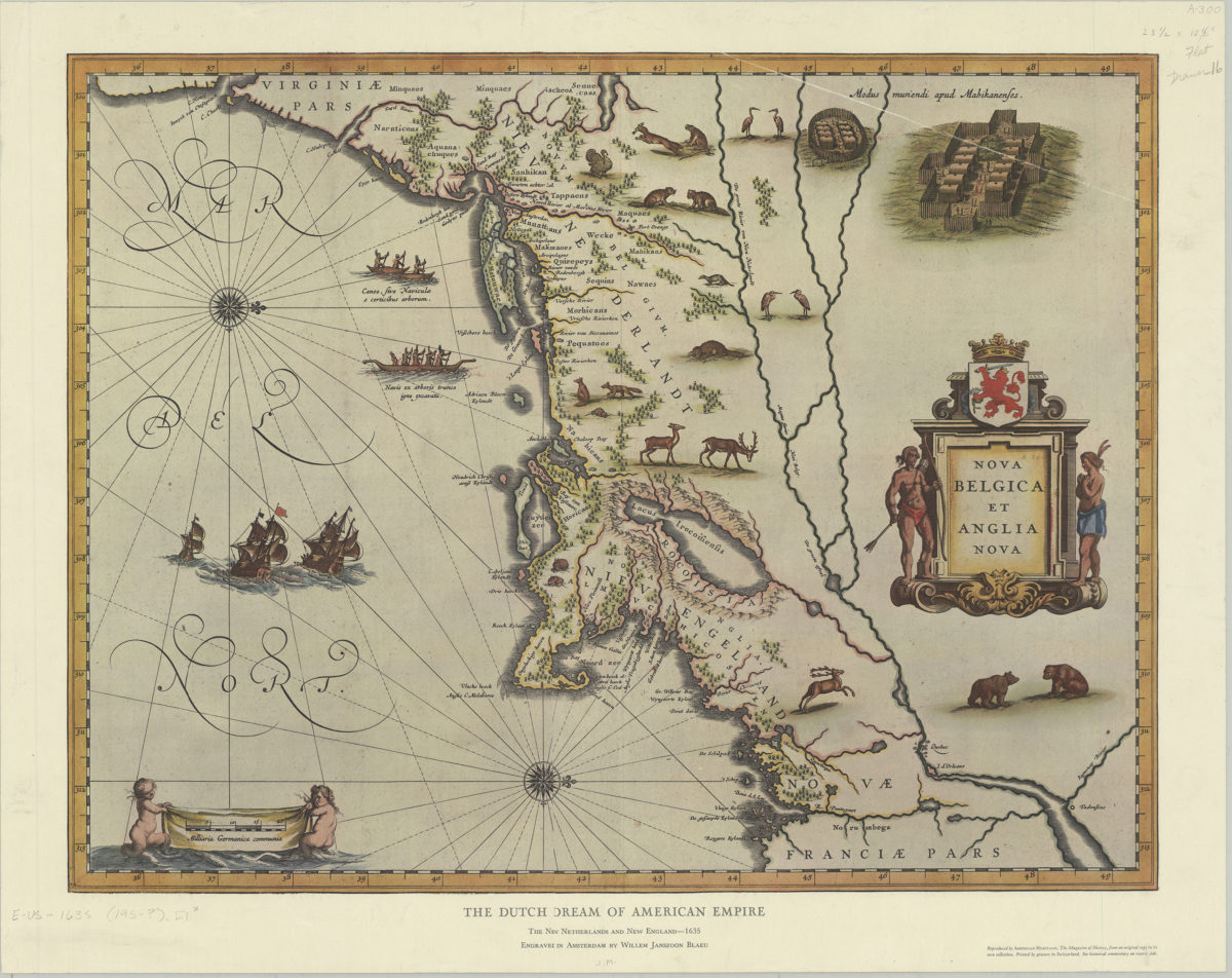
The Dutch dream of American empire: the New Netherlands and New England, 1635: engraved in Amsterdam by Willem Janszoon Blaeu
The Dutch dream of American empire: the New Netherlands and New England, 1635: engraved in Amsterdam by Willem Janszoon Blaeu
[195?]
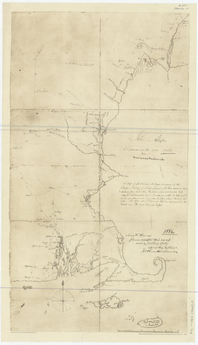
A map of all Friends Meetings belonging to the Yearly Meeting of Rhode Island: with their course or lying & distance from each other …: John Alsops ; drawn in the year 1782 for Humphrey Howland
A map of all Friends Meetings belonging to the Yearly Meeting of Rhode Island: with their course or lying & distance from each other …: John Alsops ; drawn in the year 1782 for Humphrey Howland
1963
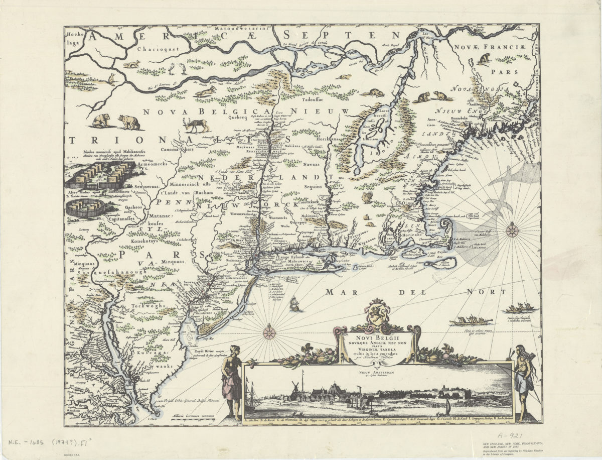
Novi Belgii Novæque Angliæ nec non partis Virginiæ tabula: multis in locis emendata per Nicolaum Visscher
Novi Belgii Novæque Angliæ nec non partis Virginiæ tabula: multis in locis emendata per Nicolaum Visscher
[1974]
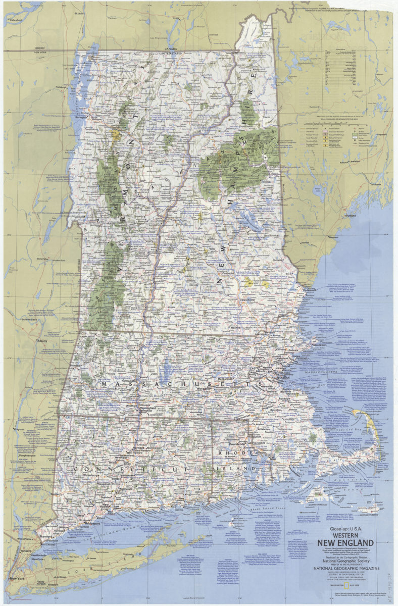
Close up: U.S.A., western New England: Produced by the Cartographic Division, National Geographic Society. William T. Peele, chief cartographer. David W. Cook, associate chief cartographer
Close up: U.S.A., western New England: Produced by the Cartographic Division, National Geographic Society. William T. Peele, chief cartographer. David W. Cook, associate chief cartographer
1975