Center for Brooklyn History
Map Collections
Search
About
Othmer Library & Archives
Submit search query
Refine 11 records
Clear filters
2
Location
Brooklyn (New York, N.Y.)
891
Connecticut
7
Jersey City (N.J.)
4
Long Island (N.Y.)
197
Manhattan (New York, N.Y.)
120
New Jersey
27
New York (N.Y.)
164
New York (State)
95
New York Metropolitan Area
40
Pennsylvania
4
Queens (New York, N.Y.)
83
Williamsburg (New York, N.Y.)
36
Subject
Aeronautical charts
1
ferries
32
Piers
25
Road maps
2
Roads
117
Streets
46
Date
19th Century
945
20th Century
469
21th Century
66
or enter range:
from
to
Genres
Map
191
Sort by:
Date (earliest)
Date (most recent)
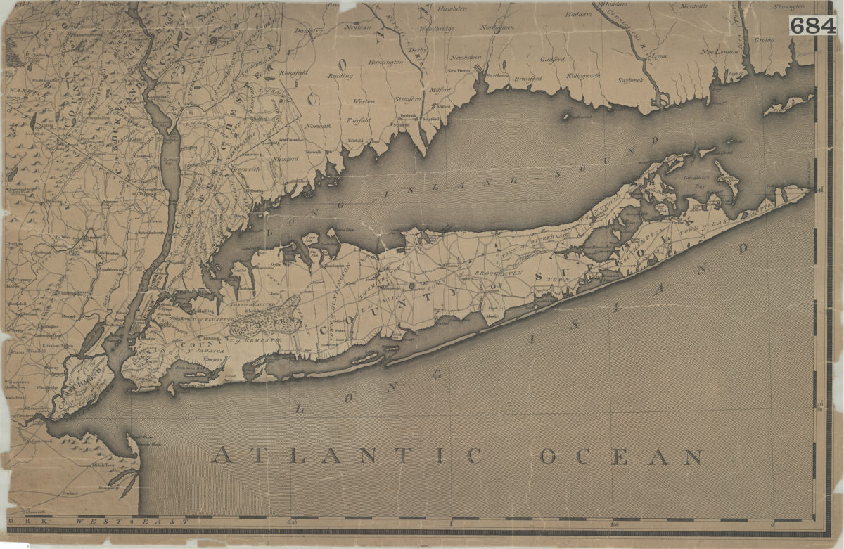
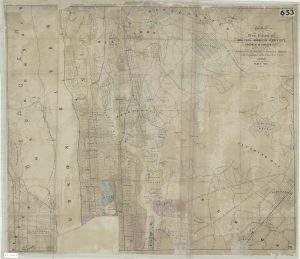
[Map of Long Island, the New York Metropolitan Area, and the southern coast of Connecticut]
[Map of Long Island, the New York Metropolitan Area, and the southern coast of Connecticut]
[18??]
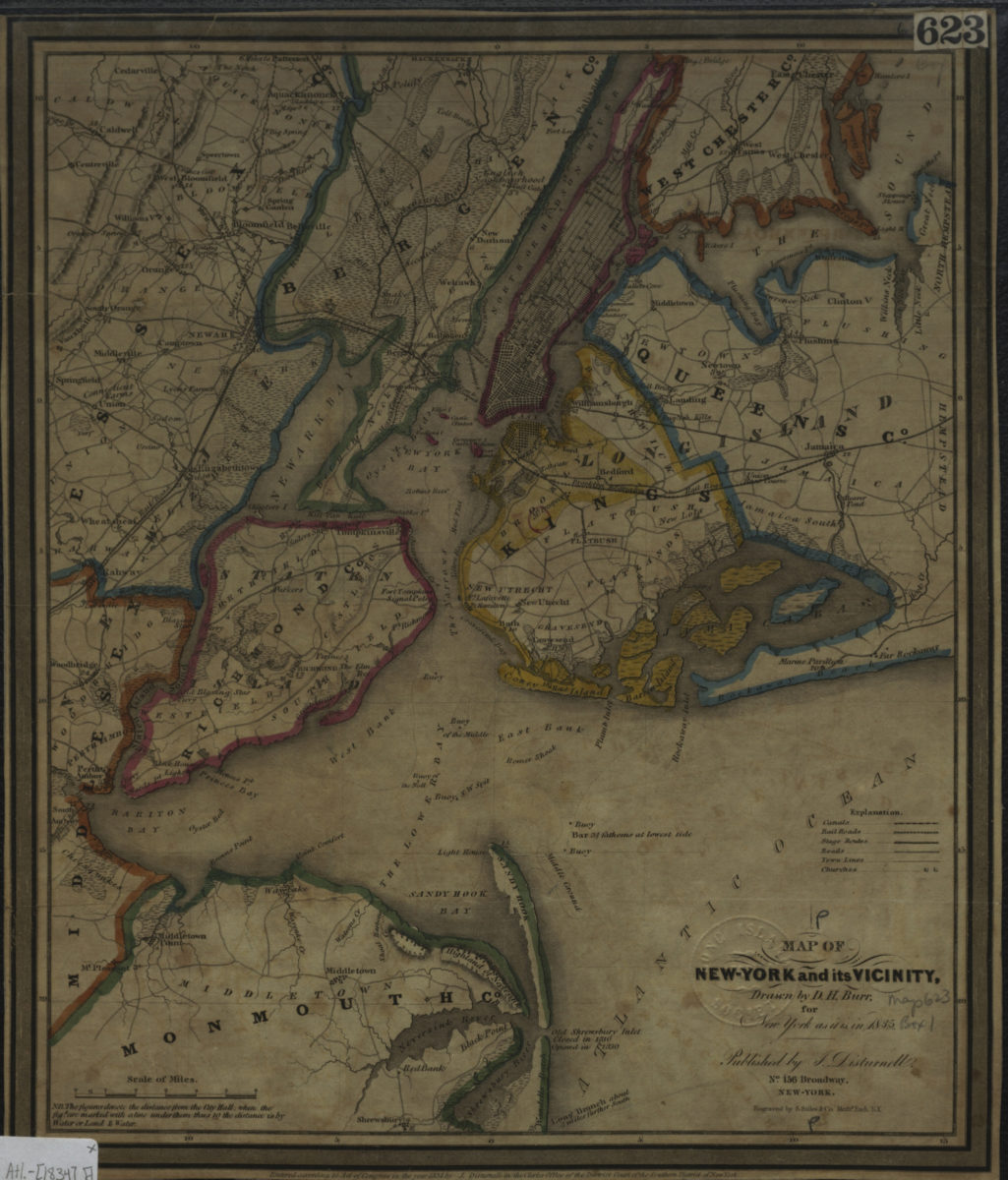
Map of New-York and its vicinity, for New York as it is in 1835: drawn by D.H. Burr
Map of New-York and its vicinity, for New York as it is in 1835: drawn by D.H. Burr
[1834]
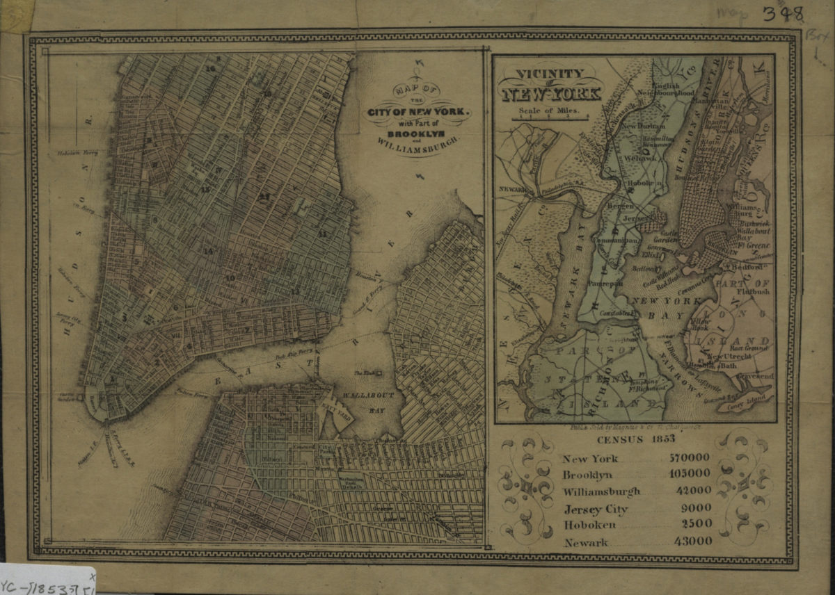
Map of the city of New York with part of Brooklyn and Williamsburgh ; Vicinity of New York
Map of the city of New York with part of Brooklyn and Williamsburgh ; Vicinity of New York
[1853]
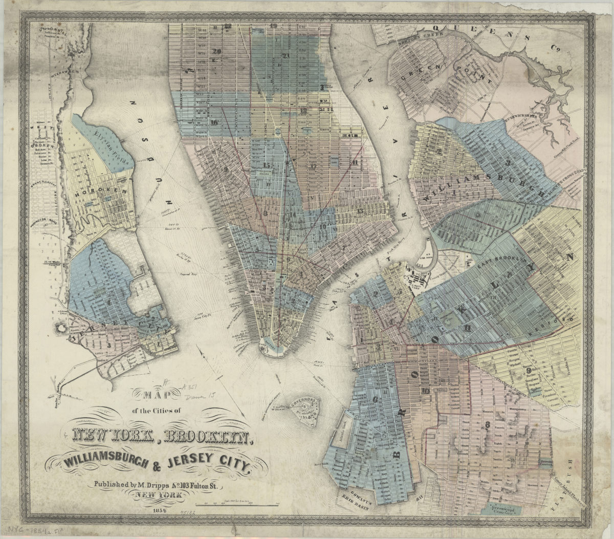
Map of the cities of New York, Brooklyn, Williamsburgh & Jersey City
Map of the cities of New York, Brooklyn, Williamsburgh & Jersey City
1854
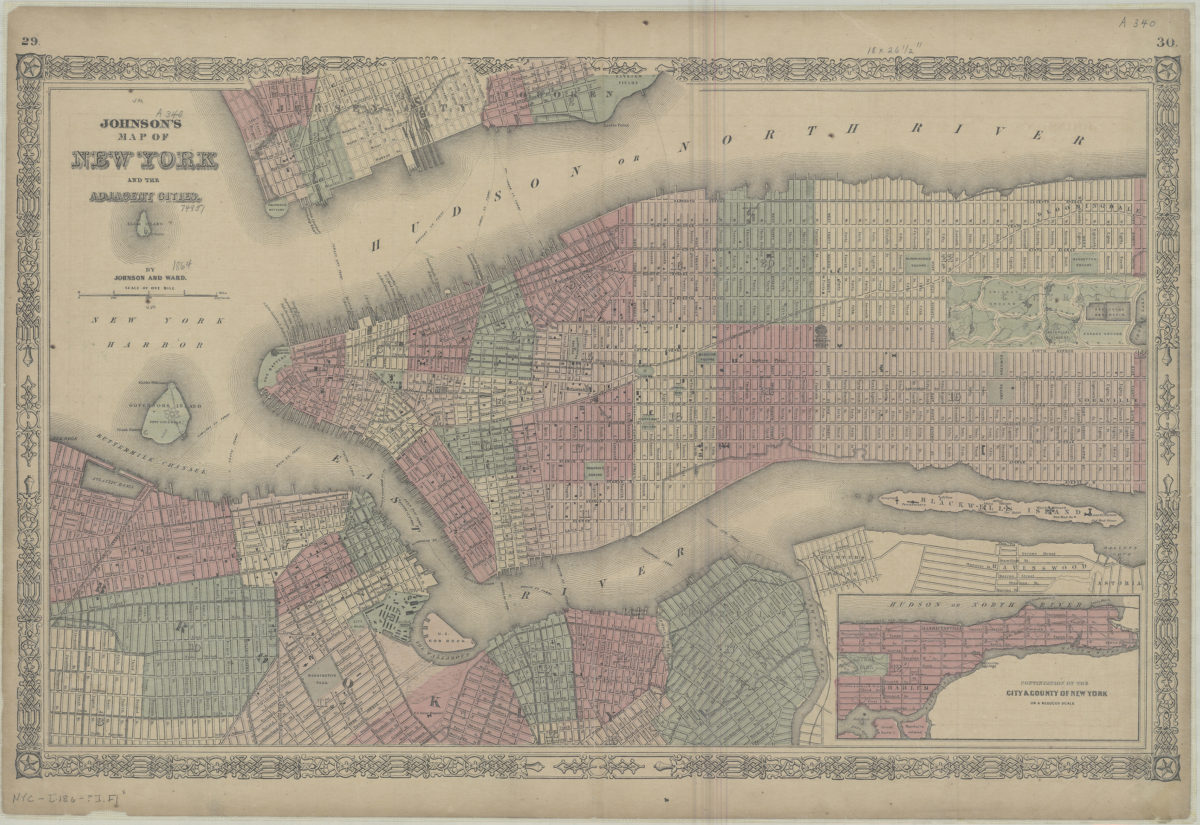
Johnson’s map of New York and the adjacent cities: by Johnson and Ward
Johnson’s map of New York and the adjacent cities: by Johnson and Ward
[186?]
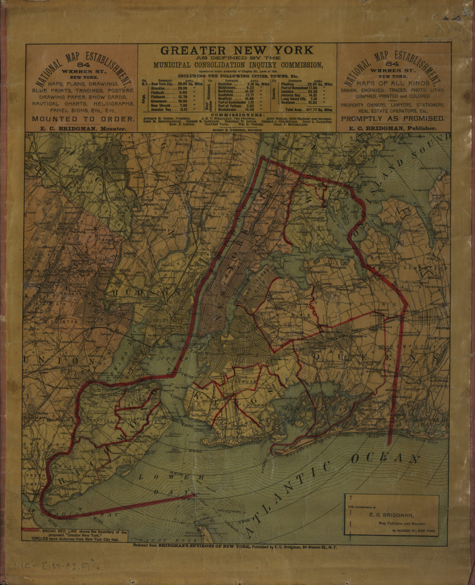
Map of the five cities of New York, Brooklyn, Jersey City, Hoboken & Hudson City: prepared by M. Dripps for Valentine’s Manuel [i.e. Manual] of the Corporation of the City of New York
Map of the five cities of New York, Brooklyn, Jersey City, Hoboken & Hudson City: prepared by M. Dripps for Valentine’s Manuel [i.e. Manual] of the Corporation of the City of New York
1860
[Map of New York metropolitan area]
[Map of New York metropolitan area]
[189?]
Shell street guide and metropolitan map of Brooklyn, Queens and Long Island: the H.M. Gousha Company
Shell street guide and metropolitan map of Brooklyn, Queens and Long Island: the H.M. Gousha Company
[1939]
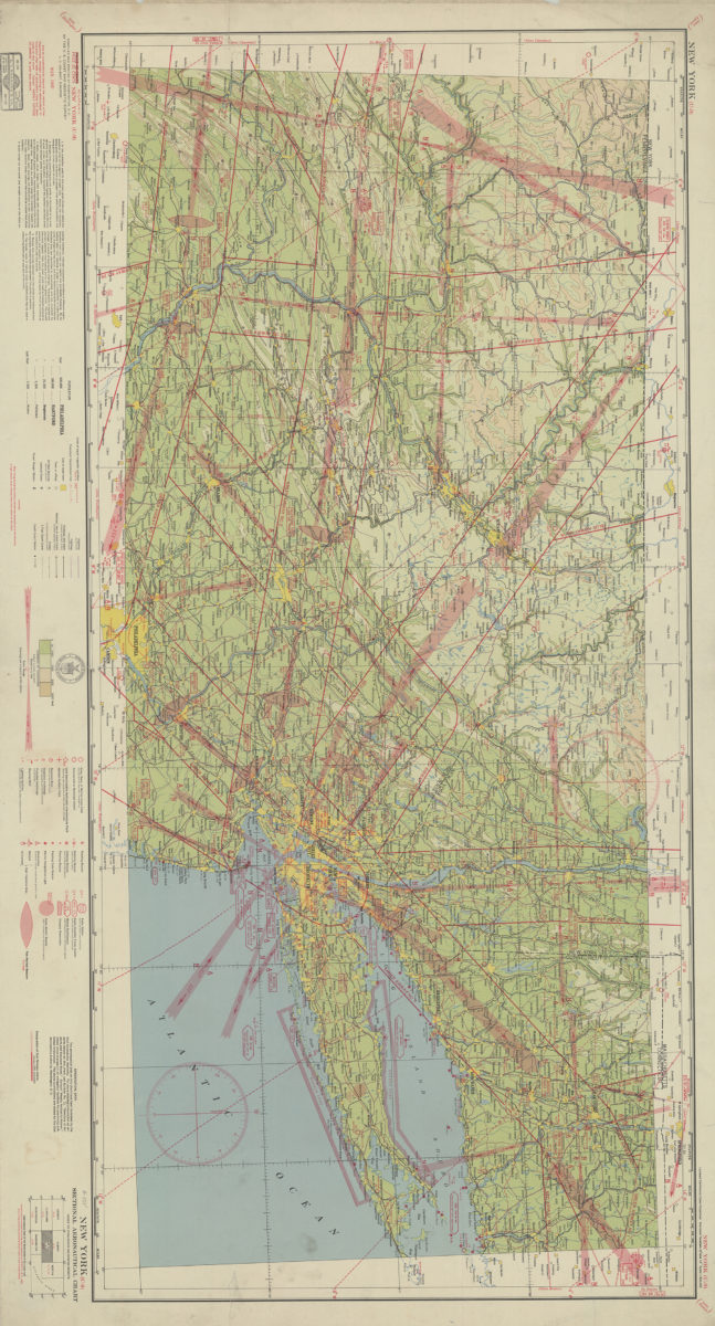
New York (U-9) sectional aeronautical chart: compiled and printed at Washington D.C. by the U.S. Coast and Geodetic Survey
New York (U-9) sectional aeronautical chart: compiled and printed at Washington D.C. by the U.S. Coast and Geodetic Survey
1940
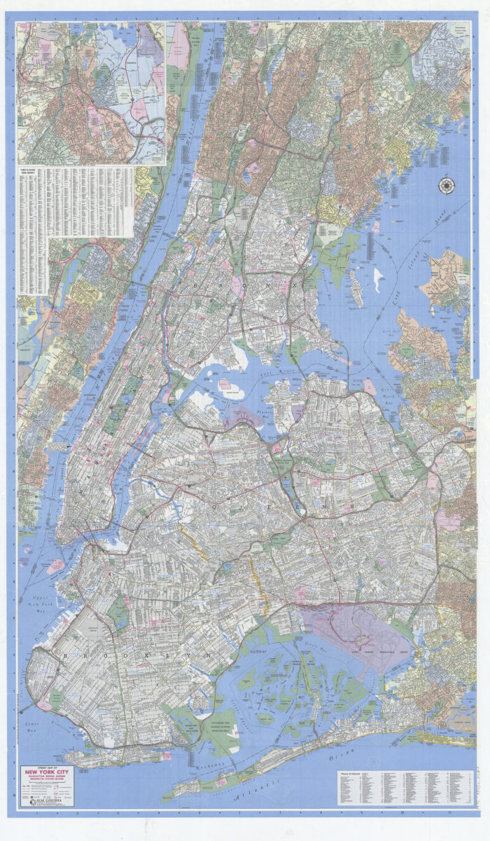
Gousha New York City citymap: including Bogota, Englewood, Fairview, Floral Park, Fort Lee … and adjoining communities, plus index to selective places of interest: H.M. Gousha
Gousha New York City citymap: including Bogota, Englewood, Fairview, Floral Park, Fort Lee … and adjoining communities, plus index to selective places of interest: H.M. Gousha
[1995; ca. 1991]
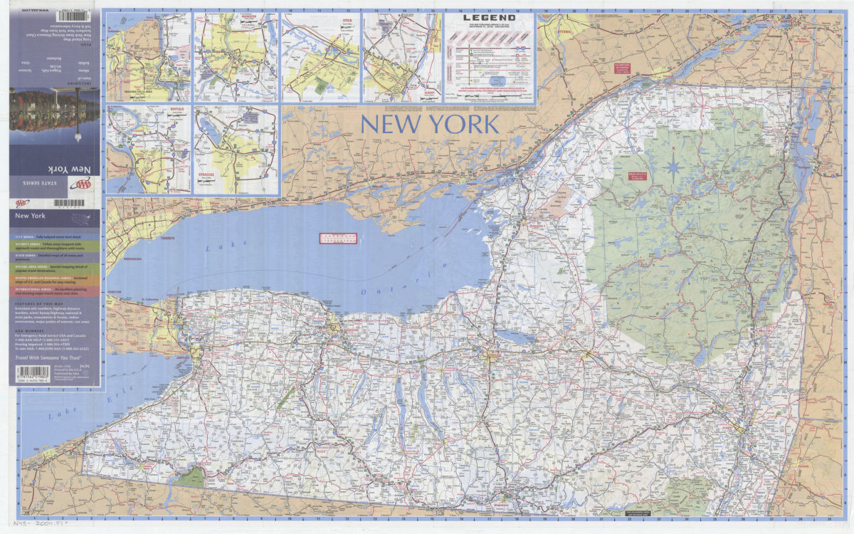
New York: including insets of Albany, Buffalo, Niagara Falls NY-ON, Rochester, Syracuse, Utica, plus Long Island map … toll & ferry information: AAA
New York: including insets of Albany, Buffalo, Niagara Falls NY-ON, Rochester, Syracuse, Utica, plus Long Island map … toll & ferry information: AAA
[2004]