Center for Brooklyn History
Map Collections
Search
About
Othmer Library & Archives
Submit search query
Refine 7 records
Clear filters
2
Location
Connecticut
7
New Jersey
27
New York (N.Y.)
164
New York Metropolitan Area
40
Pennsylvania
4
Subject
Aeronautical charts
1
New York Metropolitan Area
1
Date
19th Century
945
20th Century
469
or enter range:
from
to
Genres
Aerial views
15
Map
191
Military maps
23
Zoning maps
55
Sort by:
Date (earliest)
Date (most recent)
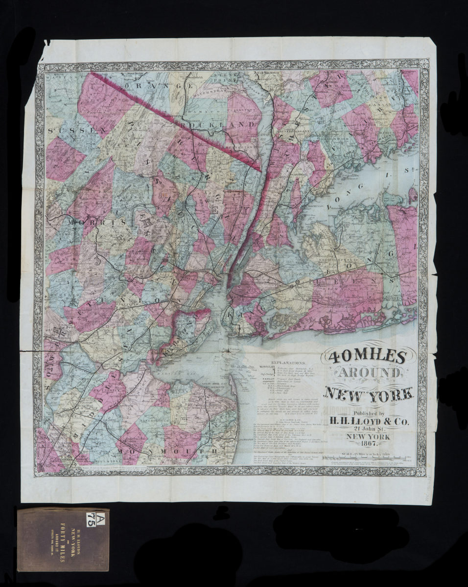
40 miles around New York
40 miles around New York
1867; [ca. 1866]
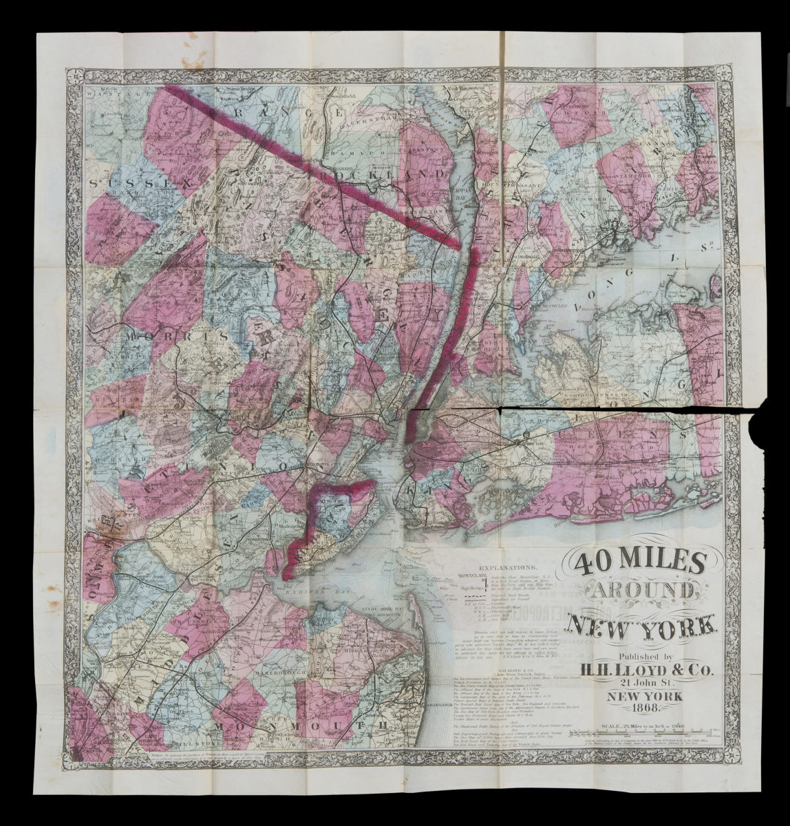
40 miles around New York
40 miles around New York
1867; [ca. 1866]
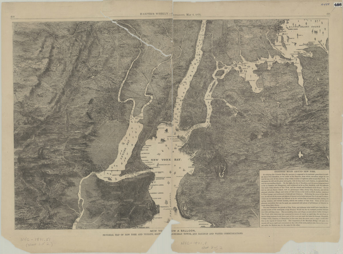
New Yo[rk fr]om a balloon: pictorial map of New York and vicinity, show[ing … ] suburban towns, and railroad and water communications
New Yo[rk fr]om a balloon: pictorial map of New York and vicinity, show[ing … ] suburban towns, and railroad and water communications
[1871]
[Map of New York metropolitan area]
[Map of New York metropolitan area]
[189?]
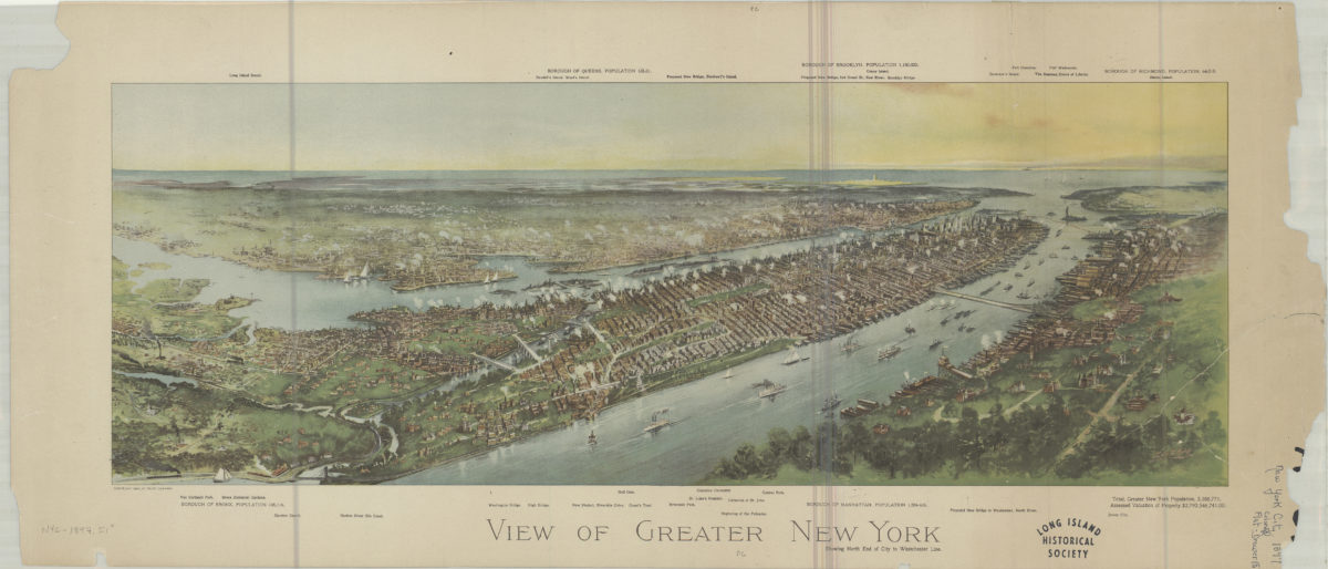
View of greater New York: showing north end of city to Westchester line
View of greater New York: showing north end of city to Westchester line
[ca. 1897]
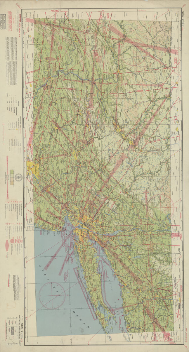
New York (U-9) sectional aeronautical chart: compiled and printed at Washington D.C. by the U.S. Coast and Geodetic Survey
New York (U-9) sectional aeronautical chart: compiled and printed at Washington D.C. by the U.S. Coast and Geodetic Survey
1940
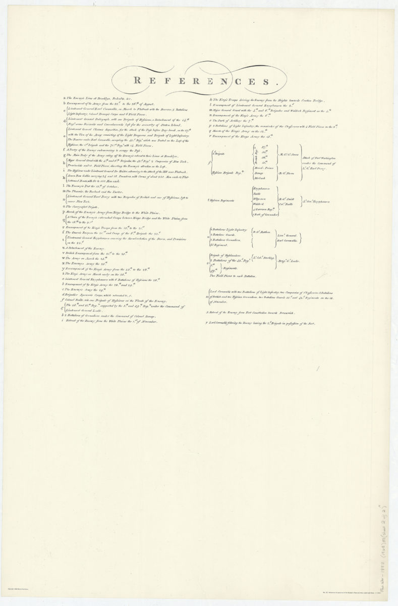
A sketch of the operations of His Majesty’s fleet and army under the command of Vice Admiral the Rt. Hble Lord Viscount Howe and Gen. Wm. Howe, K.B. in 1776
A sketch of the operations of His Majesty’s fleet and army under the command of Vice Admiral the Rt. Hble Lord Viscount Howe and Gen. Wm. Howe, K.B. in 1776
[ca. 1968]