Center for Brooklyn History
Map Collections
Search
About
Othmer Library & Archives
Submit search query
Refine 4 records
Clear filters
2
Location
Brooklyn (New York, N.Y.)
891
Manhattan (New York, N.Y.)
120
New York (N.Y.)
164
New York (State)
95
New York Harbor (N.Y. and N.J.)
16
Subject
Buildings
12
Landforms
15
Long Island, Battle of, New York, N.Y. , 1776
7
Ponds
6
Rivers
16
Wetlands
6
Date
18th Century
12
19th Century
945
or enter range:
from
to
Genres
Bathymetric maps
94
Cadastral maps
597
Early maps
35
Early works
3
Military maps
23
Sort by:
Date (earliest)
Date (most recent)
A plan of the city of New-York & its environs: to Greenwich, on the North or Hudsons River, and to Crown Point, on the East or Sound River, shewing the several streets, publick buildings, docks, fort & battery,
A plan of the city of New-York & its environs: to Greenwich, on the North or Hudsons River, and to Crown Point, on the East or Sound River, shewing the several streets, publick buildings, docks, fort & battery,
1775
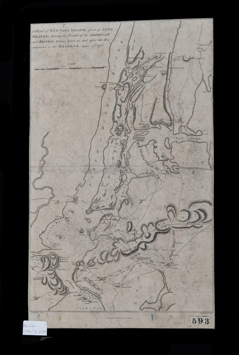
A plan of New York Island, part of Long Island &c., shewing the position of the American and British armies before, at, and after the Engagement on the Heights, August 27th, 1776: drawn by S. Lewis
A plan of New York Island, part of Long Island &c., shewing the position of the American and British armies before, at, and after the Engagement on the Heights, August 27th, 1776: drawn by S. Lewis
[1776]
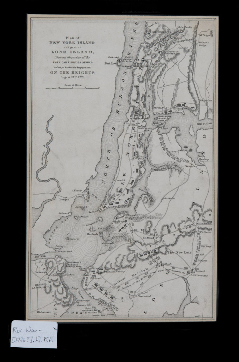
Plan of New York Island and part of Long Island, showing the position of the American & British armies before, at, & after the Engagement on the Heights, August 27th, 1776
Plan of New York Island and part of Long Island, showing the position of the American & British armies before, at, & after the Engagement on the Heights, August 27th, 1776
[1776]
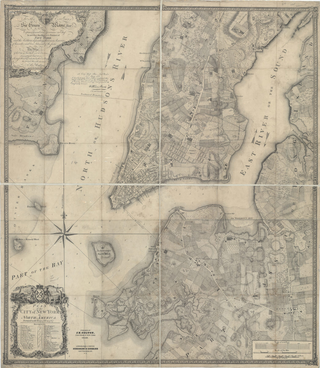
Plan of the city of New York in North America: surveyed in the years 1766 & 1767: B. Ratzer ; Thos. Kitchin sculpt
Plan of the city of New York in North America: surveyed in the years 1766 & 1767: B. Ratzer ; Thos. Kitchin sculpt
1853