Center for Brooklyn History
Map Collections
Search
About
Othmer Library & Archives
Submit search query
Refine 29 records
Clear filters
3
Location
Brooklyn (New York, N.Y.)
891
ferries
1
Long Island (N.Y.)
197
Manhattan (New York, N.Y.)
120
New York (N.Y.)
164
New York (State)
95
New York Harbor (N.Y. and N.J.)
16
New York Metropolitan Area
40
Subject
Bridges
13
Canals
15
Exhibitions
5
ferries
32
Historic districts
4
Local transit
63
Postal codes
4
Railroad terminals
2
Railroads
72
Railroads, Elevated
24
Roads
117
Street addresses
11
Street railroads
8
Streets
46
Subways
55
Traffic engineering
1
Tunnels
16
Date
20th Century
469
or enter range:
from
to
Genres
Aerial views
15
Pictorial maps
38
Road maps
83
Thematic maps
60
Tourist maps
55
Transportation maps
120
Sort by:
Date (earliest)
Date (most recent)
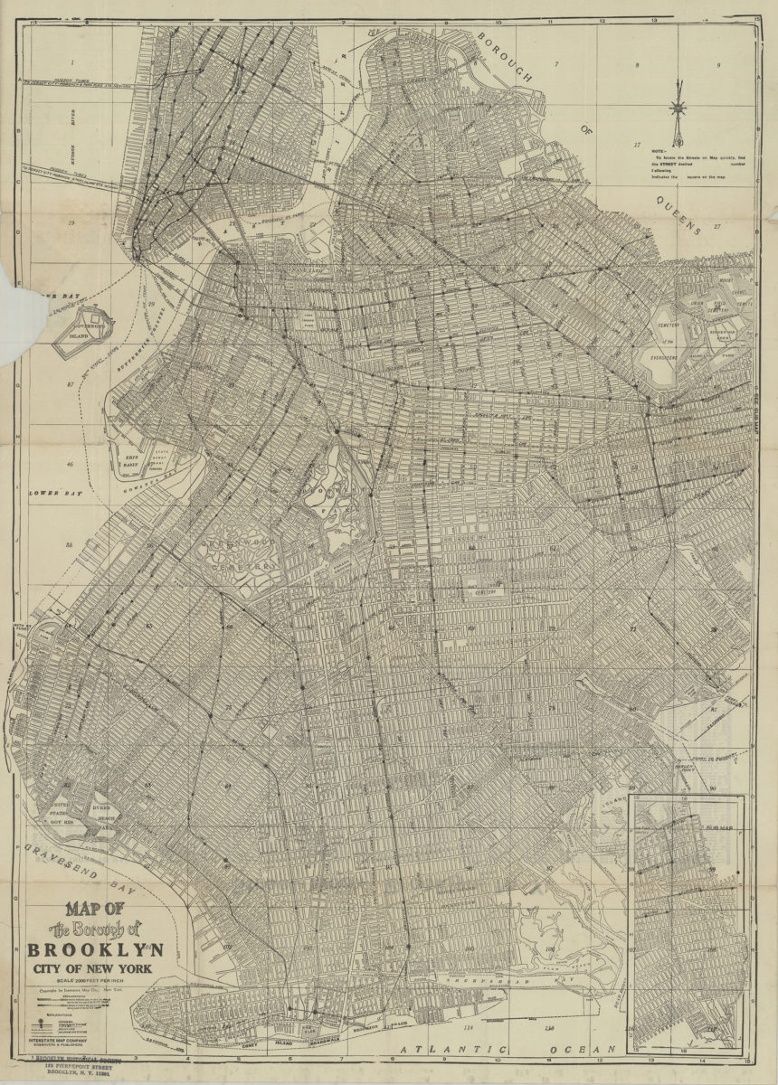
Map of the Borough of Brooklyn, City of New York
Map of the Borough of Brooklyn, City of New York
[19??]
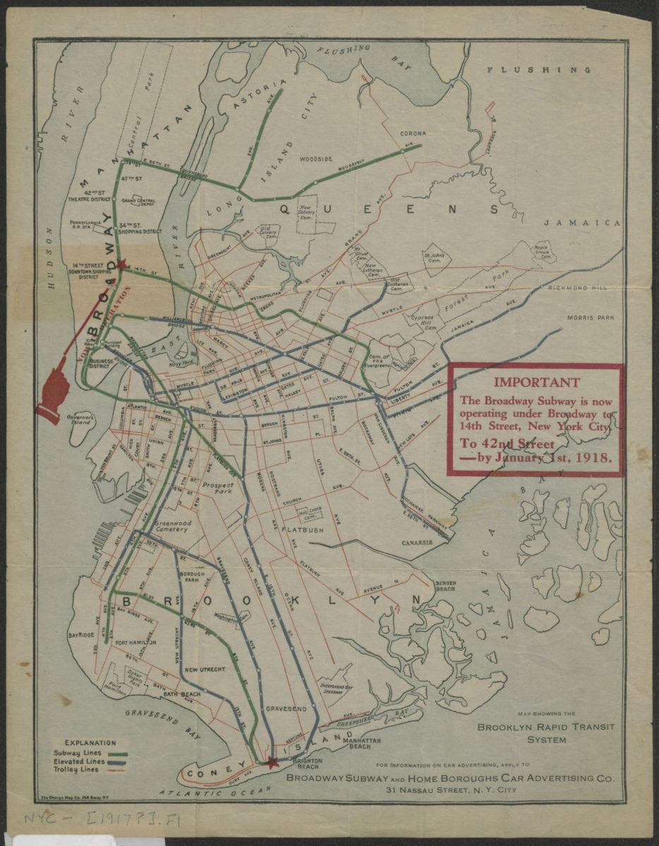
Map showing the Brooklyn Rapid Transit system
Map showing the Brooklyn Rapid Transit system
[1917]
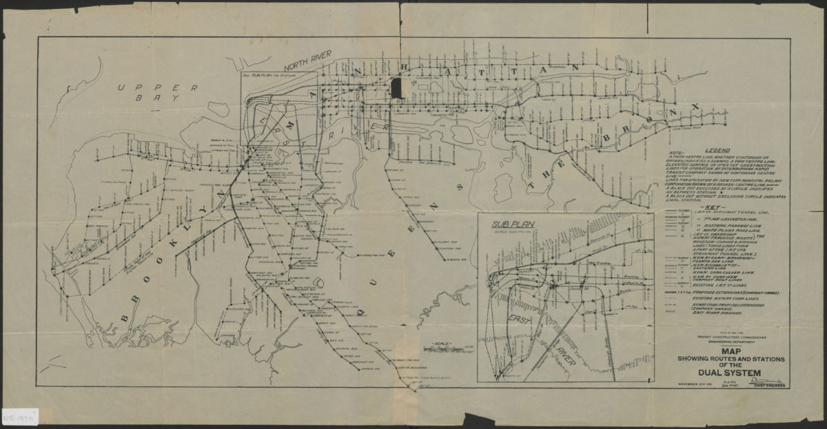
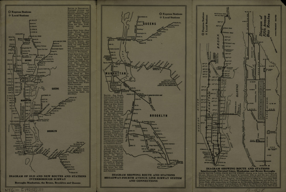
Map showing routes and stations of the dual systems
Map showing routes and stations of the dual systems
1919
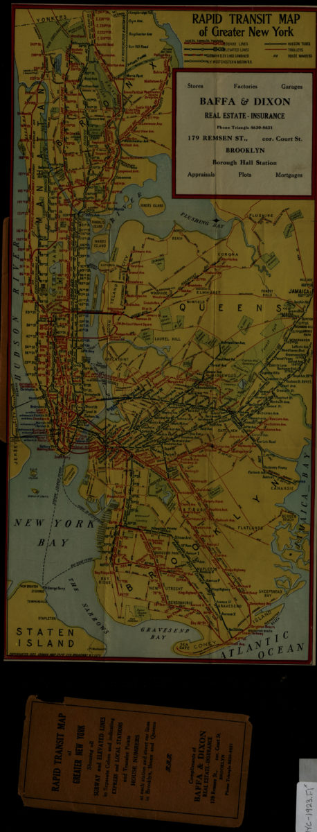
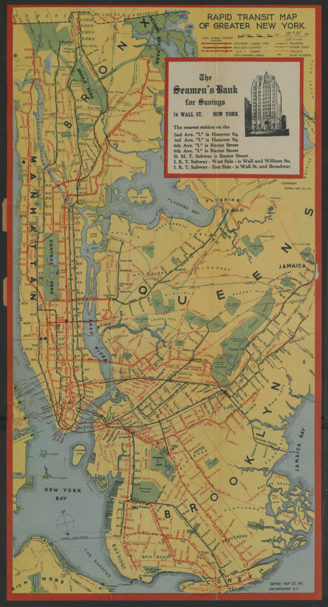
Rapid transit map of greater New York: Ohman Map Co
Rapid transit map of greater New York: Ohman Map Co
1923
Rapid transit systems of greater New York: interborough subway and elevated lines, Brooklyn rapid transit subway & elevated lines: compliments of the Corn Exchange Bank
Rapid transit systems of greater New York: interborough subway and elevated lines, Brooklyn rapid transit subway & elevated lines: compliments of the Corn Exchange Bank
[ca. 1925]
Rapid transit map of greater New York: shows house numbers at each station
Rapid transit map of greater New York: shows house numbers at each station
[1929]
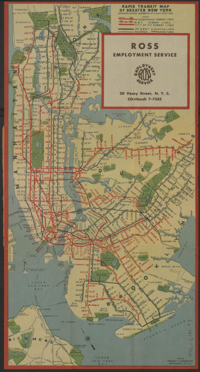
Rapid transit map of greater New York: showing house numbers at each station
Rapid transit map of greater New York: showing house numbers at each station
[193?]
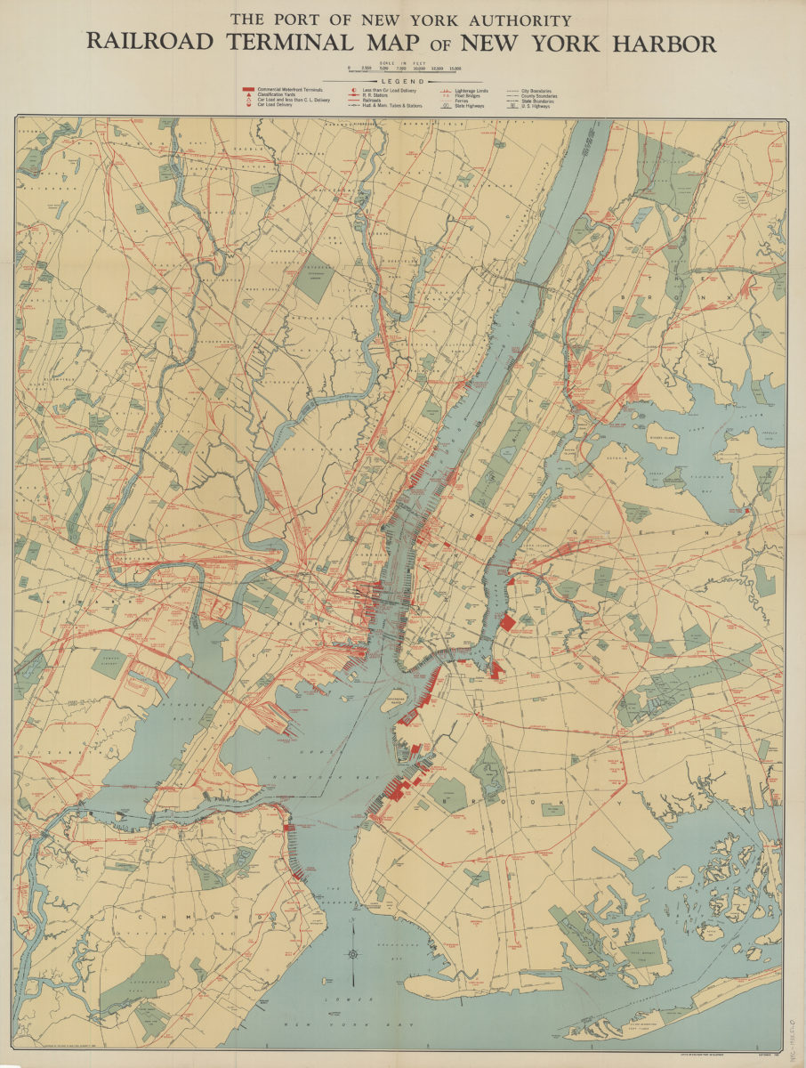
Railroad terminal map of New York Harbor
Railroad terminal map of New York Harbor
[ca. 1933]
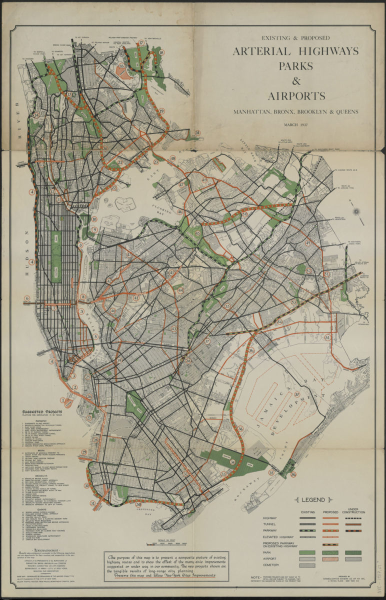
Existing & proposed arterial highways, parks & airports, Manhattan, Bronx, Brooklyn & Queens: prepared by Consolidated Edison Co. of N.Y., inc
Existing & proposed arterial highways, parks & airports, Manhattan, Bronx, Brooklyn & Queens: prepared by Consolidated Edison Co. of N.Y., inc
1937
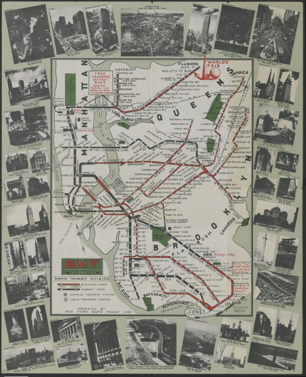
BMT Lines Rapid Transit Division
BMT Lines Rapid Transit Division
[1939]
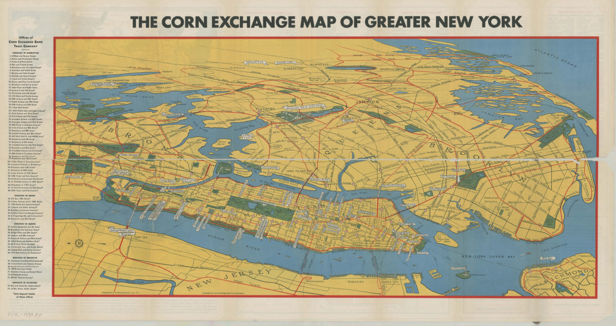
Map of greater New York: New York World’s Fair, 1939: prepared by C.S. Hammond & Co., inc ; copyright by Corn Exchange Bank Trust Company
Map of greater New York: New York World’s Fair, 1939: prepared by C.S. Hammond & Co., inc ; copyright by Corn Exchange Bank Trust Company
[1939]
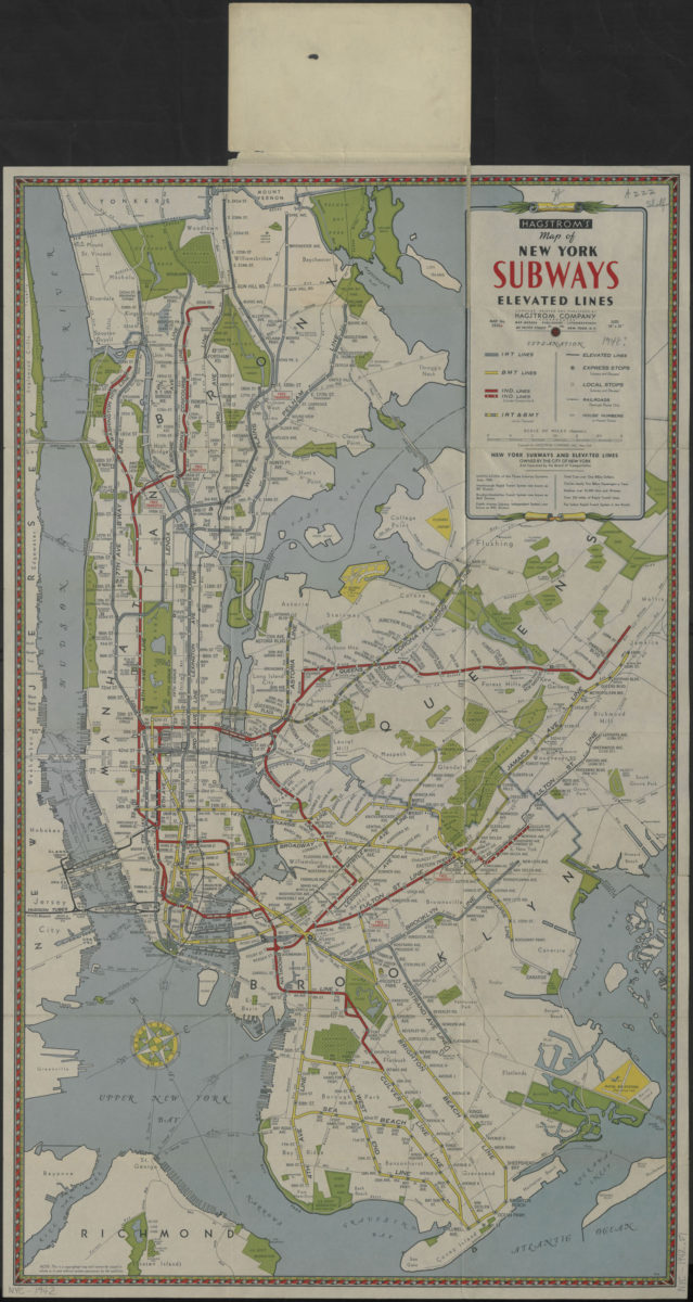
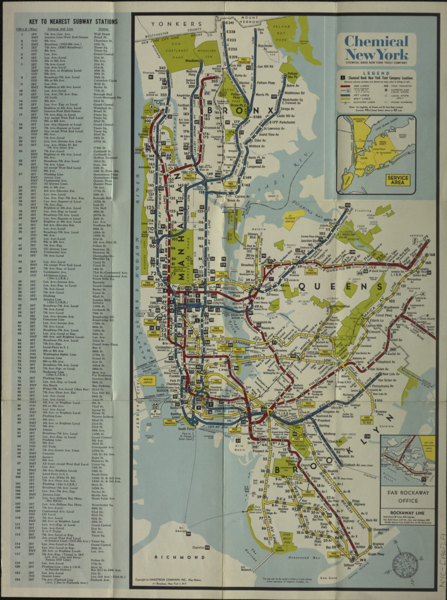
Hagstrom’s map of New York subways, elevated lines: compiled, printed and published by Hagstrom Company, Incorporated
Hagstrom’s map of New York subways, elevated lines: compiled, printed and published by Hagstrom Company, Incorporated
[1942]
Canal and railroad map of the State of New York: to accompany the Legislative Manual
Canal and railroad map of the State of New York: to accompany the Legislative Manual
1943
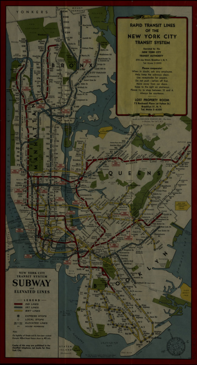
Rapid transit lines of the New York City transit system: operated by the New York City Transit Authority
Rapid transit lines of the New York City transit system: operated by the New York City Transit Authority
[1953]
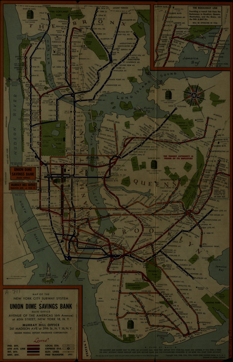
Map of the New York City subway system: designed by Stephen Voorhies
Map of the New York City subway system: designed by Stephen Voorhies
[1955; 1955]
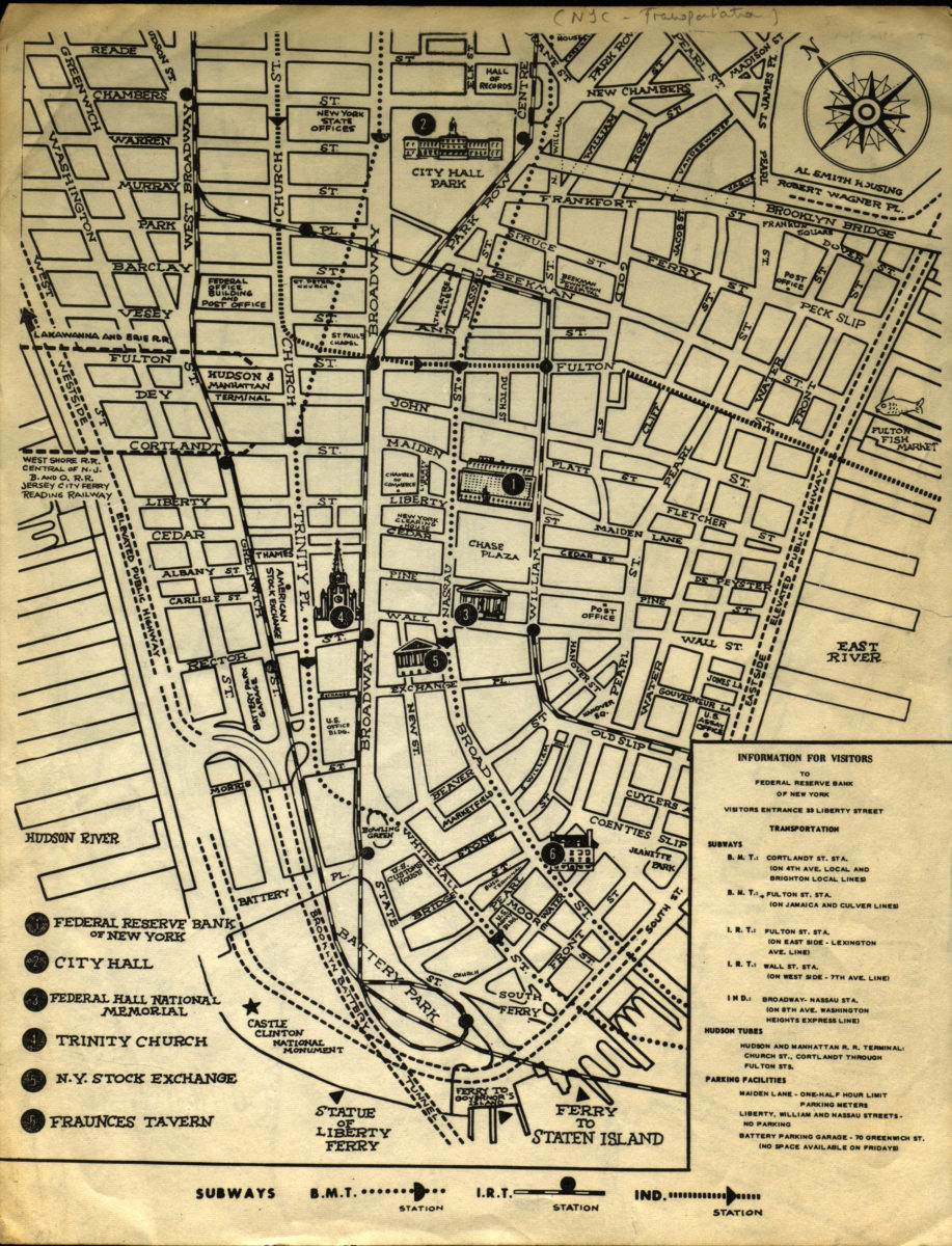
Information for visitors to Federal Reserve Bank of New York
Information for visitors to Federal Reserve Bank of New York
[1956-1966]
New York City subway map
New York City subway map
[1961]
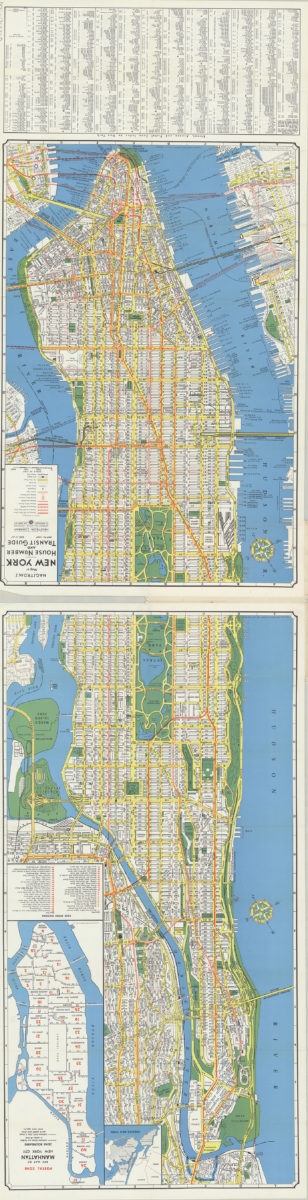
Hagstrom’s map of New York, house number and transit guide: compiled, printed and published by Hagstrom Company Incorporated
Hagstrom’s map of New York, house number and transit guide: compiled, printed and published by Hagstrom Company Incorporated
[1963]
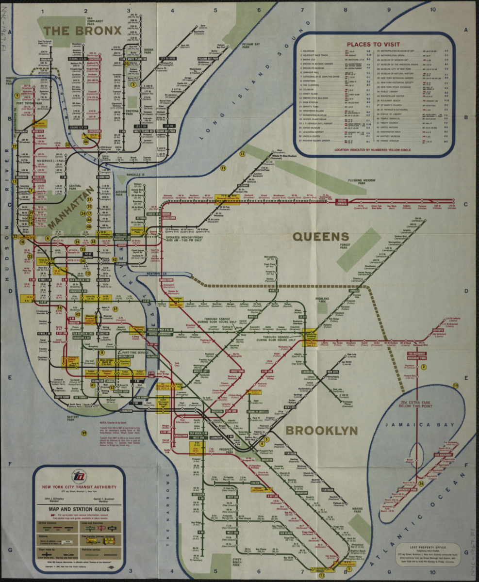
Map and station guide: New York City Transit Authority
Map and station guide: New York City Transit Authority
[ca. 1967]
The Metropolitan Transportation Authority revised map of rapid transit facilities of New York City Transit Authority: New York City Transit Authority
The Metropolitan Transportation Authority revised map of rapid transit facilities of New York City Transit Authority: New York City Transit Authority
[ca. 1972]
The Metropolitan Transportation Authority revised map of rapid transit facilities of New York City Transit Authority: New York City Transit Authority
The Metropolitan Transportation Authority revised map of rapid transit facilities of New York City Transit Authority: New York City Transit Authority
[ca. 1974]
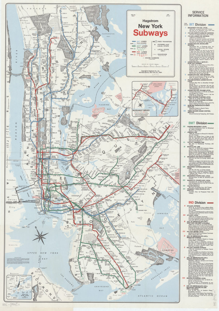
New York subways: Hagstrom
New York subways: Hagstrom
[1974]
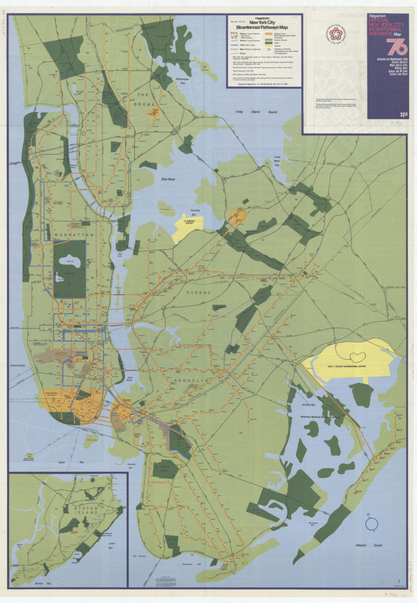
Hagstrom New York City Bicentennial pathways map
Hagstrom New York City Bicentennial pathways map
[1975]
Long Island, New York City & metro area counties: [prepared for] Texaco
Long Island, New York City & metro area counties: [prepared for] Texaco
1975
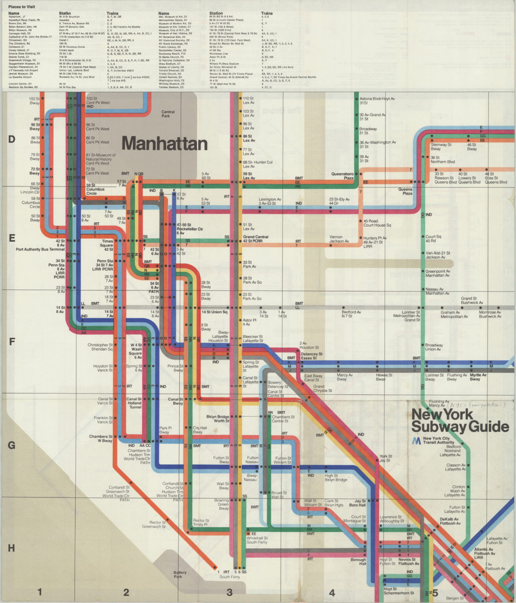
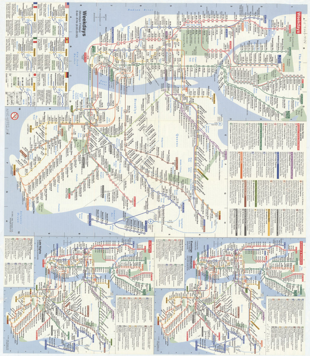
Subway map: the New York subway map = Le plan du métro de New York: the New York subway map is a Tauranac map
Subway map: the New York subway map = Le plan du métro de New York: the New York subway map is a Tauranac map
[1992]
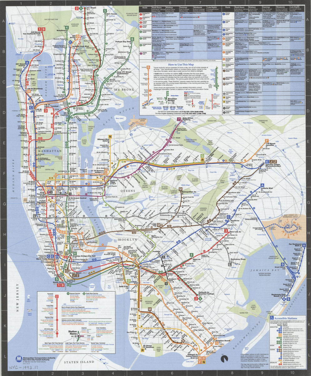
NYC subway map: June 1993, Français, Español, Deutsch, Italiano, English, Nihongo, Chung wen: New York City Transit Authority, Metropolitan Transportation Authority
NYC subway map: June 1993, Français, Español, Deutsch, Italiano, English, Nihongo, Chung wen: New York City Transit Authority, Metropolitan Transportation Authority
[ca. 1993]
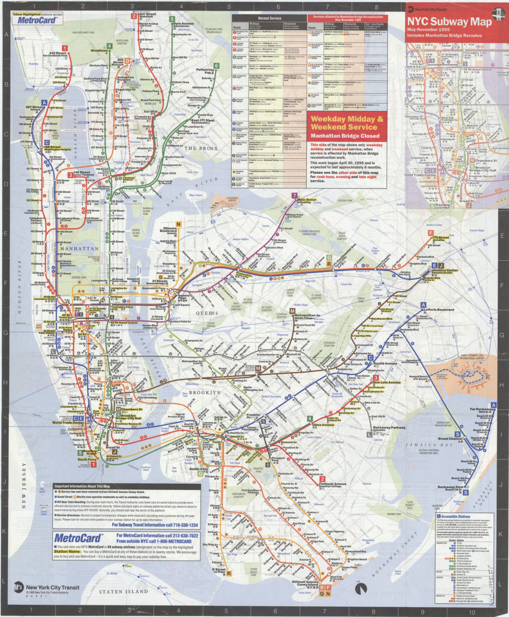
NYC subway map, May-November 1995: includes Manhattan Bridge reroutes: MTA New York City Transit Authority
NYC subway map, May-November 1995: includes Manhattan Bridge reroutes: MTA New York City Transit Authority
[ca. 1995]
New York City Transit subway map: multilingual : English, Français, Español, Deutsch, Italiano, Nihongo, Chung wen/: MTA-New York City Transit
New York City Transit subway map: multilingual : English, Français, Español, Deutsch, Italiano, Nihongo, Chung wen/: MTA-New York City Transit
[ca. 1996]
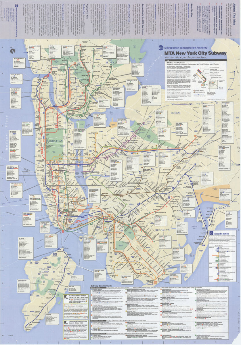
The map, MTA subways and railroads and their interconnections: connections between MTA subway, rail, and bus services, selected connections to other regional transit services: MTA Metropolitan Transportation Authority
The map, MTA subways and railroads and their interconnections: connections between MTA subway, rail, and bus services, selected connections to other regional transit services: MTA Metropolitan Transportation Authority
[ca. 1998]