Center for Brooklyn History
Map Collections
Search
About
Othmer Library & Archives
Submit search query
Refine 4 records
Clear filters
3
Location
Brooklyn (New York, N.Y.)
891
Long Island (N.Y.)
197
Manhattan (New York, N.Y.)
120
New York (N.Y.)
164
Subject
ferries
32
Piers
25
Date
19th Century
945
20th Century
469
or enter range:
from
to
Genres
Historical maps
53
Manuscript maps
365
Sort by:
Date (earliest)
Date (most recent)
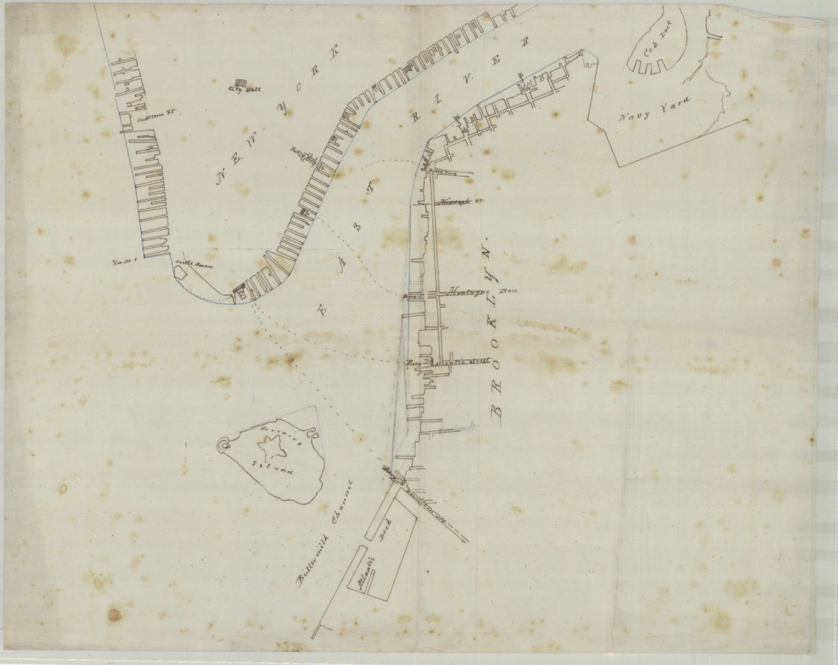
[Map of northwest Brooklyn and Lower Manhattan]
[Map of northwest Brooklyn and Lower Manhattan]
[18??]
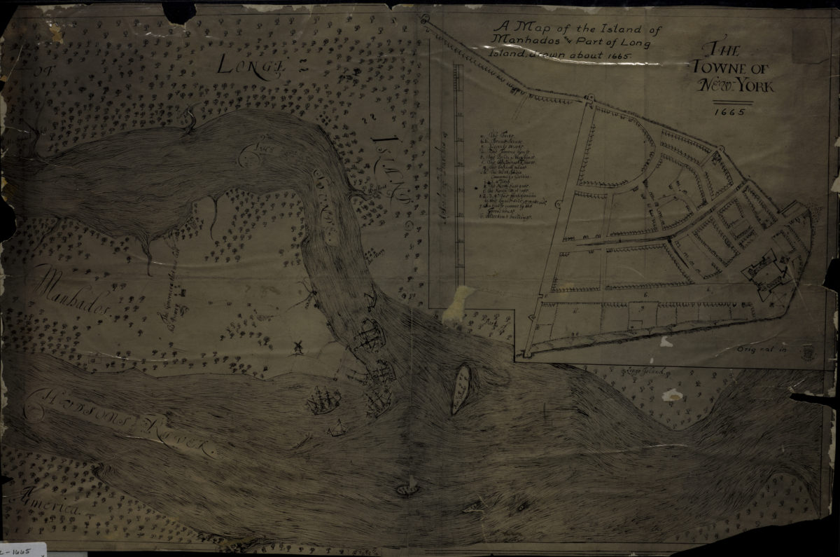
A map of the island of Manhados and part of Long Island, drawn about 1665
A map of the island of Manhados and part of Long Island, drawn about 1665
[18??]
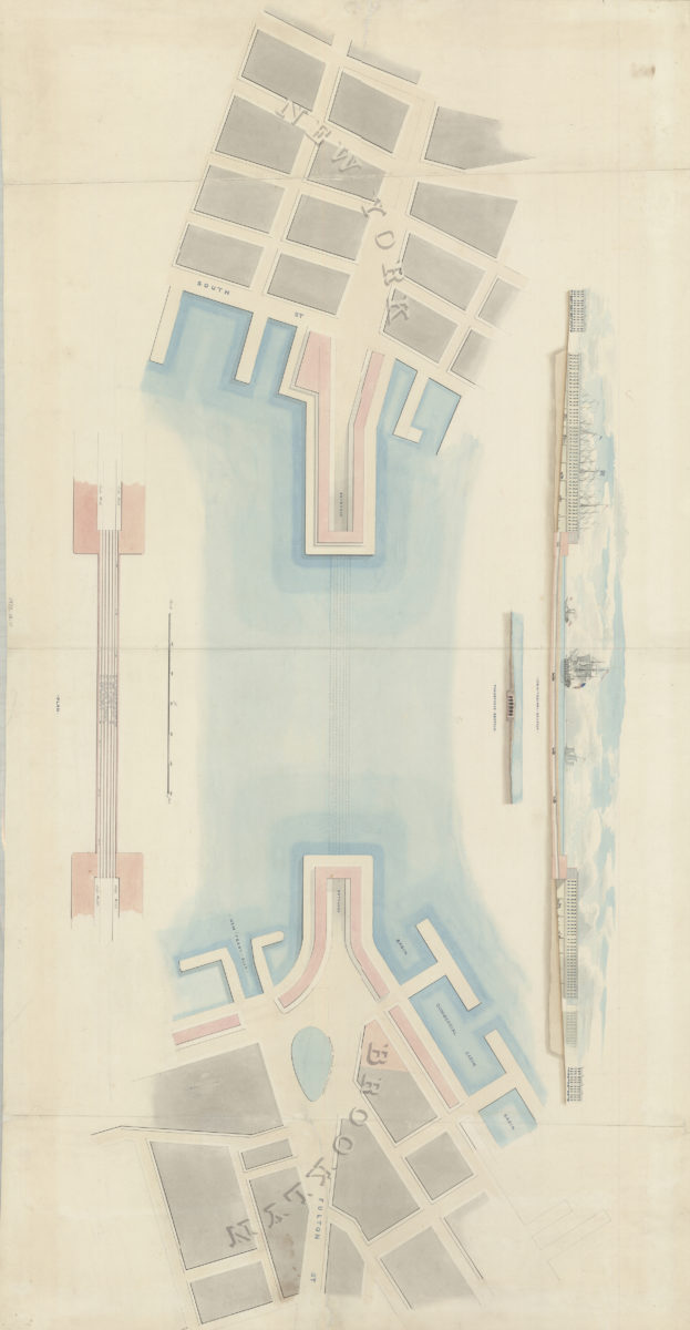
[Watercolor plan for proposed tunnel between Brooklyn and Manhattan connecting Fulton Street in Brooklyn and South Street in Manhattan]
[Watercolor plan for proposed tunnel between Brooklyn and Manhattan connecting Fulton Street in Brooklyn and South Street in Manhattan]
1978
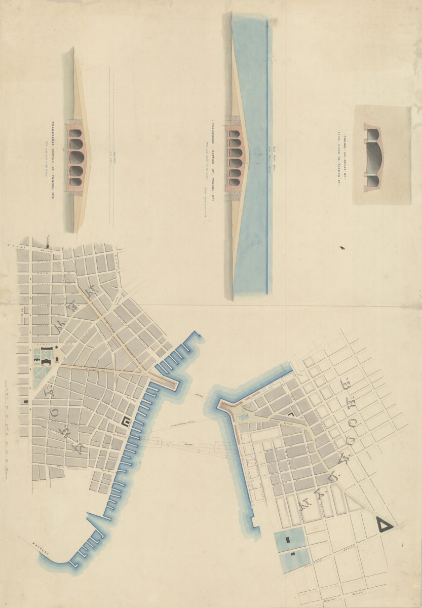
[Watercolor plan for proposed tunnel between Manhattan and Brooklyn on Poplar Street connecting Hicks Street and Furman Street]
[Watercolor plan for proposed tunnel between Manhattan and Brooklyn on Poplar Street connecting Hicks Street and Furman Street]
1978