Center for Brooklyn History
Map Collections
Search
About
Othmer Library & Archives
Submit search query
Refine 2 records
Clear filters
3
Location
Brooklyn (New York, N.Y.)
891
New Jersey
27
New York (N.Y.)
164
Queens (New York, N.Y.)
83
Stapleton (New York, N.Y.)
1
Staten Island (N.Y.)
10
Subject
ferries
32
Real property
619
Date
19th Century
945
20th Century
469
or enter range:
from
to
Genres
Bathymetric maps
94
Cadastral maps
597
Topographic maps
70
Sort by:
Date (earliest)
Date (most recent)
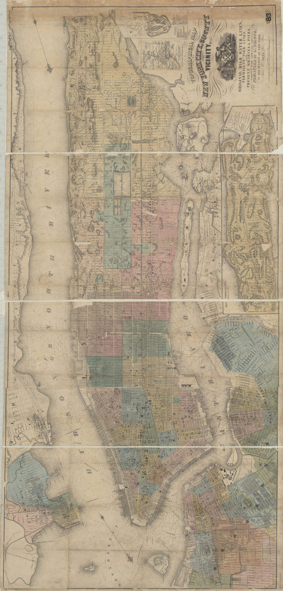
Topographical map of New York City, County and vicinity showing the original high water lines, permanent pier lines, and the present wharves & piers: compiled from authentic surveys
Topographical map of New York City, County and vicinity showing the original high water lines, permanent pier lines, and the present wharves & piers: compiled from authentic surveys
1855
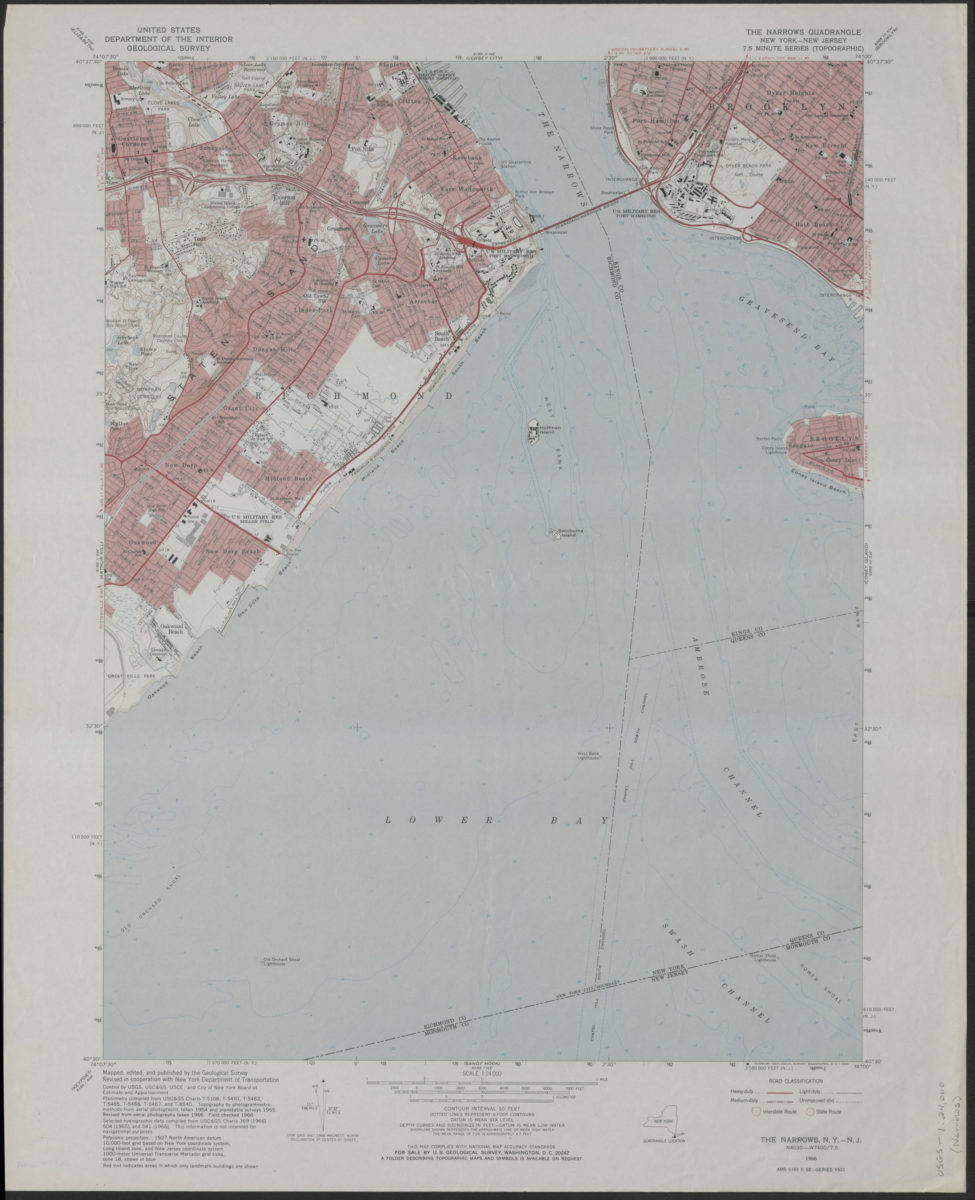
The Narrows quadrangle, New York–New Jersey: 7.5 minute series (topographic): mapped, edited, and published by the Geological Survey ; revised in cooperation with New York Department of Transportation
The Narrows quadrangle, New York–New Jersey: 7.5 minute series (topographic): mapped, edited, and published by the Geological Survey ; revised in cooperation with New York Department of Transportation
1968