Center for Brooklyn History
Map Collections
Search
About
Othmer Library & Archives
Submit search query
Refine 3 records
Clear filters
2
Location
Brooklyn (New York, N.Y.)
891
Delaware River Valley (N.Y.-Del. and N.J.)
1
Flatbush (New York, N.Y.)
35
Mohawk River Valley (N.Y.)
3
New York (N.Y.)
164
New York (State)
95
New York Harbor (N.Y. and N.J.)
16
Schoharie Creek Valley (N.Y.)
1
Susquehanna River Valley
1
Subject
Decedents' estates
1
Land grants
12
Landowners
434
Real property
619
Date
18th Century
12
19th Century
945
or enter range:
from
to
Genres
Cadastral maps
597
Early maps
35
Early works
3
Manuscript maps
365
Sort by:
Date (earliest)
Date (most recent)
A plan of the city of New-York & its environs: to Greenwich, on the North or Hudsons River, and to Crown Point, on the East or Sound River, shewing the several streets, publick buildings, docks, fort & battery,
A plan of the city of New-York & its environs: to Greenwich, on the North or Hudsons River, and to Crown Point, on the East or Sound River, shewing the several streets, publick buildings, docks, fort & battery,
1775
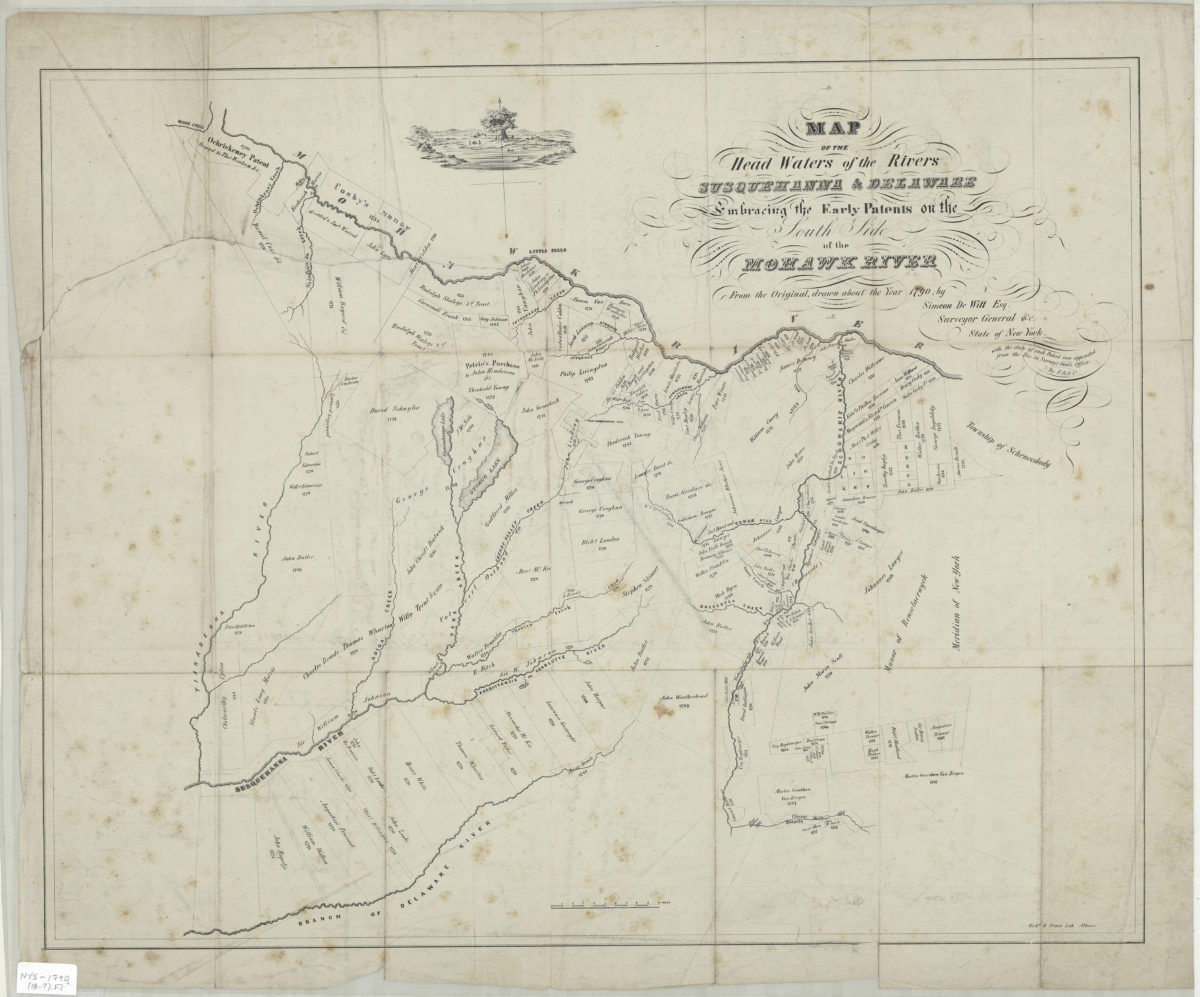
Map of the head waters of the rivers Susquehanna & Delaware: embracing the early patents on the south side of the Mohawk River : from the original, drawn about the year 1790: by Simeon DeWitt, Esq. … ;
Map of the head waters of the rivers Susquehanna & Delaware: embracing the early patents on the south side of the Mohawk River : from the original, drawn about the year 1790: by Simeon DeWitt, Esq. … ;
[18??]
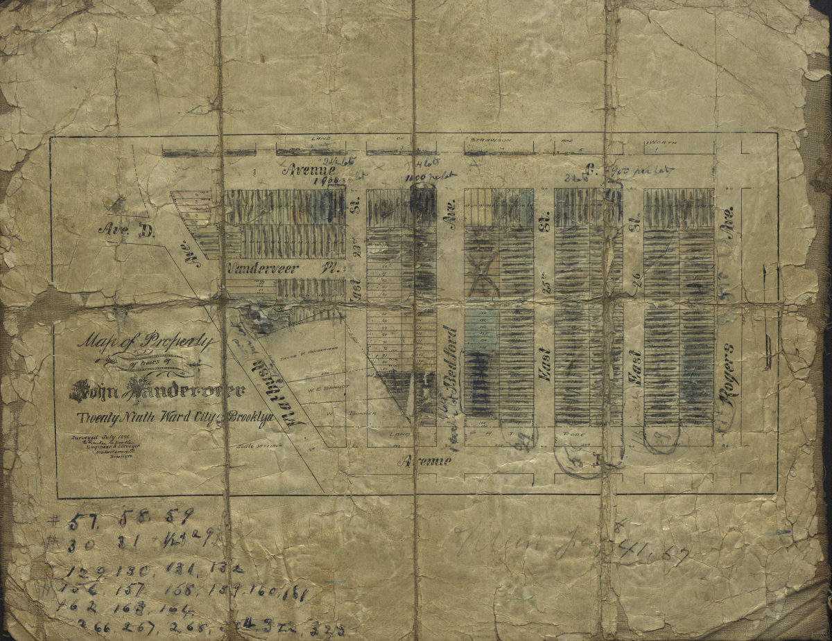
Map of property of heirs of John Vanderveer, Twenty-Ninth Ward, city of Brooklyn: surveyed July 1896 [by] Charles Crooke, city surveyor
Map of property of heirs of John Vanderveer, Twenty-Ninth Ward, city of Brooklyn: surveyed July 1896 [by] Charles Crooke, city surveyor
[1896]