Center for Brooklyn History
Map Collections
Search
About
Othmer Library & Archives
Submit search query
Refine 4 records
Clear filters
2
Location
New England
8
New Jersey
27
New York (N.Y.)
164
New York (State)
95
New York Harbor (N.Y. and N.J.)
16
New York Region
5
White Plains (N.Y.)
1
Subject
White Plains, Battle of, White Plains, N.Y., 1776
3
Date
18th Century
12
20th Century
469
or enter range:
from
to
Genres
Cadastral maps
597
Early maps
35
Early works
3
Historical maps
53
Military maps
23
Sort by:
Date (earliest)
Date (most recent)
A plan of the city of New-York & its environs: to Greenwich, on the North or Hudsons River, and to Crown Point, on the East or Sound River, shewing the several streets, publick buildings, docks, fort & battery,
A plan of the city of New-York & its environs: to Greenwich, on the North or Hudsons River, and to Crown Point, on the East or Sound River, shewing the several streets, publick buildings, docks, fort & battery,
1775
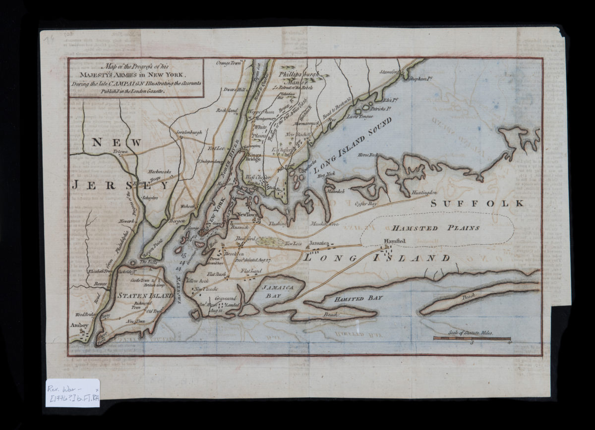
Map of the progress of His Majesty’s armies in New York, during the late campaign: illustrating the accounts published in the London Gazette
Map of the progress of His Majesty’s armies in New York, during the late campaign: illustrating the accounts published in the London Gazette
[1776]
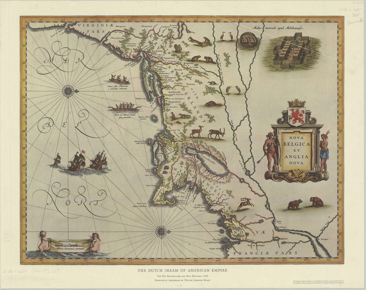
The Dutch dream of American empire: the New Netherlands and New England, 1635: engraved in Amsterdam by Willem Janszoon Blaeu
The Dutch dream of American empire: the New Netherlands and New England, 1635: engraved in Amsterdam by Willem Janszoon Blaeu
[195?]
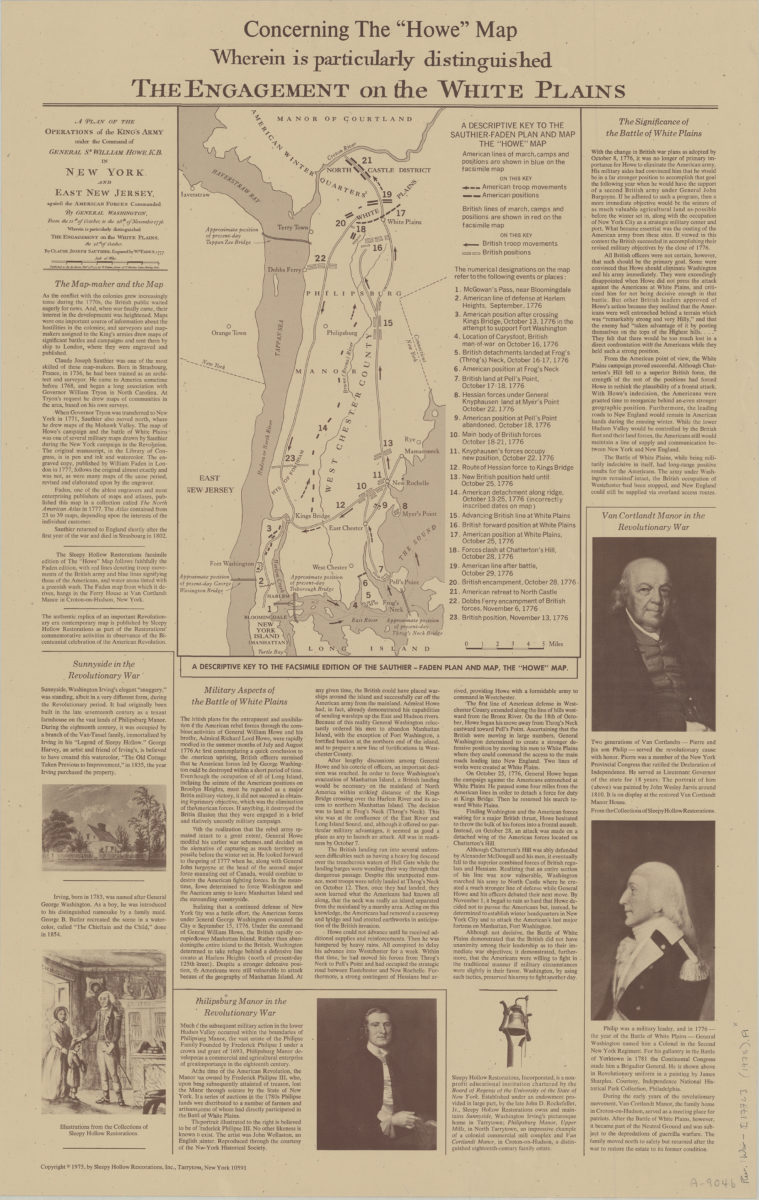
Concerning the “Howe” map, wherein is particularly distinguished the engagement on the White Plains
Concerning the “Howe” map, wherein is particularly distinguished the engagement on the White Plains
[ca. 1975]