Center for Brooklyn History
Map Collections
Search
About
Othmer Library & Archives
Submit search query
Refine 14 records
Clear filters
2
Location
Brooklyn (New York, N.Y.)
891
Brooklyn Heights (New York, N.Y.)
76
Fulton Ferry Historic District (New York, N.Y.)
5
Jersey City (N.J.)
4
Manhattan (New York, N.Y.)
120
New Jersey
27
New York (N.Y.)
164
New York Metropolitan Area
40
Williamsburg (New York, N.Y.)
36
Subject
Canals
15
ferries
32
Fills (Earthwork)
4
Fire alarms
4
Fire protection districts
2
Landowners
434
Parks
35
Piers
25
Ponds
6
Railroads
72
Real property
619
Rivers
16
School districts
4
Streets
46
Wharves
1
Date
19th Century
945
or enter range:
from
to
Genres
Bathymetric maps
94
Cadastral maps
597
Manuscript maps
365
Map
191
Topographic maps
70
Sort by:
Date (earliest)
Date (most recent)
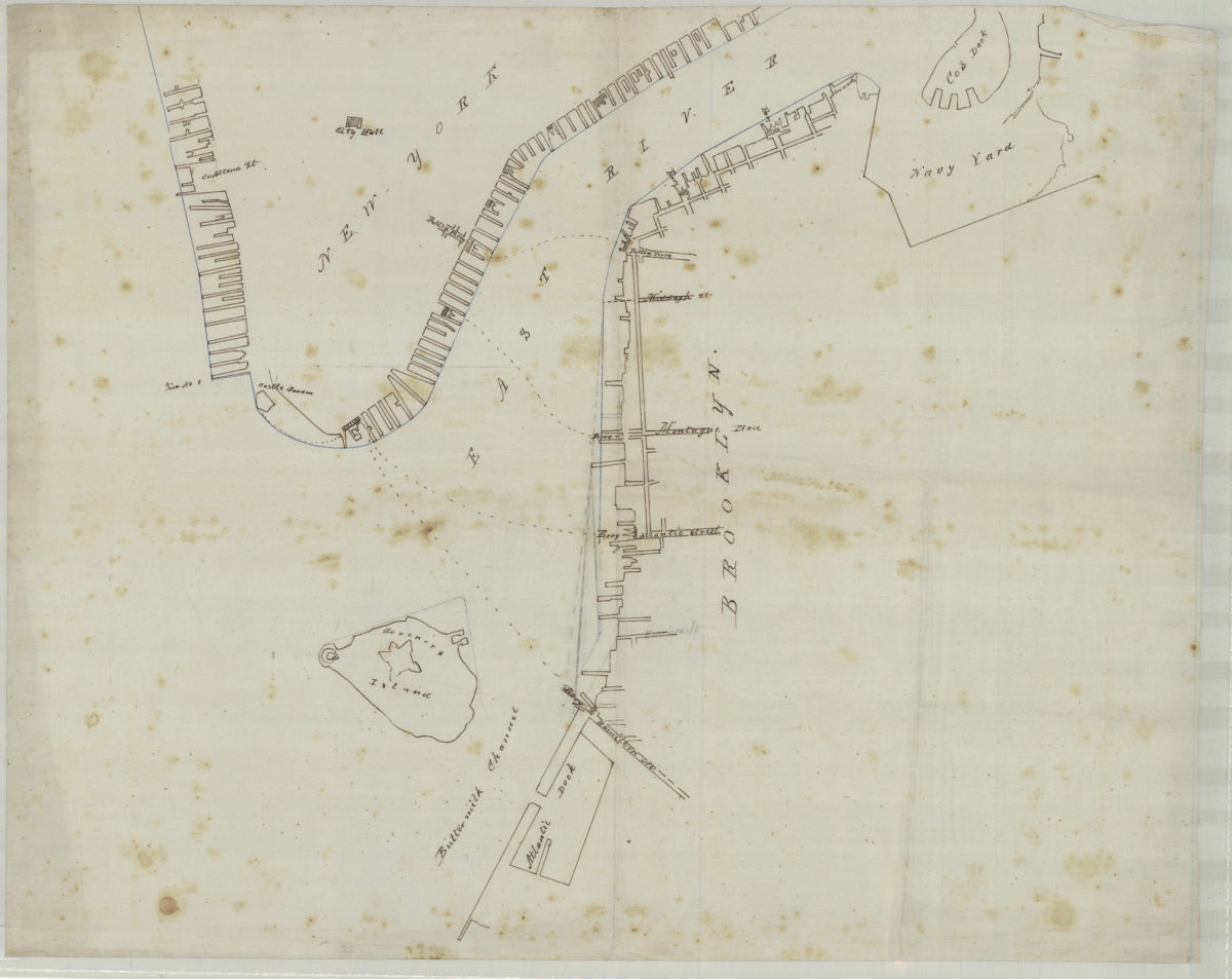
[Map of northwest Brooklyn and Lower Manhattan]
[Map of northwest Brooklyn and Lower Manhattan]
[18??]
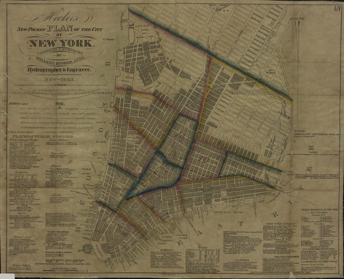
Hooker’s new pocket plan of the city of New York: compiled & surveyed by William Hooker
Hooker’s new pocket plan of the city of New York: compiled & surveyed by William Hooker
1826
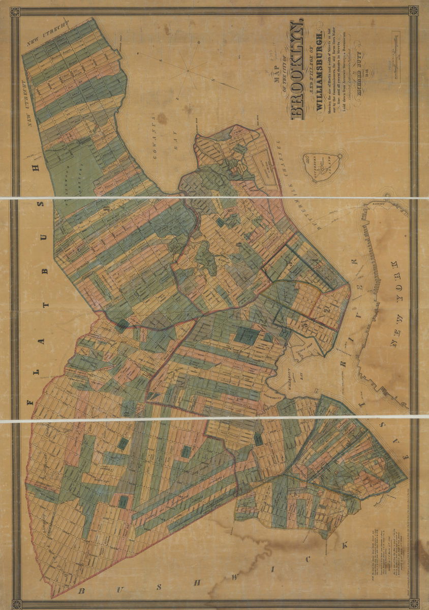
Map of the city of Brooklyn and village of Williamsburgh: showing the size of blocks and width of streets as laid out by the commissioners, the old farm lines, water line, and all recent changes in streets
Map of the city of Brooklyn and village of Williamsburgh: showing the size of blocks and width of streets as laid out by the commissioners, the old farm lines, water line, and all recent changes in streets
1846
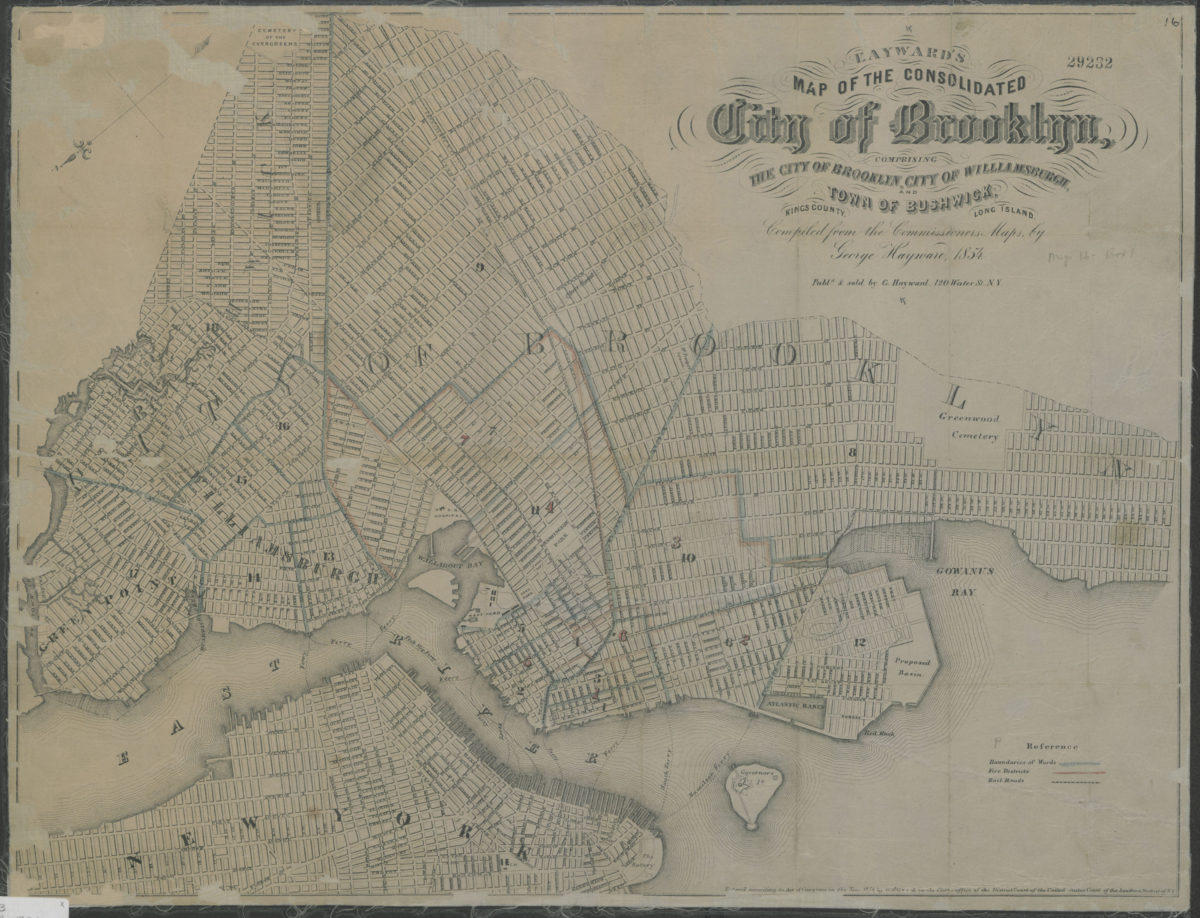
Map of the consolidated City of Brooklyn: comprising the City of Brooklyn, City of Williamsburgh and Town of Bushwick, Kings County, Long Island: compiled from the Commissioners maps by George Hayward
Map of the consolidated City of Brooklyn: comprising the City of Brooklyn, City of Williamsburgh and Town of Bushwick, Kings County, Long Island: compiled from the Commissioners maps by George Hayward
1854
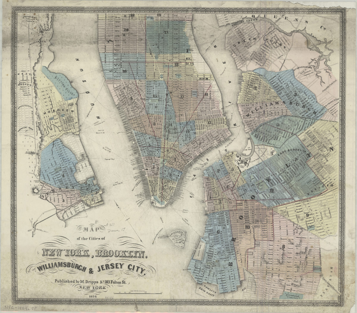
Map of the cities of New York, Brooklyn, Williamsburgh & Jersey City
Map of the cities of New York, Brooklyn, Williamsburgh & Jersey City
1854
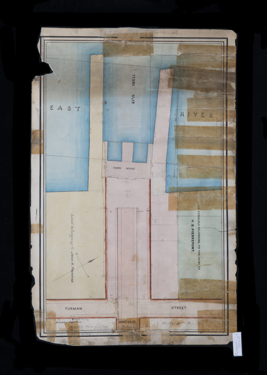
Montague Street Ferry: surveyed by Silas Ludlam ; copied … by Richd. F. Tooms
Montague Street Ferry: surveyed by Silas Ludlam ; copied … by Richd. F. Tooms
September 1854
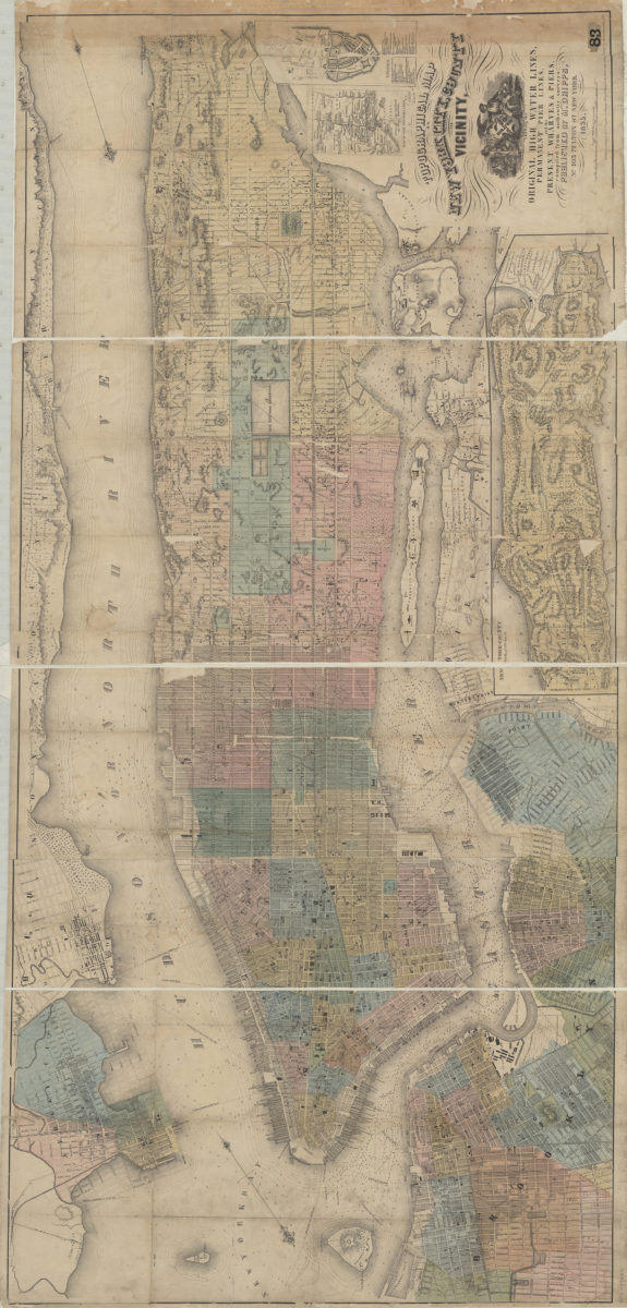
Topographical map of New York City, County and vicinity showing the original high water lines, permanent pier lines, and the present wharves & piers: compiled from authentic surveys
Topographical map of New York City, County and vicinity showing the original high water lines, permanent pier lines, and the present wharves & piers: compiled from authentic surveys
1855
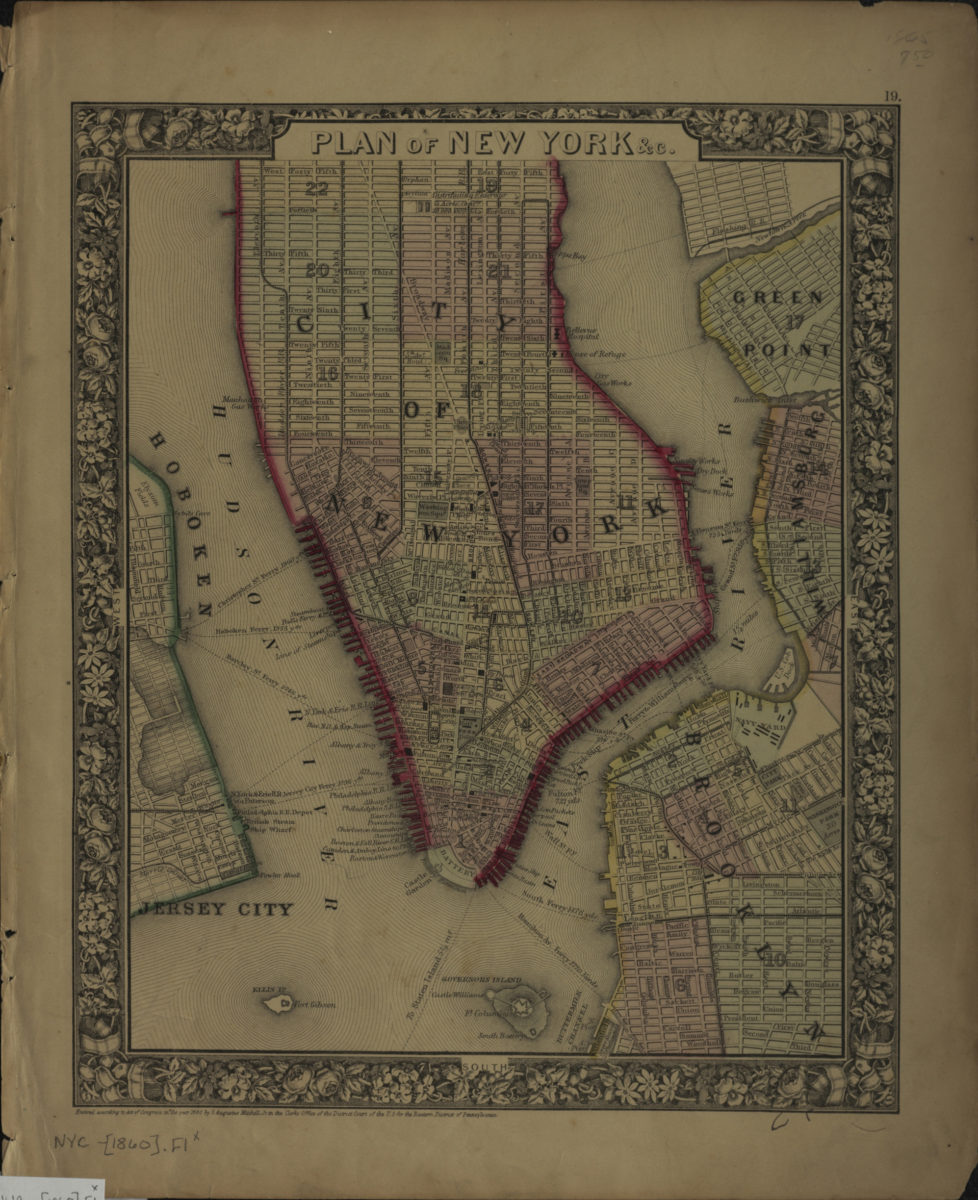
Plan of New York &c
Plan of New York &c
[ca. 1860]
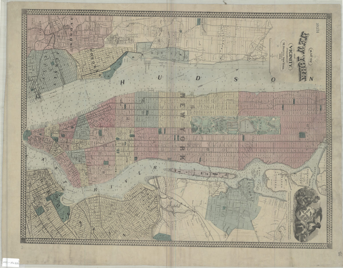
Map of New York and vicinity
Map of New York and vicinity
1863
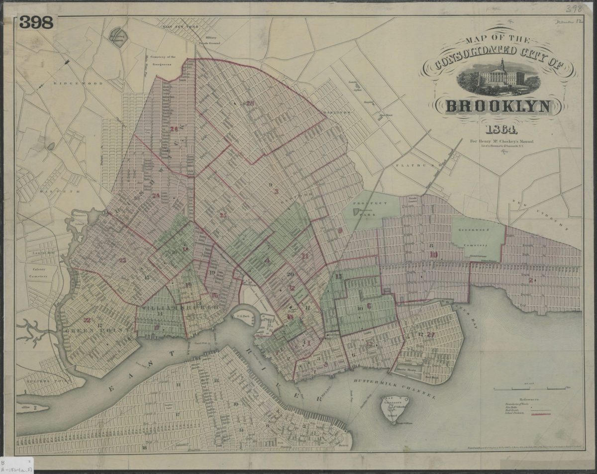
Map of the consolidated City of Brooklyn
Map of the consolidated City of Brooklyn
1864
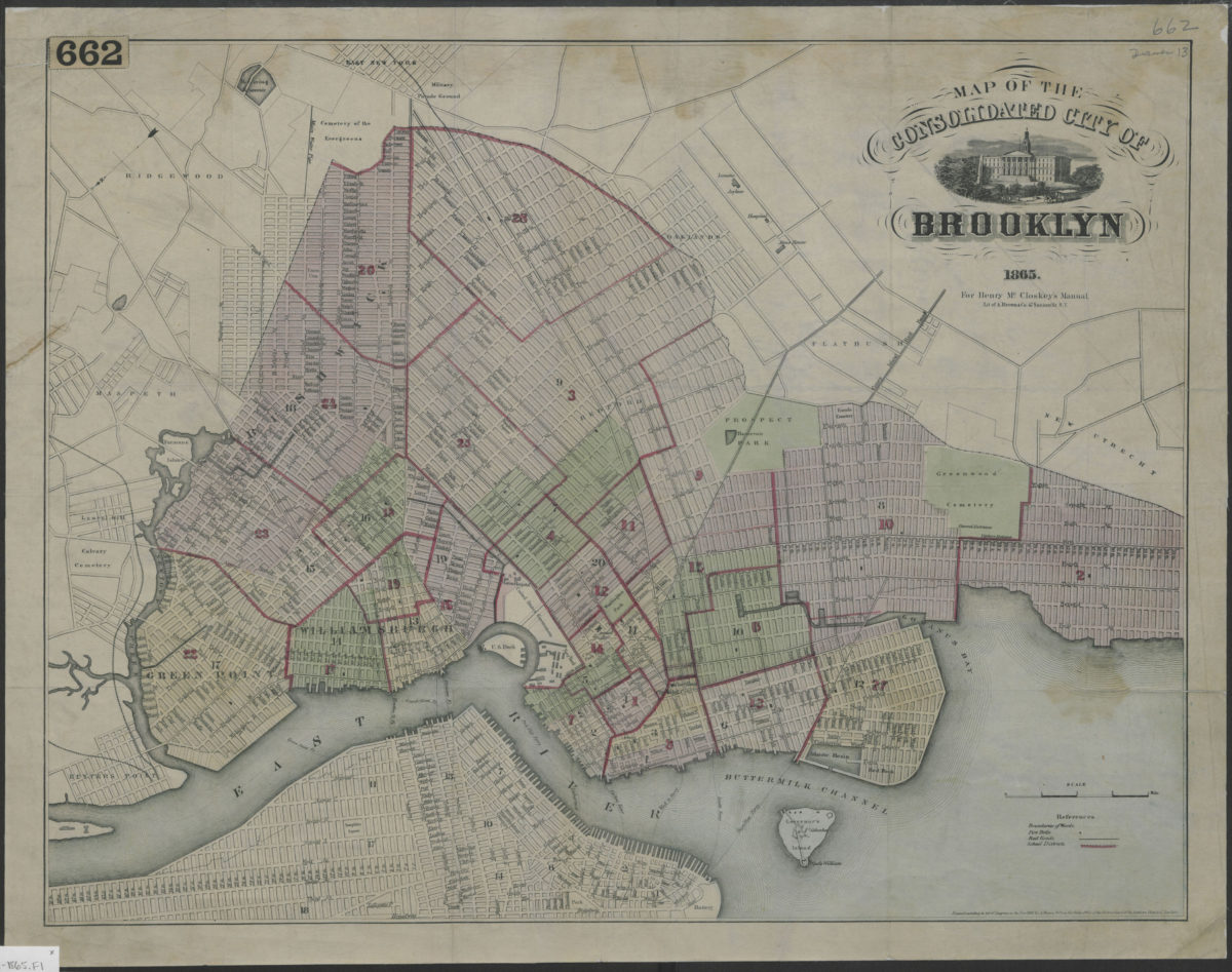
Map of the consolidated City of Brooklyn
Map of the consolidated City of Brooklyn
1865
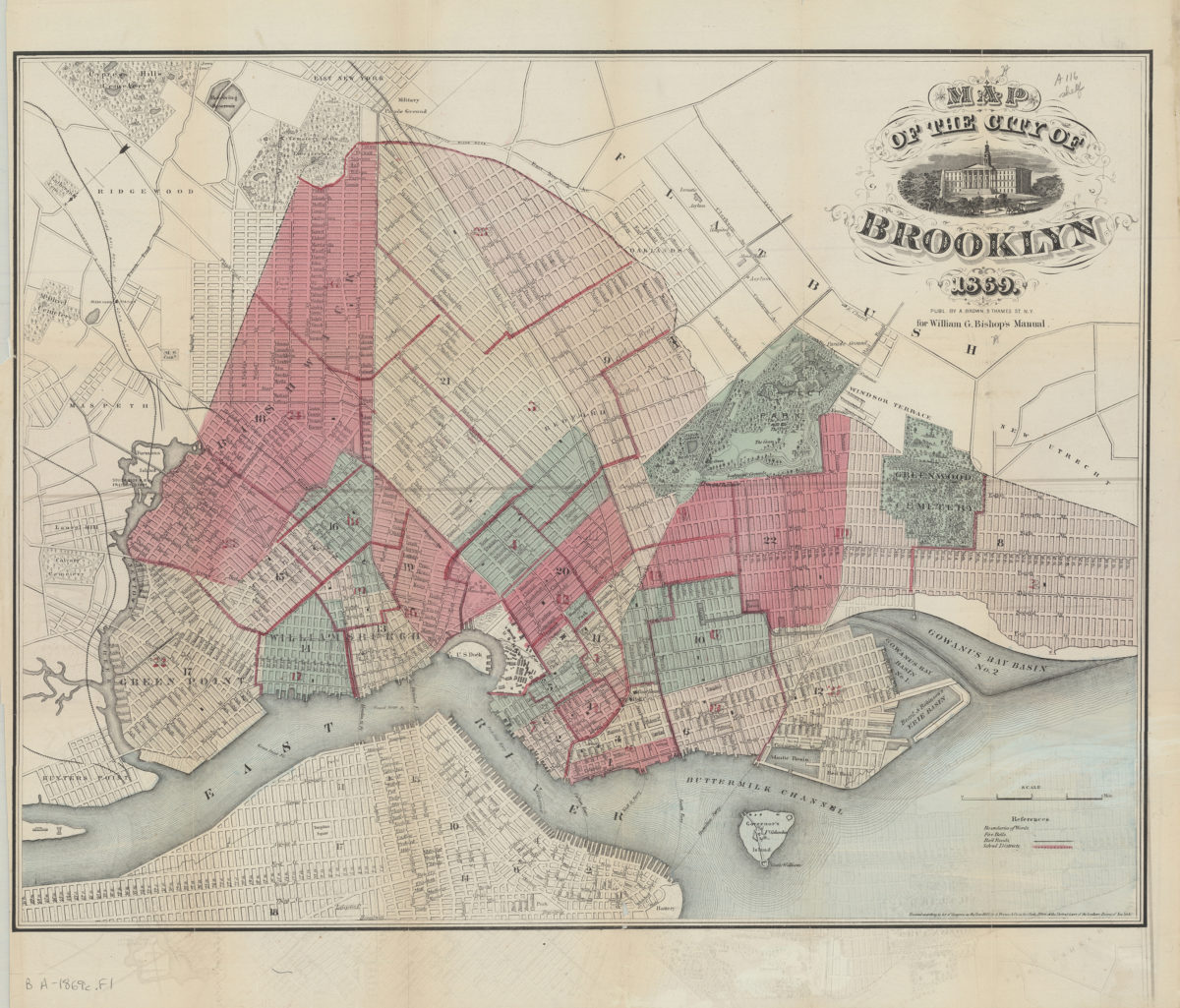
Map of the City of Brooklyn
Map of the City of Brooklyn
1869
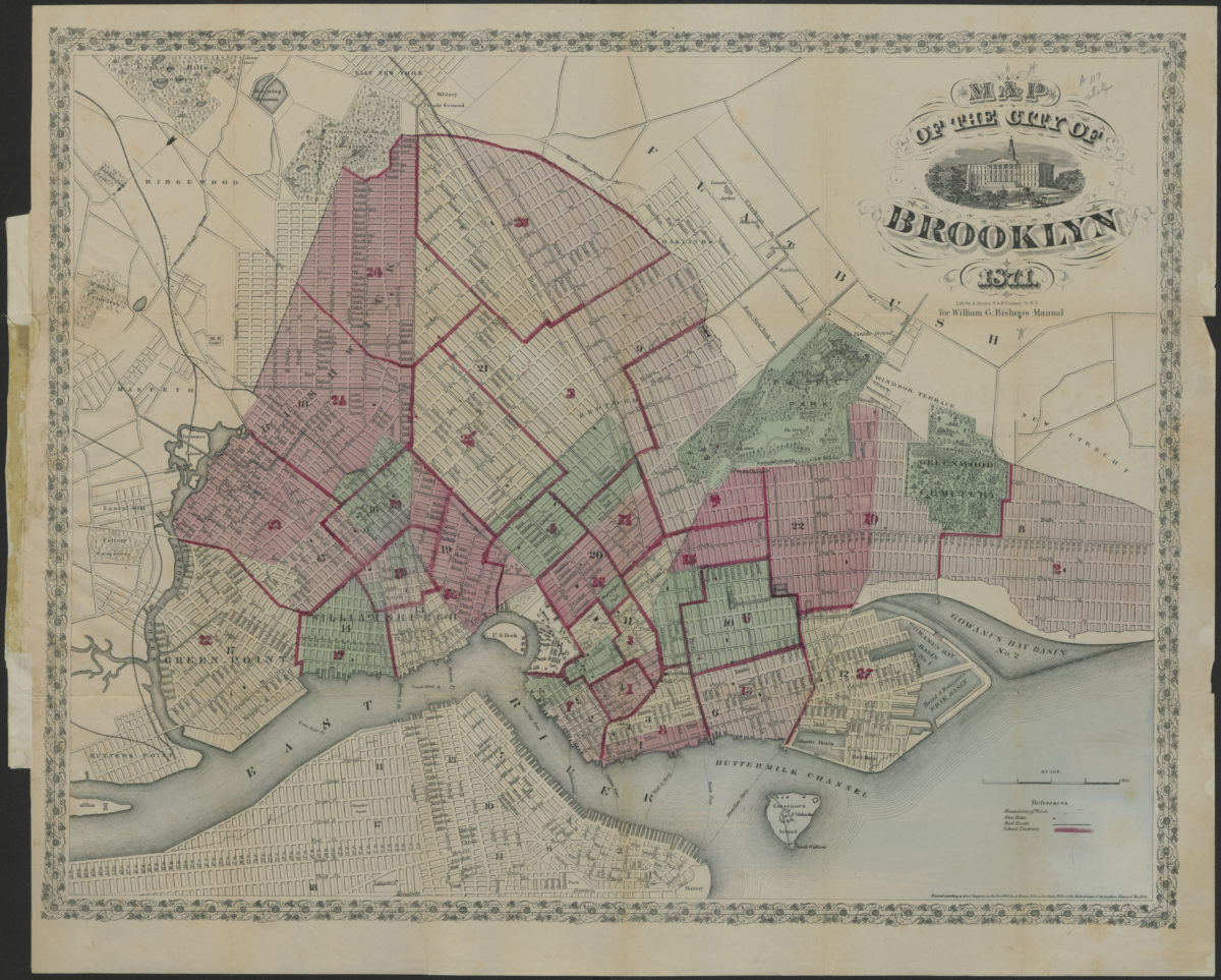
Map of the City of Brooklyn
Map of the City of Brooklyn
1871
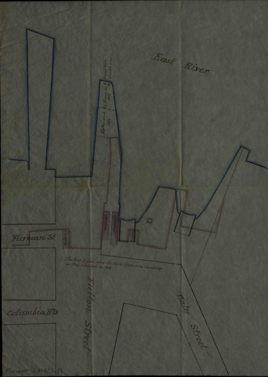
[Ferry slips, landings, and piers at Fulton St.].
[Ferry slips, landings, and piers at Fulton St.].
[1873]