Center for Brooklyn History
Map Collections
Search
About
Othmer Library & Archives
Submit search query
Refine 3 records
Clear filters
3
Location
Hempstead (N.Y.)
13
Long Island (N.Y.)
197
New York Harbor (N.Y. and N.J.)
16
Subject
Harbors
11
Date
20th Century
469
or enter range:
from
to
Genres
Bathymetric maps
94
Nautical charts
30
Sort by:
Date (earliest)
Date (most recent)
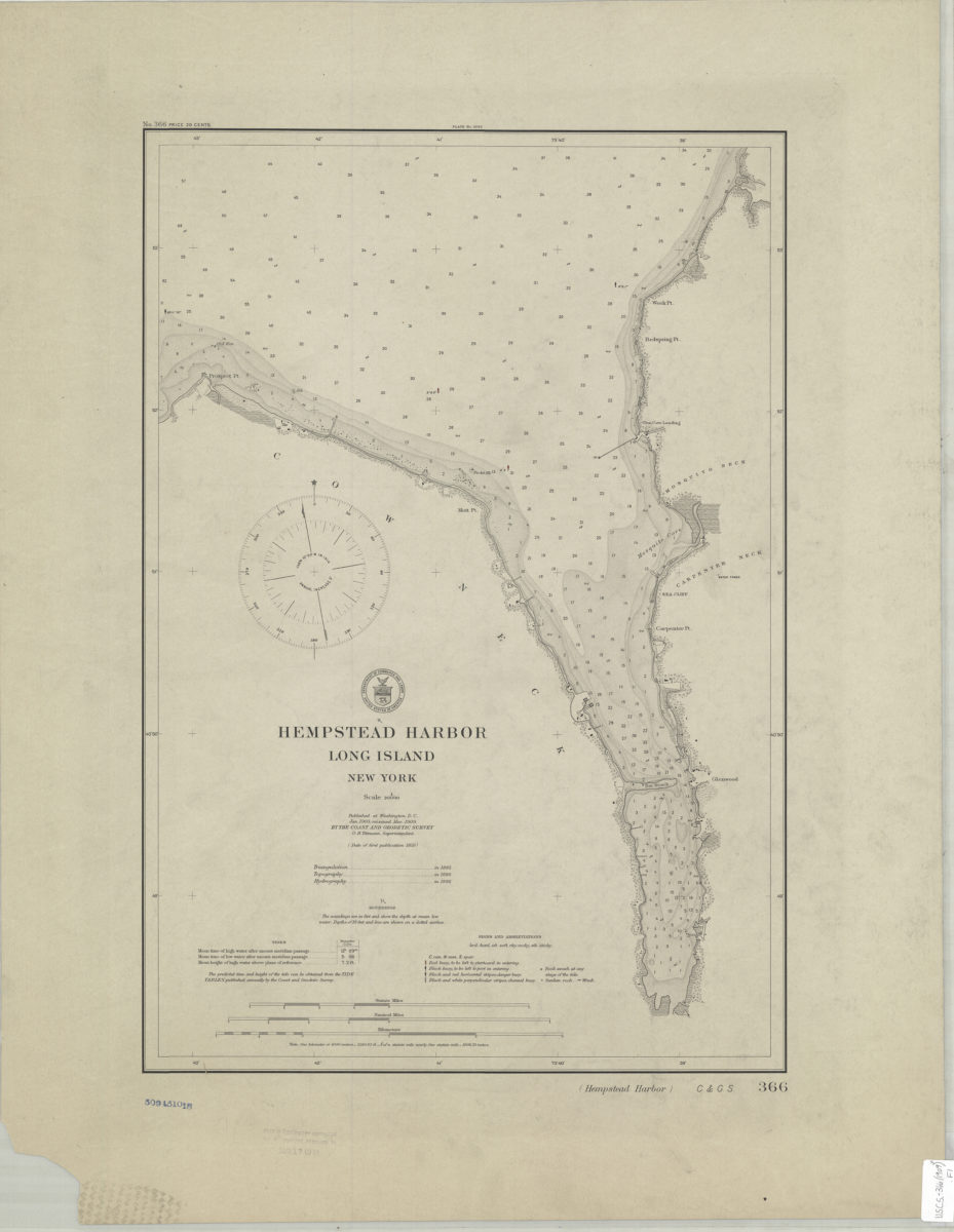
Hempstead Harbor, Long Island, New York
Hempstead Harbor, Long Island, New York
1909
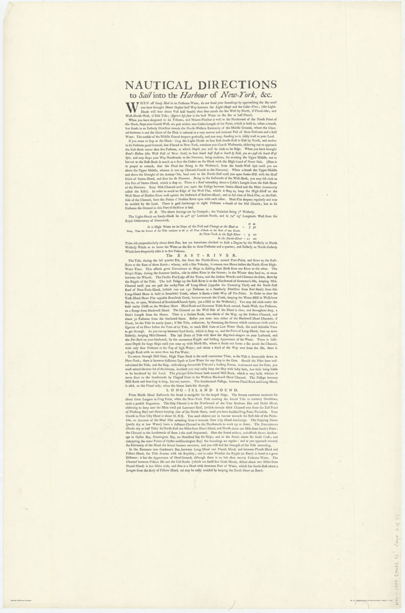
A chart of New York Harbour: with the soundings, views of land marks, and nautical directions for the use of pilotage: composed from surveys and observations of Lieutenants John Knight, John Hunter of the Navy, & others
A chart of New York Harbour: with the soundings, views of land marks, and nautical directions for the use of pilotage: composed from surveys and observations of Lieutenants John Knight, John Hunter of the Navy, & others
[ca. 1968]
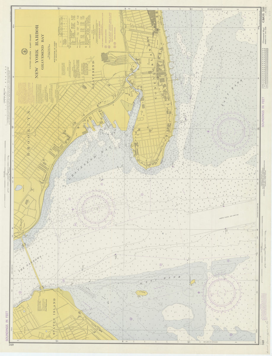
United States – East coast, New York Harbor, Gravesend Bay: National Ocean Survey
United States – East coast, New York Harbor, Gravesend Bay: National Ocean Survey
1974