Center for Brooklyn History
Map Collections
Search
About
Othmer Library & Archives
Submit search query
Refine 8 records
Clear filters
2
Location
Amagansett (N.Y.)
1
Brooklyn (New York, N.Y.)
891
Clermont (N.Y. : Town)
1
Fulton Ferry Historic District (New York, N.Y.)
5
Germantown (N.Y. : Town)
1
Great Neck (N.Y.)
3
Livingston (N.Y. : Town)
1
Long Island (N.Y.)
197
Manhattan (New York, N.Y.)
120
Mohawk River Valley (N.Y.)
3
New York (N.Y.)
164
Wallabout Bay (New York, N.Y.)
6
Subject
Bays
5
Landowners
434
Real property
619
Date
19th Century
945
20th Century
469
or enter range:
from
to
Genres
Bathymetric maps
94
Cadastral maps
597
Historical maps
53
Manuscript maps
365
Pictorial maps
38
Sort by:
Date (earliest)
Date (most recent)
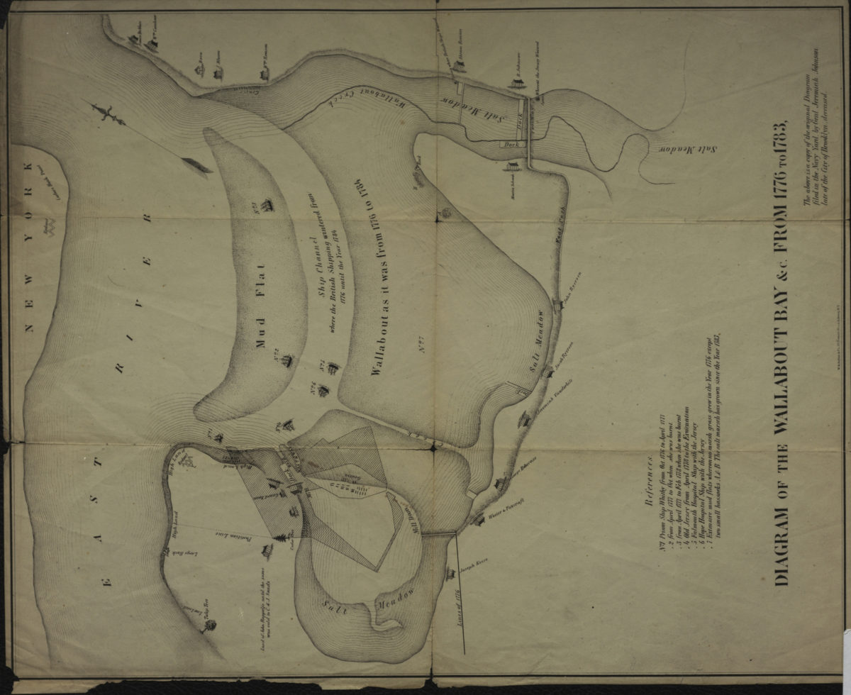
Diagram of the Wallabout Bay &c. from 1776 to 1783
Diagram of the Wallabout Bay &c. from 1776 to 1783
[18??]
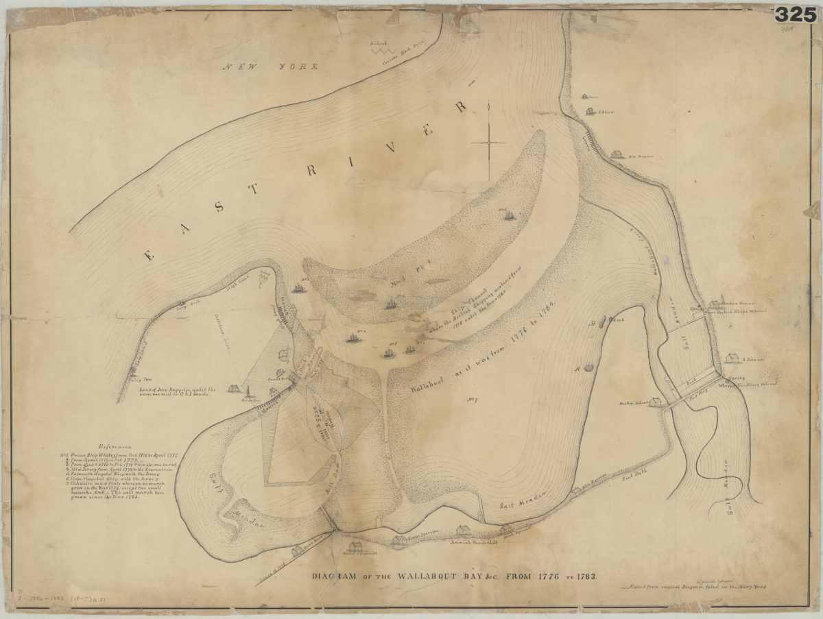
Diagram of the Wallabout Bay &c. from 1776 to 1783
Diagram of the Wallabout Bay &c. from 1776 to 1783
[18??]
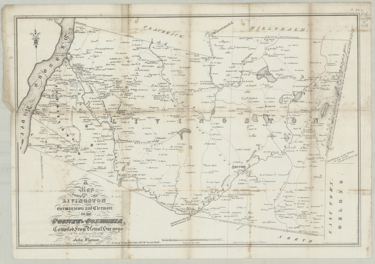
A map of the town’s of Livingston, Germantown, and Clermont in the County of Columbia: compiled from actual surveys in January 1798: [drawn by] John Wigram ; cop. by David Vaughan
A map of the town’s of Livingston, Germantown, and Clermont in the County of Columbia: compiled from actual surveys in January 1798: [drawn by] John Wigram ; cop. by David Vaughan
1850
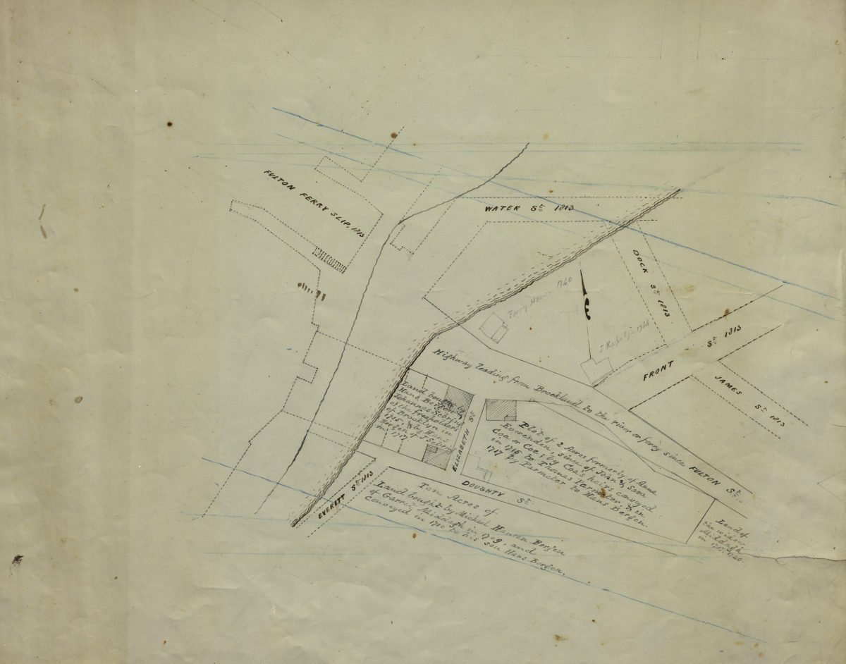
[Map of Hans Bergen’s land at Brooklyn Ferry]
[Map of Hans Bergen’s land at Brooklyn Ferry]
[ca. 1876]
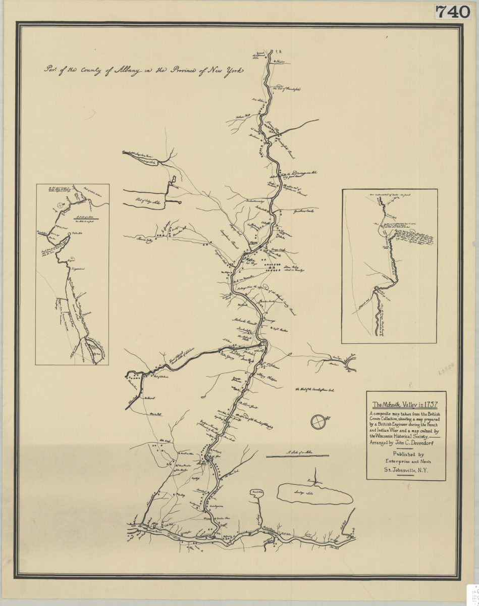
The Mohawk Valley in 1757: a composite map taken from the British Crown Collection, showing a map prepared by a British engineer during the French and Indian War and a map owned by the Wisconsin Historical Society: arranged by John C. Devendorf
The Mohawk Valley in 1757: a composite map taken from the British Crown Collection, showing a map prepared by a British engineer during the French and Indian War and a map owned by the Wisconsin Historical Society: arranged by John C. Devendorf
[19??]
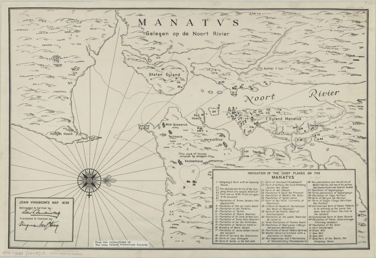
Joan Vingboom’s map 1639
Joan Vingboom’s map 1639
[19??]
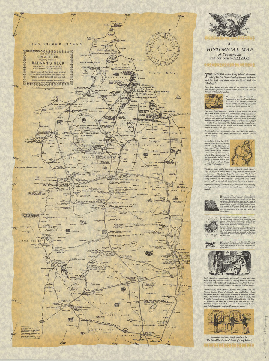
An historical map of Paumanacke and our own Wallage: compiled and drawn by George L. Whittle
An historical map of Paumanacke and our own Wallage: compiled and drawn by George L. Whittle
[ca. 1940, 1961]
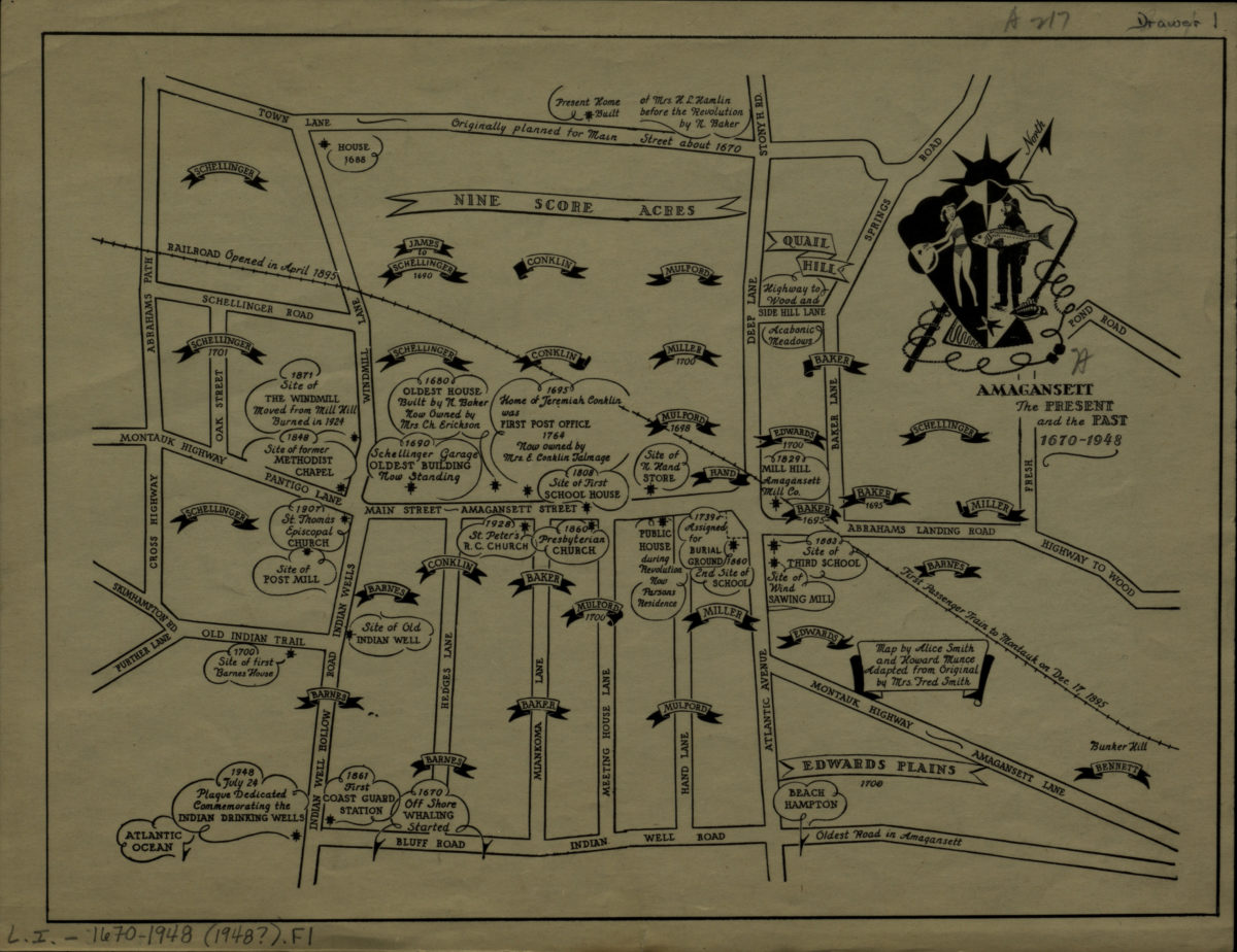
Amagansett: the present and the past, 1670-1948: map by Alice Smith and Howard Munce ; adapted from original by Mrs. Fred Smith
Amagansett: the present and the past, 1670-1948: map by Alice Smith and Howard Munce ; adapted from original by Mrs. Fred Smith
[1948]