Center for Brooklyn History
Map Collections
Search
About
Othmer Library & Archives
Submit search query
Refine 20 records
Clear filters
4
Location
Bay Ridge (New York, N.Y.)
108
Borough Park (New York, N.Y.)
23
Brooklyn (New York, N.Y.)
891
Brooklyn Heights (New York, N.Y.)
76
Bushwick (New York, N.Y.)
20
Downtown Brooklyn (New York, N.Y.)
29
Dyker Heights (New York, N.Y.)
23
East New York (New York, N.Y.)
16
Flatbush (New York, N.Y.)
35
Great Neck (N.Y.)
3
Greenpoint (New York, N.Y.)
38
Long Island (N.Y.)
197
Montauk (N.Y.)
4
Nassau County (N.Y.)
24
North Hempstead (N.Y. : Town)
4
Noyack (N.Y.)
1
Oyster Bay (N.Y.)
9
Prospect Lefferts Gardens (Brooklyn, New York, N.Y.)
16
Prospect Park South (New York, N.Y.)
8
Sea Gate (New York, N.Y.)
7
Williamsburg (New York, N.Y.)
36
Windsor Terrace (New York, N.Y.)
10
Show 2 more
Subject
Central business districts
10
Landforms
15
Landowners
434
Piers
25
Real property
619
Roads
117
Waterfronts
5
Date
20th Century
469
or enter range:
from
to
Genres
Cadastral maps
597
Historical maps
53
Manuscript maps
365
Pictorial maps
38
Zoning maps
55
Sort by:
Date (earliest)
Date (most recent)
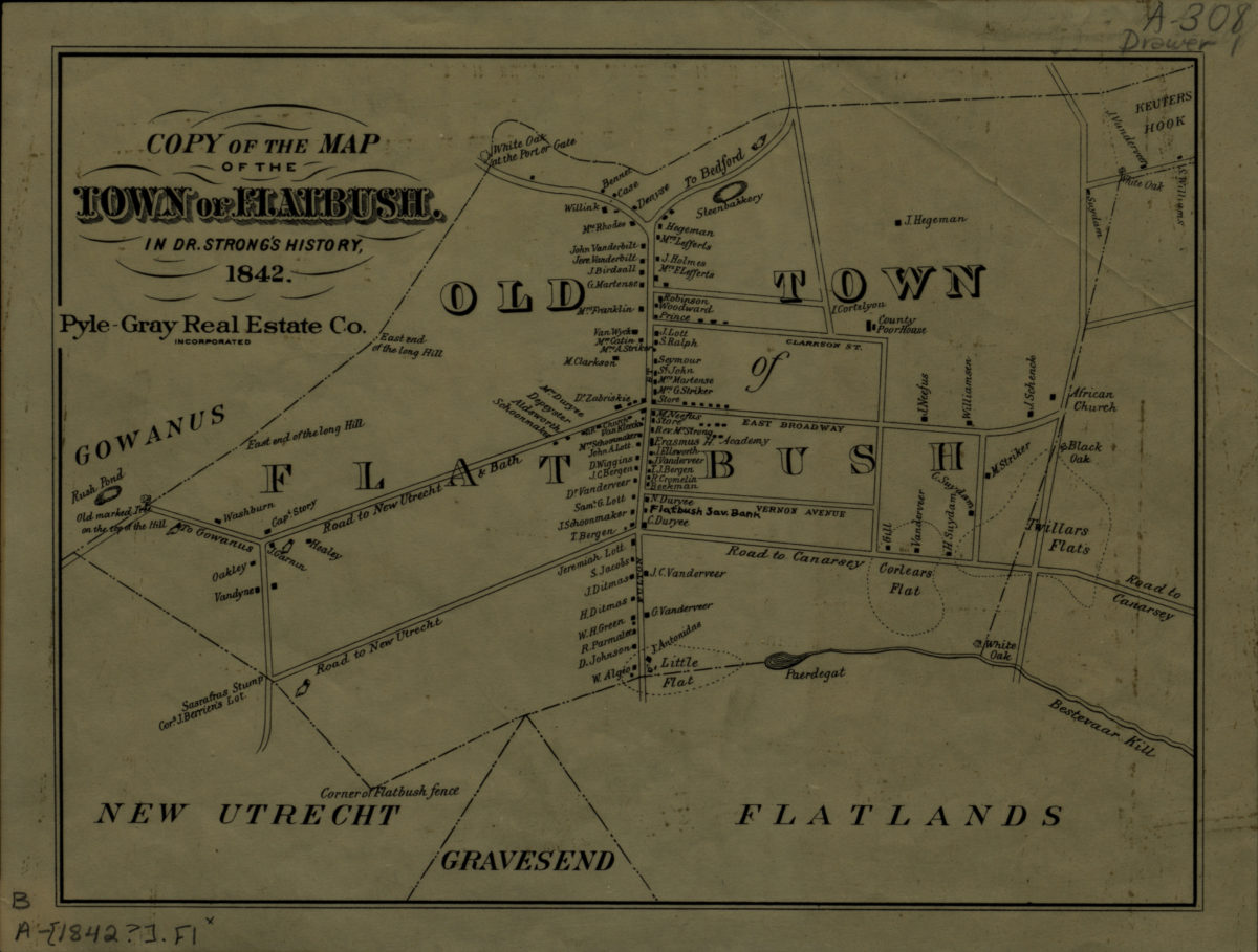
Copy of the map of the town of Flatbush in Dr. Strong’s history, 1842
Copy of the map of the town of Flatbush in Dr. Strong’s history, 1842
[19??]
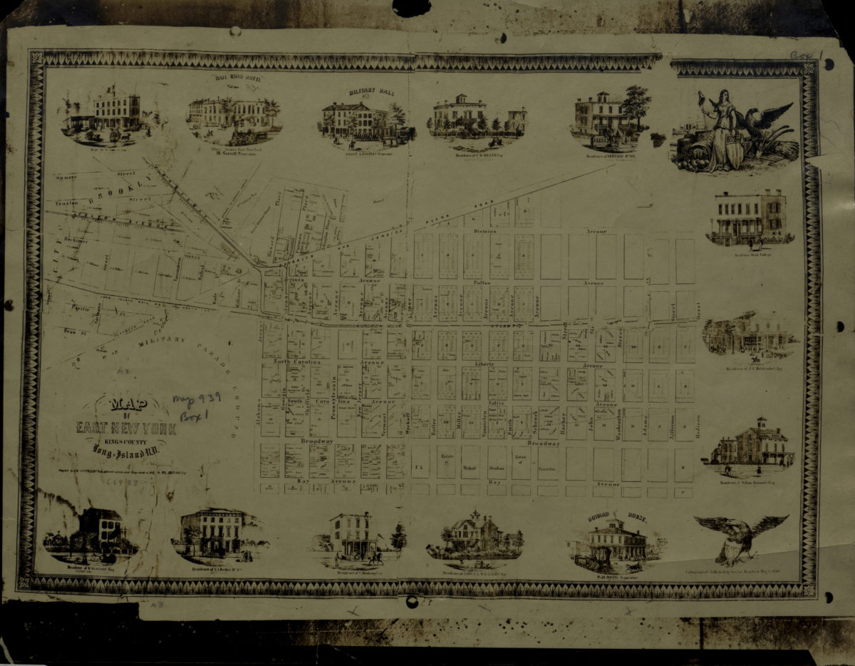
Map of East New York, Kings County, Long Island, N.Y.: compiled by C.W. Heftkamp from different surveys and maps made … by M.G. Johnson, Esqr
Map of East New York, Kings County, Long Island, N.Y.: compiled by C.W. Heftkamp from different surveys and maps made … by M.G. Johnson, Esqr
[19??]
[Property maps of North Hempstead and Oyster Bay Townships, Nassau County, N.Y.]
[Property maps of North Hempstead and Oyster Bay Townships, Nassau County, N.Y.]
[19??]
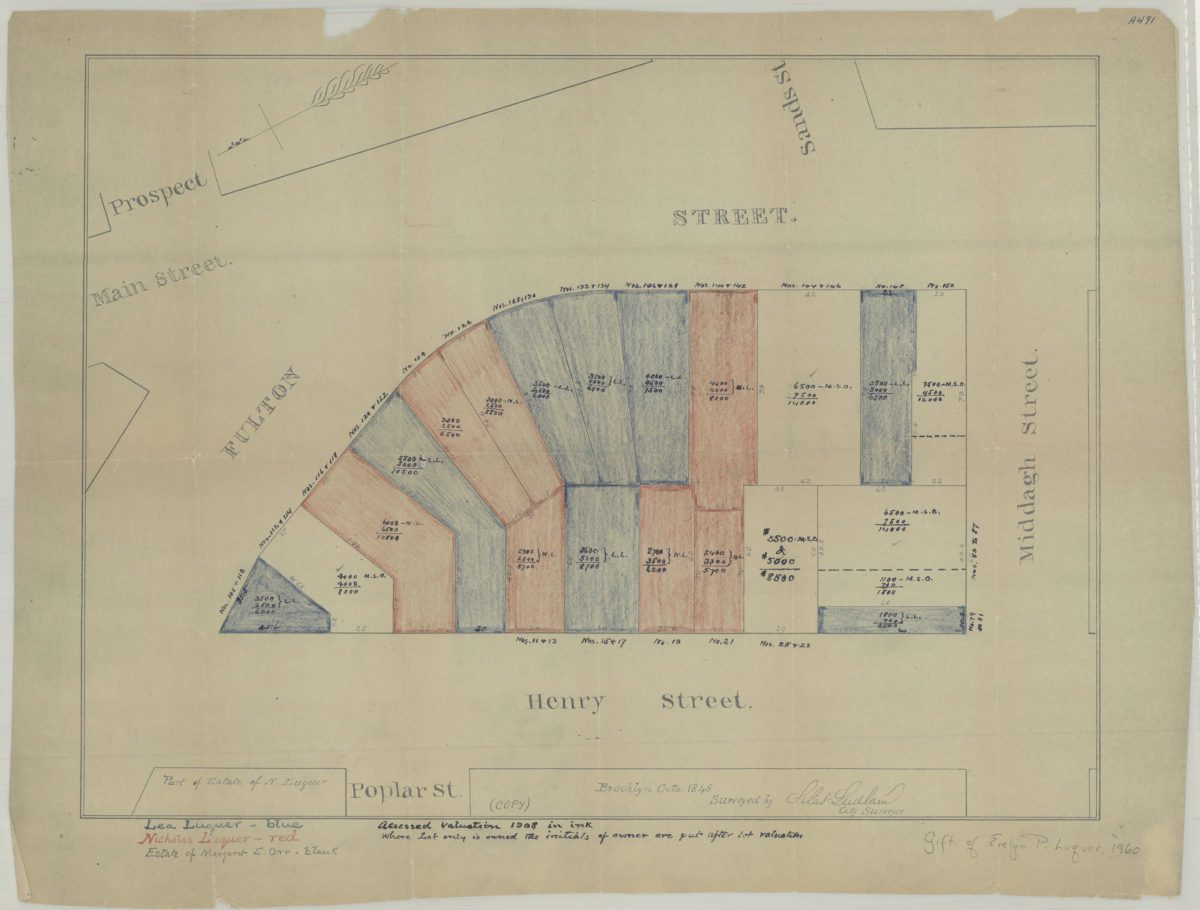
[Map of area bounded by Fulton St., Henry St., and Middagh St.]: surveyed by Silas Ludlam, city surveyor
[Map of area bounded by Fulton St., Henry St., and Middagh St.]: surveyed by Silas Ludlam, city surveyor
[19??]
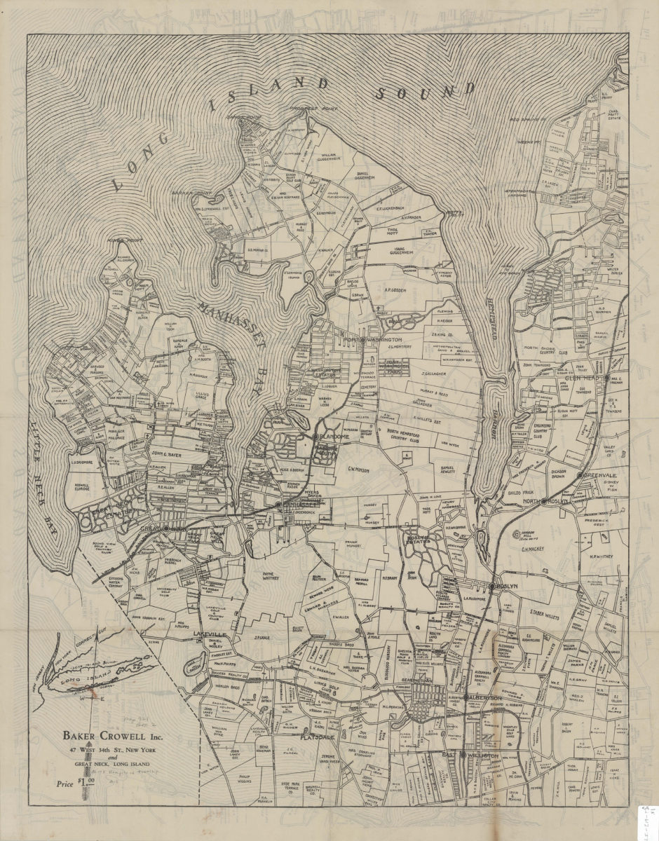
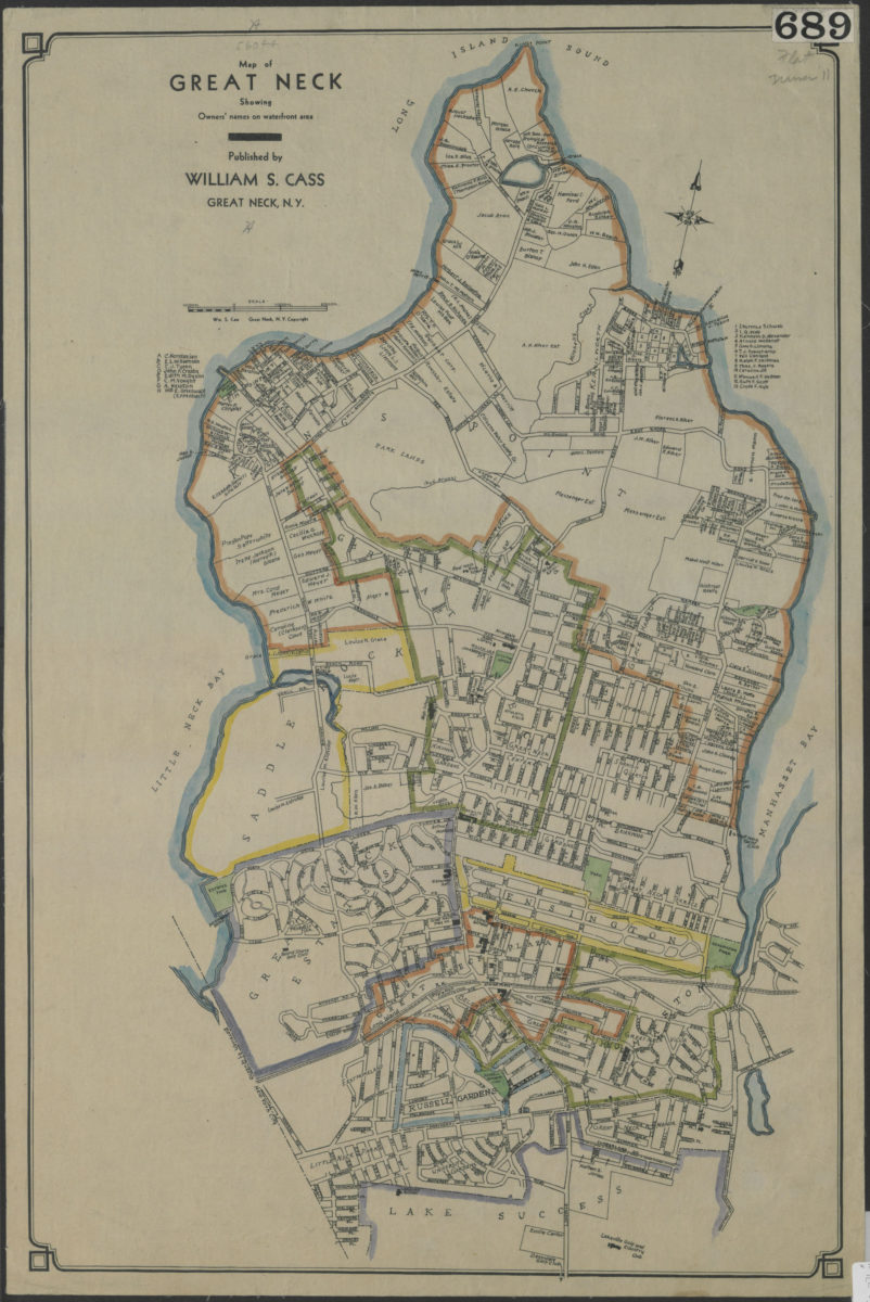
Map of Great Neck: showing owners’ names on waterfront area: published by William S. Cass, Great Neck, N.Y.
Map of Great Neck: showing owners’ names on waterfront area: published by William S. Cass, Great Neck, N.Y.
[19??]
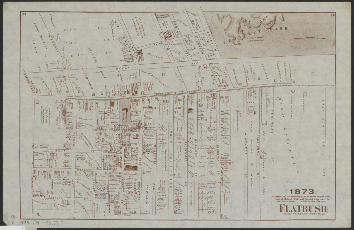
Flatbush, town of Flatbush, Kings Co., L.I.
Flatbush, town of Flatbush, Kings Co., L.I.
[19??]
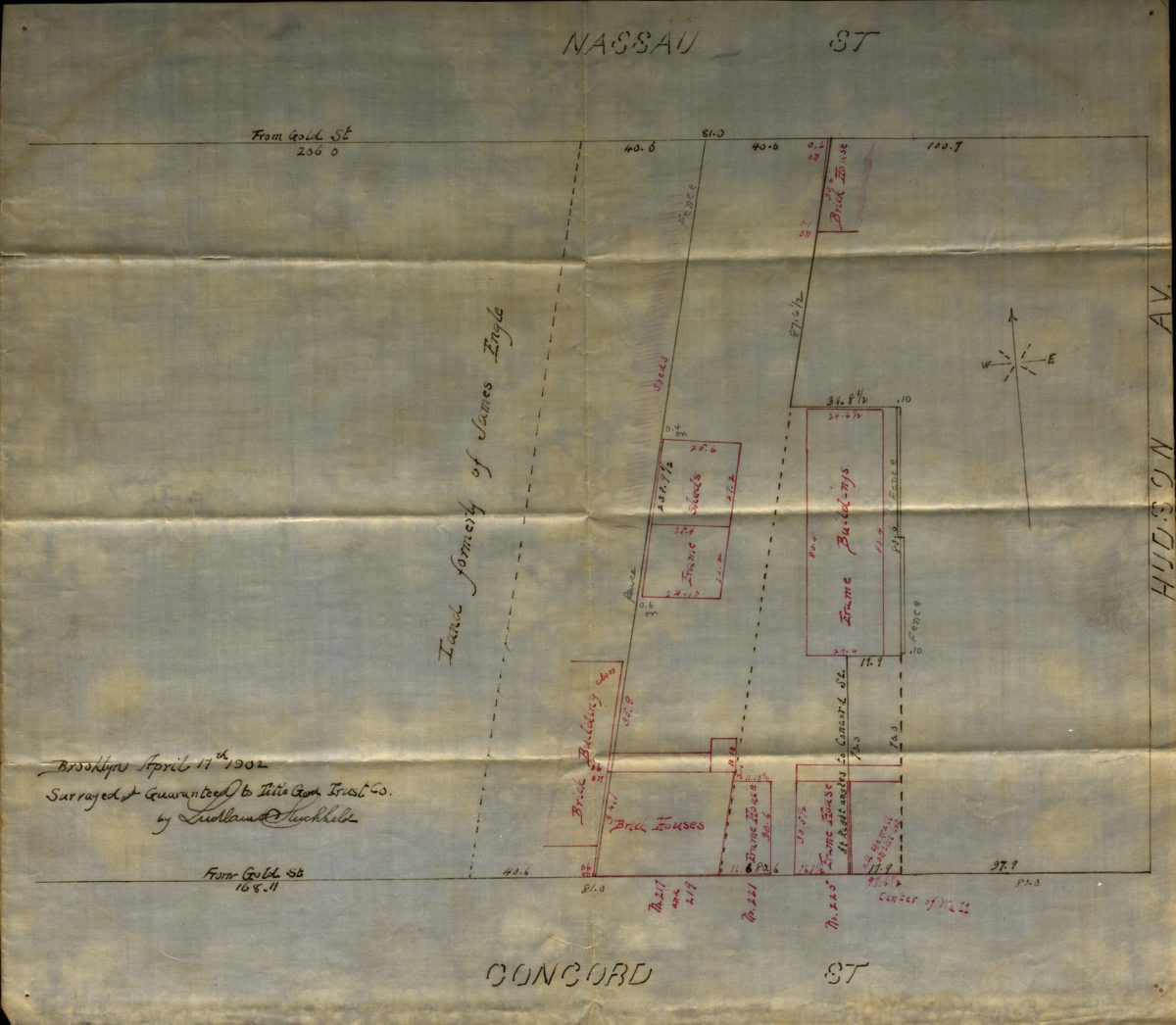
[Map of Hudson Avenue at Nassau Street and Concord Street]
[Map of Hudson Avenue at Nassau Street and Concord Street]
1902
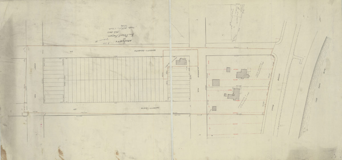
Property of Van Brunt Bergen
Property of Van Brunt Bergen
Feb-03
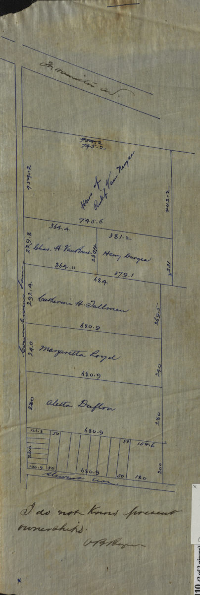
[Maps of Cowenhoven Lane and profile map of the grade of 2nd Avenue]
[Maps of Cowenhoven Lane and profile map of the grade of 2nd Avenue]
[ca. 1903]
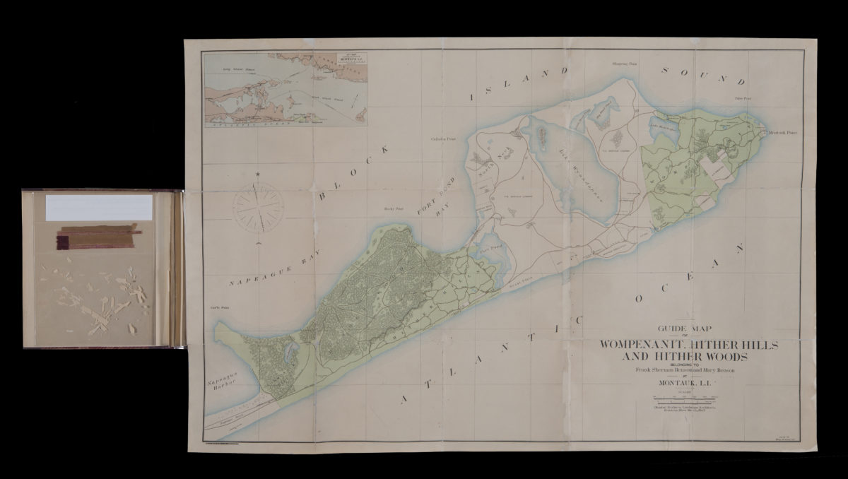
Guide map of Wompenanit, Hither Hills, and Hither Woods, belonging to Frank Sherman Benson and Mary Benson at Montauk, L.I.: Olmsted Brothers; William M. Humans, del
Guide map of Wompenanit, Hither Hills, and Hither Woods, belonging to Frank Sherman Benson and Mary Benson at Montauk, L.I.: Olmsted Brothers; William M. Humans, del
1905
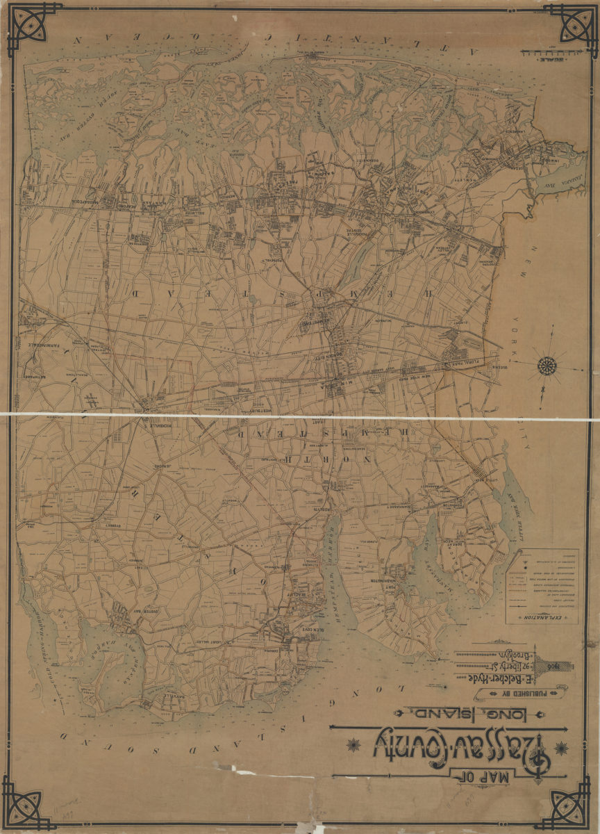
Map of Nassau County, Long Island: C.W. Hooper del
Map of Nassau County, Long Island: C.W. Hooper del
1906
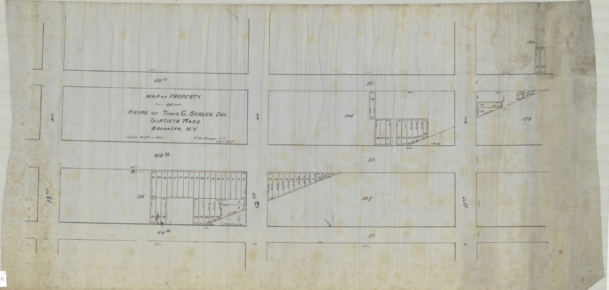
Map of property of heirs of Tunis G. Bergen, dec., Thirtieth Ward, Brooklyn, N.Y.: V.B. Bergen, C.E.
Map of property of heirs of Tunis G. Bergen, dec., Thirtieth Ward, Brooklyn, N.Y.: V.B. Bergen, C.E.
April 1907
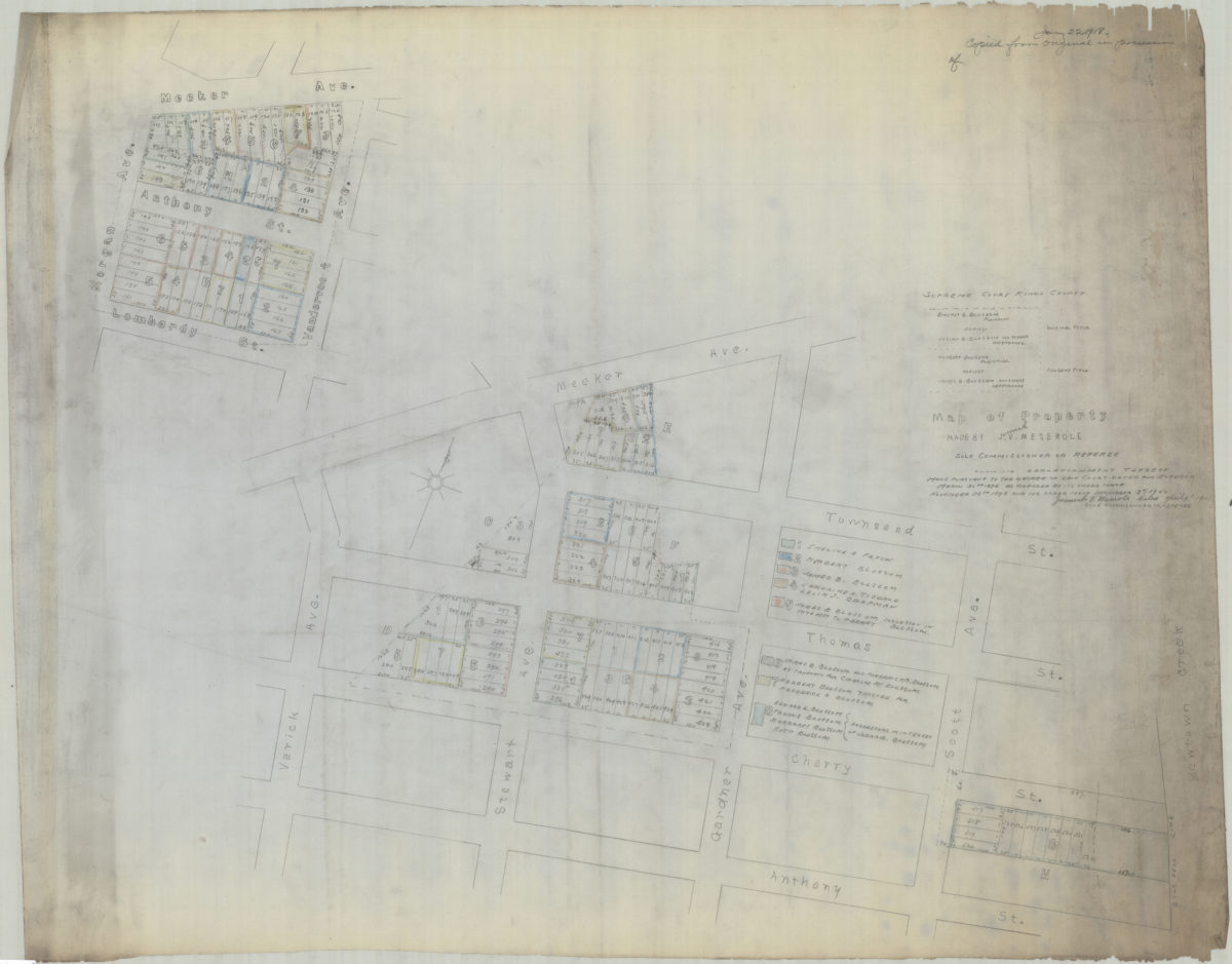
[Copy of] map of property made by J[eremiah] V. Meserole, sole commissioner or referee: showing apportionment thereof made pursuant to the decree of said court, dated and entered March 30th 1896 as amended by its order made of November 25th 1898
[Copy of] map of property made by J[eremiah] V. Meserole, sole commissioner or referee: showing apportionment thereof made pursuant to the decree of said court, dated and entered March 30th 1896 as amended by its order made of November 25th 1898
1918
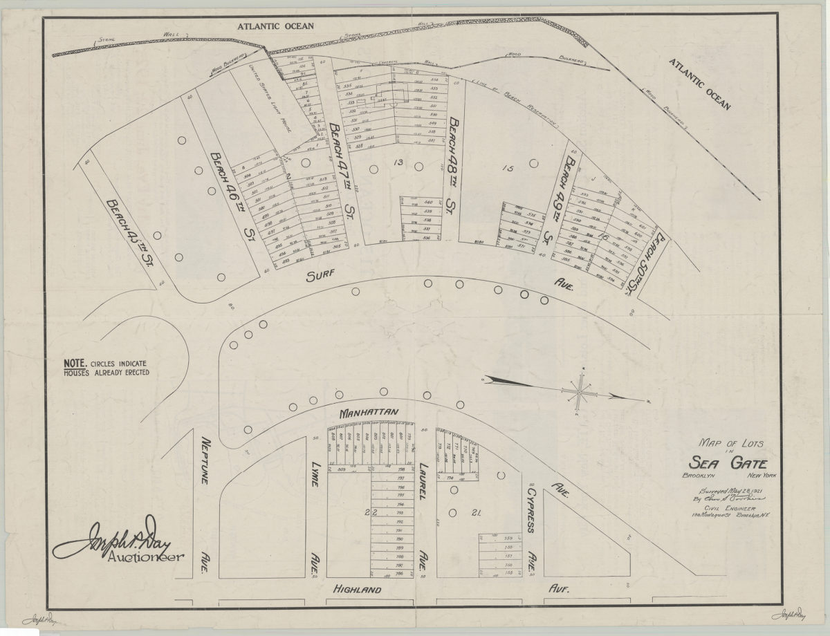
Map of lots in Sea Gate: surveyed May 28, 1921 by Cha[rle]s S. Voorhies
Map of lots in Sea Gate: surveyed May 28, 1921 by Cha[rle]s S. Voorhies
1921
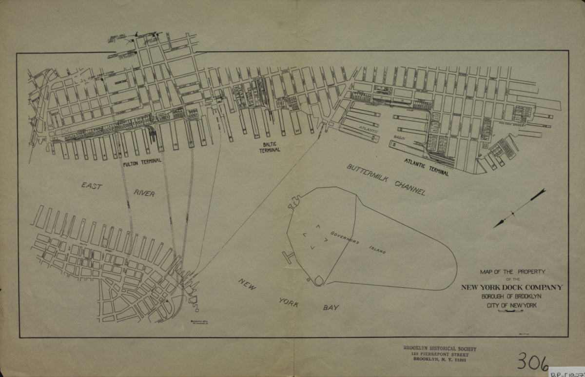
Map of the property of the New York Dock Company, Borough of Brooklyn, City of New York
Map of the property of the New York Dock Company, Borough of Brooklyn, City of New York
[1927]
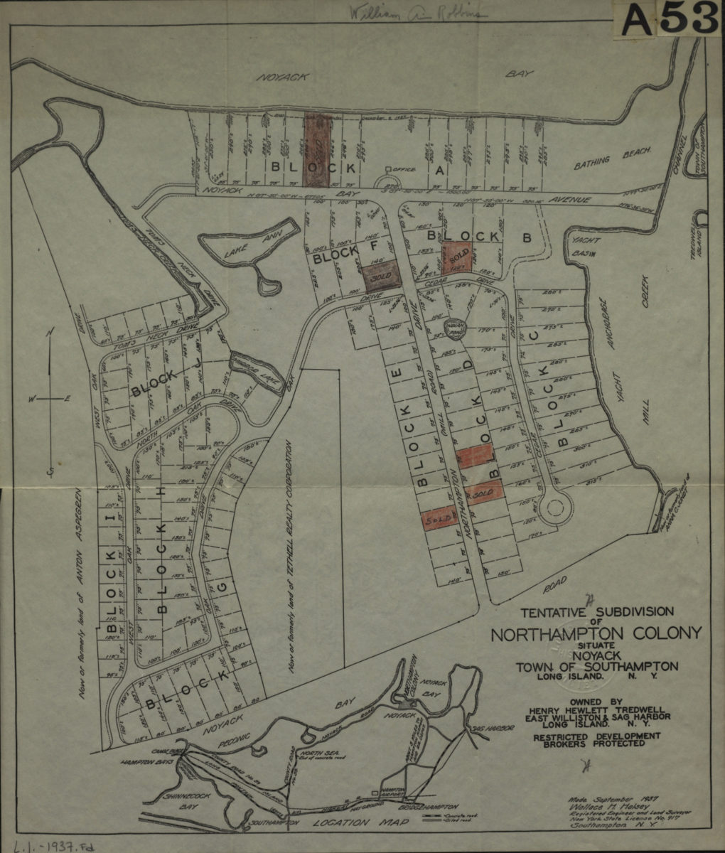
Tentative subdivision of Northampton Colony, situate Noyack, Town of Southampton, Long Island, N.Y. owned by Henry Hewlett Tredwell
Tentative subdivision of Northampton Colony, situate Noyack, Town of Southampton, Long Island, N.Y. owned by Henry Hewlett Tredwell
1937
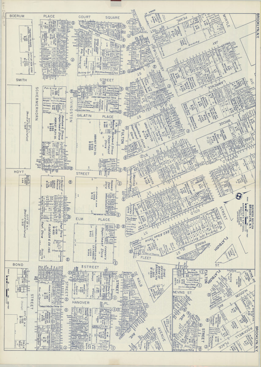
Business section, Brooklyn, N.Y.: Nirenstein’s National Realty Map Co
Business section, Brooklyn, N.Y.: Nirenstein’s National Realty Map Co
[1937]
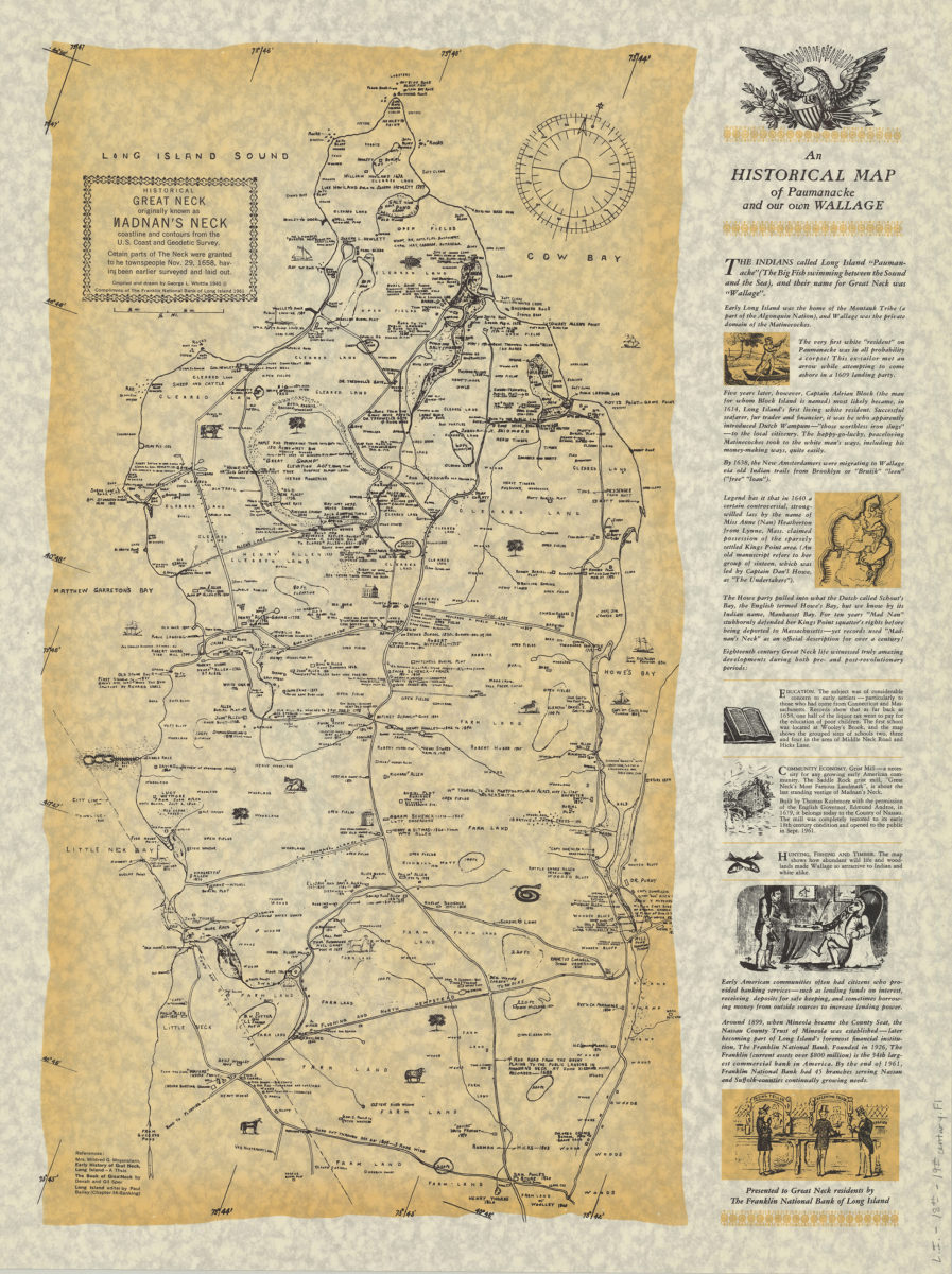
An historical map of Paumanacke and our own Wallage: compiled and drawn by George L. Whittle
An historical map of Paumanacke and our own Wallage: compiled and drawn by George L. Whittle
[ca. 1940, 1961]
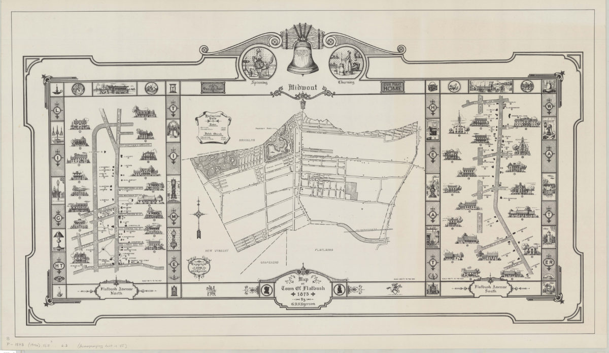
Map of town of Flatbush, 1873: by G.V.S. Ryerson
Map of town of Flatbush, 1873: by G.V.S. Ryerson
1946
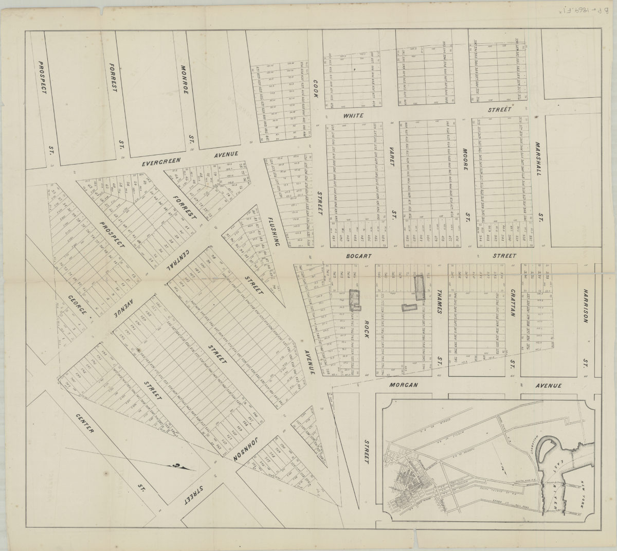
538 desirable lots, together with the farm house and barn thereon, belonging to the estate of George White, deceased, finely situated in the 18th Ward, Brooklyn
538 desirable lots, together with the farm house and barn thereon, belonging to the estate of George White, deceased, finely situated in the 18th Ward, Brooklyn
[1995; ca. 1991]