Center for Brooklyn History
Map Collections
Search
About
Othmer Library & Archives
Submit search query
Refine 3 records
Clear filters
4
Location
Brooklyn (New York, N.Y.)
891
Downtown Brooklyn (New York, N.Y.)
29
Flushing (New York, N.Y.)
13
New York (N.Y.)
164
Queens (New York, N.Y.)
83
Subject
Exhibitions
5
Historic districts
4
Local transit
63
Roads
117
Subways
55
Transportation
3
Date
20th Century
469
or enter range:
from
to
Genres
Aerial views
15
Road maps
83
Thematic maps
60
Tourist maps
55
Transportation maps
120
Sort by:
Date (earliest)
Date (most recent)
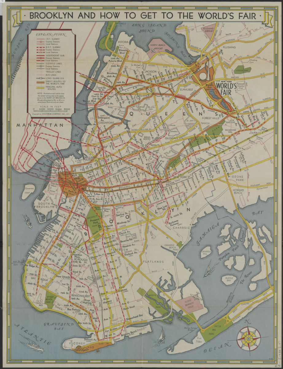
How to get to the New York World’s Fair, and The heart of Brooklyn: issued by the Downtown Brooklyn Association, Inc
How to get to the New York World’s Fair, and The heart of Brooklyn: issued by the Downtown Brooklyn Association, Inc
[1939]
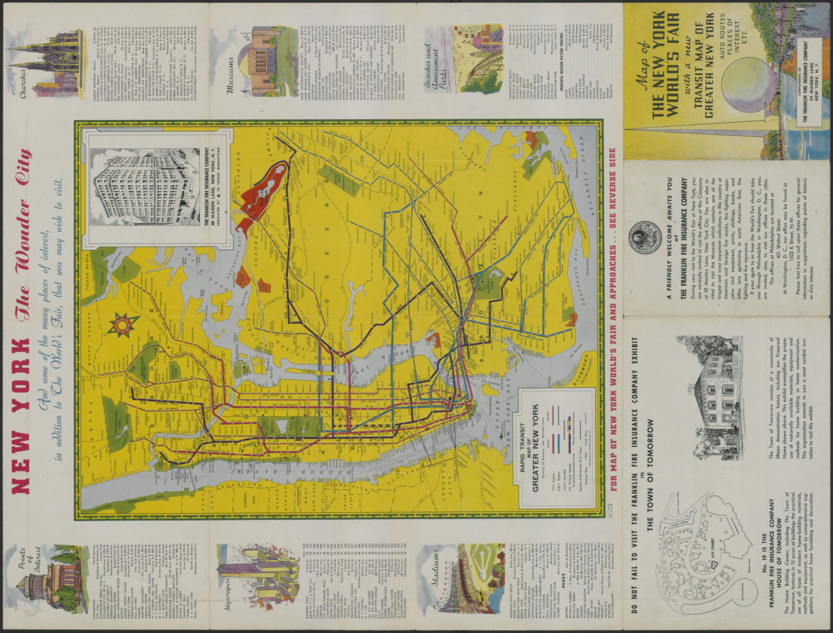
Map of the New York World’s Fair with a new transit map of Greater New York: auto routes, places of interest
Map of the New York World’s Fair with a new transit map of Greater New York: auto routes, places of interest
[1939]
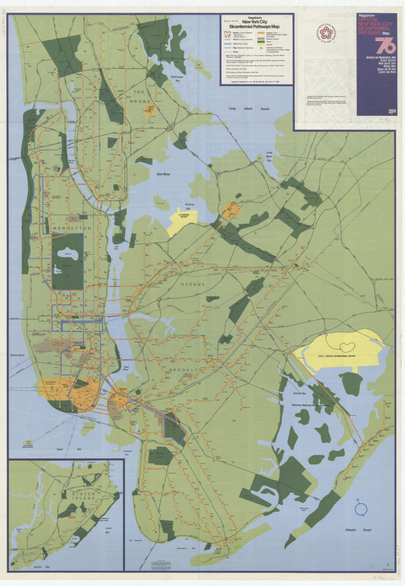
Hagstrom New York City Bicentennial pathways map
Hagstrom New York City Bicentennial pathways map
[1975]