Center for Brooklyn History
Map Collections
Search
About
Othmer Library & Archives
Submit search query
Refine 37 records
Clear filters
2
Location
Brooklyn (New York, N.Y.)
891
Brooklyn Heights (New York, N.Y.)
76
Downtown Brooklyn (New York, N.Y.)
29
ferries
1
Flushing (New York, N.Y.)
13
Manhattan (New York, N.Y.)
120
New York (N.Y.)
164
New York (State)
95
Queens (New York, N.Y.)
83
Subject
Advertising
4
Airports
2
Baseball teams
1
Bridges
13
Central business districts
10
City planning
7
Electric railroads
5
Elevated highways
1
Exhibitions
5
ferries
32
Local transit
63
Postal codes
4
Railroads
72
Railroads, Elevated
24
Roads
117
Street addresses
11
Street railroads
8
Streets
46
Subways
55
Transportation
3
Tunnels
16
Show 1 more
Date
20th Century
469
or enter range:
from
to
Genres
Aerial views
15
Map
191
Pictorial maps
38
Road maps
83
Thematic maps
60
Tourist maps
55
Transportation maps
120
Sort by:
Date (earliest)
Date (most recent)
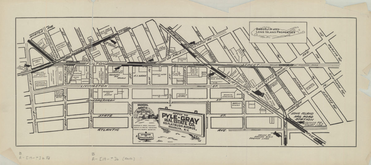
[Map of the Fulton Street area in downtown Brooklyn]
[Map of the Fulton Street area in downtown Brooklyn]
[19??]
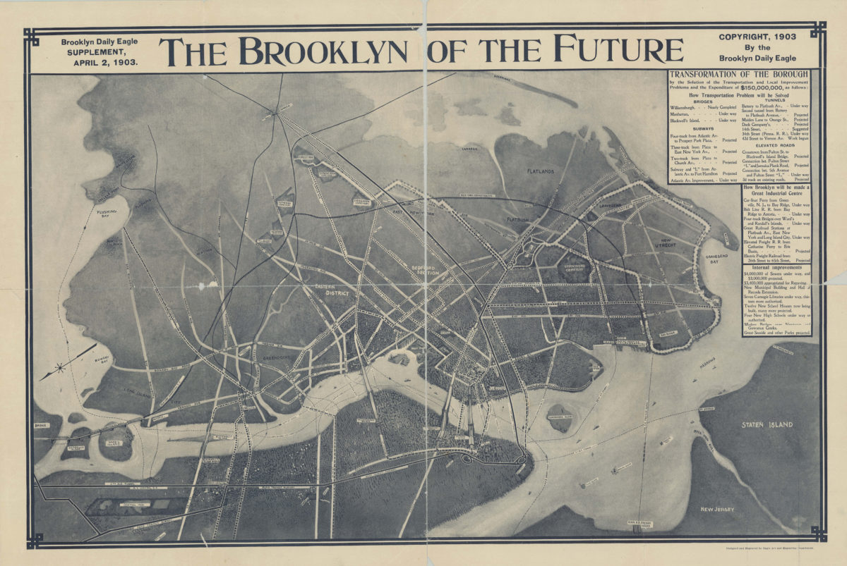
The Brooklyn of the future: Brooklyn Daily Eagle supplement, April 2, 1903
The Brooklyn of the future: Brooklyn Daily Eagle supplement, April 2, 1903
[1903; 1903]
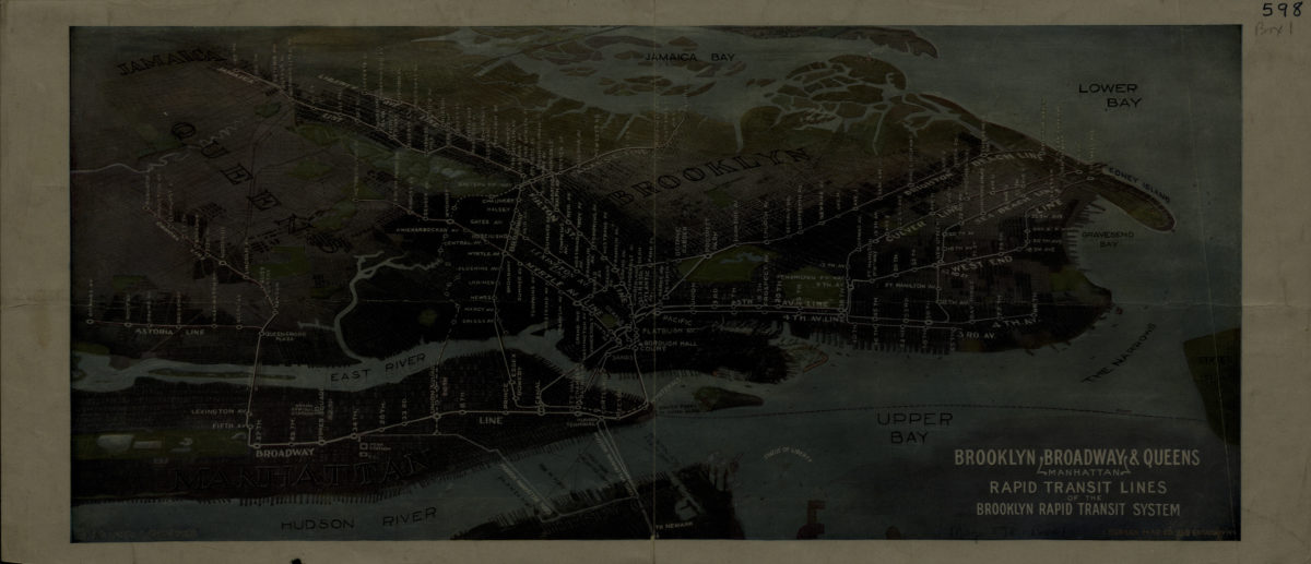
Brooklyn, Broadway (Manhattan), Queens rapid transit lines of the Brooklyn Rapid Transit System: Harry A. Chandler
Brooklyn, Broadway (Manhattan), Queens rapid transit lines of the Brooklyn Rapid Transit System: Harry A. Chandler
[1916-1924]
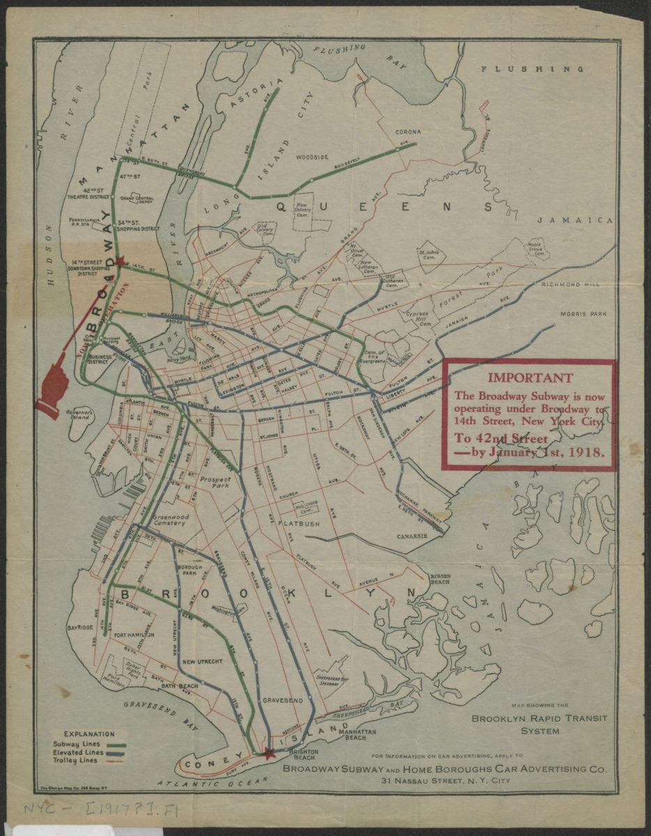
Map showing the Brooklyn Rapid Transit system
Map showing the Brooklyn Rapid Transit system
[1917]
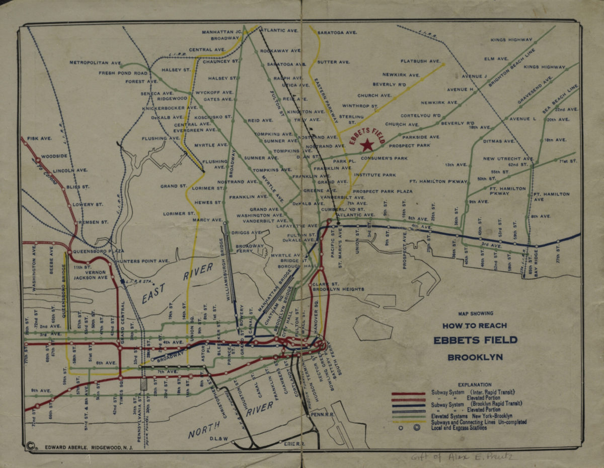
Map showing how to reach Ebbets Field, Brooklyn
Map showing how to reach Ebbets Field, Brooklyn
[1919]
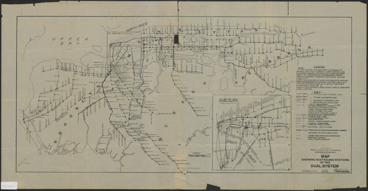
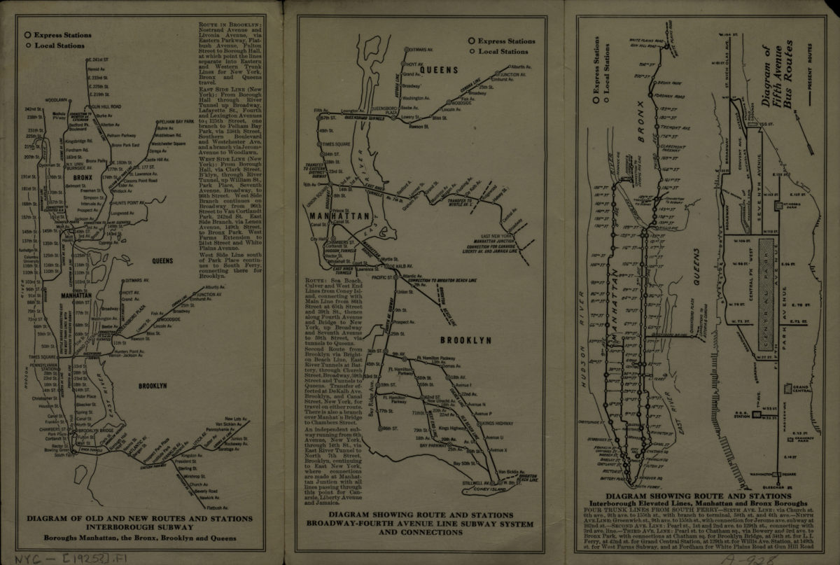
Map showing routes and stations of the dual systems
Map showing routes and stations of the dual systems
1919
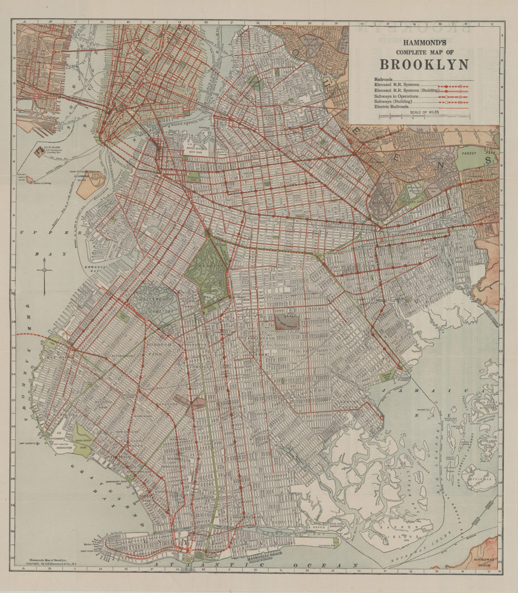
Hammond’s complete map of Brooklyn: copyright by C.S. Hammond Co
Hammond’s complete map of Brooklyn: copyright by C.S. Hammond Co
[192?]
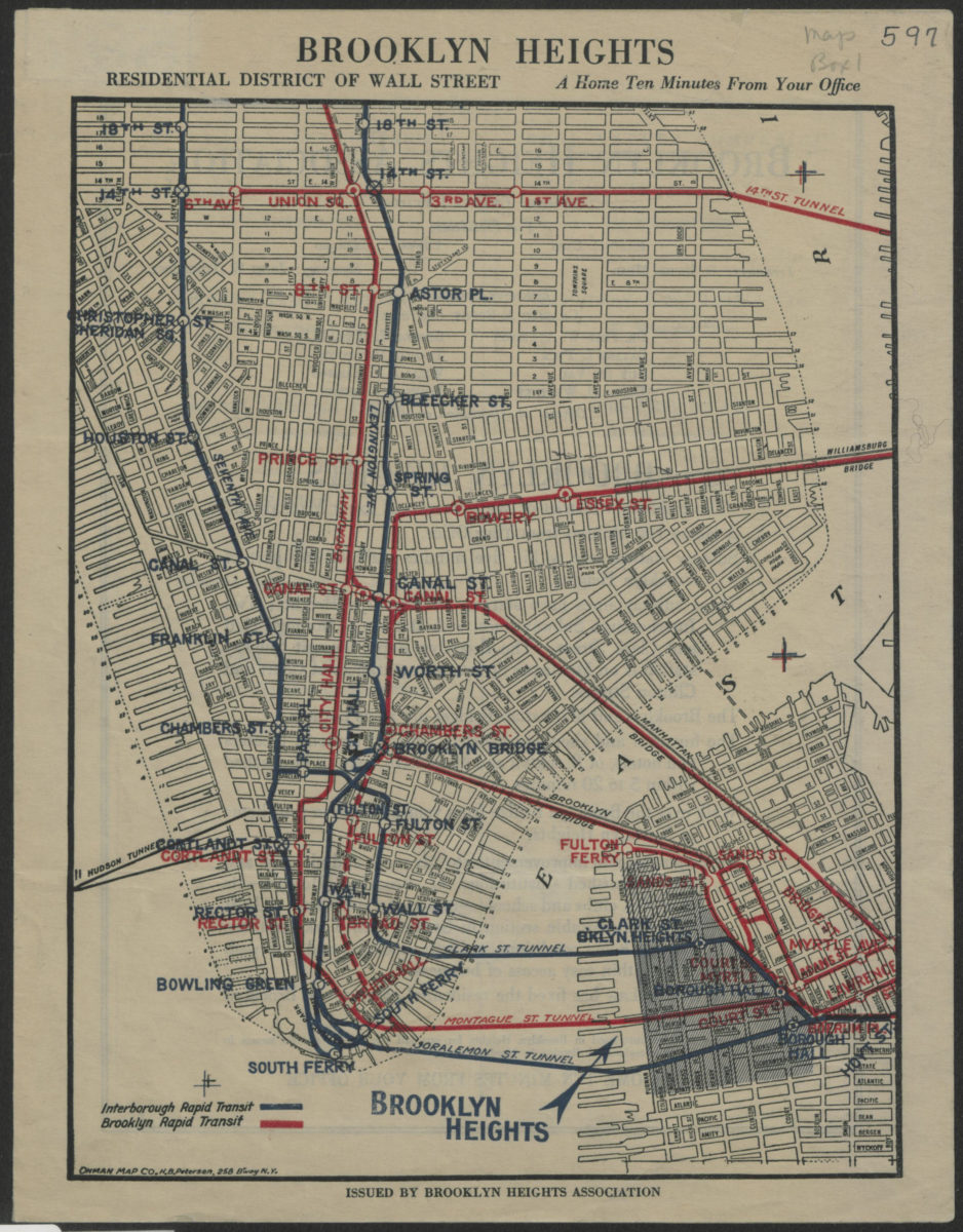
Brooklyn Heights, residential district of Wall Street: a home ten minutes from your office
Brooklyn Heights, residential district of Wall Street: a home ten minutes from your office
[1921]
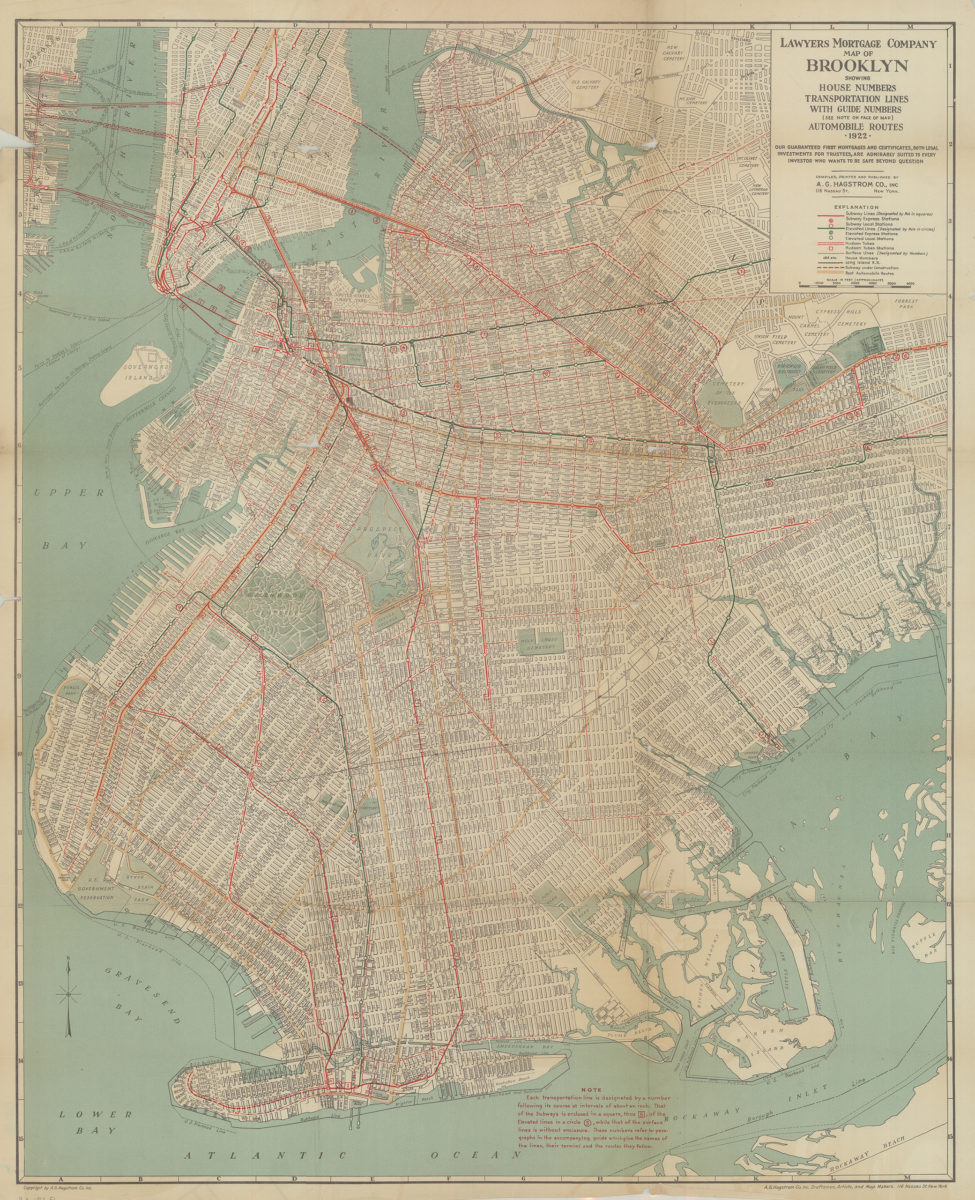
Lawyer’s Mortgage Company map of Brooklyn: showing house-numbers, transportation lines, with guide numbers … automobile routes, 1922: compiled, printed and published A.G. Hagstrom Co., Inc
Lawyer’s Mortgage Company map of Brooklyn: showing house-numbers, transportation lines, with guide numbers … automobile routes, 1922: compiled, printed and published A.G. Hagstrom Co., Inc
1922
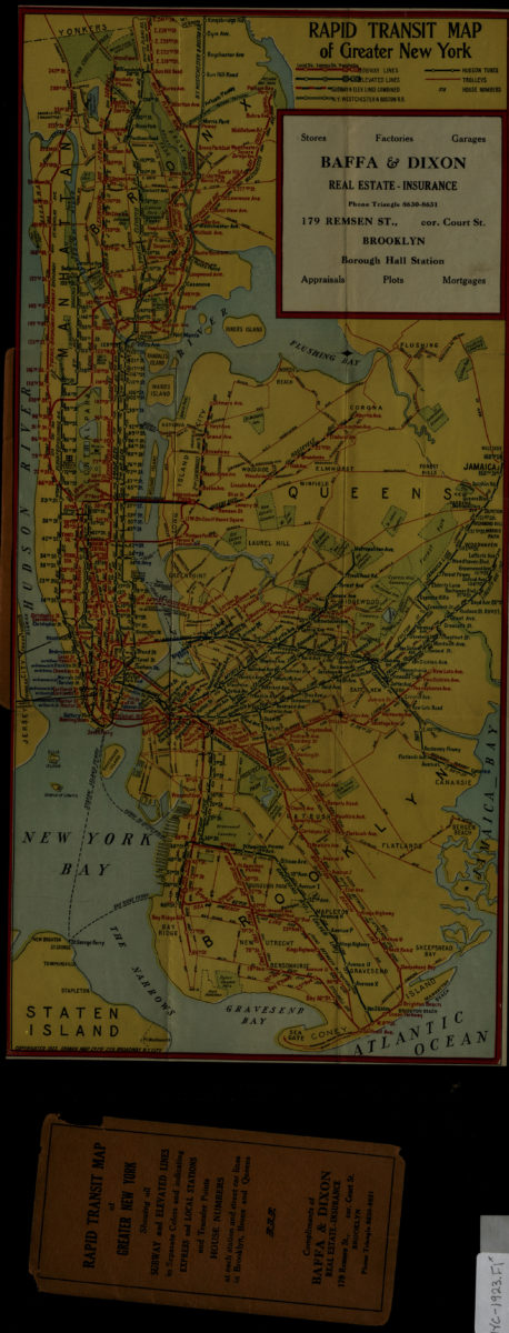
Rapid transit map of greater New York: Ohman Map Co
Rapid transit map of greater New York: Ohman Map Co
1923
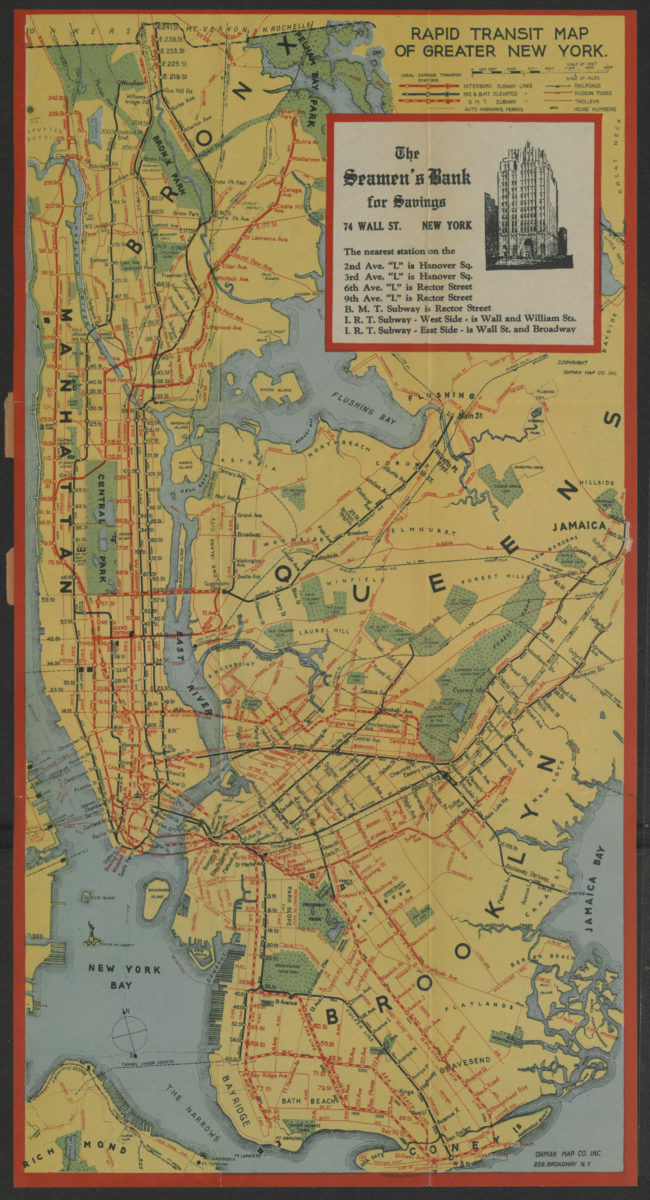
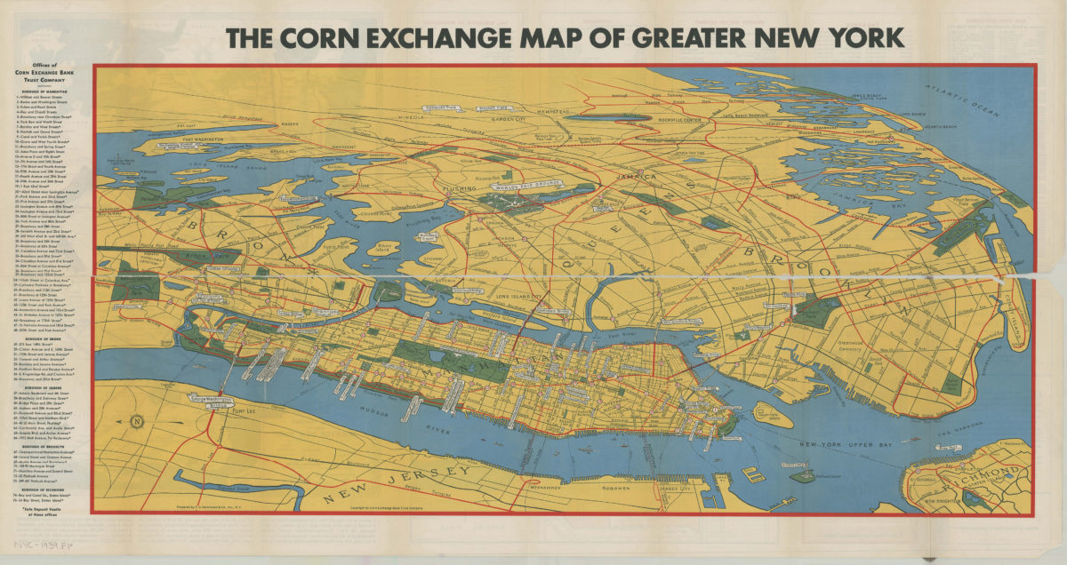
Rapid transit systems of greater New York: interborough subway and elevated lines, Brooklyn rapid transit subway & elevated lines: compliments of the Corn Exchange Bank
Rapid transit systems of greater New York: interborough subway and elevated lines, Brooklyn rapid transit subway & elevated lines: compliments of the Corn Exchange Bank
[ca. 1925]
Hagstrom’s map of Queens (New York City): house-number and subway guide: compiled, printed, and published by Hagstrom Map Company, map makers and publishers
Hagstrom’s map of Queens (New York City): house-number and subway guide: compiled, printed, and published by Hagstrom Map Company, map makers and publishers
[1928]
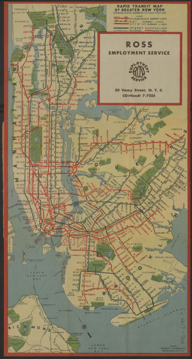
Rapid transit map of greater New York: shows house numbers at each station
Rapid transit map of greater New York: shows house numbers at each station
[1929]
Rapid transit map of greater New York: showing house numbers at each station
Rapid transit map of greater New York: showing house numbers at each station
[193?]
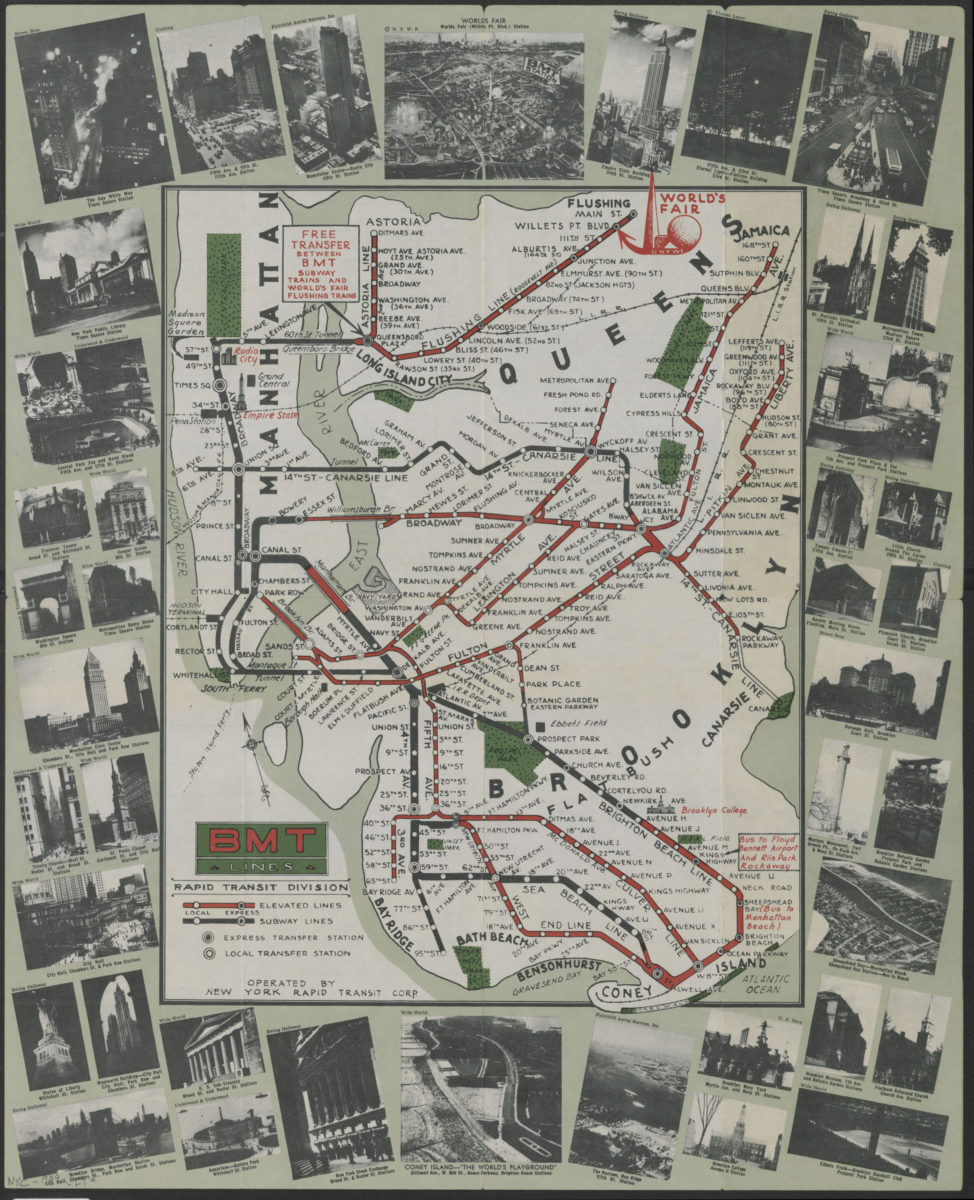
BMT Lines Rapid Transit Division
BMT Lines Rapid Transit Division
[1939]
Map of greater New York: New York World’s Fair, 1939: prepared by C.S. Hammond & Co., inc ; copyright by Corn Exchange Bank Trust Company
Map of greater New York: New York World’s Fair, 1939: prepared by C.S. Hammond & Co., inc ; copyright by Corn Exchange Bank Trust Company
[1939]
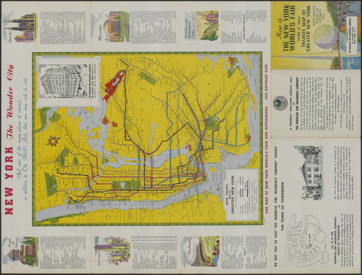
Map of the New York World’s Fair with a new transit map of Greater New York: auto routes, places of interest
Map of the New York World’s Fair with a new transit map of Greater New York: auto routes, places of interest
[1939]
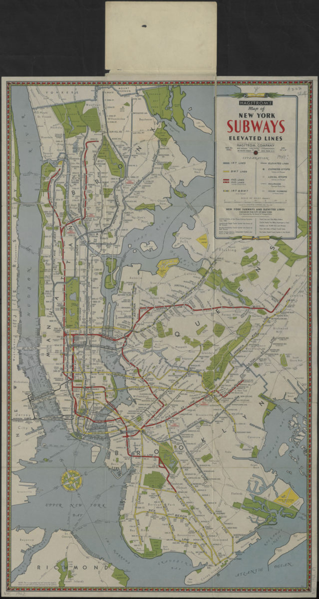
Hagstrom’s map of New York subways, elevated lines: compiled, printed and published by Hagstrom Company, Incorporated
Hagstrom’s map of New York subways, elevated lines: compiled, printed and published by Hagstrom Company, Incorporated
[1942]
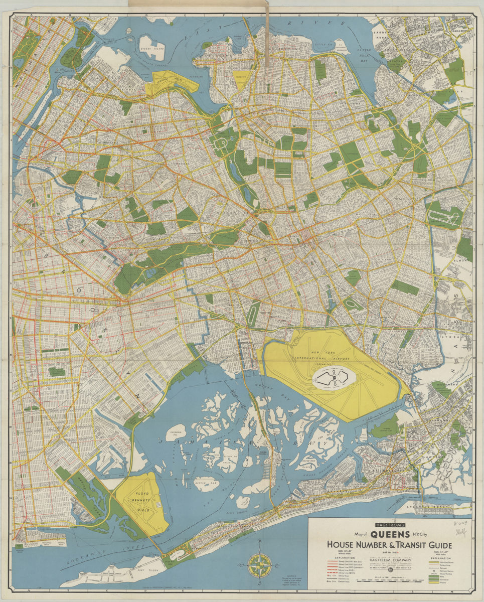
Hagstrom’s map of Queens N.Y. City: house number & transit guide: compiled, printed, and published by Hagstrom Company Incorporated
Hagstrom’s map of Queens N.Y. City: house number & transit guide: compiled, printed, and published by Hagstrom Company Incorporated
[1948]
The complete map of Brooklyn (New York City): featuring house numbers, transit lines, playgrounds, wading pools, etc.: produced under the direction of Alexander Gross
The complete map of Brooklyn (New York City): featuring house numbers, transit lines, playgrounds, wading pools, etc.: produced under the direction of Alexander Gross
[195?]
Hagstrom’s map of Brooklyn, New York City: house number and transit guide: compiled, printed, and published by Hagstrom Company Incorporated
Hagstrom’s map of Brooklyn, New York City: house number and transit guide: compiled, printed, and published by Hagstrom Company Incorporated
[1950; 1947]
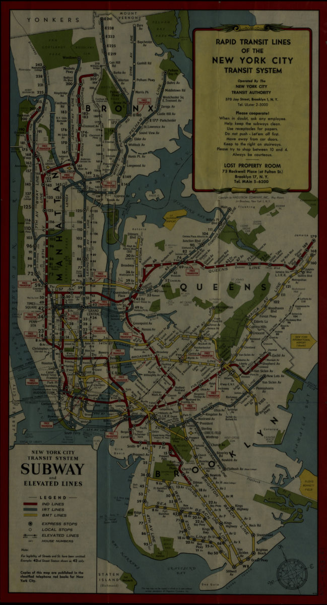
Rapid transit lines of the New York City transit system: operated by the New York City Transit Authority
Rapid transit lines of the New York City transit system: operated by the New York City Transit Authority
[1953]
Map of the New York City subway system: designed by Stephen Voorhies
Map of the New York City subway system: designed by Stephen Voorhies
[1955; 1955]
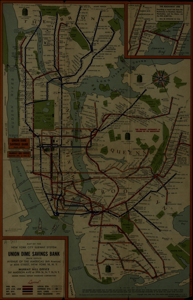
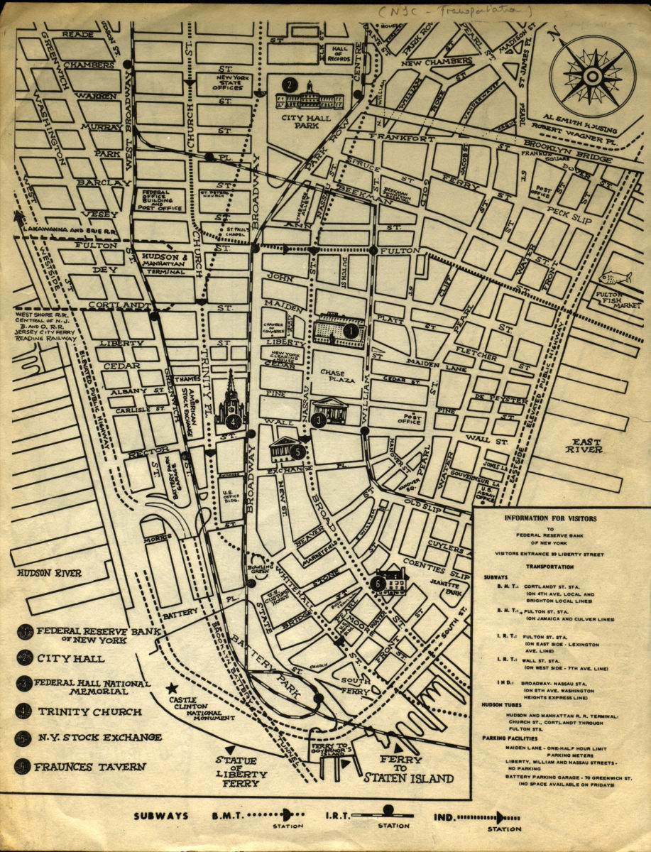
Information for visitors to Federal Reserve Bank of New York
Information for visitors to Federal Reserve Bank of New York
[1956-1966]
New York City subway map
New York City subway map
[1961]
Hagstrom’s map of New York, house number and transit guide: compiled, printed and published by Hagstrom Company Incorporated
Hagstrom’s map of New York, house number and transit guide: compiled, printed and published by Hagstrom Company Incorporated
[1963]
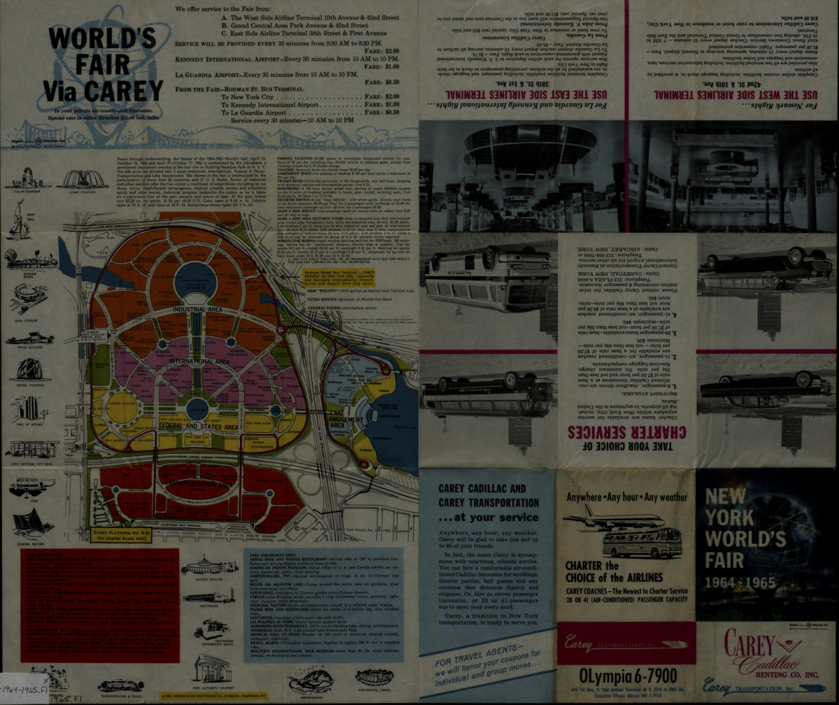
New York World’s Fair 1964-1965: [prepared for] Carey Transportation, Inc. ; published by City Street Directory, Inc
New York World’s Fair 1964-1965: [prepared for] Carey Transportation, Inc. ; published by City Street Directory, Inc
[1964; 1964]
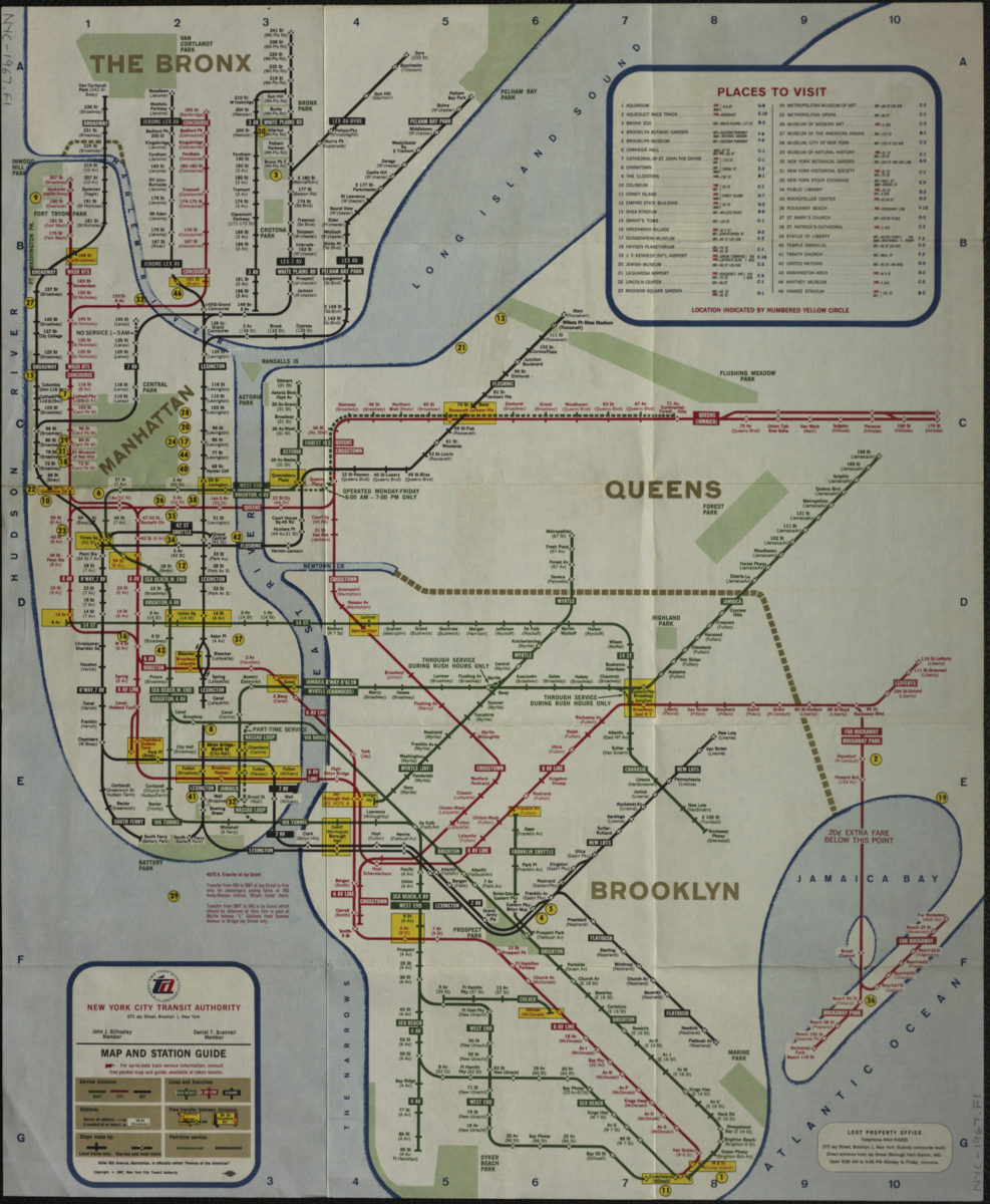
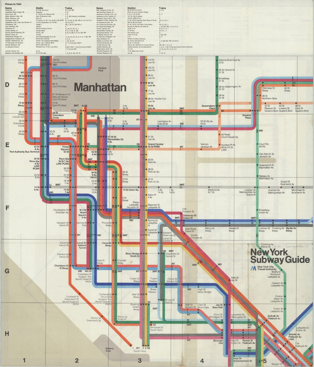
Map and station guide: New York City Transit Authority
Map and station guide: New York City Transit Authority
[ca. 1967]
The Metropolitan Transportation Authority revised map of rapid transit facilities of New York City Transit Authority: New York City Transit Authority
The Metropolitan Transportation Authority revised map of rapid transit facilities of New York City Transit Authority: New York City Transit Authority
[ca. 1972]
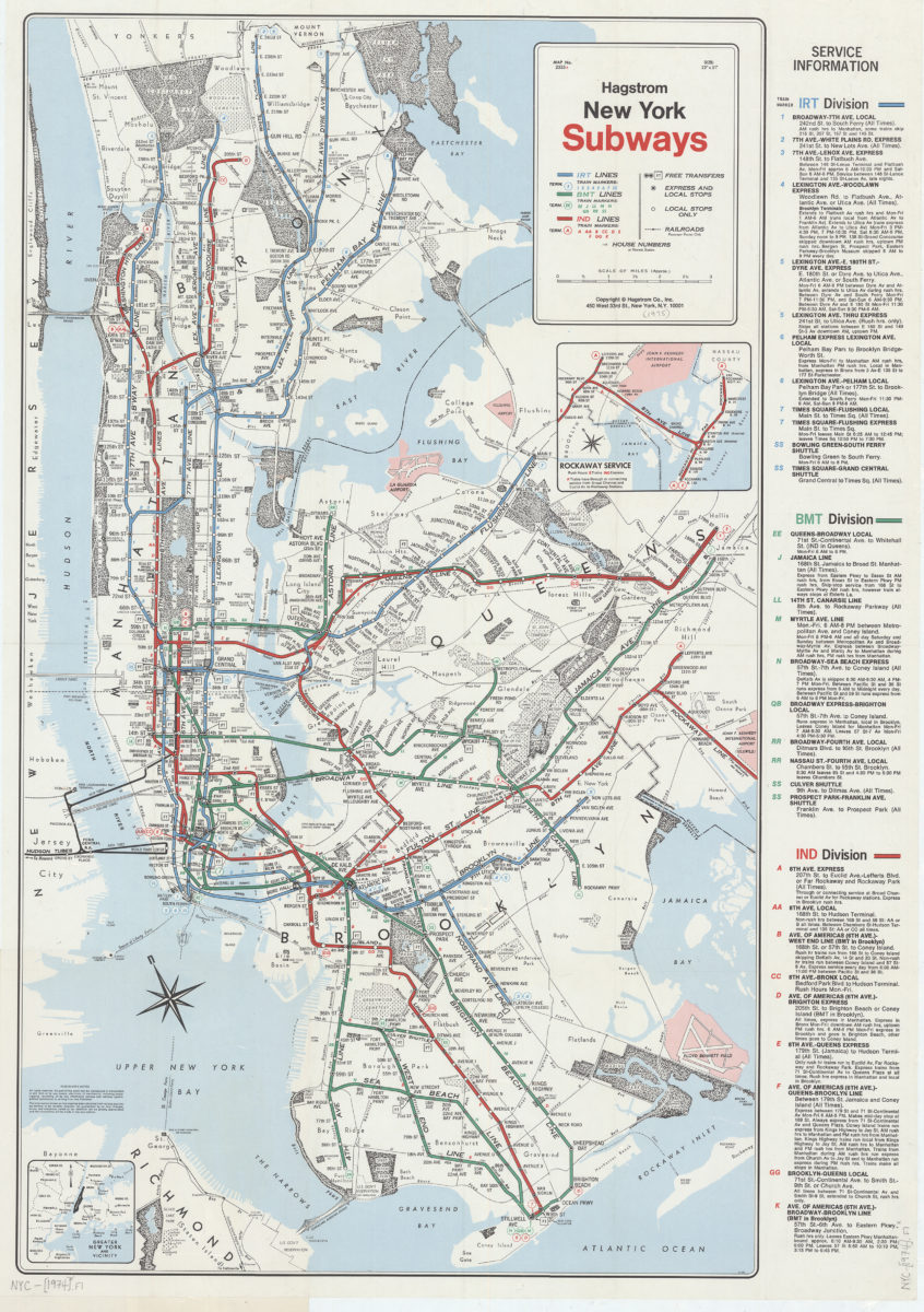
New York subways: Hagstrom
New York subways: Hagstrom
[1974]
The Metropolitan Transportation Authority revised map of rapid transit facilities of New York City Transit Authority: New York City Transit Authority
The Metropolitan Transportation Authority revised map of rapid transit facilities of New York City Transit Authority: New York City Transit Authority
[ca. 1974]
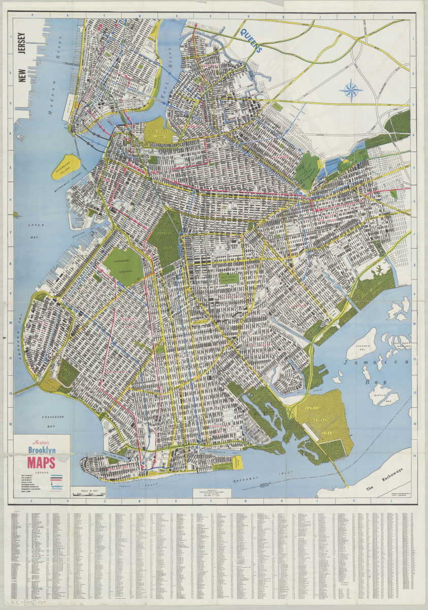
Nester’s Brooklyn maps: produced and designed by Lewis J. Nesterman
Nester’s Brooklyn maps: produced and designed by Lewis J. Nesterman
[1976]
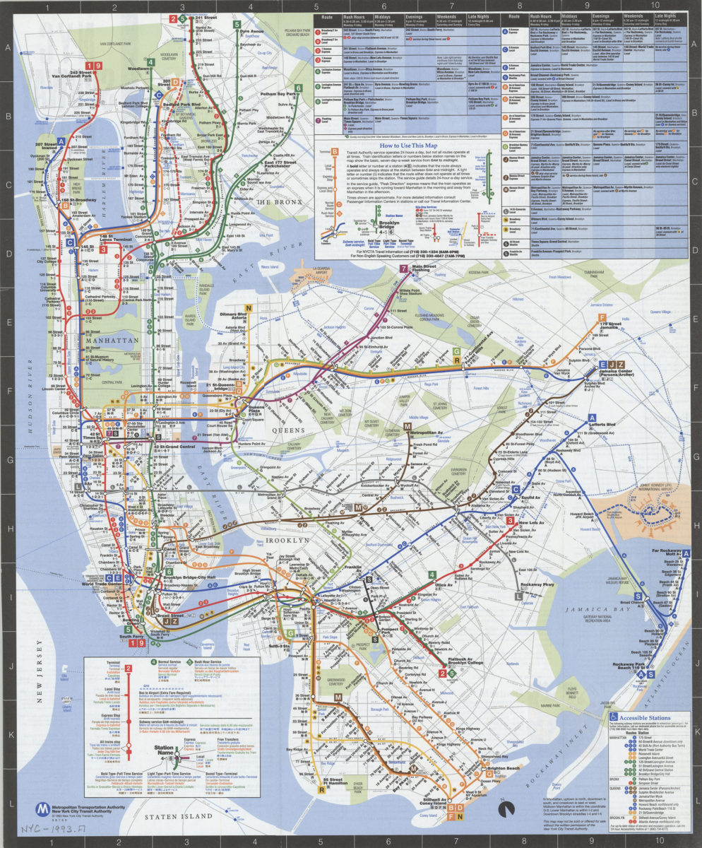
Subway map: the New York subway map = Le plan du métro de New York: the New York subway map is a Tauranac map
Subway map: the New York subway map = Le plan du métro de New York: the New York subway map is a Tauranac map
[1992]
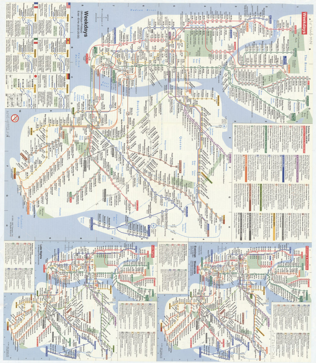
NYC subway map: June 1993, Français, Español, Deutsch, Italiano, English, Nihongo, Chung wen: New York City Transit Authority, Metropolitan Transportation Authority
NYC subway map: June 1993, Français, Español, Deutsch, Italiano, English, Nihongo, Chung wen: New York City Transit Authority, Metropolitan Transportation Authority
[ca. 1993]
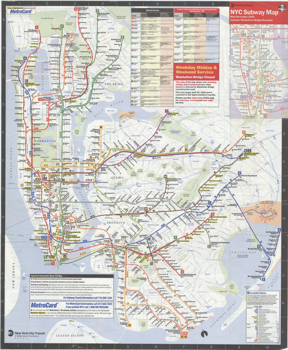
NYC subway map, May-November 1995: includes Manhattan Bridge reroutes: MTA New York City Transit Authority
NYC subway map, May-November 1995: includes Manhattan Bridge reroutes: MTA New York City Transit Authority
[ca. 1995]
New York City Transit subway map: multilingual : English, Français, Español, Deutsch, Italiano, Nihongo, Chung wen/: MTA-New York City Transit
New York City Transit subway map: multilingual : English, Français, Español, Deutsch, Italiano, Nihongo, Chung wen/: MTA-New York City Transit
[ca. 1996]
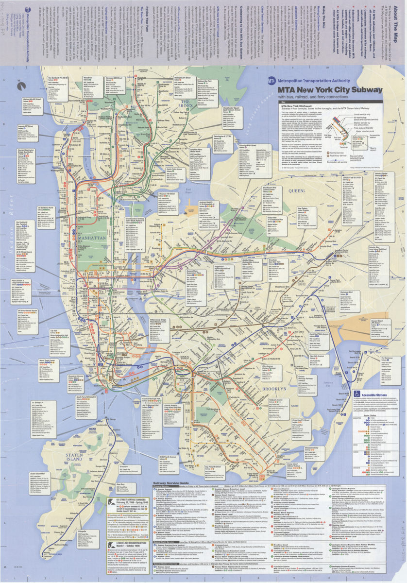
The map, MTA subways and railroads and their interconnections: connections between MTA subway, rail, and bus services, selected connections to other regional transit services: MTA Metropolitan Transportation Authority
The map, MTA subways and railroads and their interconnections: connections between MTA subway, rail, and bus services, selected connections to other regional transit services: MTA Metropolitan Transportation Authority
[ca. 1998]