Center for Brooklyn History
Map Collections
Search
About
Othmer Library & Archives
Submit search query
Refine 52 records
Clear filters
3
Location
Albany (N.Y.)
3
Amityville (N.Y.)
1
Babylon (N.Y. : Town)
2
Babylon (N.Y.)
1
Brightwaters (N.Y.)
1
Brooklyn (New York, N.Y.)
891
Buffalo (N.Y.)
3
Columbia County (N.Y.)
1
Dutchess County (N.Y.)
2
Flushing (New York, N.Y.)
13
Greene County (N.Y.)
3
Islip (N.Y.)
5
Lindenhurst (N.Y.)
1
Long Island (N.Y.)
197
Manhattan (New York, N.Y.)
120
Nassau County (N.Y.)
24
New Jersey
27
New York (N.Y.)
164
New York (State)
95
New York Metropolitan Area
40
Ocean Beach (N.Y.)
1
Queens (New York, N.Y.)
83
Saltaire (N.Y.)
1
Smithtown (N.Y. : Town)
4
Southampton (N.Y.)
5
Staten Island (N.Y.)
10
Suffolk County (N.Y.)
43
Westchester County (N.Y.)
11
Show 8 more
Subject
Automobile racing
1
Bicycle trails
17
Canals
15
Country clubs
1
Electric railroads
5
Exhibitions
5
ferries
32
Golf courses
2
Golf resorts
1
Local transit
63
Postal codes
4
Railroads
72
Railroads, Elevated
24
Recreation
5
Roads
117
Steamboat lines
4
Street addresses
11
Streets
46
Subways
55
Tourism
1
Traffic engineering
1
Transportation
3
Zip codes
4
Show 3 more
Date
20th Century
469
or enter range:
from
to
Genres
Aerial views
15
Pictorial maps
38
Road maps
83
Thematic maps
60
Tourist maps
55
Transportation maps
120
Sort by:
Date (earliest)
Date (most recent)
Road map of Long Island: published by Gustav Kobbé
Road map of Long Island: published by Gustav Kobbé
[19??]
Road and bicycle path map of Suffolk County, New York: R.D. Servoss
Road and bicycle path map of Suffolk County, New York: R.D. Servoss
[ca. 1900]
Hammond’s new road map of Long Island: C.S. Hammond & Co
Hammond’s new road map of Long Island: C.S. Hammond & Co
[19??]
Automobile map of Long Island, New York, west: Automobile Club of America
Automobile map of Long Island, New York, west: Automobile Club of America
[ca. 1904]
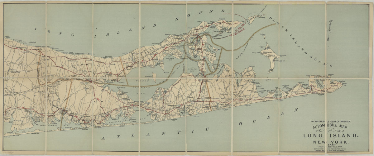
Automobile map of Long Island, New York, east: Automobile Club of America
Automobile map of Long Island, New York, east: Automobile Club of America
1905[1904]
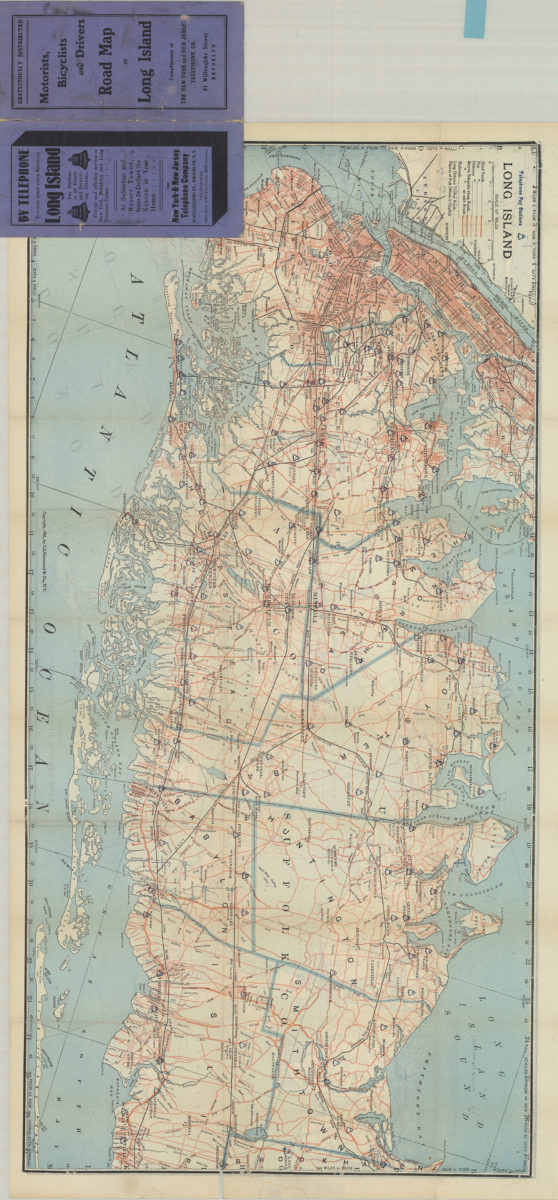
Motorists, bicyclists and drivers road map of Long Island: compliments of The New York and New Jersey Telephone Co
Motorists, bicyclists and drivers road map of Long Island: compliments of The New York and New Jersey Telephone Co
[1905; 1905]
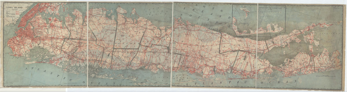
Long Island
Long Island
[ca. 1906]
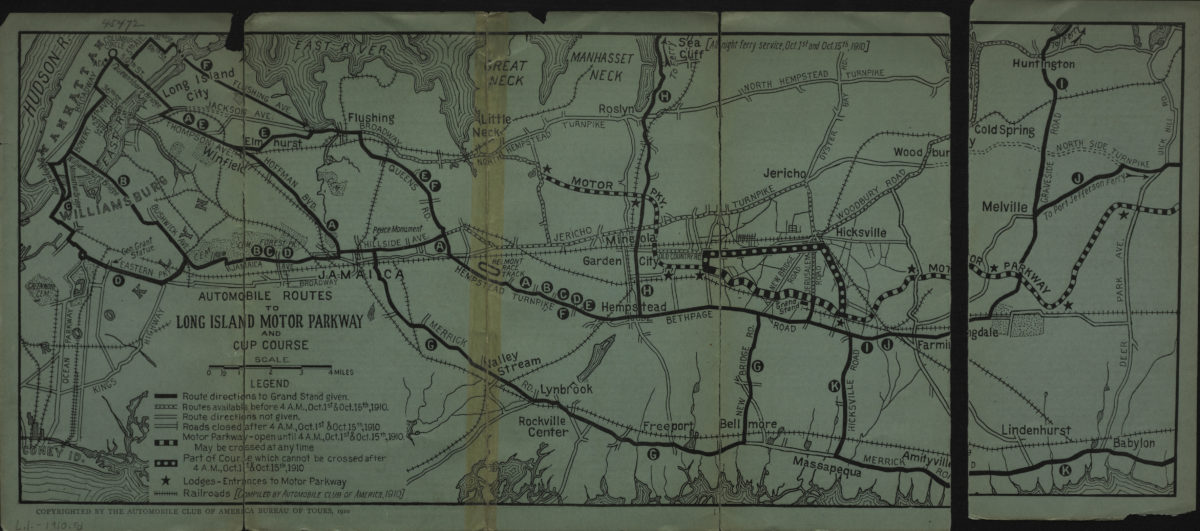
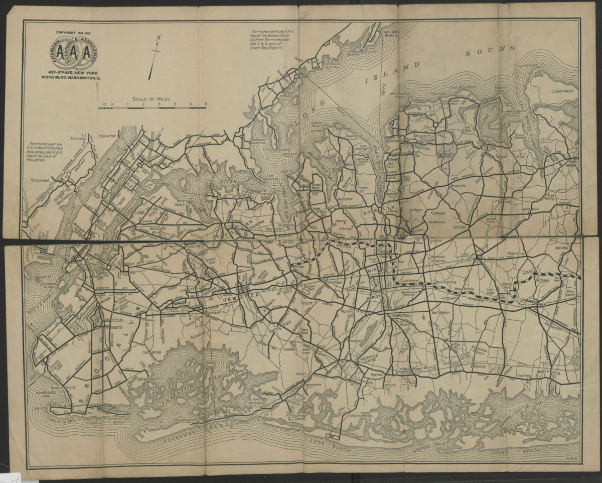
Automobile routes to Long Island Motor Parkway and Cup course
Automobile routes to Long Island Motor Parkway and Cup course
[1910; 1910]
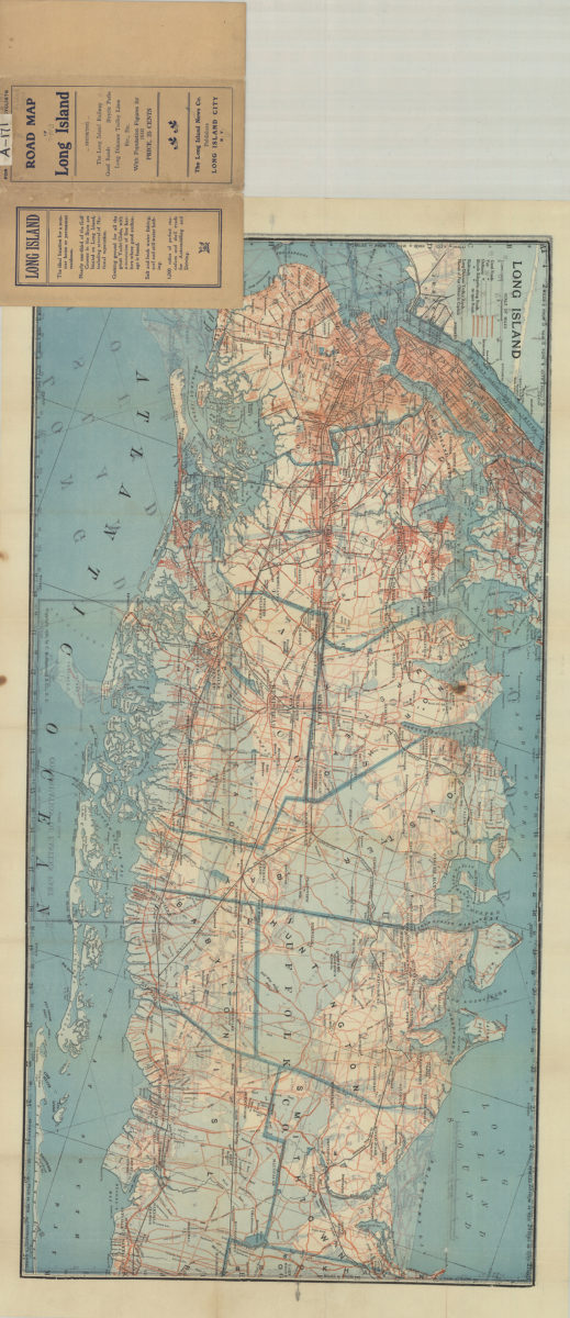
Road map of Long Island
Road map of Long Island
[1910; 1906]
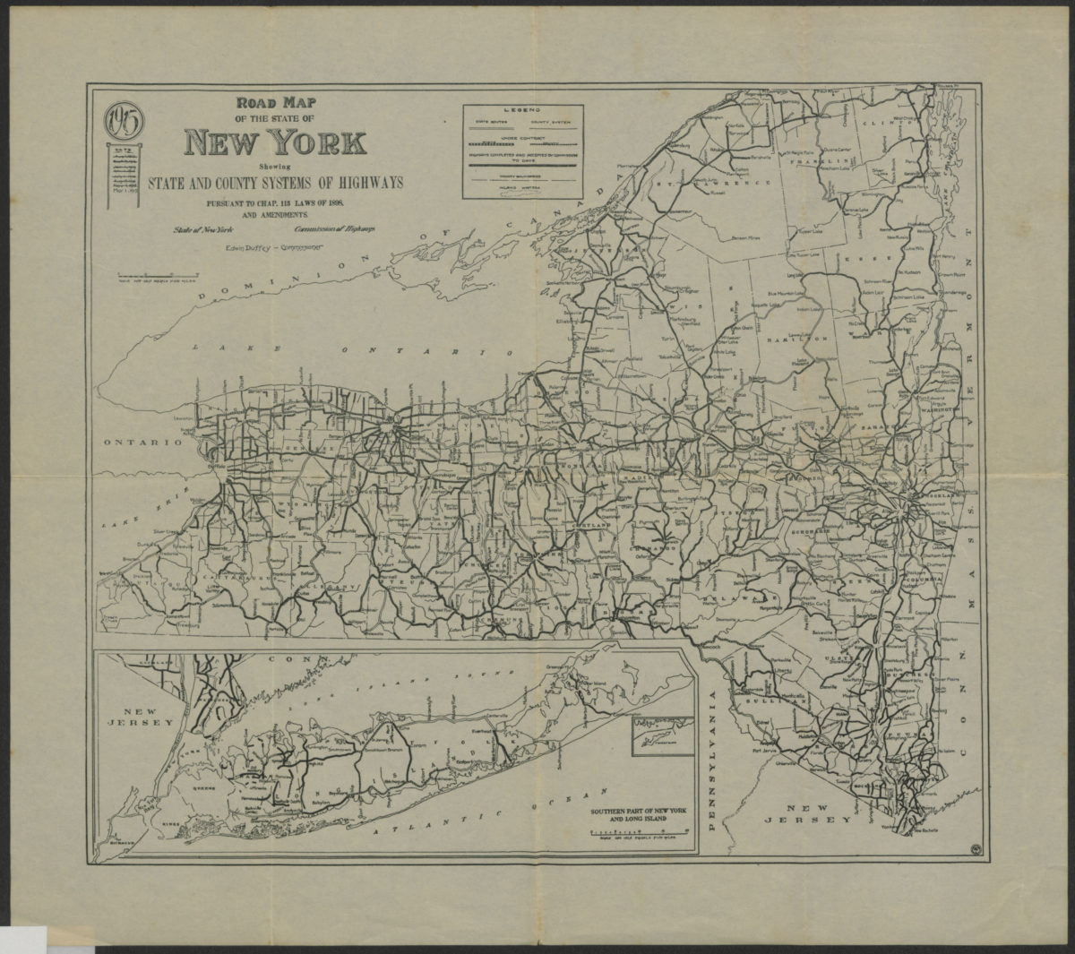
Road map of the state of New York: showing state and county systems of highways: pursuant to Chap. 115 Laws of 1898 and amendments, State of New York, Department of Highways
Road map of the state of New York: showing state and county systems of highways: pursuant to Chap. 115 Laws of 1898 and amendments, State of New York, Department of Highways
1915
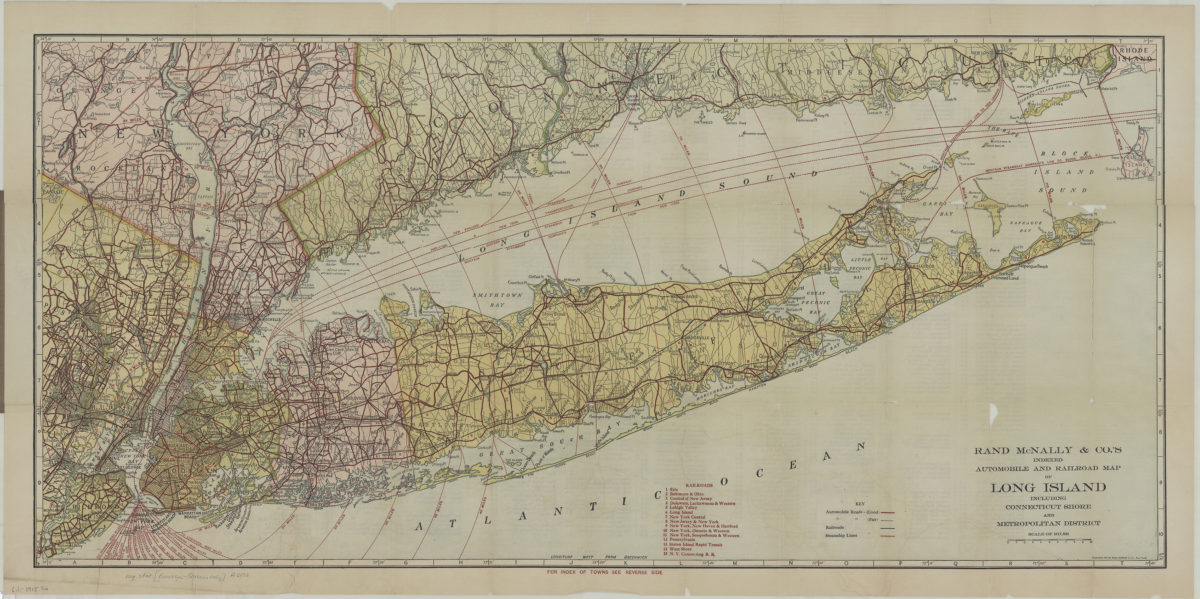
Rand McNally indexed automobile and railroad pocket map of Long Island including Connecticut shore and Metropolitan district
Rand McNally indexed automobile and railroad pocket map of Long Island including Connecticut shore and Metropolitan district
[1915; 1915]
Suburban Long Island: detail of routes in a heavily-traveled and complicated section of the metropolitan district, showing bridges and ferries to and from Manhattan, the Bronx, lower Westchester County and suburban New Jersey
Suburban Long Island: detail of routes in a heavily-traveled and complicated section of the metropolitan district, showing bridges and ferries to and from Manhattan, the Bronx, lower Westchester County and suburban New Jersey
[ca. 1916]
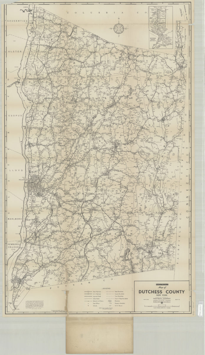
Hagstrom’s street and road map of Dutchess County, New York: contents Beacon, Millbrook, Millerton, Pawling, Poughkeepsie, Red Hook, Rhinebeck, Wappingers Falls, etc
Hagstrom’s street and road map of Dutchess County, New York: contents Beacon, Millbrook, Millerton, Pawling, Poughkeepsie, Red Hook, Rhinebeck, Wappingers Falls, etc
[1916-1924]
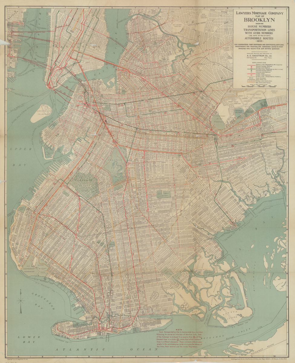
Lawyer’s Mortgage Company map of Brooklyn: showing house-numbers, transportation lines, with guide numbers … automobile routes, 1922: compiled, printed and published A.G. Hagstrom Co., Inc
Lawyer’s Mortgage Company map of Brooklyn: showing house-numbers, transportation lines, with guide numbers … automobile routes, 1922: compiled, printed and published A.G. Hagstrom Co., Inc
1922
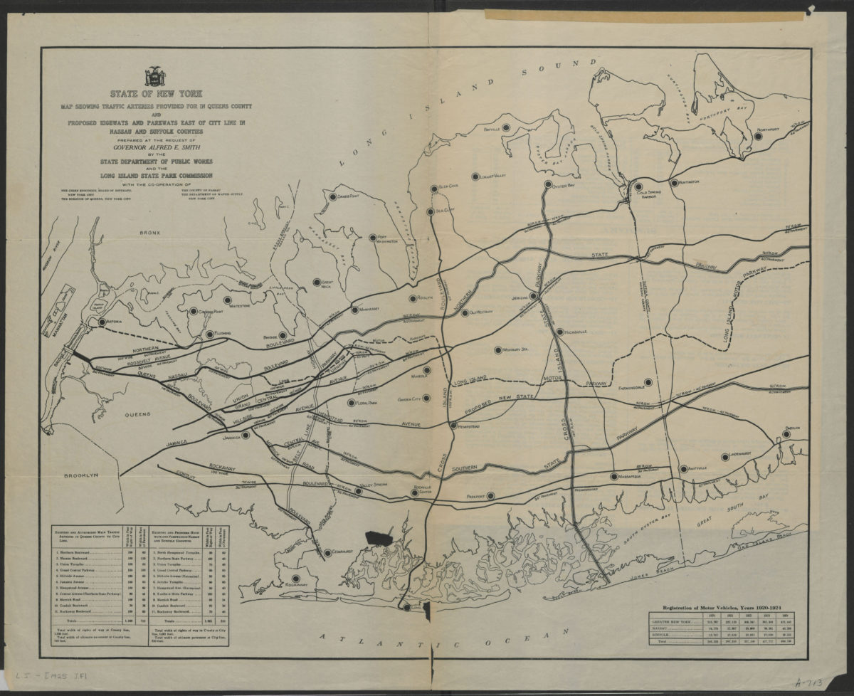
State of New York map showing traffic arteries provided for in Queens County and proposed highways and parkways east of city line in Nassau and Suffolk Counties: prepared at the request of Governor Alfred E. Smith
State of New York map showing traffic arteries provided for in Queens County and proposed highways and parkways east of city line in Nassau and Suffolk Counties: prepared at the request of Governor Alfred E. Smith
[1925]
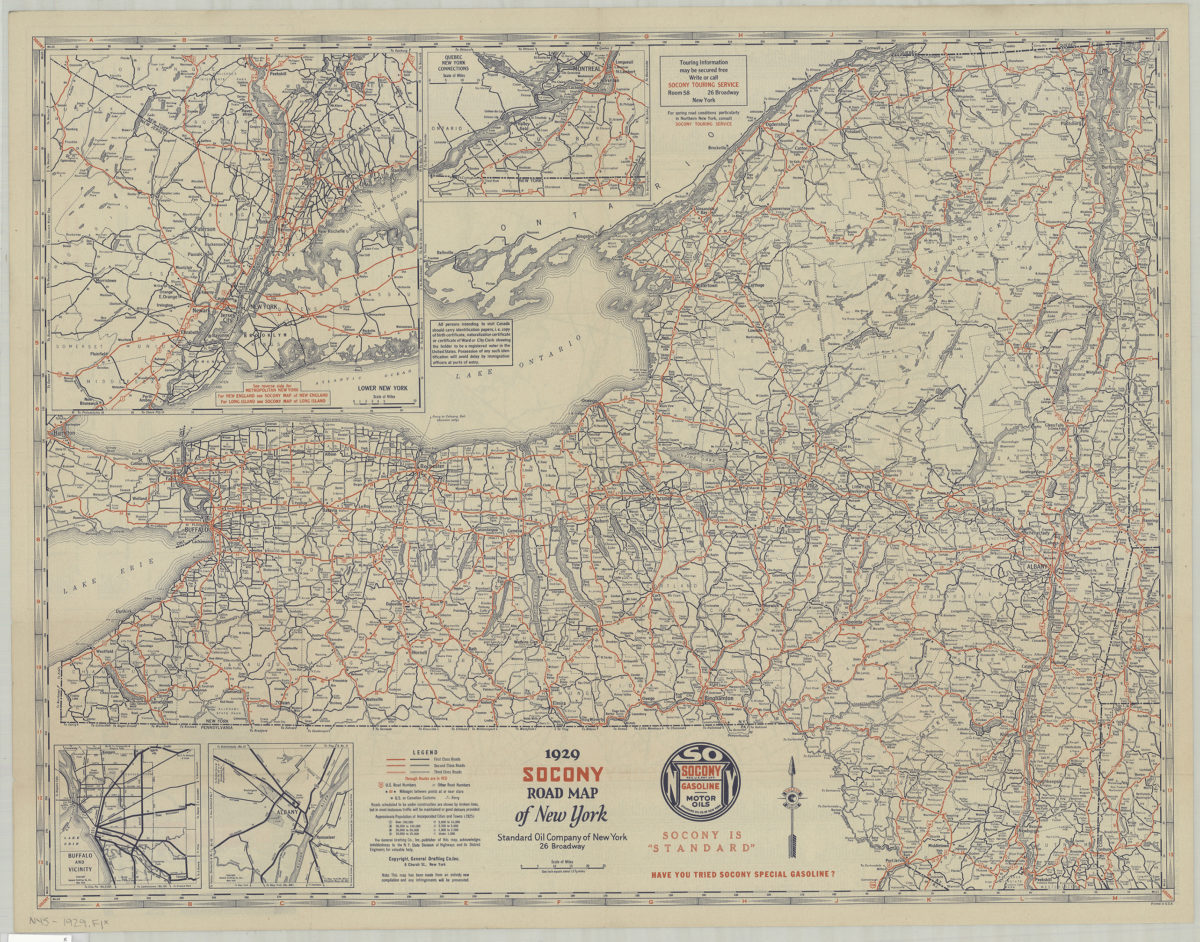
1929 Socony Road map of New York: copyright General Drafting Co., Inc
1929 Socony Road map of New York: copyright General Drafting Co., Inc
[1929]
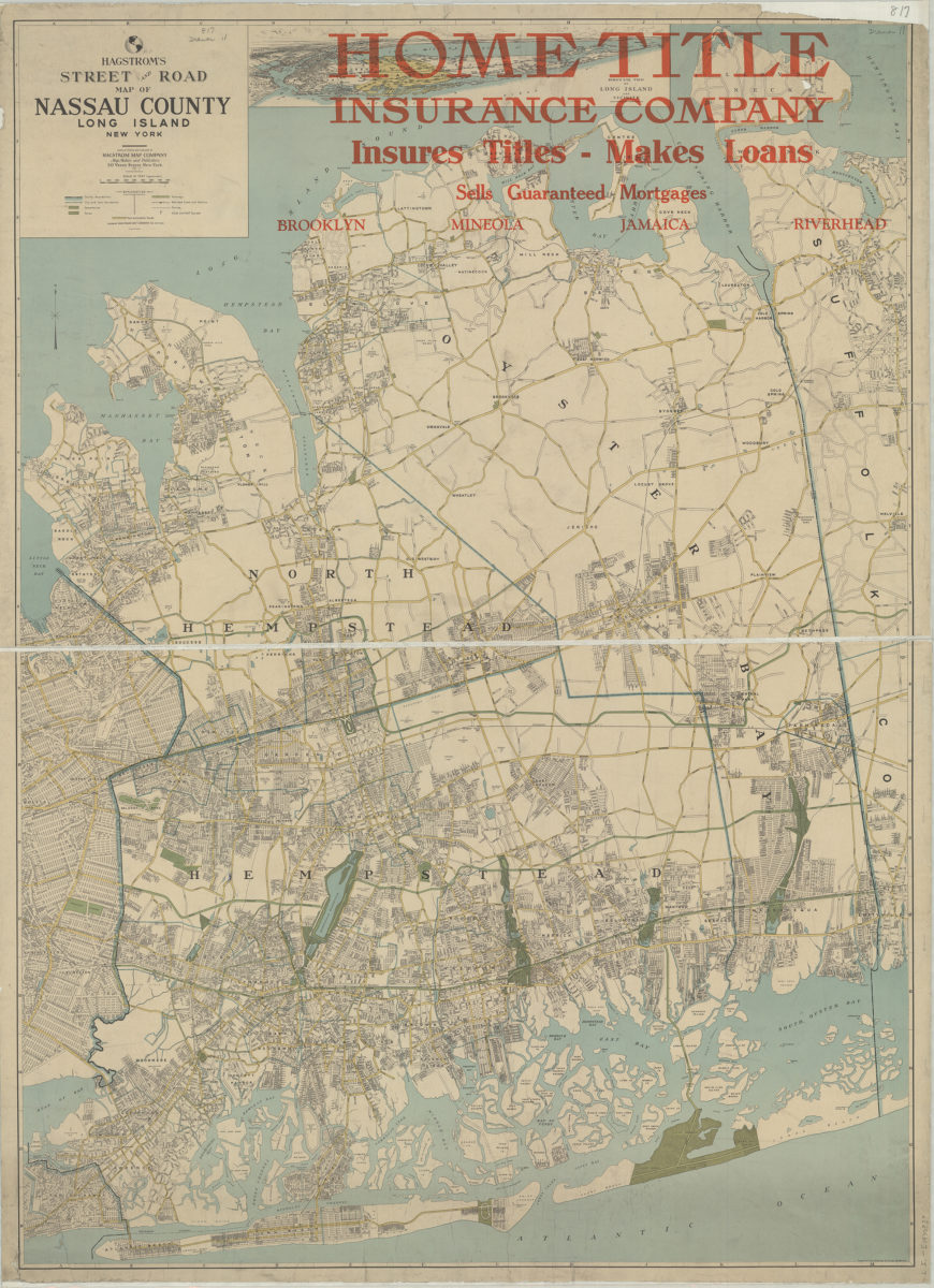
Hagstrom’s street and road map of Nassau County, Long Island, New York: compiled, printed and published by Hagstrom Map Company
Hagstrom’s street and road map of Nassau County, Long Island, New York: compiled, printed and published by Hagstrom Map Company
[1930]
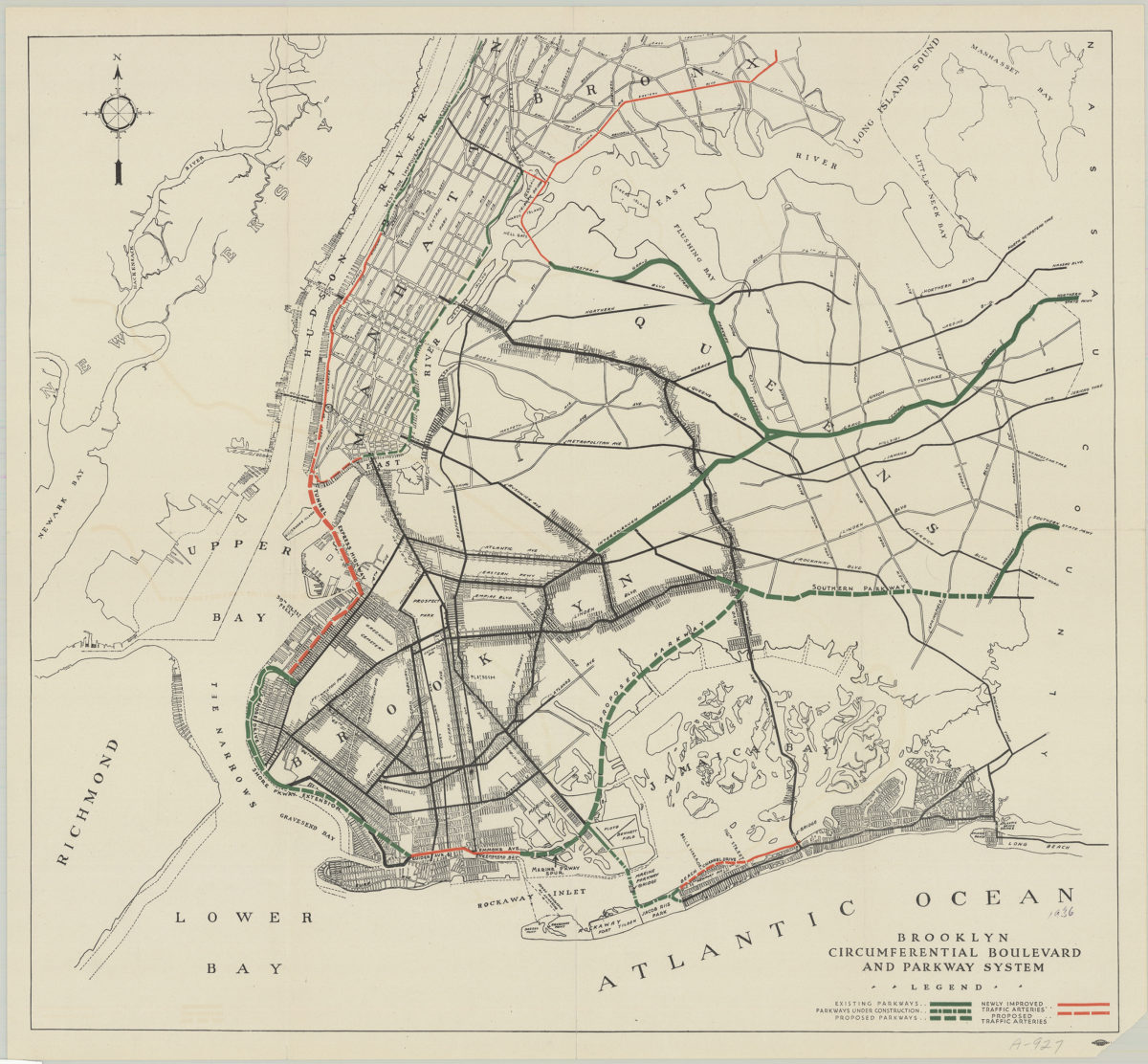
Brooklyn circumferential boulevard and parkway system
Brooklyn circumferential boulevard and parkway system
[193?]
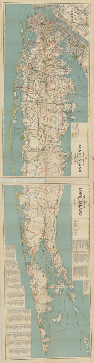
Hagstrom’s map of Long Island, New York
Hagstrom’s map of Long Island, New York
1932
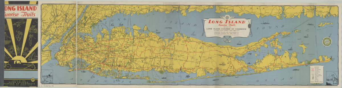
Long Island sunrise trails: issued by the Long Island Chamber of commerce, compiled … by Hagstrom Map Company
Long Island sunrise trails: issued by the Long Island Chamber of commerce, compiled … by Hagstrom Map Company
[1932]
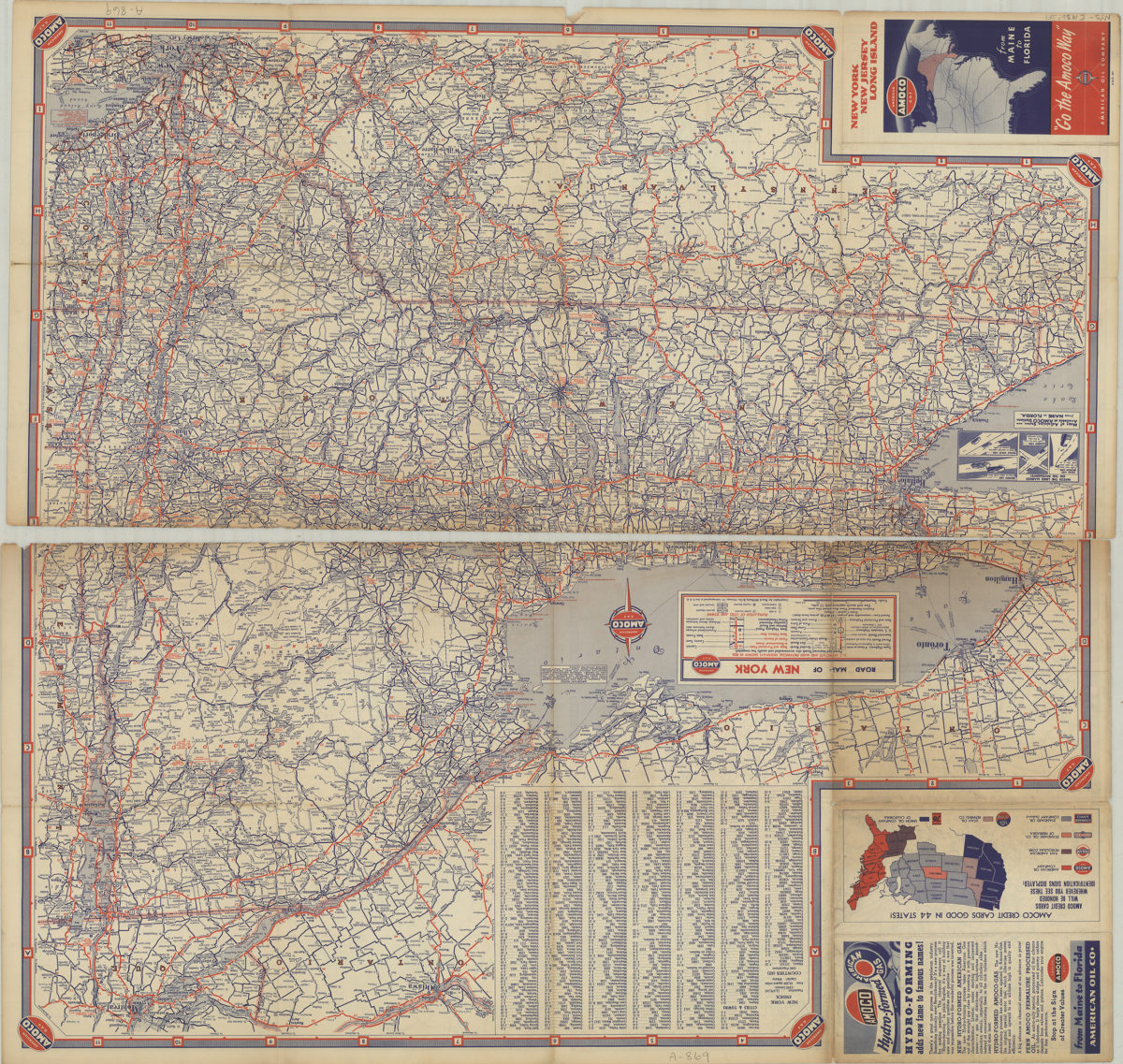
New York, New Jersey, Long Island: [compliments of] Amoco
New York, New Jersey, Long Island: [compliments of] Amoco
[1936]
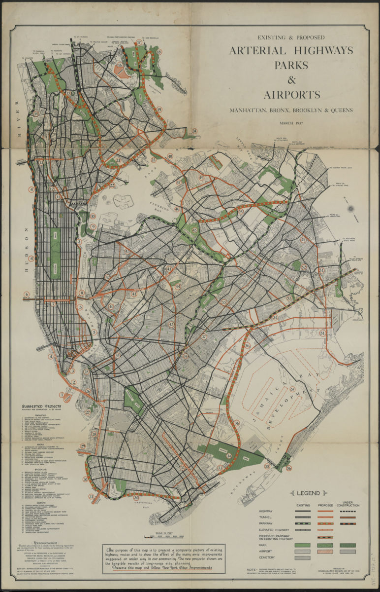
Existing & proposed arterial highways, parks & airports, Manhattan, Bronx, Brooklyn & Queens: prepared by Consolidated Edison Co. of N.Y., inc
Existing & proposed arterial highways, parks & airports, Manhattan, Bronx, Brooklyn & Queens: prepared by Consolidated Edison Co. of N.Y., inc
1937
The locale of the New York World’s Fair: H.M. Gousha Company
The locale of the New York World’s Fair: H.M. Gousha Company
1939
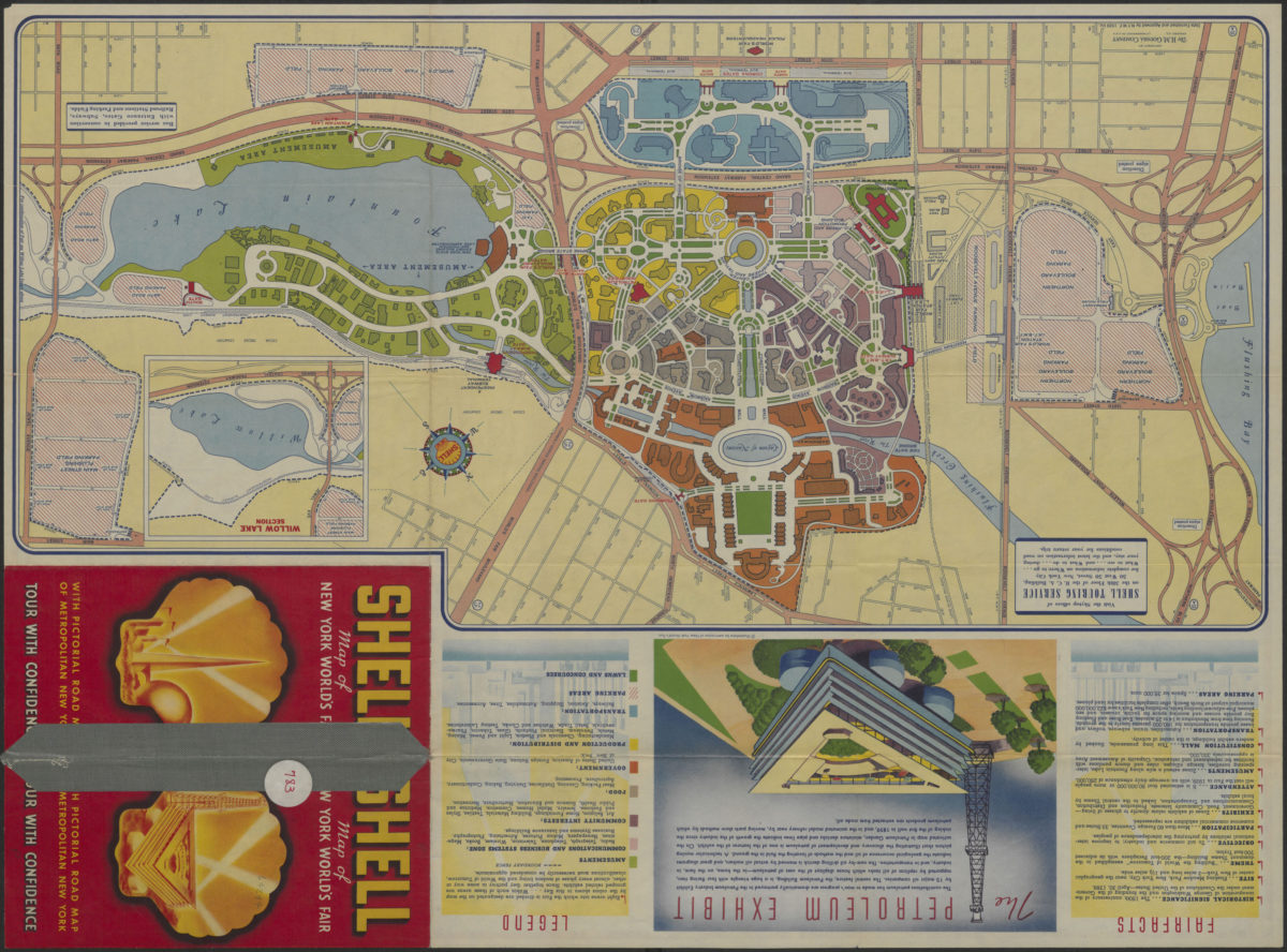
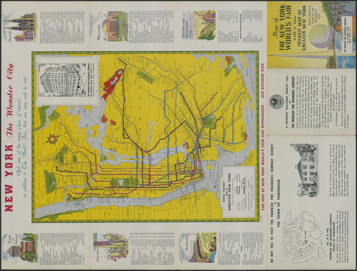
Map of the New York World’s Fair with a new transit map of Greater New York: auto routes, places of interest
Map of the New York World’s Fair with a new transit map of Greater New York: auto routes, places of interest
[1939]
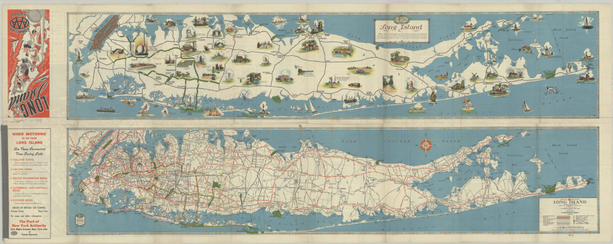
Long Island: AAA ; Automobile Club of New York
Long Island: AAA ; Automobile Club of New York
[1939]
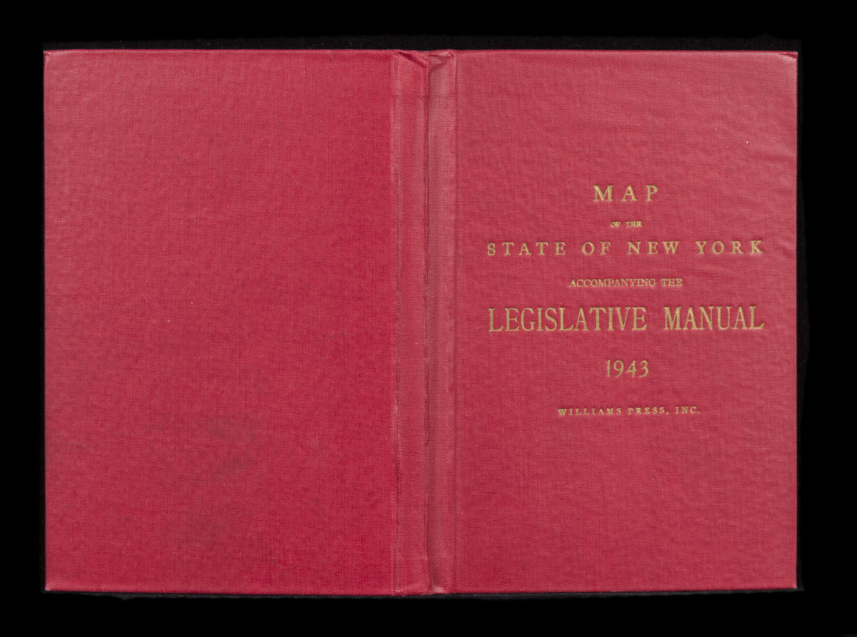
Canal and railroad map of the State of New York: to accompany the Legislative Manual
Canal and railroad map of the State of New York: to accompany the Legislative Manual
1943
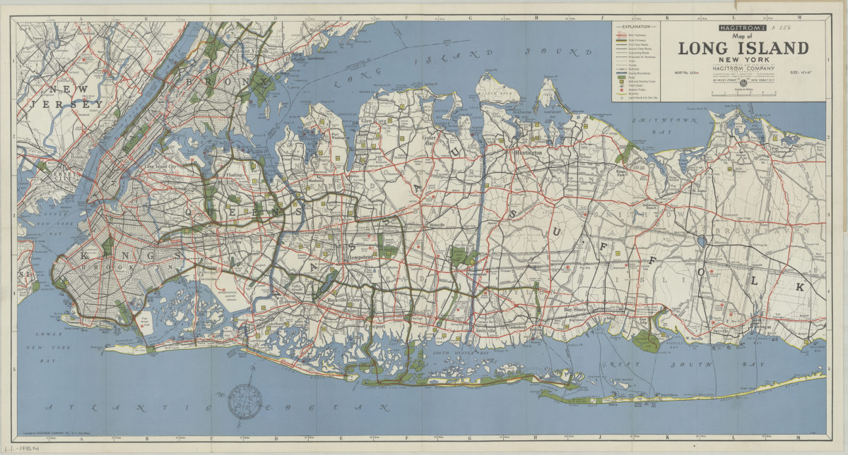
Hagstrom’s map of Long Island, New York
Hagstrom’s map of Long Island, New York
[1948]
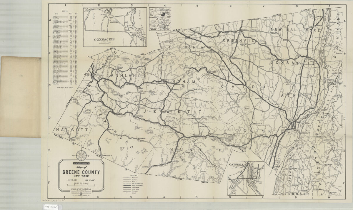
Hagstrom’s map of Greene County, New York: Hagstrom Company
Hagstrom’s map of Greene County, New York: Hagstrom Company
[1950]
The complete map of Brooklyn (New York City): featuring house numbers, transit lines, playgrounds, wading pools, etc.: produced under the direction of Alexander Gross
The complete map of Brooklyn (New York City): featuring house numbers, transit lines, playgrounds, wading pools, etc.: produced under the direction of Alexander Gross
[195?]
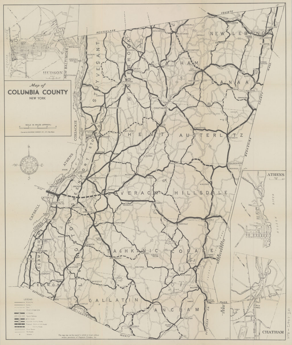
Map of Columbia County, New York
Map of Columbia County, New York
1951
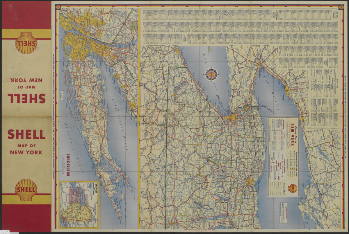
Highway map of New York
Highway map of New York
[1953]
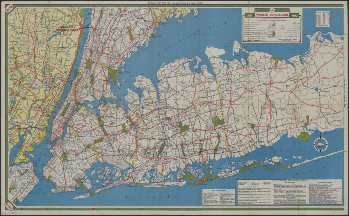
Long Island, Metropolitan New York, Westchester County
Long Island, Metropolitan New York, Westchester County
[1957]
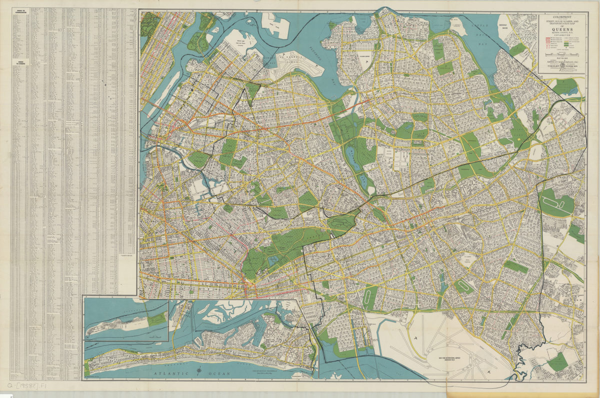
Colorprint street, house number and transportation map of Queens: (Queens County, N.Y.): American Map Company
Colorprint street, house number and transportation map of Queens: (Queens County, N.Y.): American Map Company
[1958]
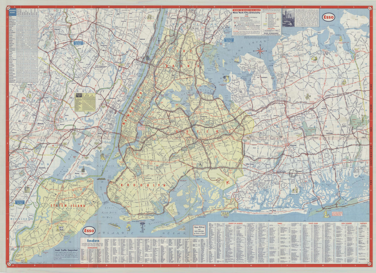
New York City & vicinity,1960: General Drafting Company ; [prepared for] Esso Standard
New York City & vicinity,1960: General Drafting Company ; [prepared for] Esso Standard
1960
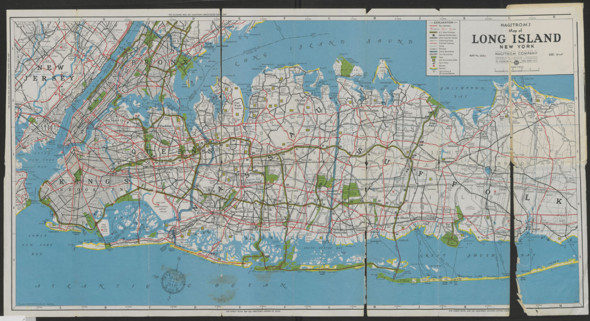
Hagstrom’s map of Long Island, New York
Hagstrom’s map of Long Island, New York
[1962]
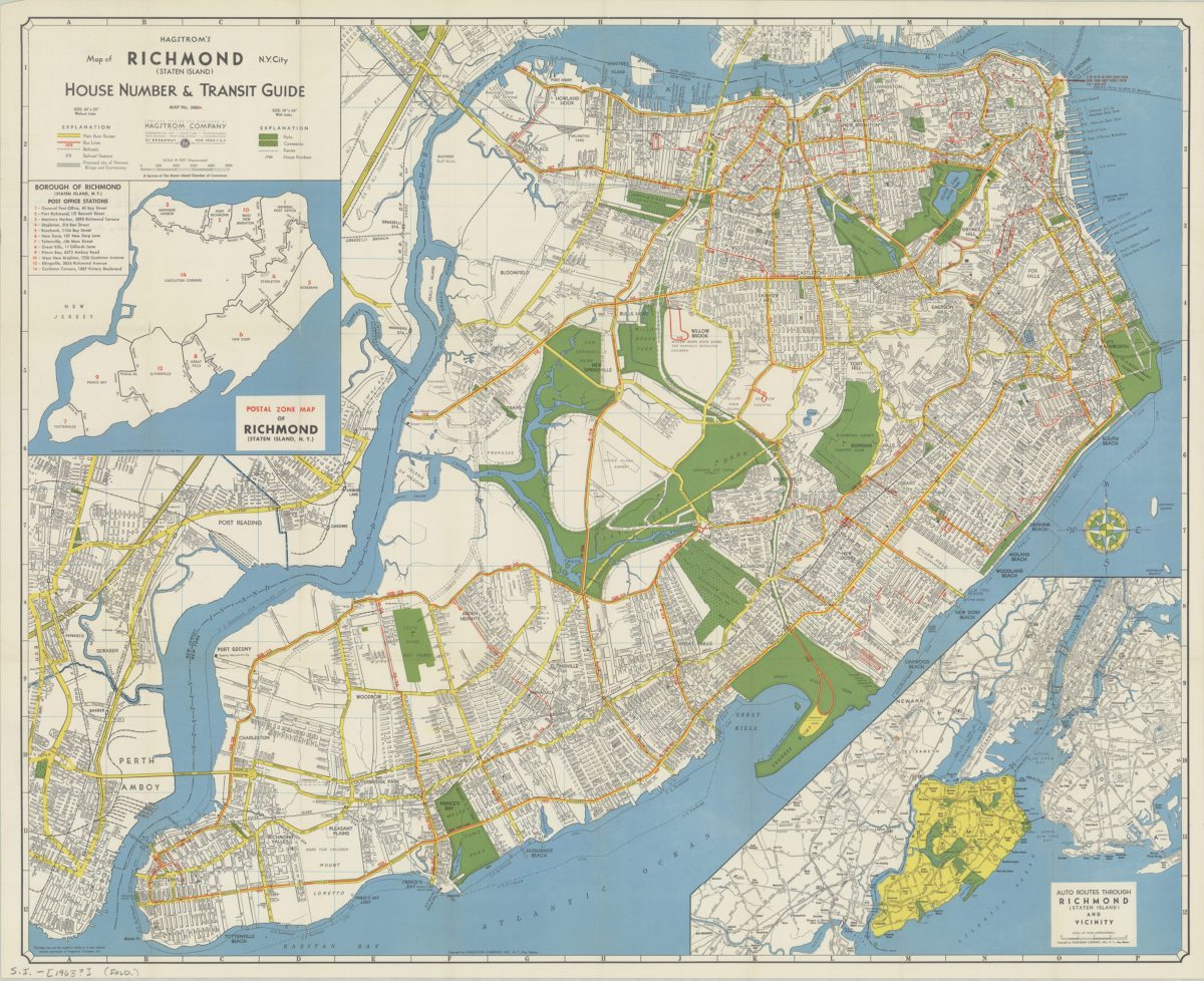
Hagstrom’s map of Richmond (Staten Island), N. Y. City: house number & transit guide: compiled, printed, and published by Hagstrom Company
Hagstrom’s map of Richmond (Staten Island), N. Y. City: house number & transit guide: compiled, printed, and published by Hagstrom Company
[1963]
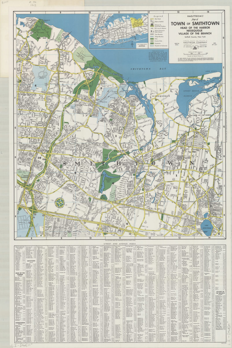
Hagstrom’s map of town of Smithtown, Head of the Harbor, Nissequgue [sic], Village of the Branch, Suffolk County, New York: compiled, printed, and published by Hagstrom Company Incorporated
Hagstrom’s map of town of Smithtown, Head of the Harbor, Nissequgue [sic], Village of the Branch, Suffolk County, New York: compiled, printed, and published by Hagstrom Company Incorporated
[1968]
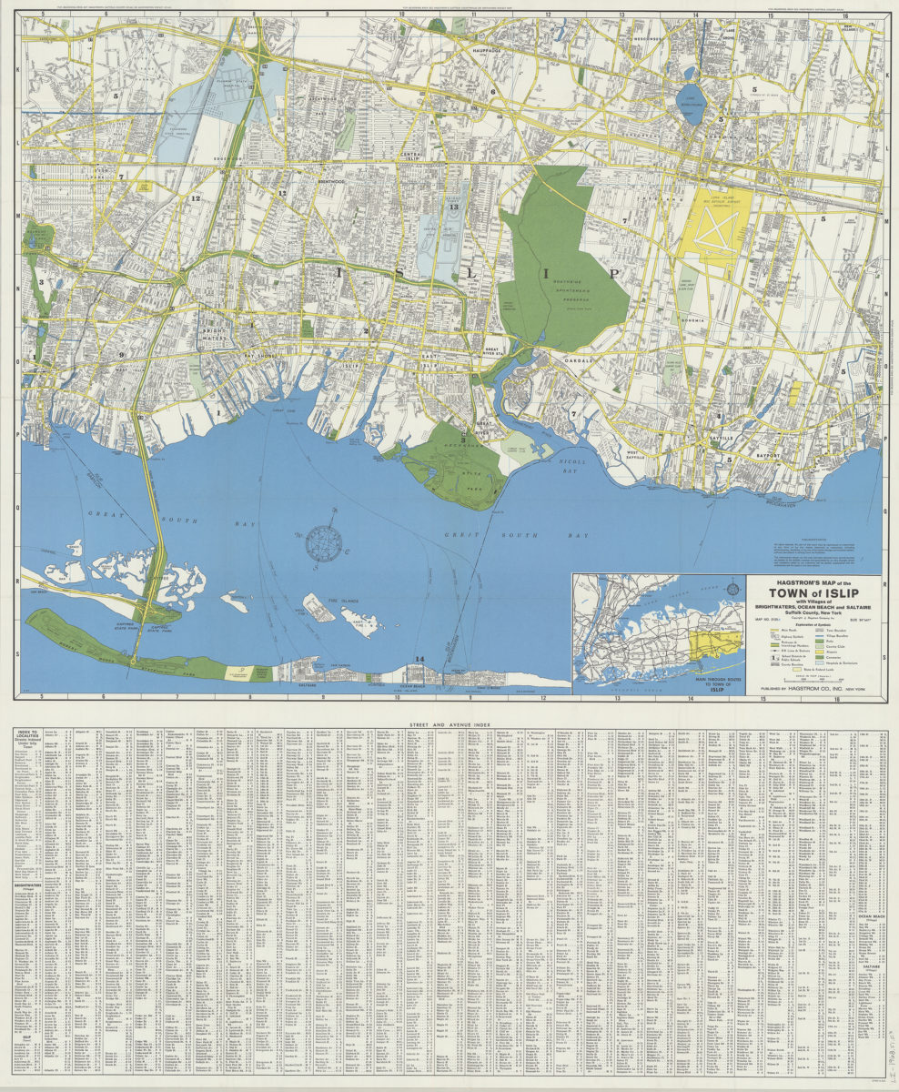
Hagstrom’s map of the Town of Islip: with the villages of Brightwaters, Ocean Beach and Saltaire, Suffolk County, New York
Hagstrom’s map of the Town of Islip: with the villages of Brightwaters, Ocean Beach and Saltaire, Suffolk County, New York
1968
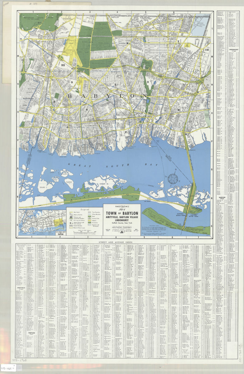
Hagstrom’s street and road map of Town of Babylon: Amityville, Babylon Village, Lindenhurst, Suffolk County, Long Island, N.Y.
Hagstrom’s street and road map of Town of Babylon: Amityville, Babylon Village, Lindenhurst, Suffolk County, Long Island, N.Y.
1968
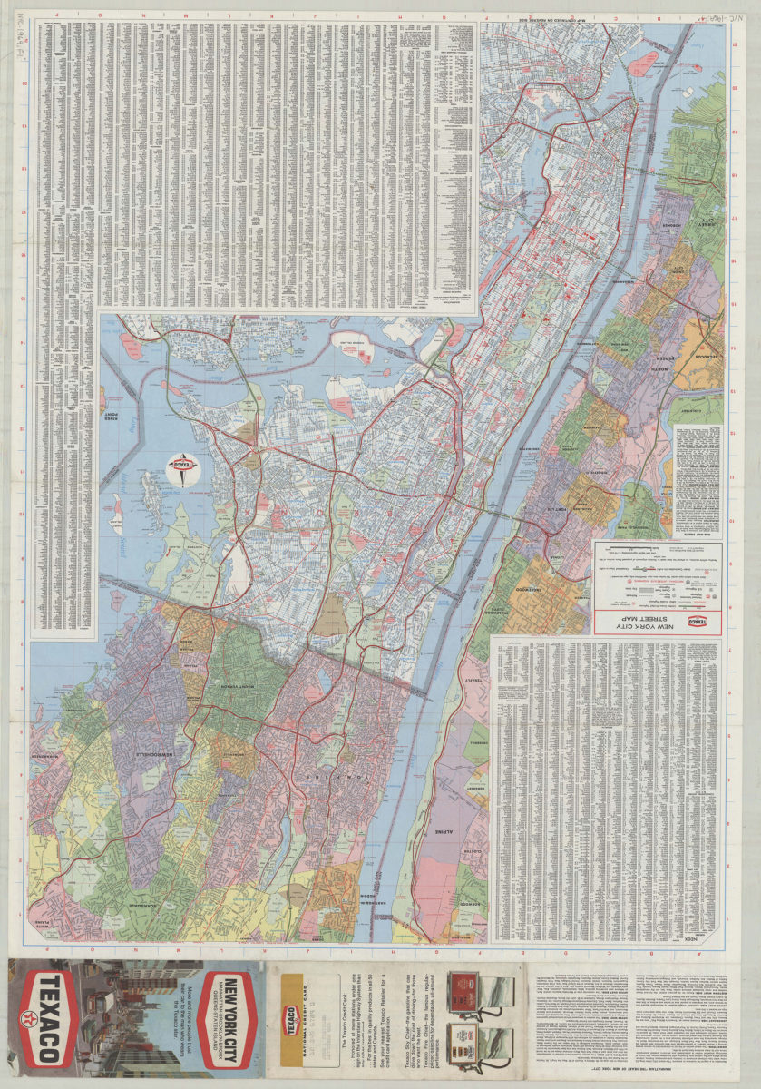
Texaco New York City street map
Texaco New York City street map
[1969; 1969]
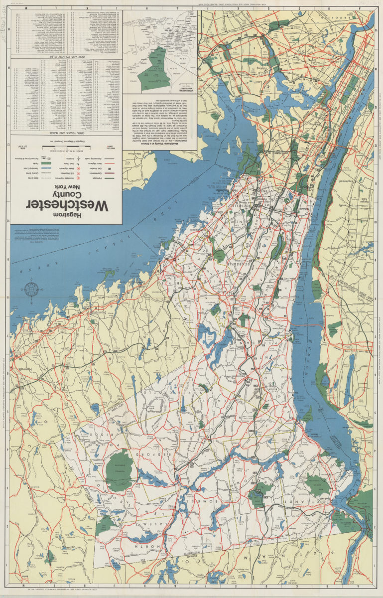
Hagstrom Westchester County, New York
Hagstrom Westchester County, New York
1970
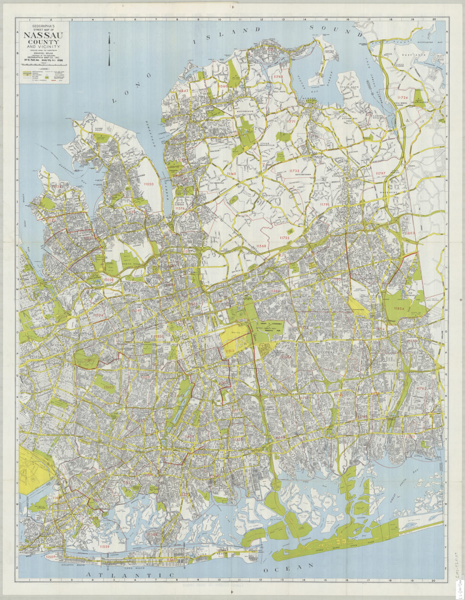
Geographia’s street map of Nassau County and vicinity: produced under the direction of Emanuel Polak
Geographia’s street map of Nassau County and vicinity: produced under the direction of Emanuel Polak
[197?]
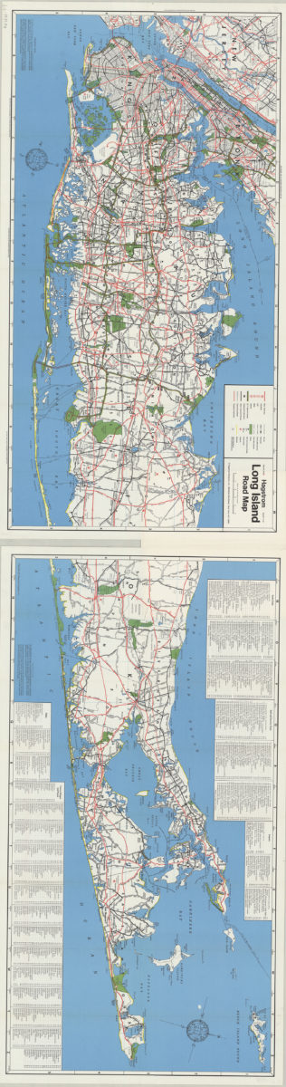
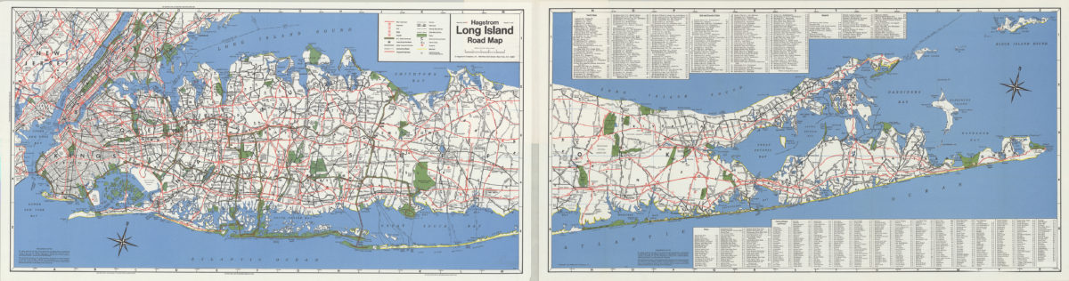
Hagstrom Long Island road map
Hagstrom Long Island road map
[1971]
Long Island, New York City & metro area counties
Long Island, New York City & metro area counties
[1972]
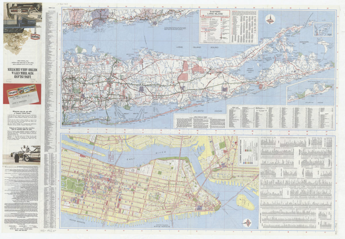
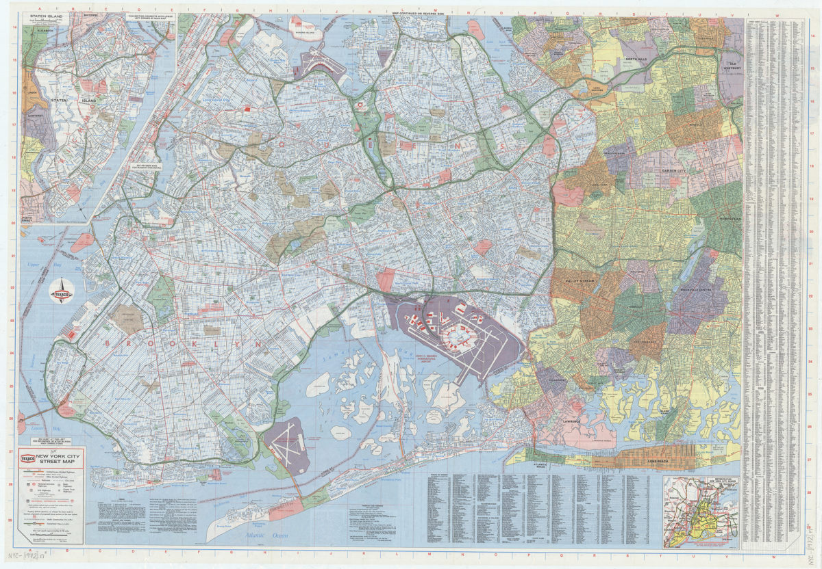
New York City street map: [prepared for] Texaco
New York City street map: [prepared for] Texaco
[1972]
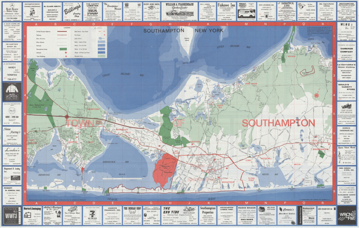
Southampton, New York
Southampton, New York
[1973]
Hagstrom Long Island road map
Hagstrom Long Island road map
[1974]
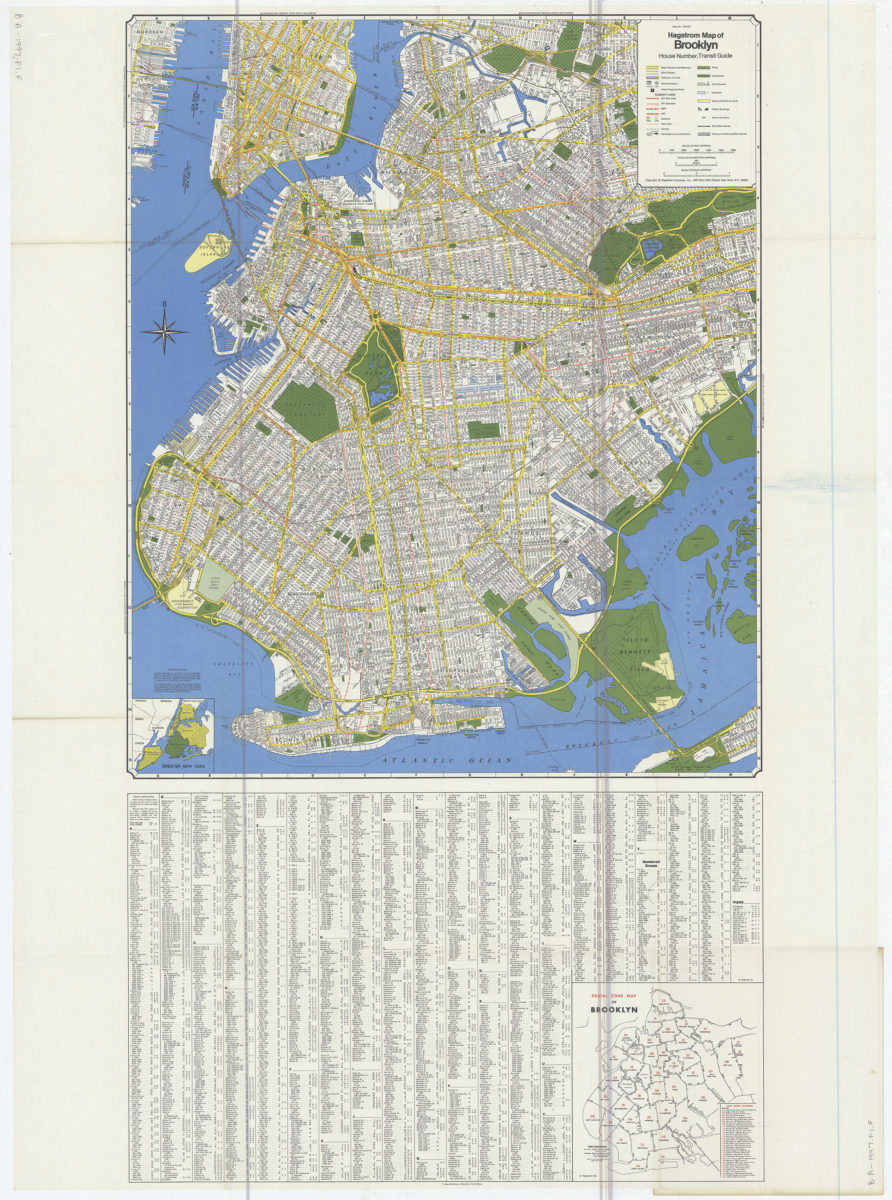
Hagstrom map of Brooklyn: house number, transit guide
Hagstrom map of Brooklyn: house number, transit guide
[1977]
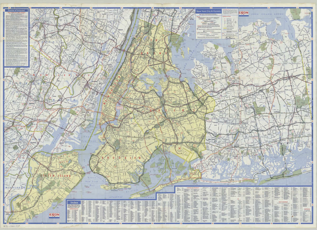
New York City and Long Island: featuring complete index, special area maps, recreation areas, points of interest text: Exxon
New York City and Long Island: featuring complete index, special area maps, recreation areas, points of interest text: Exxon
[ca. 1982]
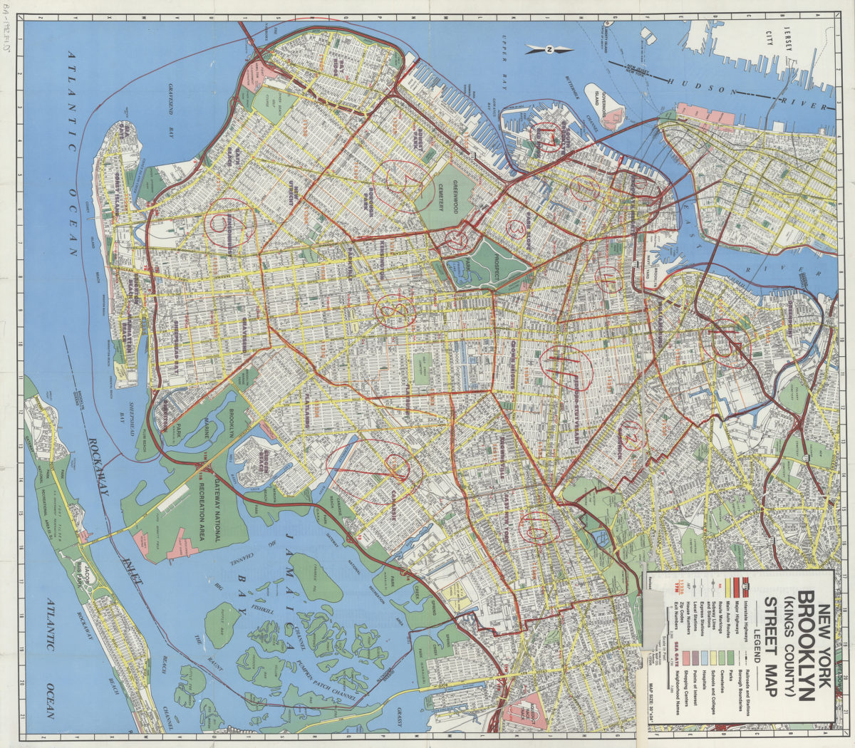
New York, Brooklyn (Kings County), street map: Geographia Map Co., Inc
New York, Brooklyn (Kings County), street map: Geographia Map Co., Inc
[ca. 1982]
1
2
Next