Center for Brooklyn History
Map Collections
Search
About
Othmer Library & Archives
Submit search query
Refine 72 records
Clear filters
2
Location
Adirondack Mountains (N.Y.)
2
Bronx (New York, N.Y.)
10
Brooklyn (New York, N.Y.)
891
Brooklyn Heights (New York, N.Y.)
76
Champlain, Lake
1
Downtown Brooklyn (New York, N.Y.)
29
ferries
1
George, Lake (N.Y. : Lake)
1
Hempstead (N.Y.)
13
Long Island (N.Y.)
197
Long Island Sound (N.Y. and Conn.)
12
Manhattan (New York, N.Y.)
120
Nassau County (N.Y.)
24
New York (N.Y.)
164
New York (State)
95
New York Harbor (N.Y. and N.J.)
16
New York Metropolitan Area
40
Queens (New York, N.Y.)
83
Red Hook (New York, N.Y.)
19
Staten Island (N.Y.)
10
Suffolk County (N.Y.)
43
Westchester County (N.Y.)
11
Show 2 more
Subject
Airports
2
Airways
2
Bridges
13
Bus lines
20
Bus travel
22
Canals
15
Central business districts
10
City planning
7
Electric railroads
5
Elevated highways
1
Exhibitions
5
Federal aid to transportation
1
ferries
32
Ferry routes
3
Golf courses
2
Harbors
11
Historic districts
4
Land use
5
Local transit
63
Marine terminals
2
Piers
25
Postal codes
4
Railroad terminals
2
Railroads
72
Railroads, Elevated
24
River channels
1
Roads
117
Service stations
1
Steamboat lines
4
Street addresses
11
Street railroads
8
Streets
46
Subways
55
Traffic engineering
1
Transportation
3
Trolley buses
1
Tunnels
16
Show 17 more
Date
20th Century
469
or enter range:
from
to
Genres
Aerial views
15
Pictorial maps
38
Road
1
Road maps
83
Thematic maps
60
Tourist maps
55
Transportation maps
120
Zoning maps
55
Sort by:
Date (earliest)
Date (most recent)
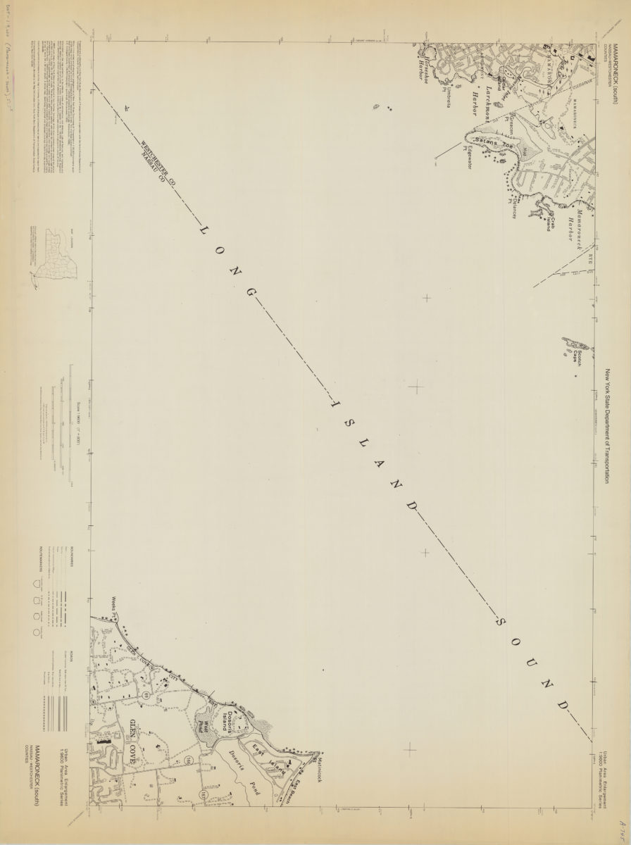
Mamaroneck (south)-Nassau/Westchester Counties: New York State Department of Transportation
Mamaroneck (south)-Nassau/Westchester Counties: New York State Department of Transportation
[1968]
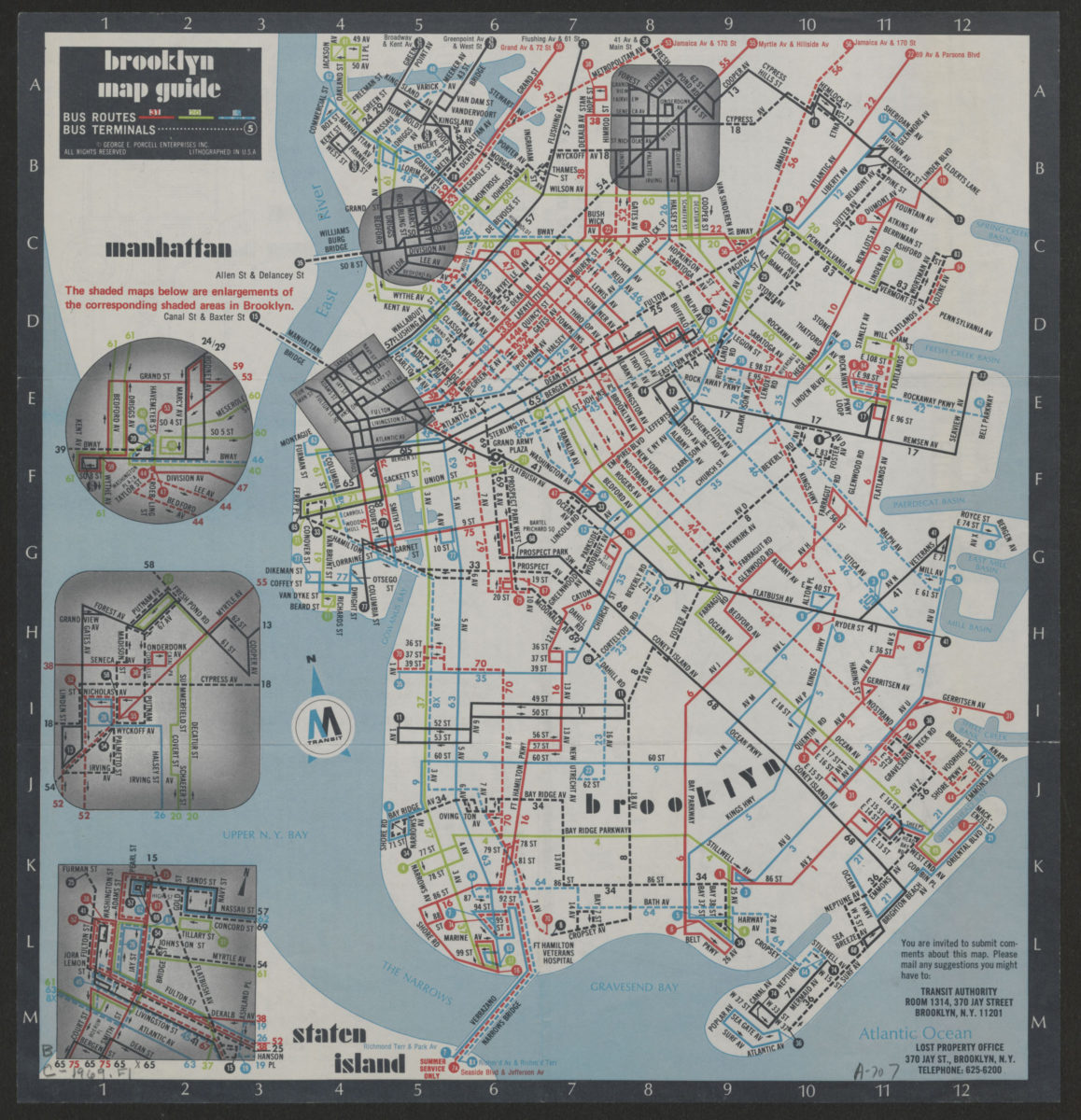
Brooklyn Staten Island bus map: M Transit
Brooklyn Staten Island bus map: M Transit
[ca. 1969]
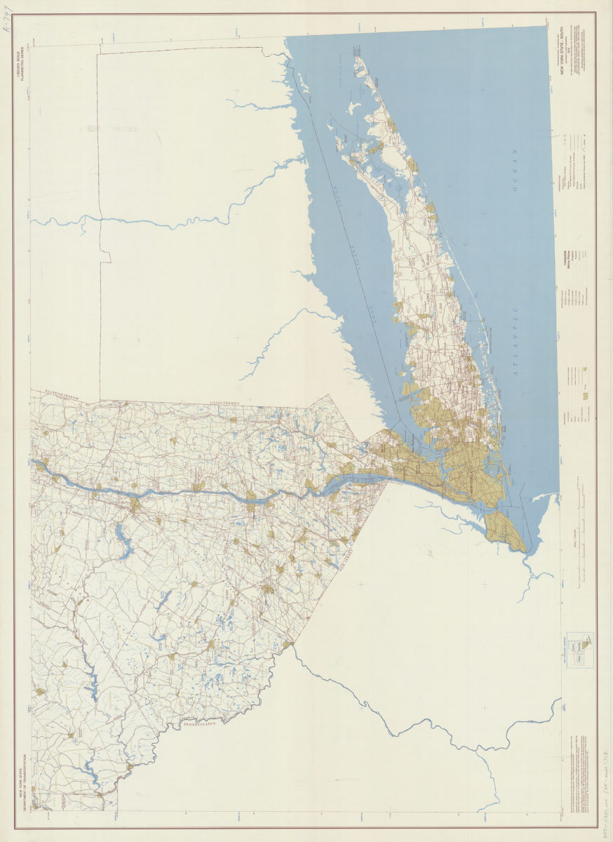
Transportation/planning map, New York State–South: prepared and published by the New York State Department of Transportation in cooperation with the Federal Highway Administration, U.S. Department of Transportation
Transportation/planning map, New York State–South: prepared and published by the New York State Department of Transportation in cooperation with the Federal Highway Administration, U.S. Department of Transportation
[1970; 1970]
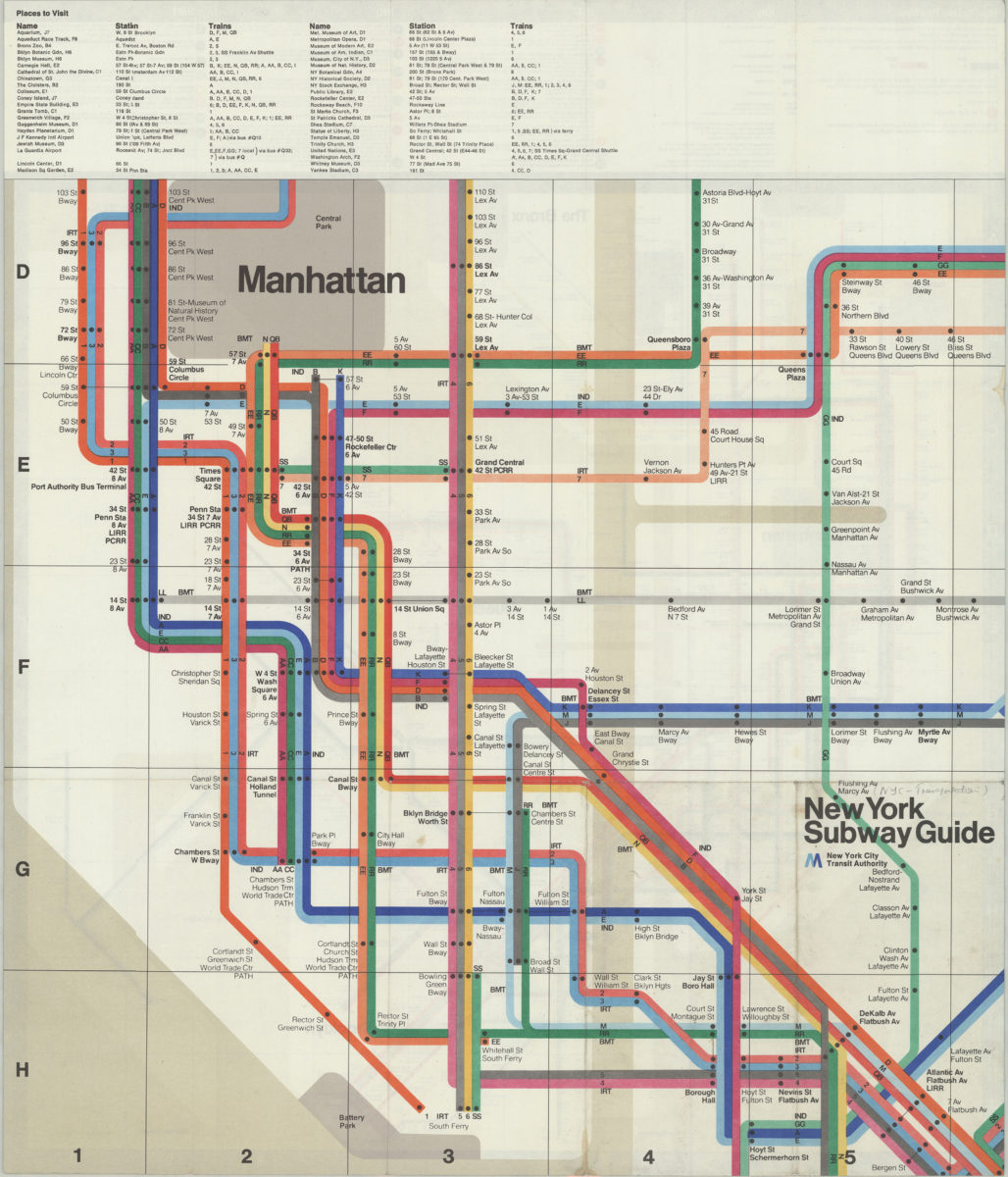
The Metropolitan Transportation Authority revised map of rapid transit facilities of New York City Transit Authority: New York City Transit Authority
The Metropolitan Transportation Authority revised map of rapid transit facilities of New York City Transit Authority: New York City Transit Authority
[ca. 1972]
The Metropolitan Transportation Authority revised map of rapid transit facilities of New York City Transit Authority: New York City Transit Authority
The Metropolitan Transportation Authority revised map of rapid transit facilities of New York City Transit Authority: New York City Transit Authority
[ca. 1974]
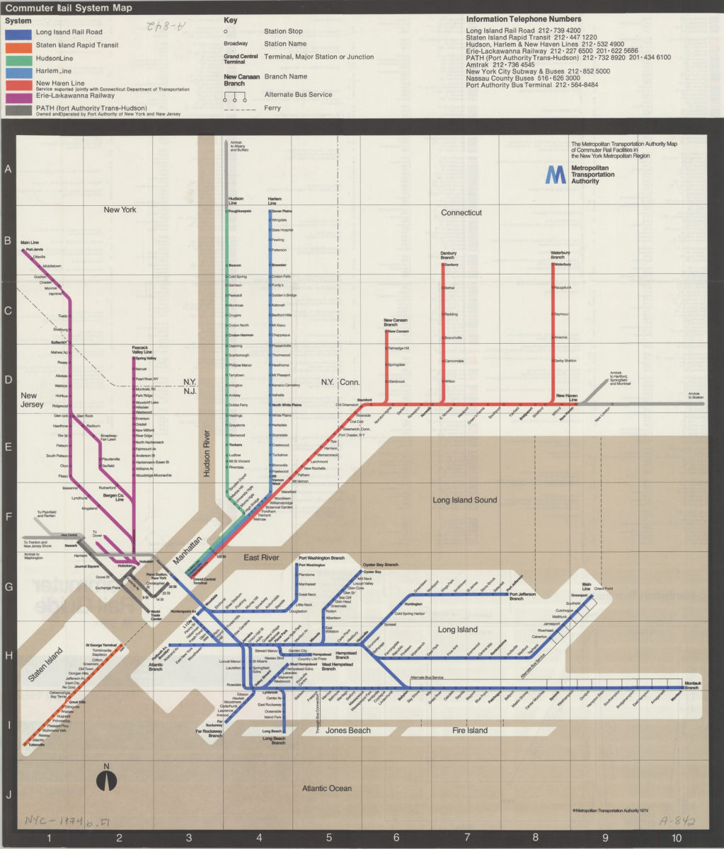
Commuter rail system map
Commuter rail system map
[ca. 1974]
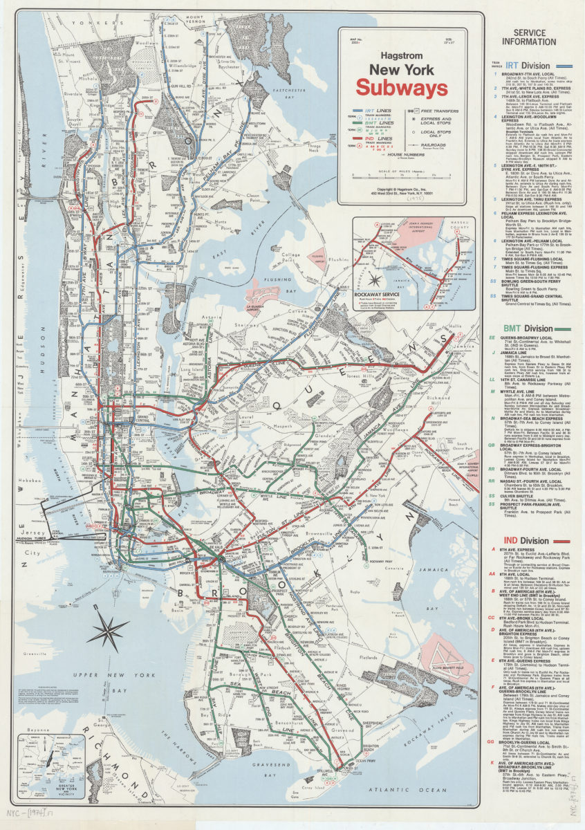
New York subways: Hagstrom
New York subways: Hagstrom
[1974]
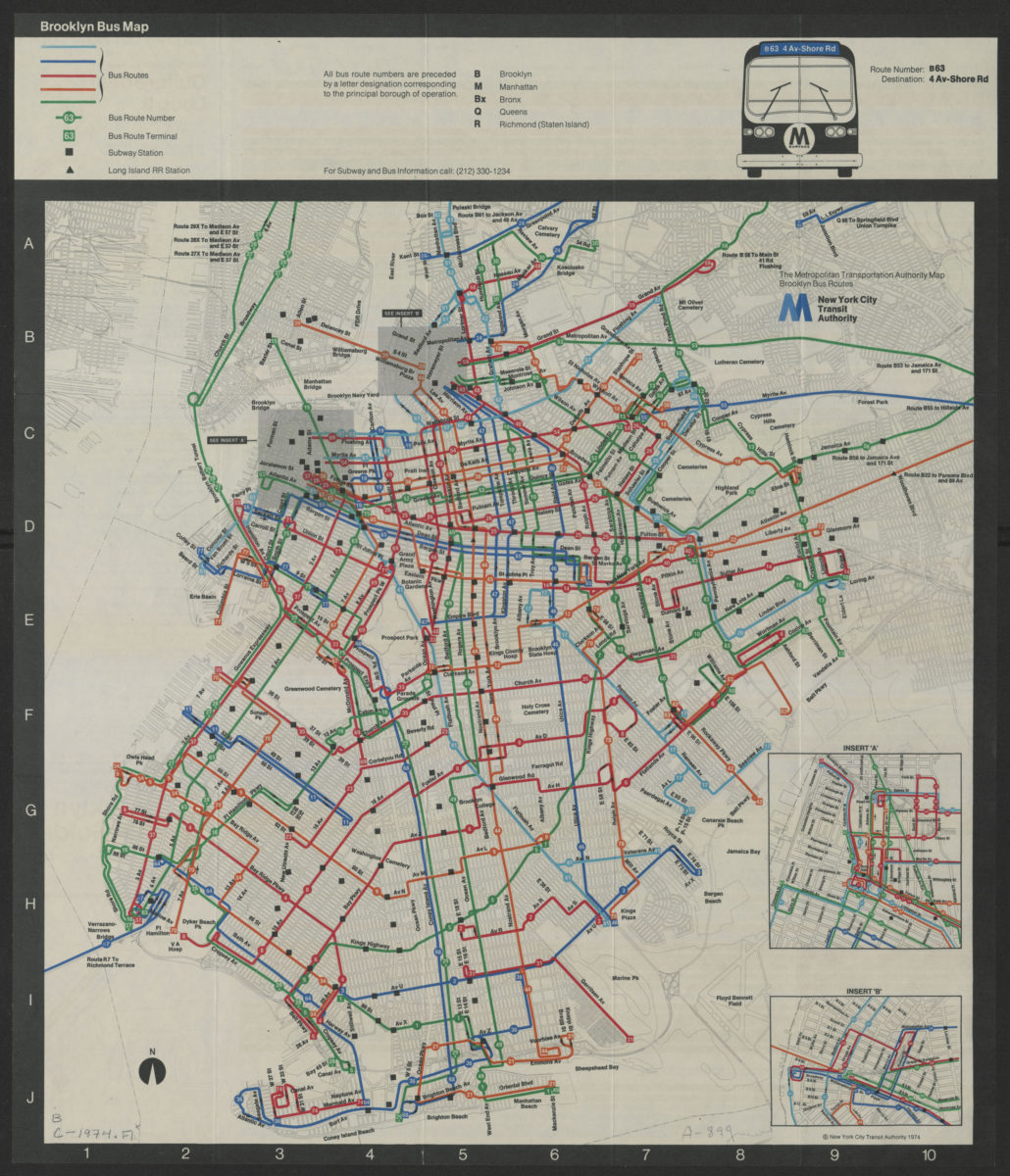
Brooklyn bus map
Brooklyn bus map
[ca. 1974]
Long Island, New York City & metro area counties: [prepared for] Texaco
Long Island, New York City & metro area counties: [prepared for] Texaco
1975
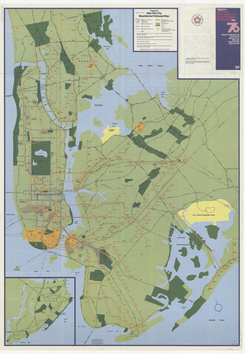
Hagstrom New York City Bicentennial pathways map
Hagstrom New York City Bicentennial pathways map
[1975]
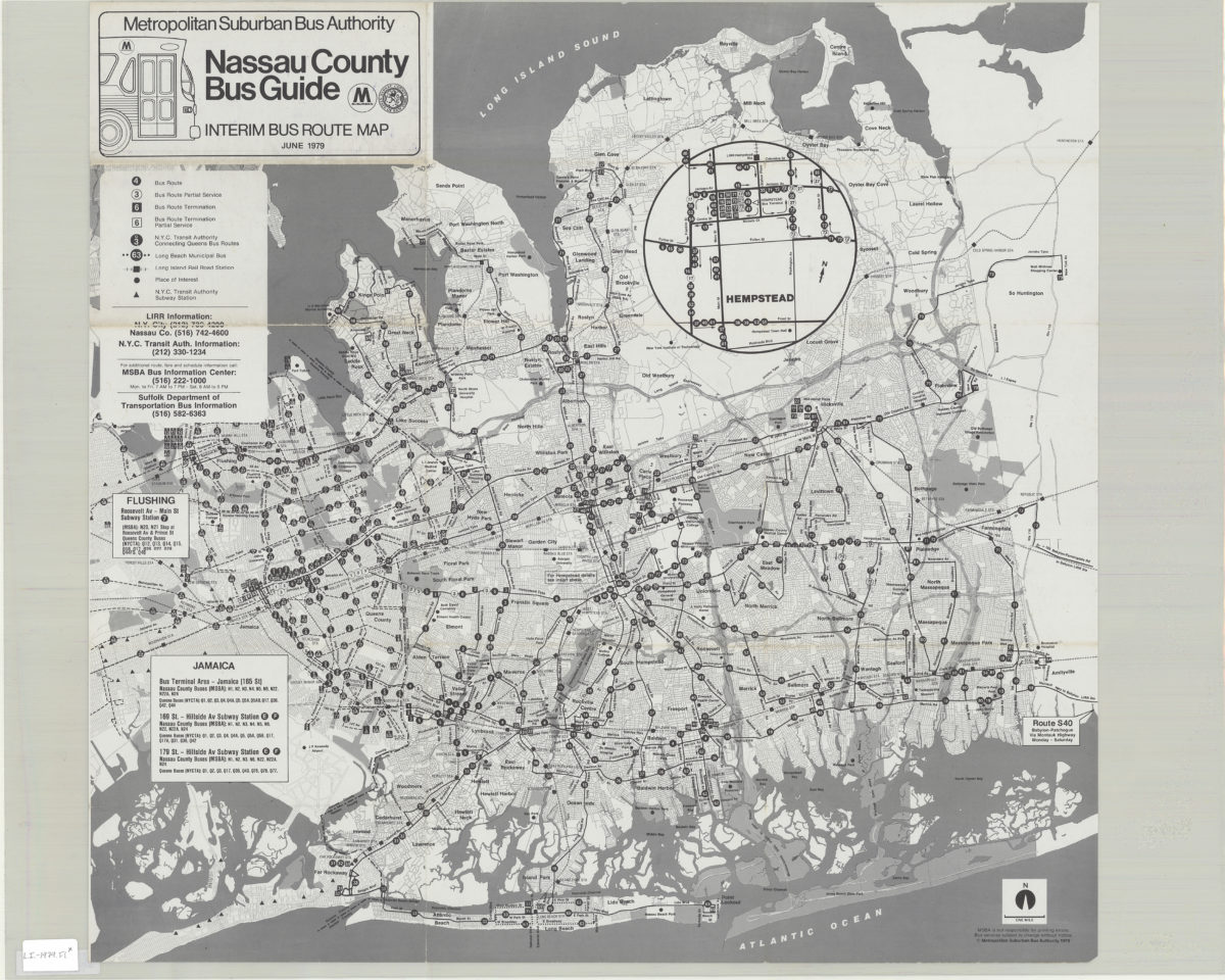
Nassau County bus guide: interim bus route map: Metropolitan Suburban Bus Authority
Nassau County bus guide: interim bus route map: Metropolitan Suburban Bus Authority
1979;c1979
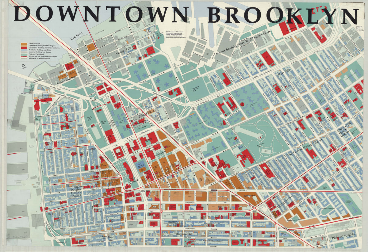
Downtown Brooklyn: designed by Incentra International, Inc
Downtown Brooklyn: designed by Incentra International, Inc
[1990]
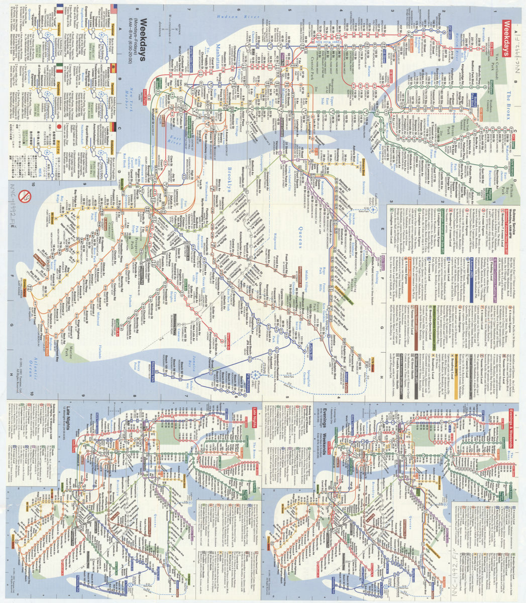
Subway map: the New York subway map = Le plan du métro de New York: the New York subway map is a Tauranac map
Subway map: the New York subway map = Le plan du métro de New York: the New York subway map is a Tauranac map
[1992]
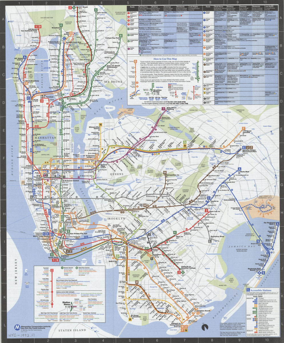
NYC subway map: June 1993, Français, Español, Deutsch, Italiano, English, Nihongo, Chung wen: New York City Transit Authority, Metropolitan Transportation Authority
NYC subway map: June 1993, Français, Español, Deutsch, Italiano, English, Nihongo, Chung wen: New York City Transit Authority, Metropolitan Transportation Authority
[ca. 1993]
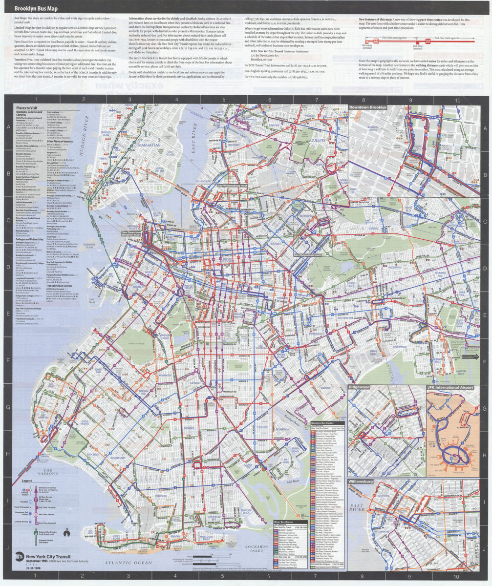
Brooklyn bus map: updated for fall service changes: MTA, New York City Transit
Brooklyn bus map: updated for fall service changes: MTA, New York City Transit
[ca. 1995]
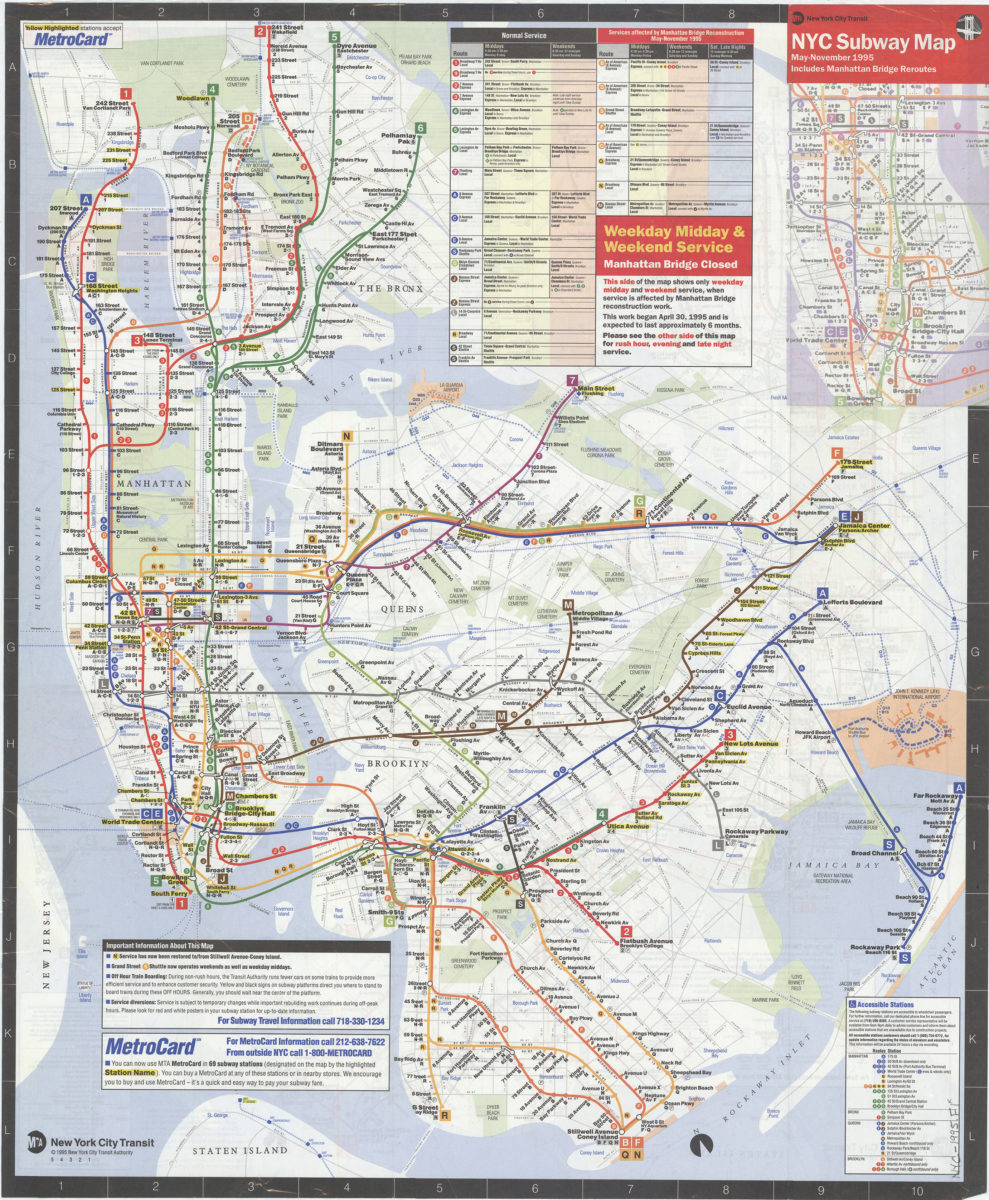
NYC subway map, May-November 1995: includes Manhattan Bridge reroutes: MTA New York City Transit Authority
NYC subway map, May-November 1995: includes Manhattan Bridge reroutes: MTA New York City Transit Authority
[ca. 1995]
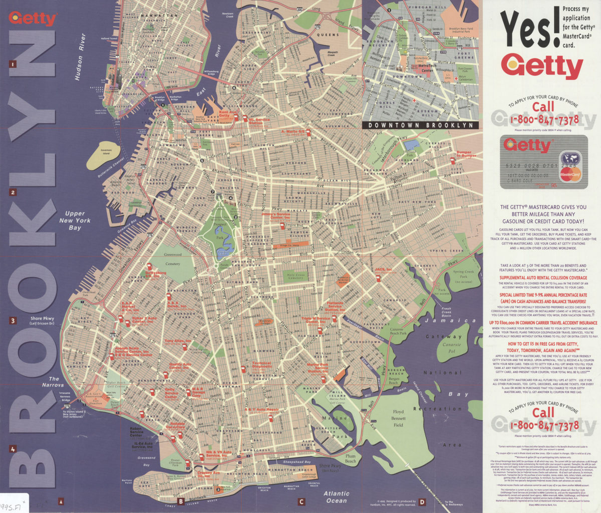
Getty Brooklyn: designed & produced by VanDam, Inc
Getty Brooklyn: designed & produced by VanDam, Inc
[ca. 1995]
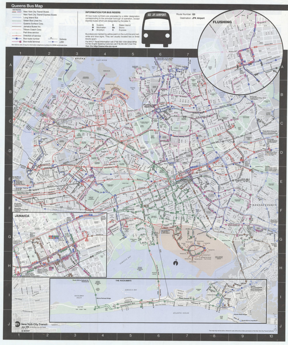
Queens bus map: MTA, New York City Transit
Queens bus map: MTA, New York City Transit
[ca. 1996]
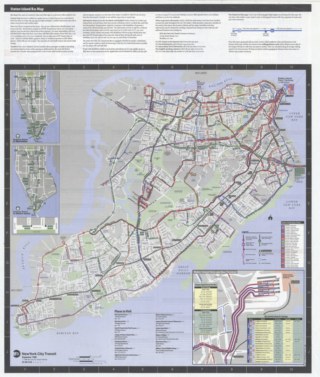
Staten Island bus map: MTA, New York City Transit
Staten Island bus map: MTA, New York City Transit
[ca. 1996]
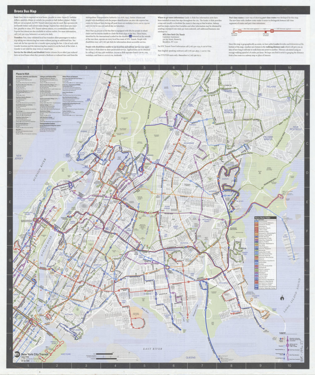
Bronx bus map: MTA, New York City Transit
Bronx bus map: MTA, New York City Transit
[ca. 1996]
New York City Transit subway map: multilingual : English, Français, Español, Deutsch, Italiano, Nihongo, Chung wen/: MTA-New York City Transit
New York City Transit subway map: multilingual : English, Français, Español, Deutsch, Italiano, Nihongo, Chung wen/: MTA-New York City Transit
[ca. 1996]
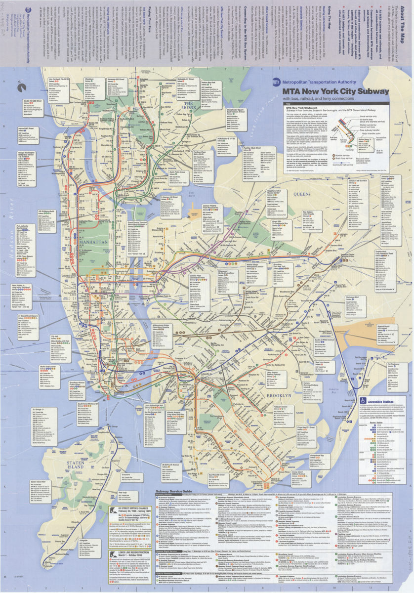
The map, MTA subways and railroads and their interconnections: connections between MTA subway, rail, and bus services, selected connections to other regional transit services: MTA Metropolitan Transportation Authority
The map, MTA subways and railroads and their interconnections: connections between MTA subway, rail, and bus services, selected connections to other regional transit services: MTA Metropolitan Transportation Authority
[ca. 1998]
Previous
1
2