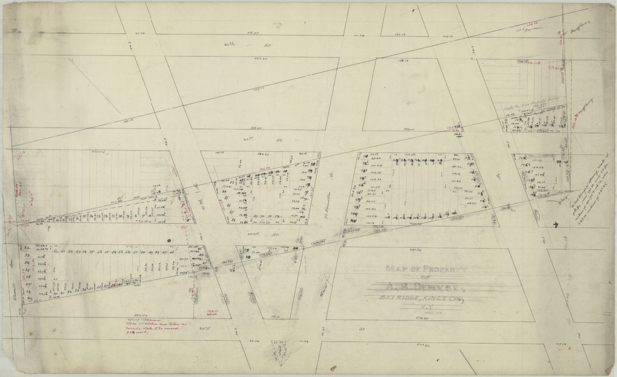
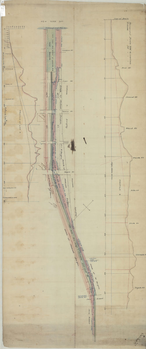
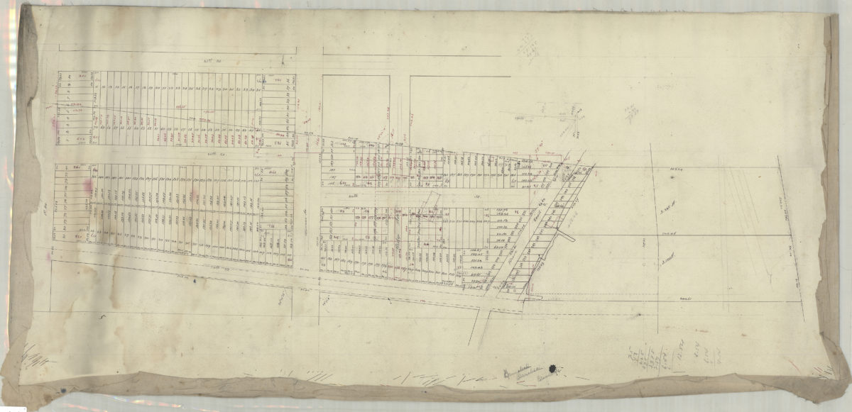
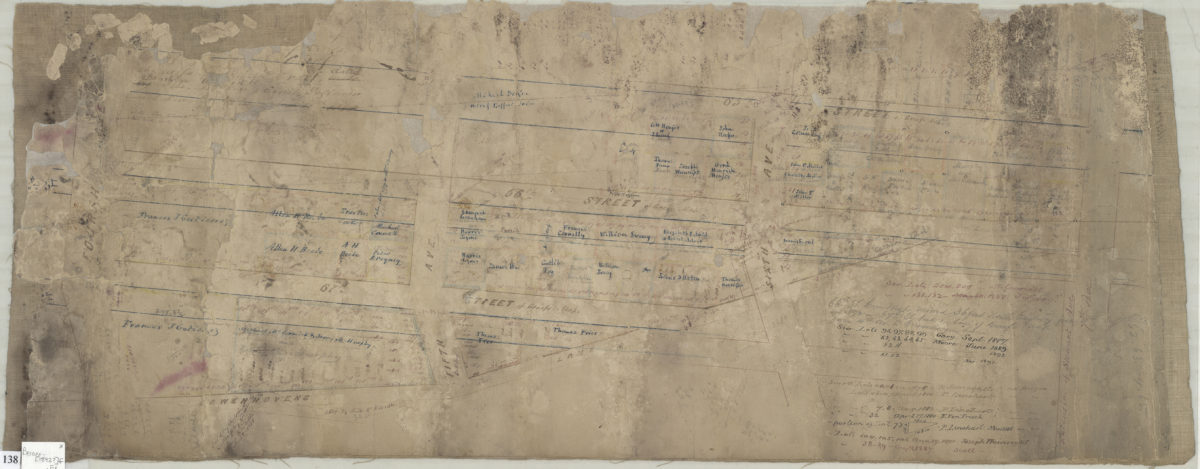
[Map of area north from Senator St. to Latting Pl. and east from New York Bay to 2nd Ave.]: V.B. Bergen, C.E.
July 30, 1888
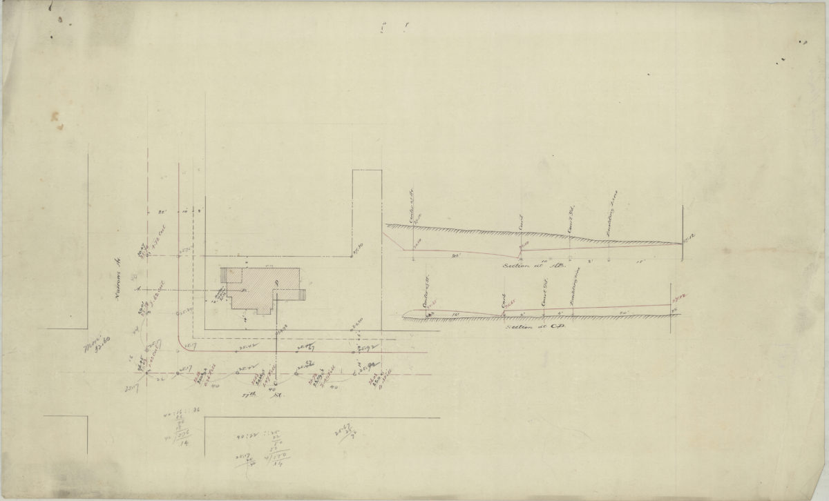
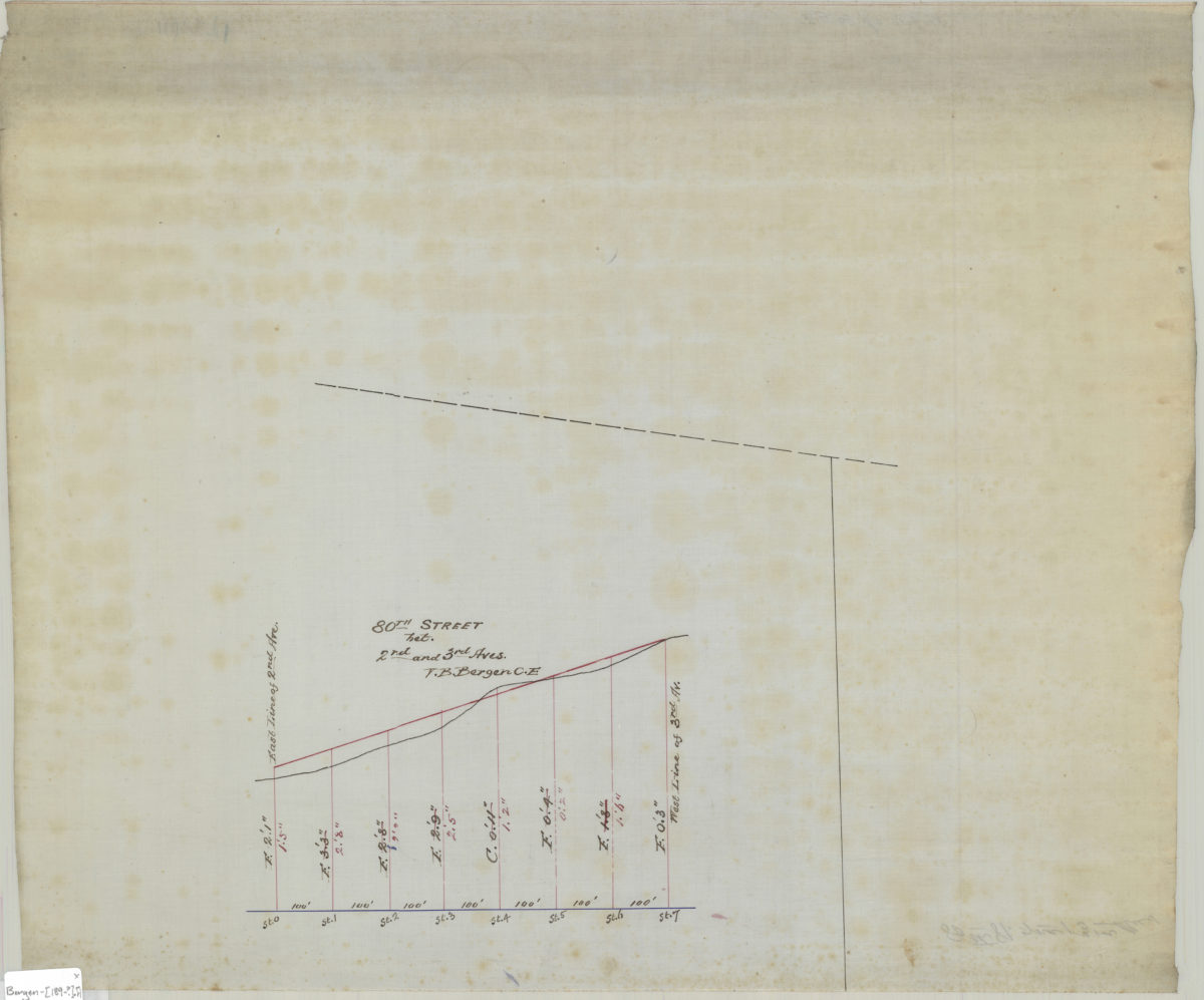
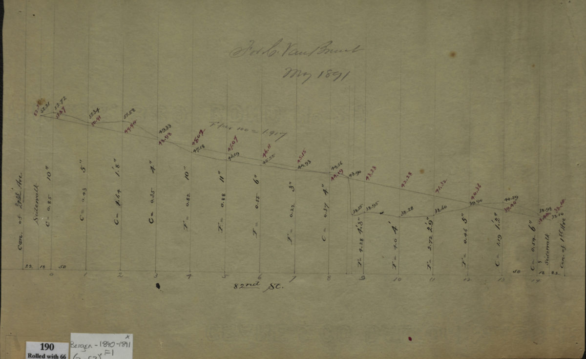
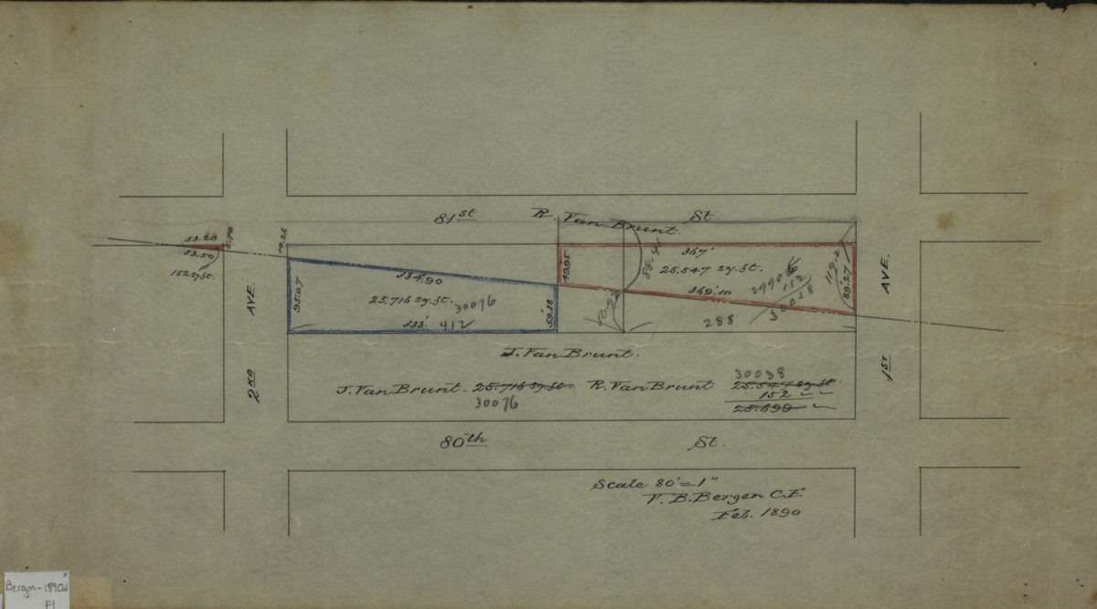
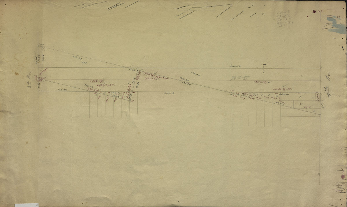
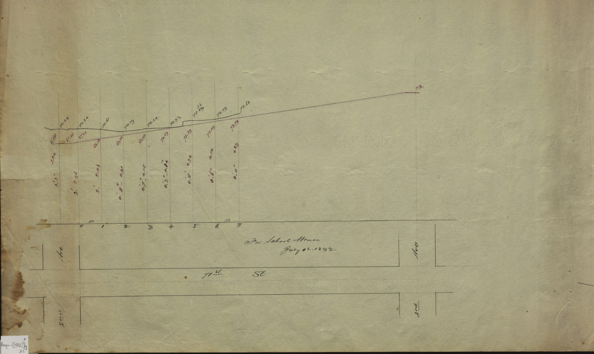
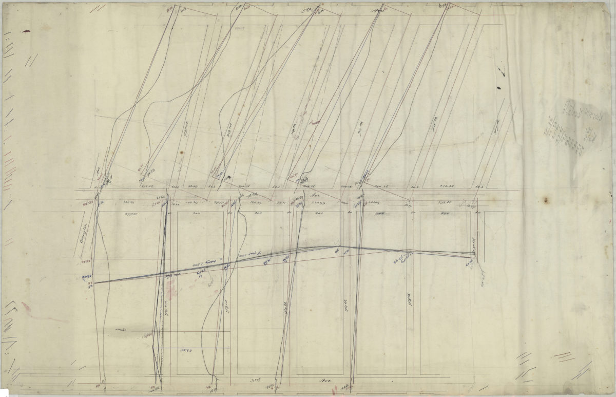
[Profile maps of the grades of 81st Street and 82nd Street between 1st Avenue and 2nd Avenue]
1890-1891
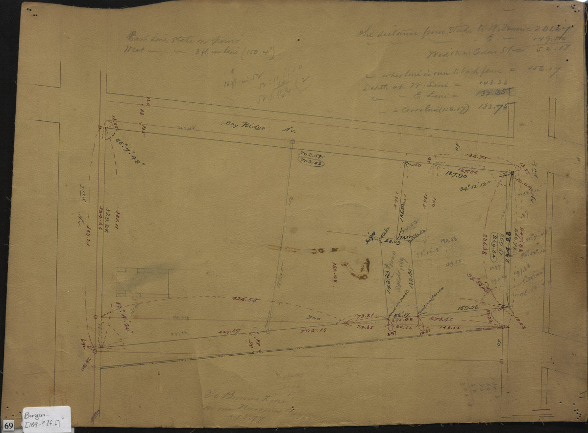
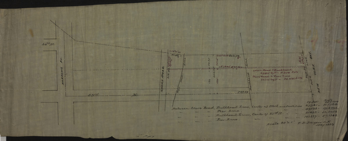
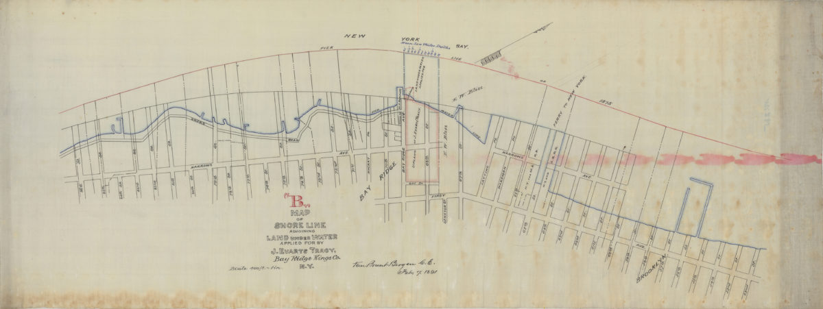
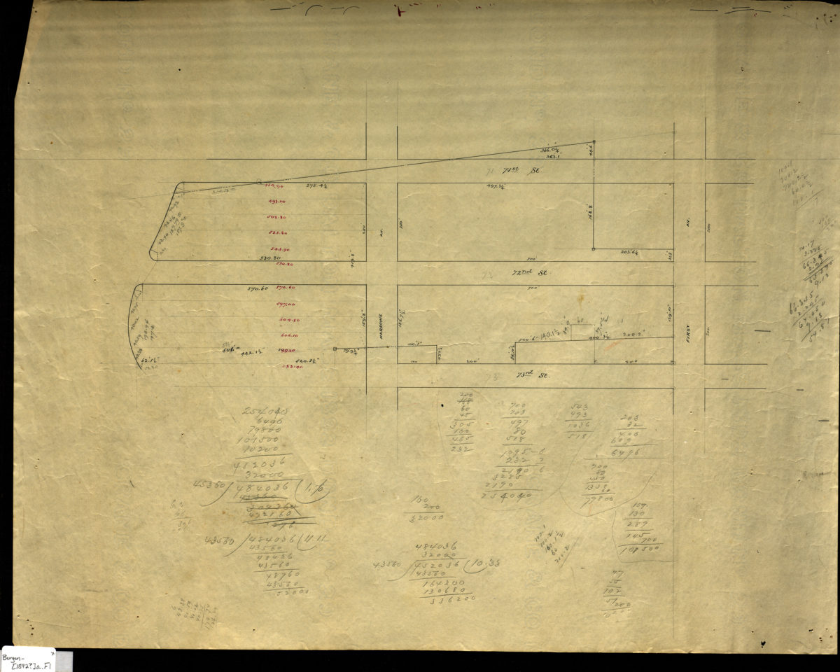
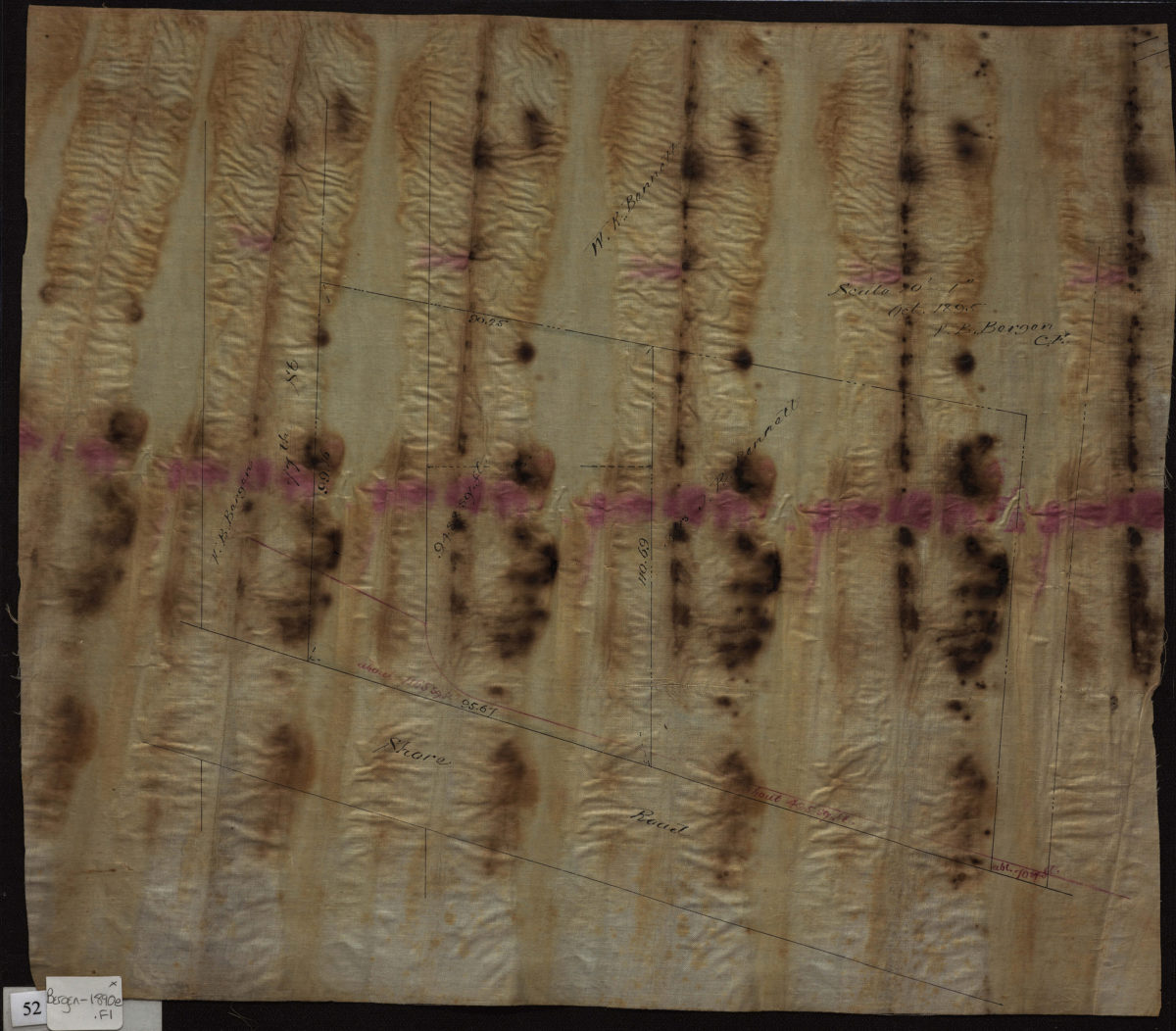
Map “B” of shore line adjoining land under water applied for by J. Evarts Tracy, Bay Ridge, Kings Co., N.Y.: Van Brunt Bergen, C.E.
February 7, 1891
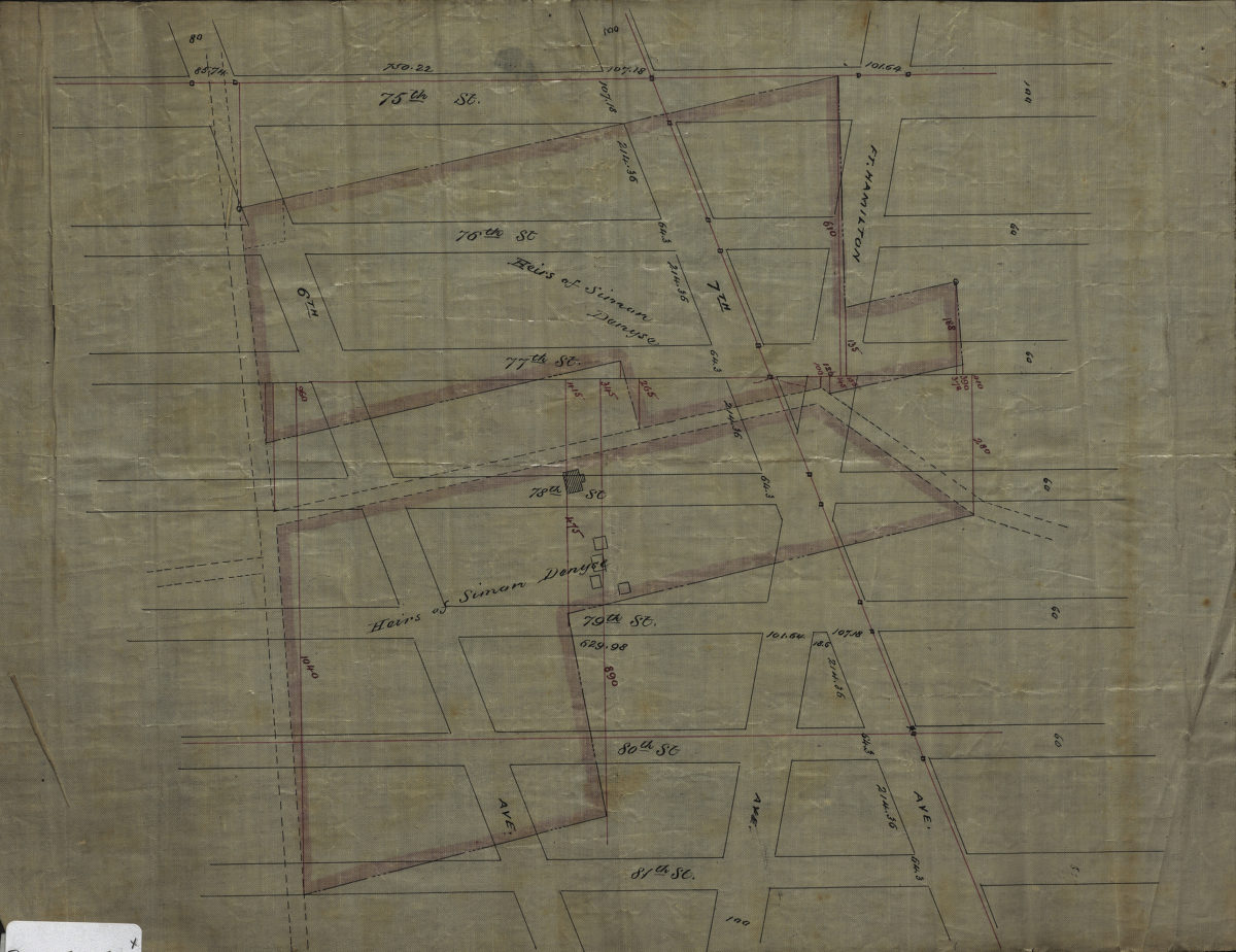
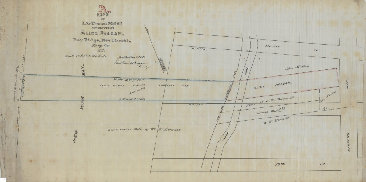
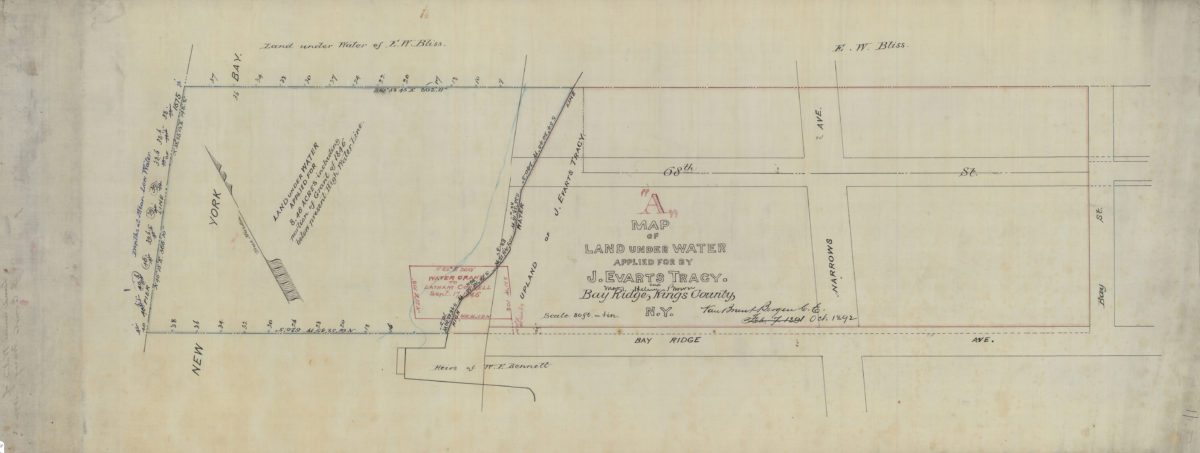
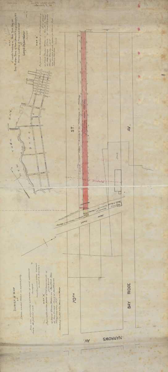
Map “A” of land under water applied for by Alice Reagan, Bay Ridge, New Utrecht, Kings Co., N.Y.: Van Brunt Bergen, surveyor
September 1, 1891
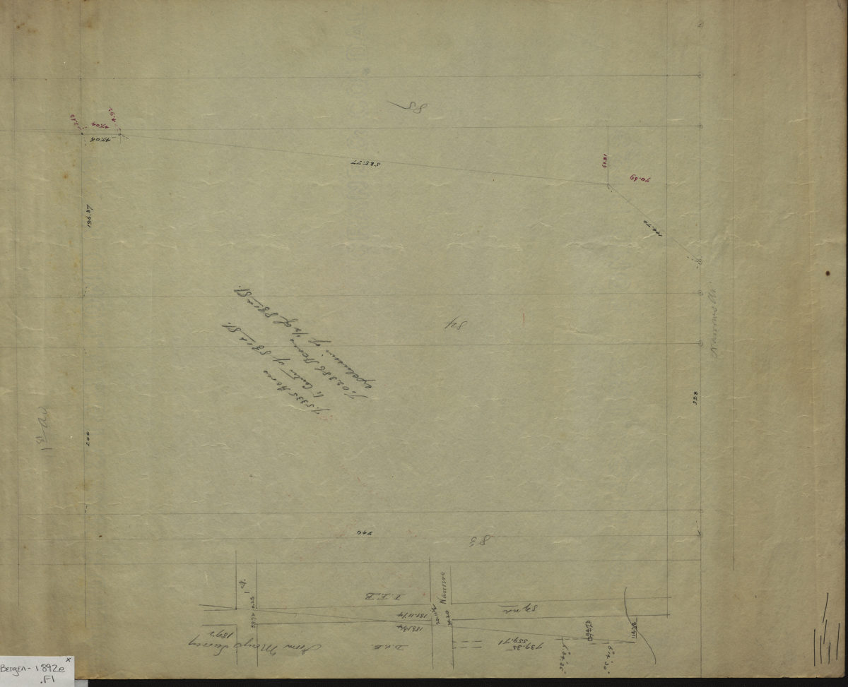
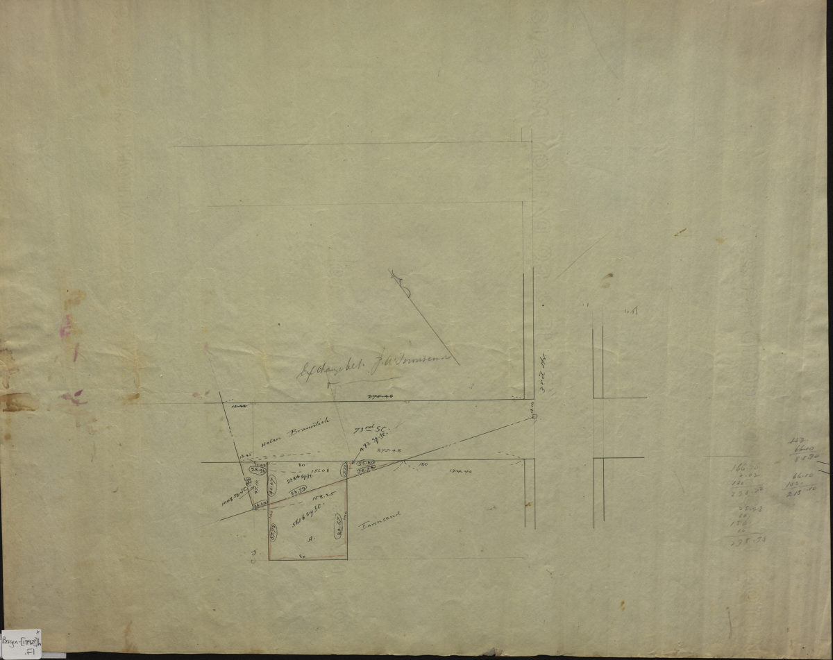
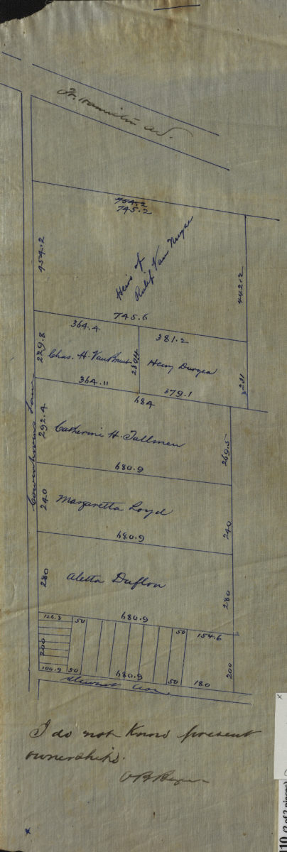
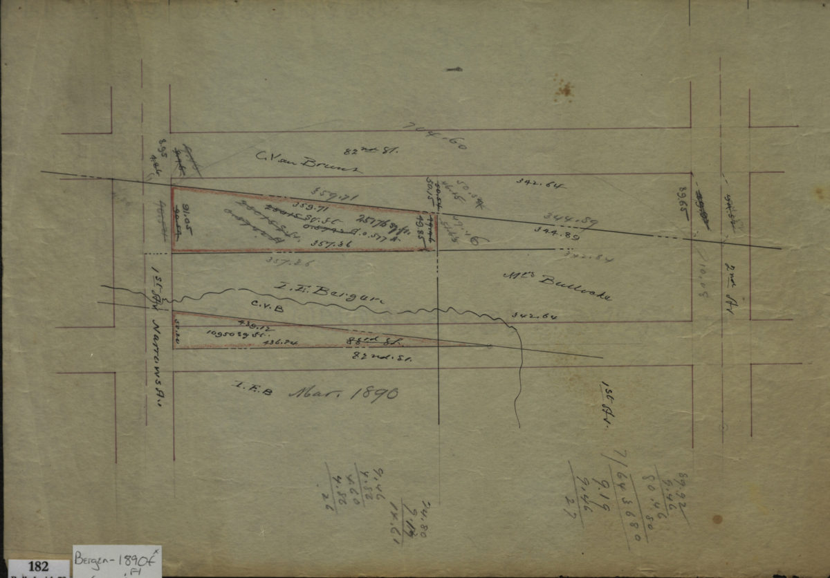
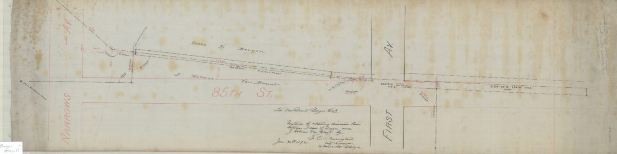
Method of retracing division line between Isaac E. Bergen and J. Holmes Van Brunt: by F.C. Dennington, city surveyor
January 30, 1892
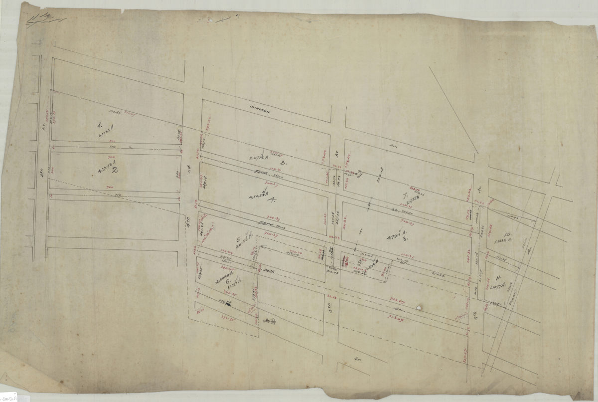
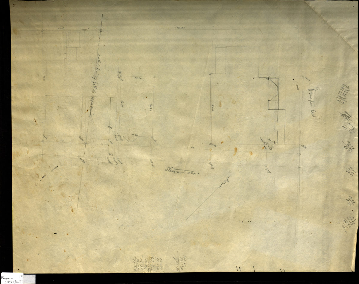
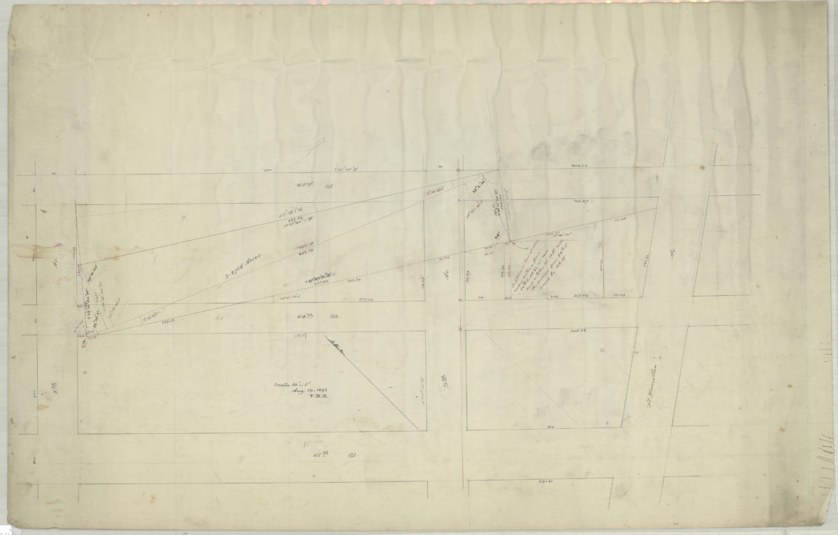
[Map of area bounded by 8th Ave., 65th St., Fort Hamilton Ave., and 63rd St.]: V.B.B. [Van Brunt Bergen]
August 19, 1893
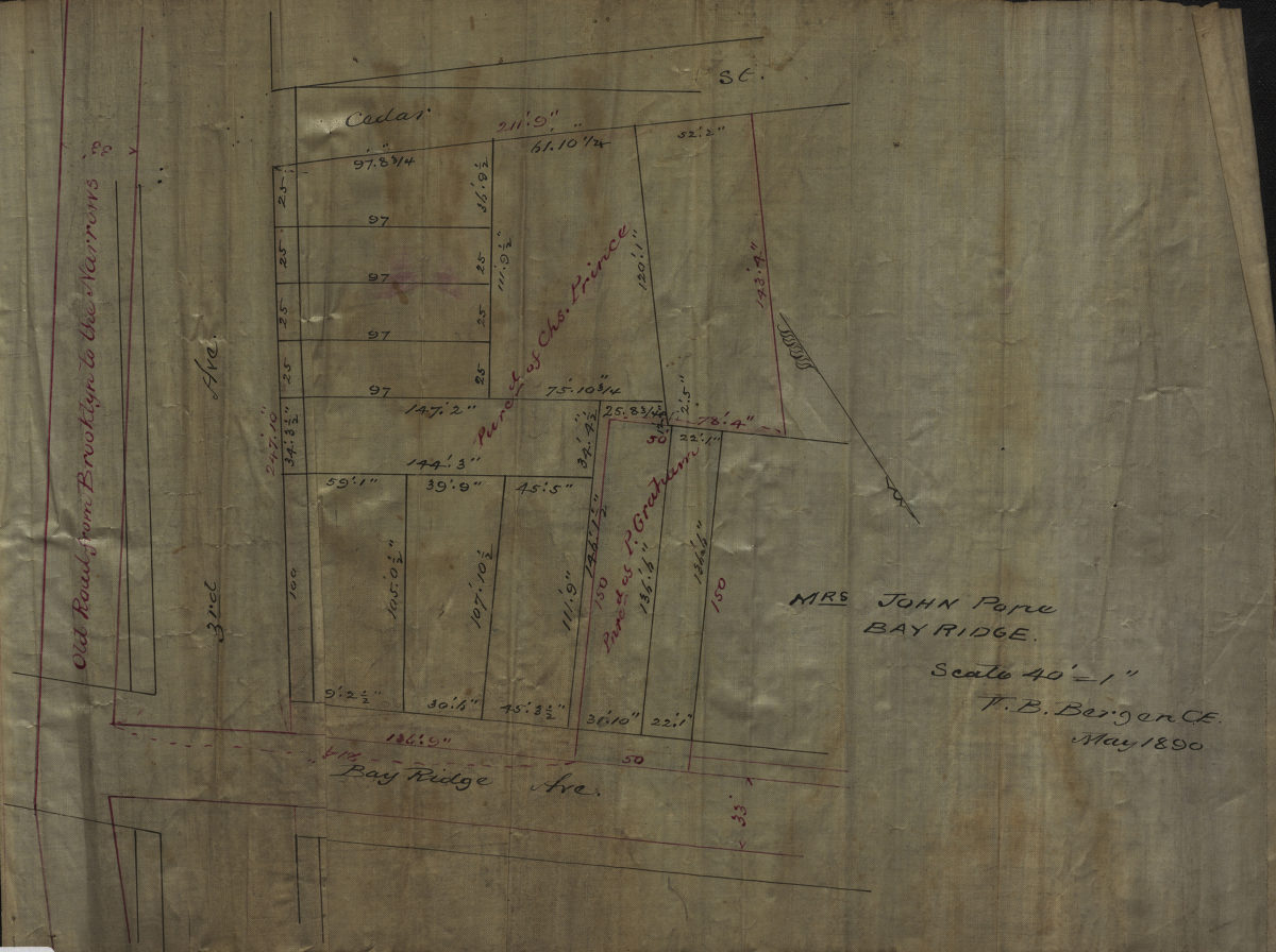
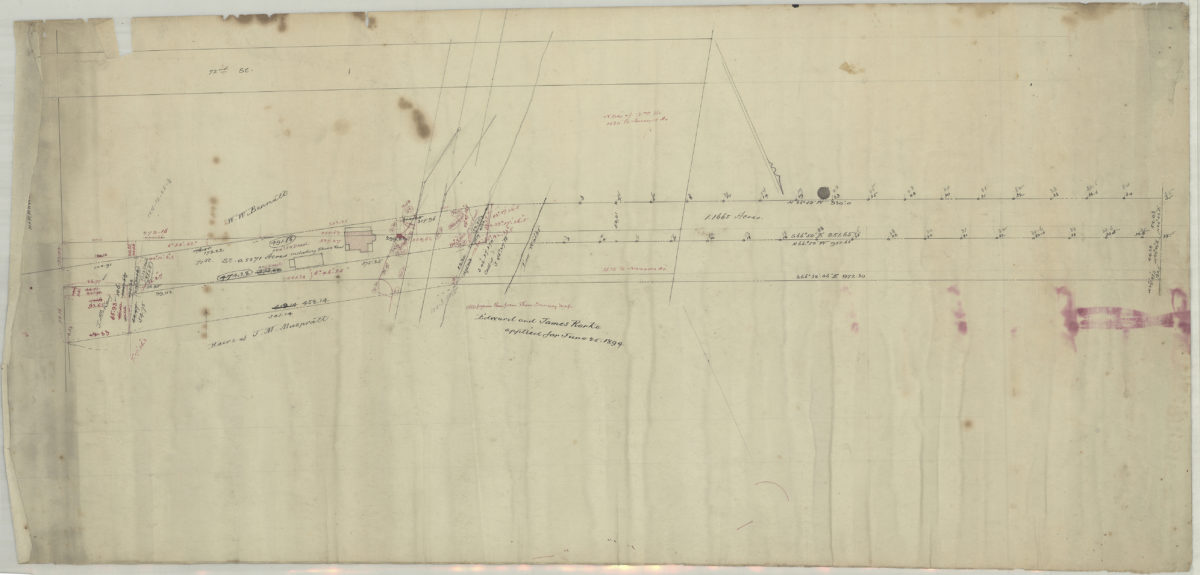
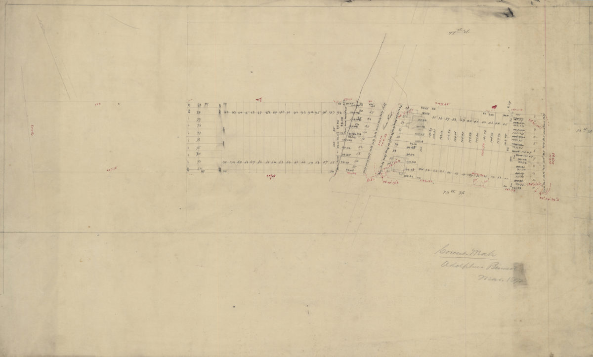
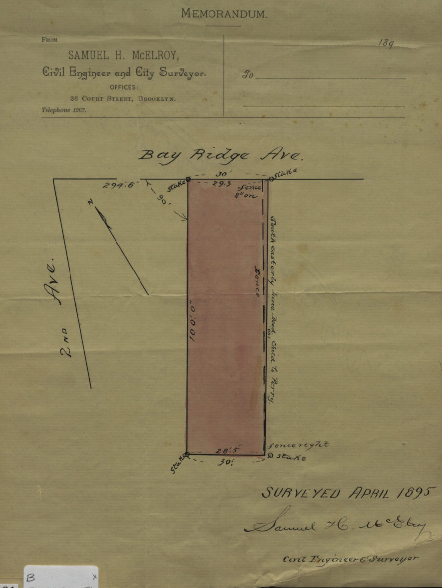
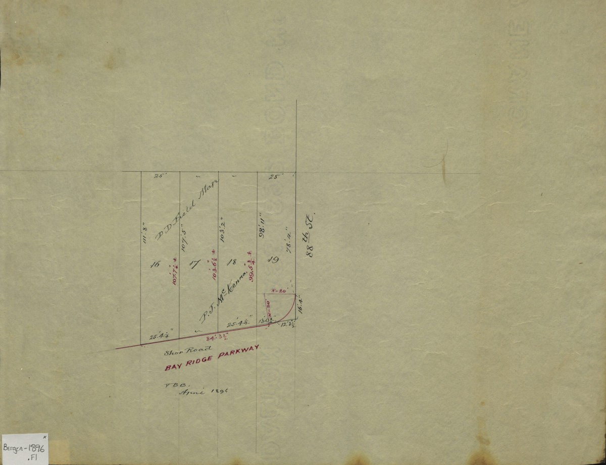
[Map of Bay Ridge Ave. at 2nd Ave.]: surveyed … [by] Samuel H. McElroy, civil engineer & surveyor
April 1895
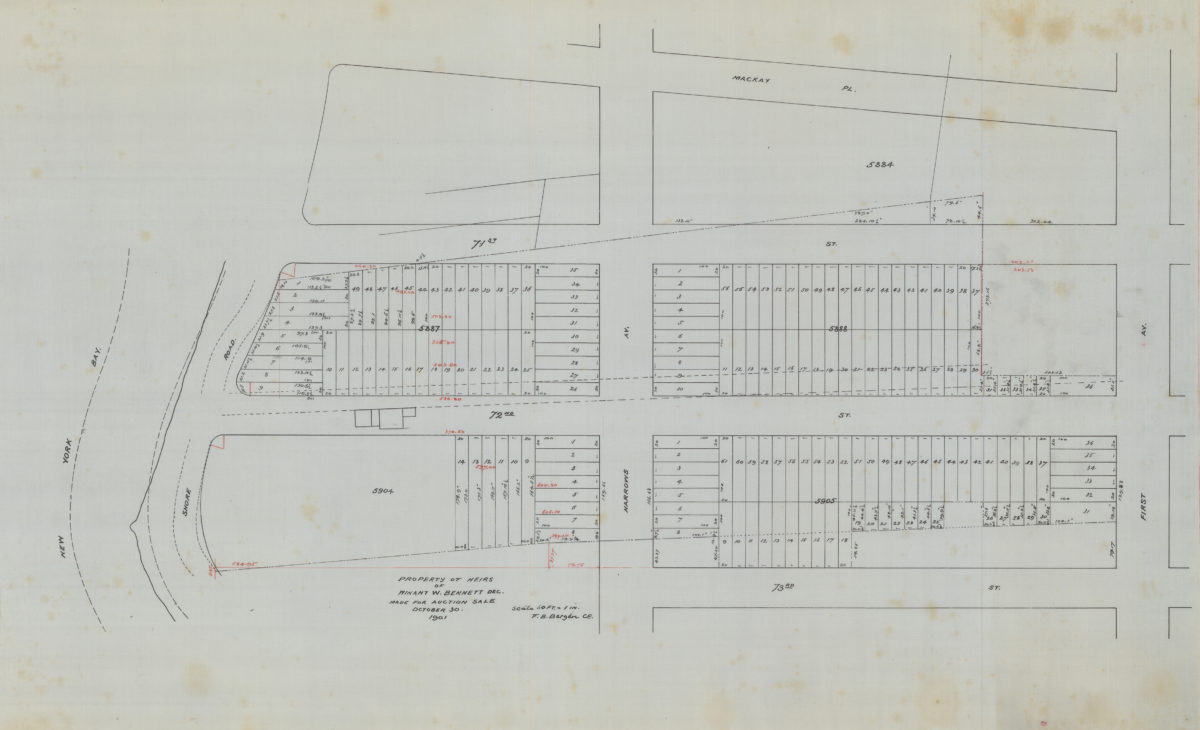
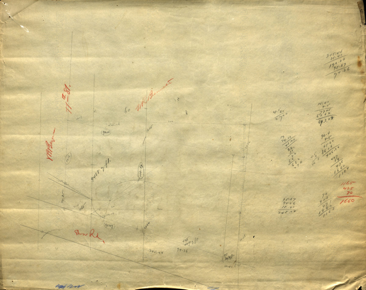
Property of heirs of Winant W. Bennett, dec., made for auction sale: V.B. Bergen, C.E.
October 30 1901