Center for Brooklyn History
Map Collections
Search
About
Othmer Library & Archives
Submit search query
Refine 76 records
Clear filters
2
Location
Babylon (N.Y. : Town)
2
Block Island (R.I. : Island)
2
Bridgehampton (N.Y.)
1
Brookhaven (N.Y. : Town)
3
Brookhaven (N.Y.)
2
Brooklyn (New York, N.Y.)
891
Connecticut
7
East Patchogue (N.Y.)
1
Freeport (N.Y.)
1
Glen Cove (N.Y.)
1
Great Neck (N.Y.)
3
Greenport (N.Y.)
1
Hempstead (N.Y.)
13
Hicksville (N.Y.)
1
Huntington (N.Y.)
7
Islip (N.Y.)
5
Jamaica (New York, N.Y.)
8
Lakeland (N.Y.)
1
Lawrence Beach (N.Y.)
1
Long Island (N.Y.)
197
Long Island Sound (N.Y. and Conn.)
12
Manhattan (New York, N.Y.)
120
Mattituck (N.Y.)
1
Miller Place (N.Y.)
1
Mineola (N.Y.)
1
Montauk (N.Y.)
4
Napeague Bay (N.Y.)
1
New York (N.Y.)
164
New York (State)
95
New York Metropolitan Area
40
North Hempstead (N.Y. : Town)
4
Northport Bay (N.Y. : Bay)
1
Oyster Bay (N.Y.)
9
Patchogue (N.Y.)
2
Pearsalls (N.Y.)
1
Port Jefferson (N.Y.)
1
Queens (New York, N.Y.)
83
Quiogue (N.Y.)
1
Riverhead (N.Y.)
3
Rockville Centre (N.Y.)
2
Rosevale (N.Y.)
2
Roslyn (N.Y.)
3
Roslyn Harbor (N.Y.)
1
Roslyn Highlands (N.Y.)
1
Sag Harbor (N.Y.)
2
Sayville (N.Y.)
1
Sea Cliff (N.Y.)
1
Shelter Island (N.Y.)
2
Smithtown (N.Y. : Town)
4
Southampton (N.Y.)
5
Southold (N.Y.)
4
Stony Brook (N.Y.)
1
Suffolk (N.Y.)
1
Suffolk County (N.Y.)
43
United States
10
Westhampton Beach (N.Y.)
1
Woodhaven (New York, N.Y.)
1
Yaphank (N.Y.)
1
Show 38 more
Subject
Auctions
32
Bays
5
Election districts
36
Fortification
7
Ice sheets
1
Land titles
1
Landowners
434
Long Island, Battle of, New York, N.Y. , 1776
7
Nautical charts
14
Parishes
1
Railroads
72
Real property
619
Riparian rights
13
Roads
117
Submerged lands
17
Trials
1
Waterworks
5
Date
19th Century
945
or enter range:
from
to
Genres
Advertisements
30
Bathymetric maps
94
Broadsides
33
Cadastral maps
597
Early maps
35
Historical maps
53
Manuscript maps
365
Map
191
Military maps
23
Nautical charts
30
Pictorial maps
38
Public utility maps
15
Road maps
83
Statistical maps
8
Thematic maps
60
Topographic maps
70
Tourist maps
55
Transportation maps
120
Zoning maps
55
Sort by:
Date (earliest)
Date (most recent)
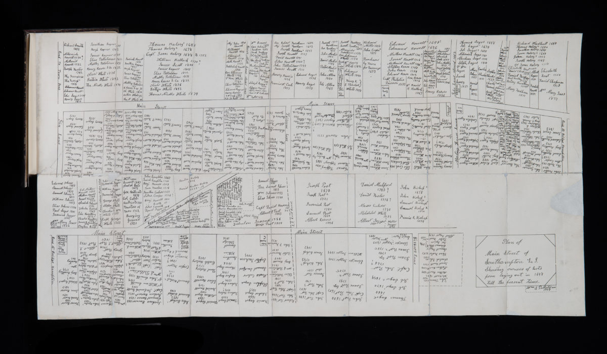
Plan of Main Street of Southampton, L.I., showing owners of lots from laying out in 1648 till the present time: by William S. Pelletreau
Plan of Main Street of Southampton, L.I., showing owners of lots from laying out in 1648 till the present time: by William S. Pelletreau
1878
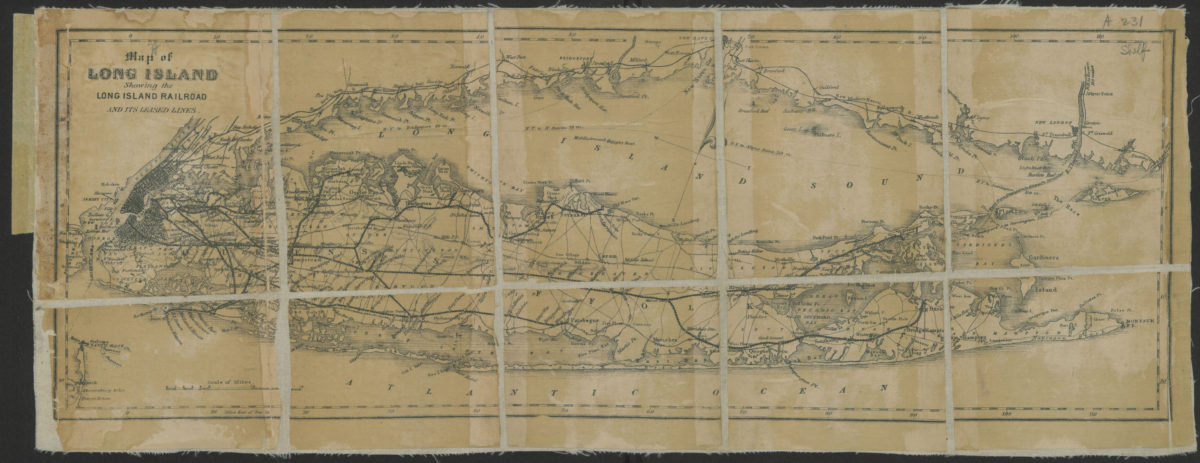
Map of Long Island showing the Long Island Railroad and its leased lines
Map of Long Island showing the Long Island Railroad and its leased lines
[188?]
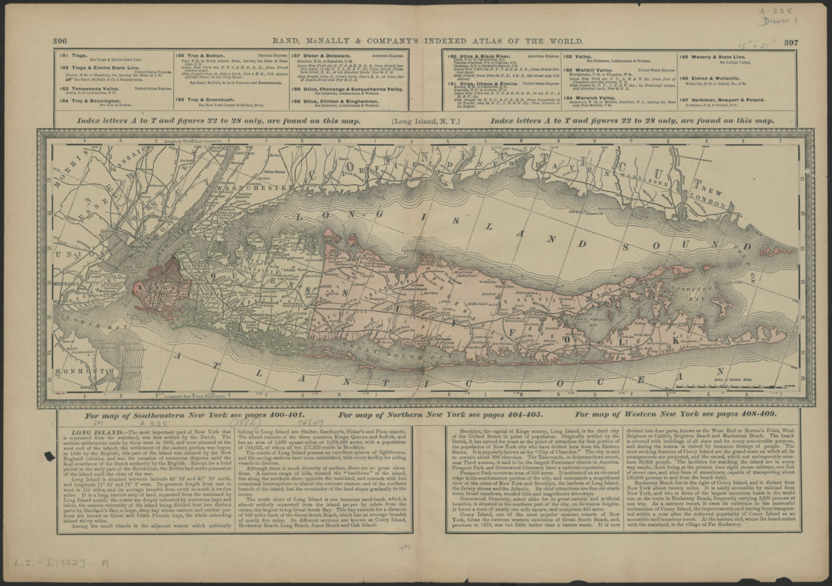
Long Island, N.Y.
Long Island, N.Y.
[1882]
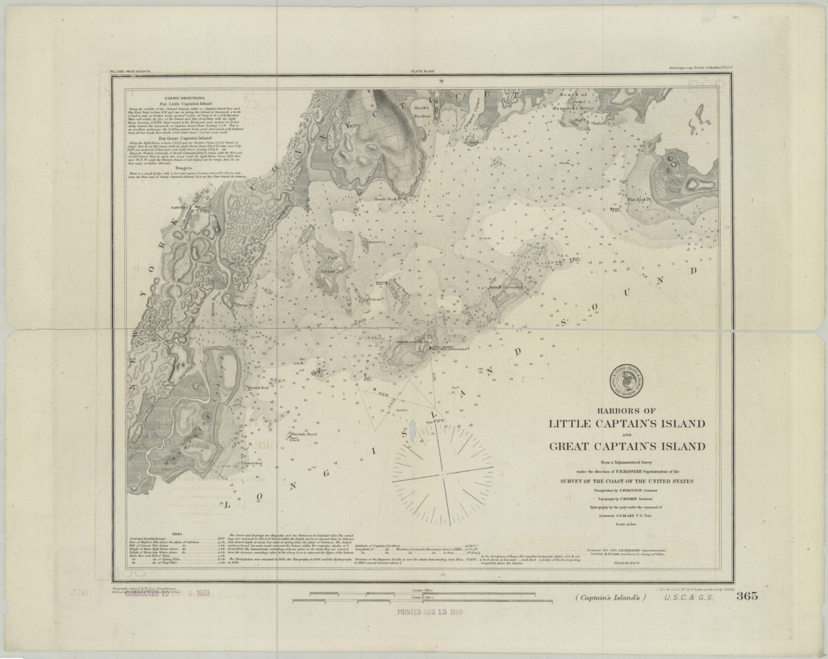
Harbors of Little Captain’s Island and Great Captain’s Island: from a trigonometrical survey under the direction of F.R. Hassler superintendent of the Survey of the Coast of the United States
Harbors of Little Captain’s Island and Great Captain’s Island: from a trigonometrical survey under the direction of F.R. Hassler superintendent of the Survey of the Coast of the United States
[1882]
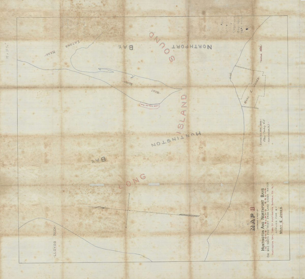
Map B showing a part of Huntington and Northport Bays in Long Island Sound, one mile north and west from land under water, Huntington Bay, town of Huntington, Suffolk Co., N.Y., applied for by Mary E. Jones: Oscar Darling, C.E.
Map B showing a part of Huntington and Northport Bays in Long Island Sound, one mile north and west from land under water, Huntington Bay, town of Huntington, Suffolk Co., N.Y., applied for by Mary E. Jones: Oscar Darling, C.E.
April 1882
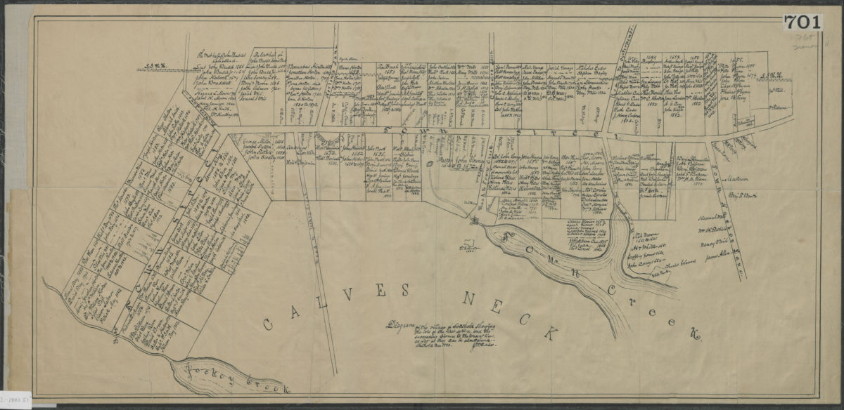
Diagram of the village of Southold showing the lots of the first settlers, and the succeeding owners, to the present times, as far as they can be ascertained: J.M. Case
Diagram of the village of Southold showing the lots of the first settlers, and the succeeding owners, to the present times, as far as they can be ascertained: J.M. Case
March 1882
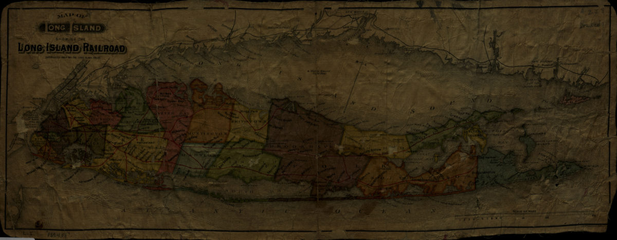
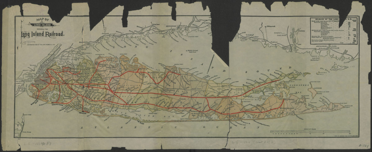
Map of Long Island showing the Long Island Railroad
Map of Long Island showing the Long Island Railroad
[ca. 1884]
Map of Long Island showing the Long Island Railroad
Map of Long Island showing the Long Island Railroad
[ca. 1884]
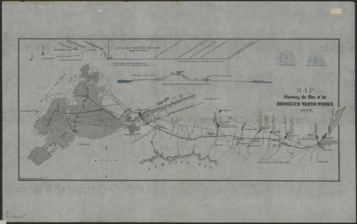
Map showing the line of the Brooklyn Water Works: drawn by Bernhard Essroger
Map showing the line of the Brooklyn Water Works: drawn by Bernhard Essroger
1885
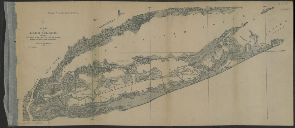
Map of Long Island, showing the southern limit of the ice sheet: adapted from the U.S. Coast Survey Chart: by F.J.H. Merrill
Map of Long Island, showing the southern limit of the ice sheet: adapted from the U.S. Coast Survey Chart: by F.J.H. Merrill
[1886]
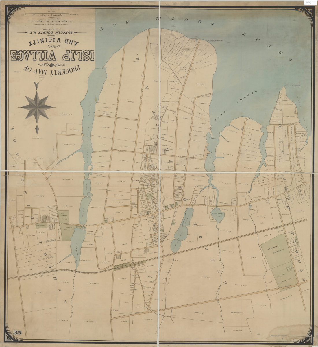
Property map of Islip Village and vicinity: Suffolk County, N.Y.: made from original surveys by Eugene R. Smith, civil engineer, Islip, Suffolk Co. N.Y.
Property map of Islip Village and vicinity: Suffolk County, N.Y.: made from original surveys by Eugene R. Smith, civil engineer, Islip, Suffolk Co. N.Y.
[1887]
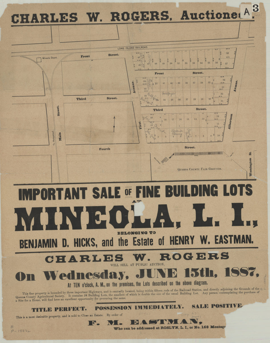
Important sale of fine building lots at Mineola, L.I., belonging to Benjamin D. Hicks, and the estate of Henry W. Eastman
Important sale of fine building lots at Mineola, L.I., belonging to Benjamin D. Hicks, and the estate of Henry W. Eastman
[1887]
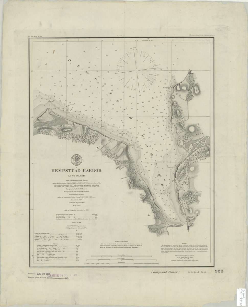
Hempstead Harbor, Long Island: from a trigonometrical survey under the direction of F.R. Hassler and A.D. Bache, superintendents of the Survey of the Coast of the United States
Hempstead Harbor, Long Island: from a trigonometrical survey under the direction of F.R. Hassler and A.D. Bache, superintendents of the Survey of the Coast of the United States
[1888]
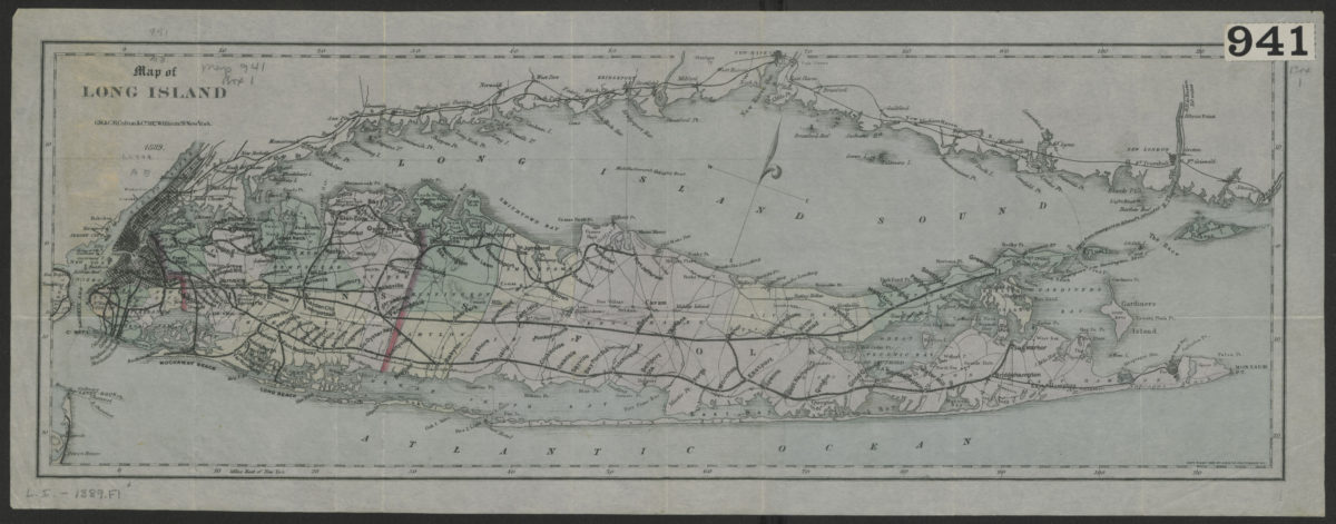
Map of Long Island
Map of Long Island
1889; [ca. 1882]
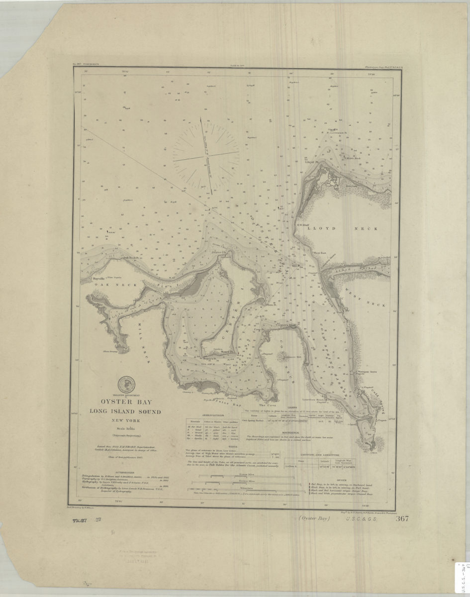
Oyster Bay, Long Island Sound, New York: U.S. Coast and Geodetic Survey ; red. drawing by E. Molkow
Oyster Bay, Long Island Sound, New York: U.S. Coast and Geodetic Survey ; red. drawing by E. Molkow
1889
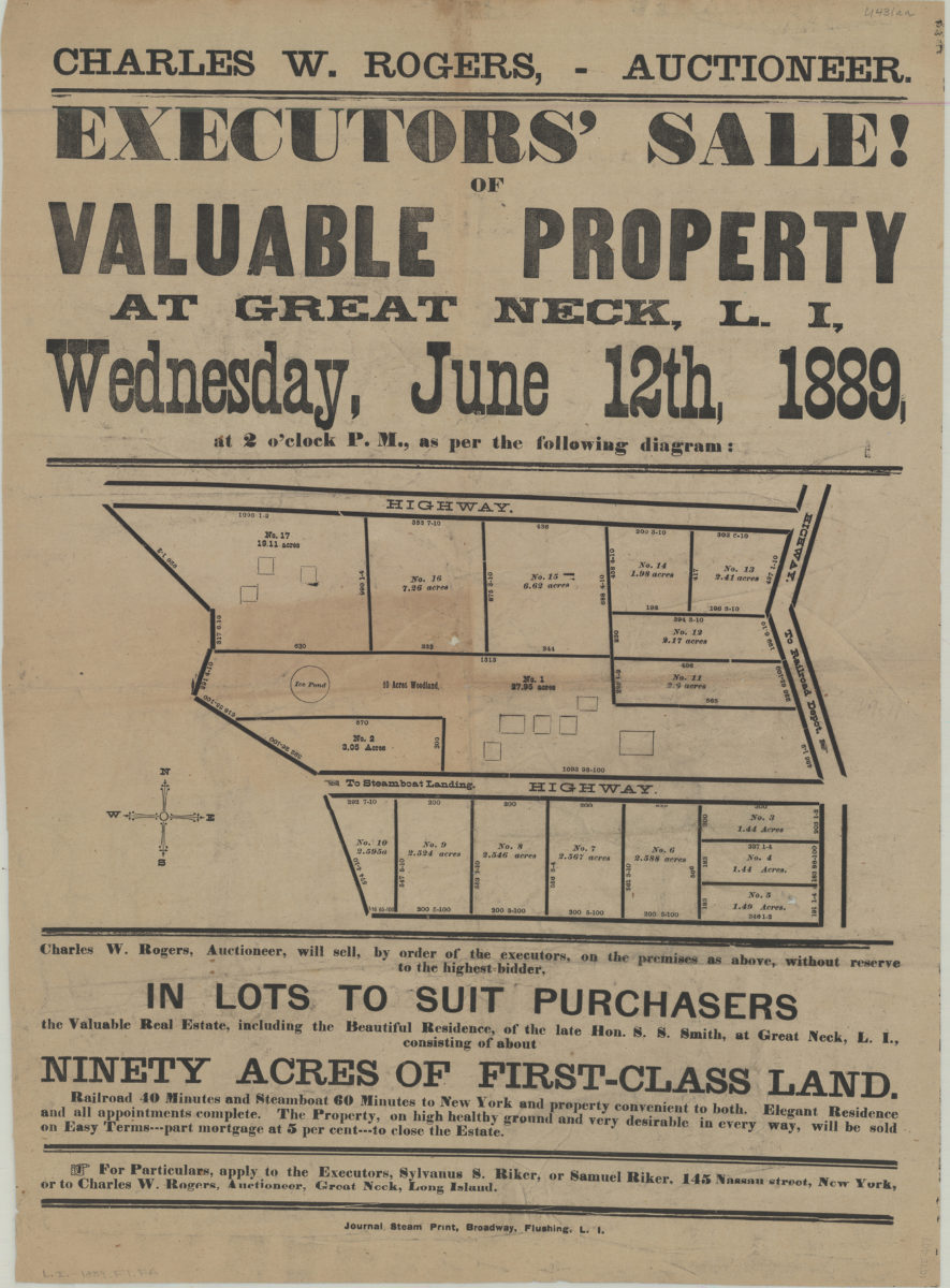
Executors’ sale of valuable property at Great Neck, L.I., Wednesday, June 12th, 1889, at 2 o’clock P.M. as per the following diagram
Executors’ sale of valuable property at Great Neck, L.I., Wednesday, June 12th, 1889, at 2 o’clock P.M. as per the following diagram
[1889]
Huntington Bay, Long Island Sound, New York: U.S. Coast and Geodetic Survey ; red. drawing by E. Molkow
Huntington Bay, Long Island Sound, New York: U.S. Coast and Geodetic Survey ; red. drawing by E. Molkow
1889
Roslyn Highlands (Incorporated), New York
Roslyn Highlands (Incorporated), New York
[189?]
Suffolk County, New York
Suffolk County, New York
[189?]
Colton’s road map of Long Island
Colton’s road map of Long Island
1891
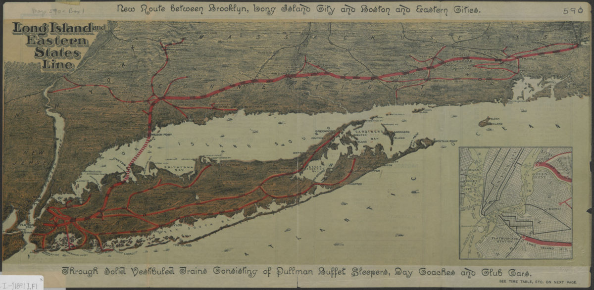
Long Island and Eastern States Line
Long Island and Eastern States Line
[1891]
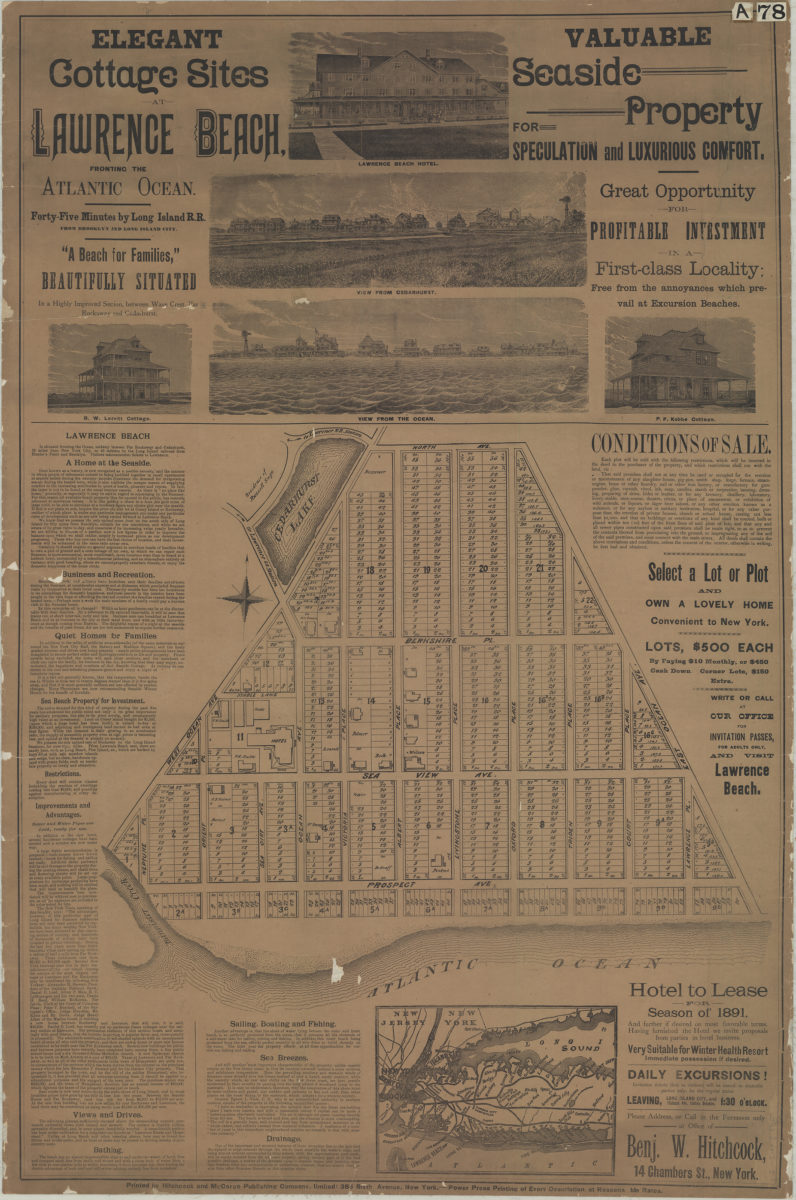
Elegant cottage sites at Lawrence Beach, fronting the Atlantic Ocean, forty-five minutes by Long Island R.R. from Brooklyn and Long Island City, “a beach for families,” beautifully situated in a highly improved section between Wave Crest, Far Rockaway and Cedarhurst, valuable seaside property for speculation and luxurious comfort, great opportunity for profitable investment in a first-class locality, free from the annoyances which prevail at excursion beaches.
Elegant cottage sites at Lawrence Beach, fronting the Atlantic Ocean, forty-five minutes by Long Island R.R. from Brooklyn and Long Island City, “a beach for families,” beautifully situated in a highly improved section between Wave Crest, Far Rockaway and Cedarhurst, valuable seaside property for speculation and luxurious comfort, great opportunity for profitable investment in a first-class locality, free from the annoyances which prevail at excursion beaches.
[1891?]
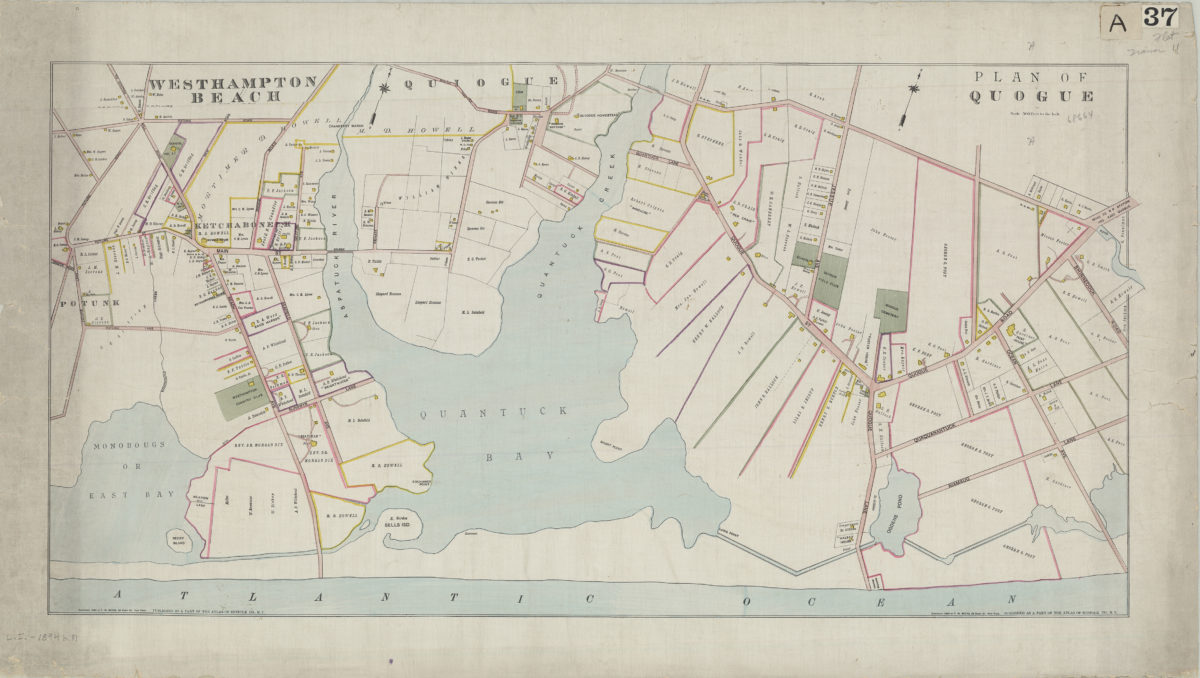
Westhampton Beach: plan of Quogue
Westhampton Beach: plan of Quogue
[ca. 1894]
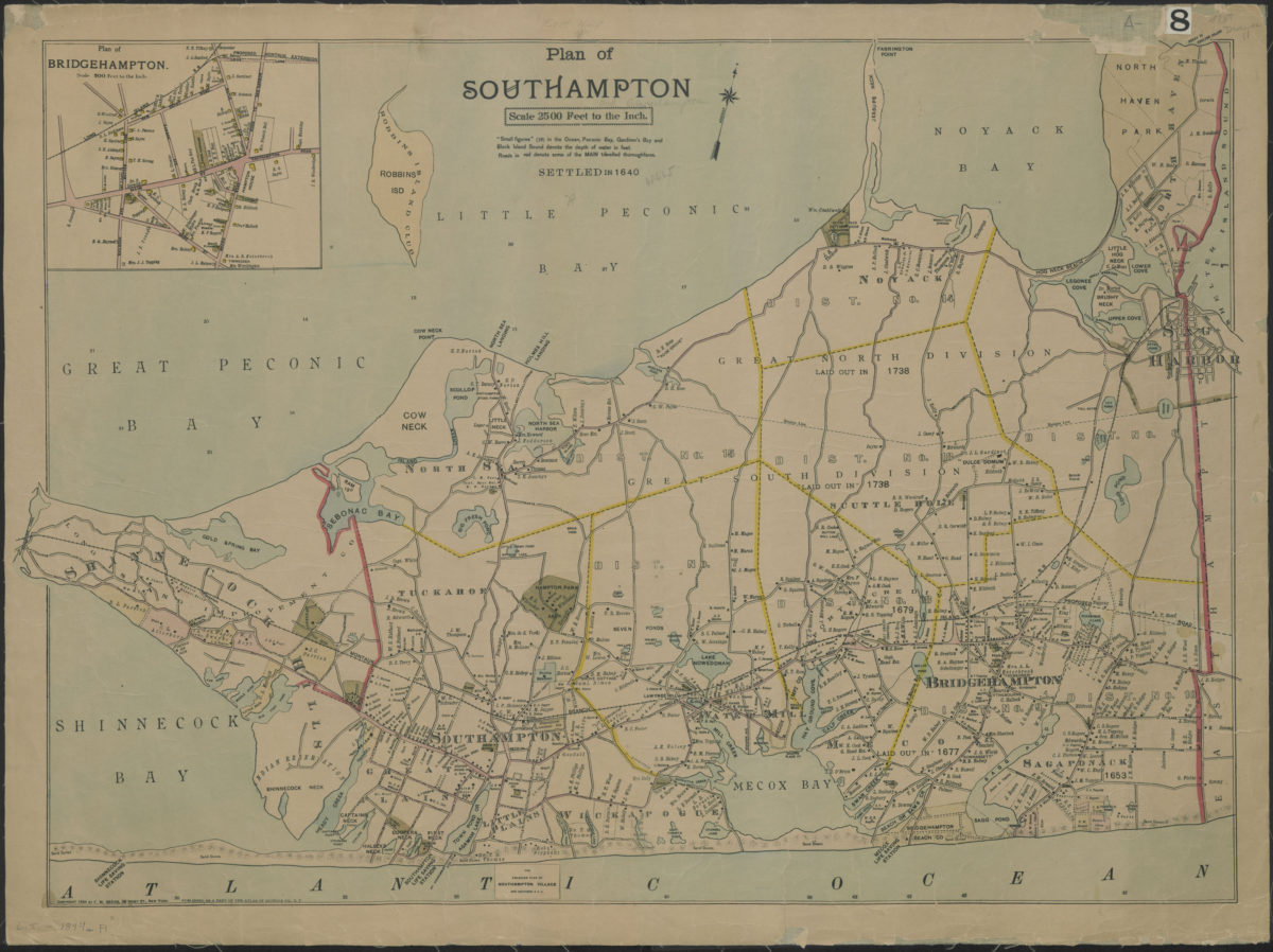
Plan of Southampton
Plan of Southampton
[ca. 1894]
Plan of Southampton
Plan of Southampton
[ca. 1894]
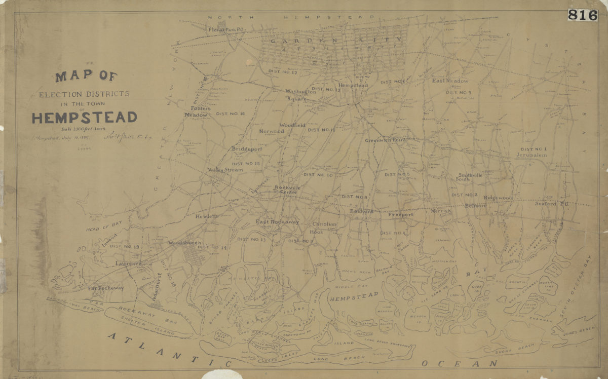
Map of election districts in the town of Hempstead: Thos. V. Smith, civ. eng., Hempstead, July 19, 1899
Map of election districts in the town of Hempstead: Thos. V. Smith, civ. eng., Hempstead, July 19, 1899
[1899]
Previous
1
2