Center for Brooklyn History
Map Collections
Search
About
Othmer Library & Archives
Submit search query
Refine 60 records
Clear filters
2
Location
Albany (N.Y.)
3
Bronx (New York, N.Y.)
10
Brooklyn (New York, N.Y.)
891
Buffalo (N.Y.)
3
Coney Island (New York, N.Y.)
22
Delaware County (N.Y.)
1
Far Rockaway (New York, N.Y.)
2
Greene County (N.Y.)
3
Long Island (N.Y.)
197
Manhattan (New York, N.Y.)
120
Nassau County (N.Y.)
24
New England
8
New Jersey
27
New York (N.Y.)
164
New York (State)
95
New York Metropolitan Area
40
Queens (New York, N.Y.)
83
Suffolk County (N.Y.)
43
Ulster County (N.Y.)
4
Vermont
1
Westchester County (N.Y.)
11
White Plains (N.Y.)
1
Show 2 more
Subject
Airports
2
Airways
2
Camp sites, facilities, etc
1
Canals
15
Counties
1
Federal aid to transportation
1
ferries
32
Forest reserves
1
Historic sites
3
Indians of North America
6
Local transit
63
Natural areas
1
Outdoor recreation
1
Parks
35
Railroads
72
Railroads, Elevated
24
Recreation
5
River channels
1
Roads
117
Street addresses
11
Streets
46
Subways
55
Tourism
1
Transportation
3
White Plains, Battle of, White Plains, N.Y., 1776
3
Show 5 more
Date
20th Century
469
or enter range:
from
to
Genres
Bathymetric maps
94
Early maps
35
Historical maps
53
Map
191
Military maps
23
Pictorial maps
38
Road maps
83
Topographic maps
70
Tourist maps
55
Transportation maps
120
Sort by:
Date (earliest)
Date (most recent)
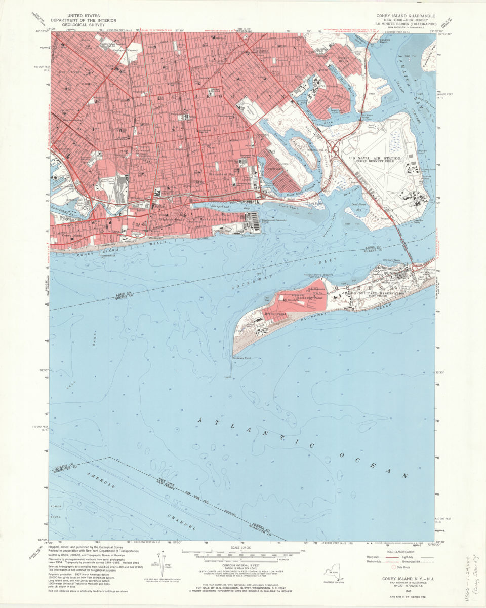
Coney Island quadrangle, New York–New Jersey: 7.5 minute series (topographic): mapped, edited, and published by the Geological Survey ; revised in cooperation with New York Department of Transportation
Coney Island quadrangle, New York–New Jersey: 7.5 minute series (topographic): mapped, edited, and published by the Geological Survey ; revised in cooperation with New York Department of Transportation
1968
Flushing quadrangle, New York
Flushing quadrangle, New York
[1969]
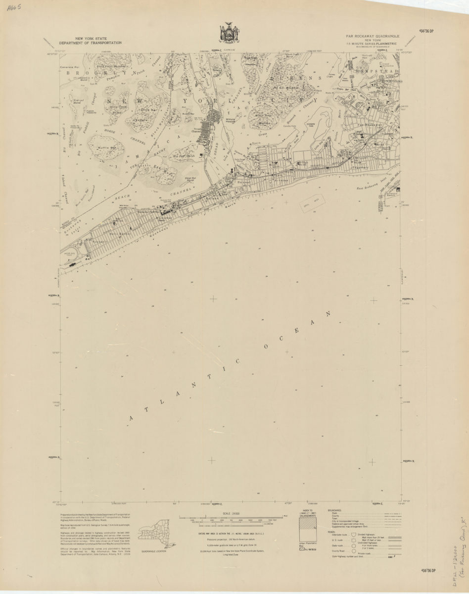
Far Rockaway quadrangle, New York
Far Rockaway quadrangle, New York
[1969]
Coney Island quadrangle, New York–New Jersey
Coney Island quadrangle, New York–New Jersey
[1969]
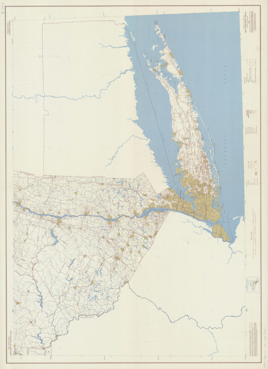
Transportation/planning map, New York State–South: prepared and published by the New York State Department of Transportation in cooperation with the Federal Highway Administration, U.S. Department of Transportation
Transportation/planning map, New York State–South: prepared and published by the New York State Department of Transportation in cooperation with the Federal Highway Administration, U.S. Department of Transportation
[1970; 1970]
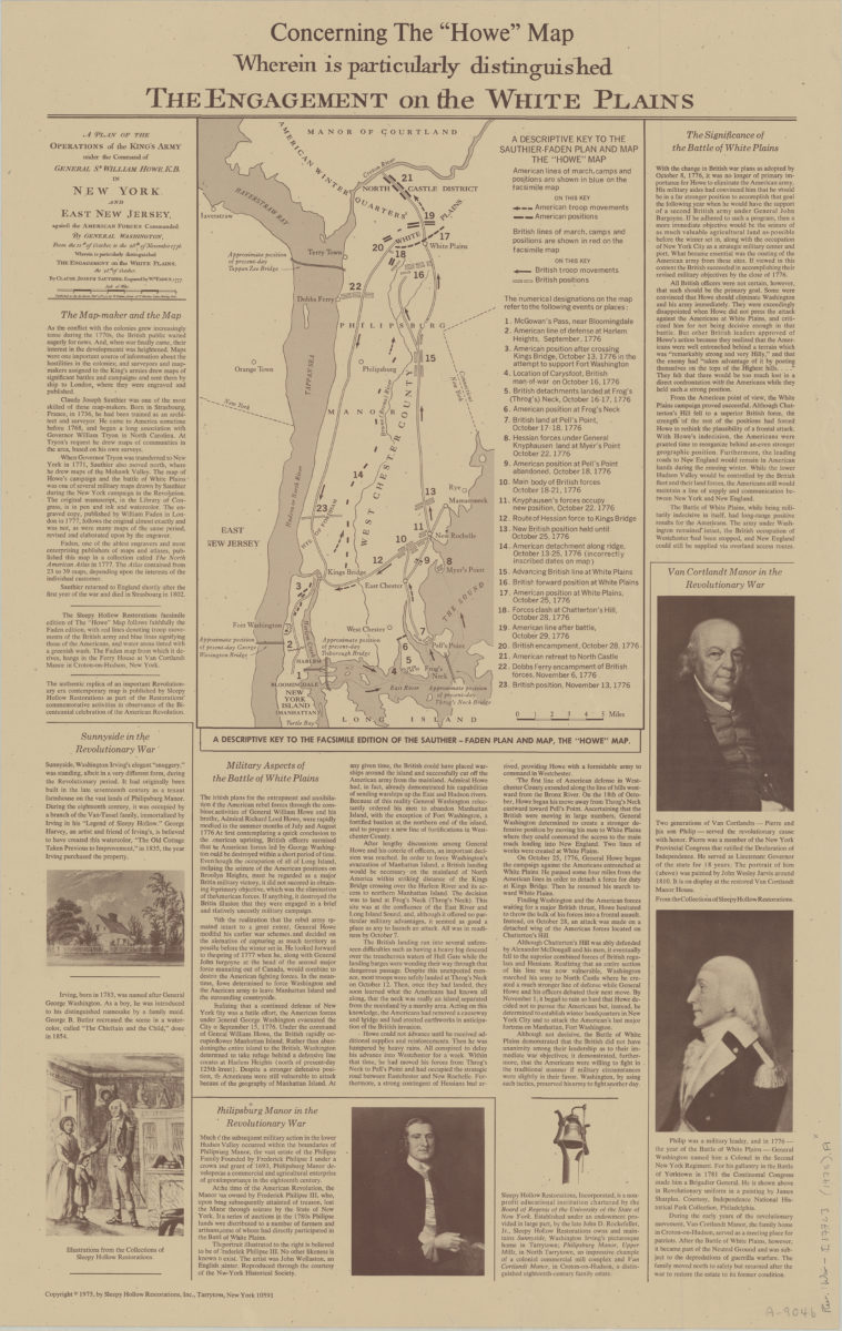
Concerning the “Howe” map, wherein is particularly distinguished the engagement on the White Plains
Concerning the “Howe” map, wherein is particularly distinguished the engagement on the White Plains
[ca. 1975]
Long Island, New York City & metro area counties: [prepared for] Texaco
Long Island, New York City & metro area counties: [prepared for] Texaco
1975
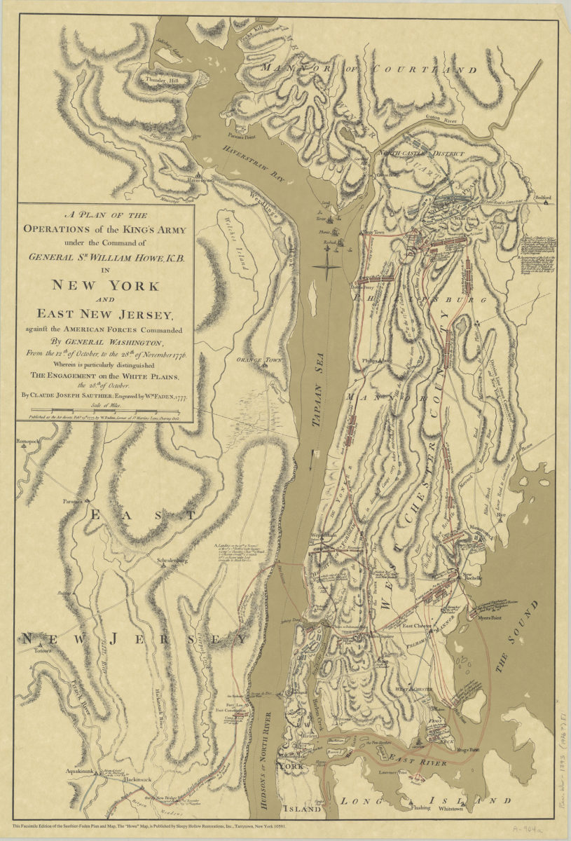
A plan of the operations of the King’s army under the command of General Sr. William Howe, K.B. in New York and East New Jersey against the American forces commanded by General Washington, from the 12th of October, to the 28th of November 1776
A plan of the operations of the King’s army under the command of General Sr. William Howe, K.B. in New York and East New Jersey against the American forces commanded by General Washington, from the 12th of October, to the 28th of November 1776
[ca. 1976]
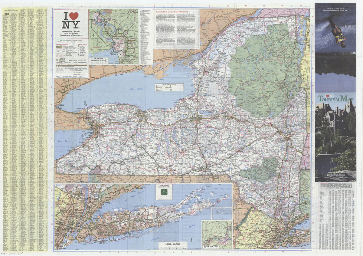
I [heart symbol] NY: Division of Tourism, New York State Department of Commerce
I [heart symbol] NY: Division of Tourism, New York State Department of Commerce
[1987]
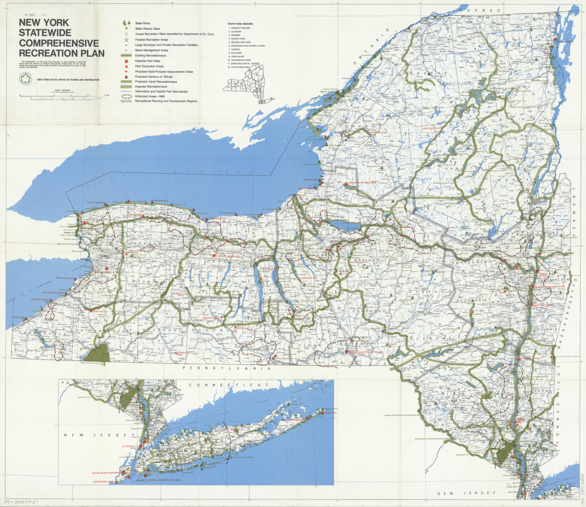
New York statewide comprehensive recreation plan
New York statewide comprehensive recreation plan
[1990]
Previous
1
2