Center for Brooklyn History
Map Collections
Search
About
Othmer Library & Archives
Submit search query
Refine 52 records
Clear filters
3
Location
Albany (N.Y.)
3
Amityville (N.Y.)
1
Babylon (N.Y. : Town)
2
Babylon (N.Y.)
1
Brightwaters (N.Y.)
1
Brooklyn (New York, N.Y.)
891
Buffalo (N.Y.)
3
Columbia County (N.Y.)
1
Dutchess County (N.Y.)
2
Flushing (New York, N.Y.)
13
Greene County (N.Y.)
3
Islip (N.Y.)
5
Lindenhurst (N.Y.)
1
Long Island (N.Y.)
197
Manhattan (New York, N.Y.)
120
Nassau County (N.Y.)
24
New Jersey
27
New York (N.Y.)
164
New York (State)
95
New York Metropolitan Area
40
Ocean Beach (N.Y.)
1
Queens (New York, N.Y.)
83
Saltaire (N.Y.)
1
Smithtown (N.Y. : Town)
4
Southampton (N.Y.)
5
Staten Island (N.Y.)
10
Suffolk County (N.Y.)
43
Westchester County (N.Y.)
11
Show 8 more
Subject
Automobile racing
1
Bicycle trails
17
Canals
15
Country clubs
1
Electric railroads
5
Exhibitions
5
ferries
32
Golf courses
2
Golf resorts
1
Local transit
63
Postal codes
4
Railroads
72
Railroads, Elevated
24
Recreation
5
Roads
117
Steamboat lines
4
Street addresses
11
Streets
46
Subways
55
Tourism
1
Traffic engineering
1
Transportation
3
Zip codes
4
Show 3 more
Date
20th Century
469
or enter range:
from
to
Genres
Aerial views
15
Pictorial maps
38
Road maps
83
Thematic maps
60
Tourist maps
55
Transportation maps
120
Sort by:
Date (earliest)
Date (most recent)
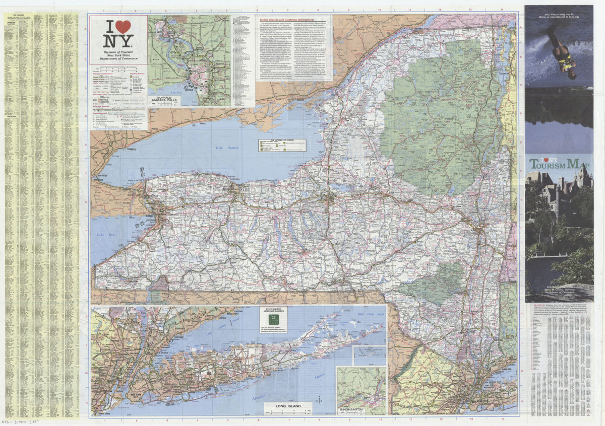
I [heart symbol] NY: Division of Tourism, New York State Department of Commerce
I [heart symbol] NY: Division of Tourism, New York State Department of Commerce
[1987]
Long Island road map: Hagstrom
Long Island road map: Hagstrom
[ca. 1987]
Previous
1
2