# 146: Sekakus patent: 2000 acres: based on the Indian purchase of Jan. 30, 1658 (Stila Nova) [1957; 1957]
Map No. NJ-17th-19th century(1957).Fl
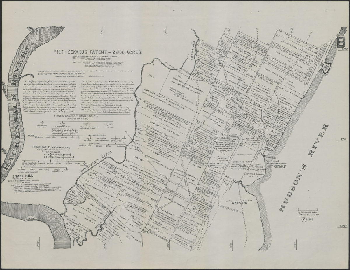
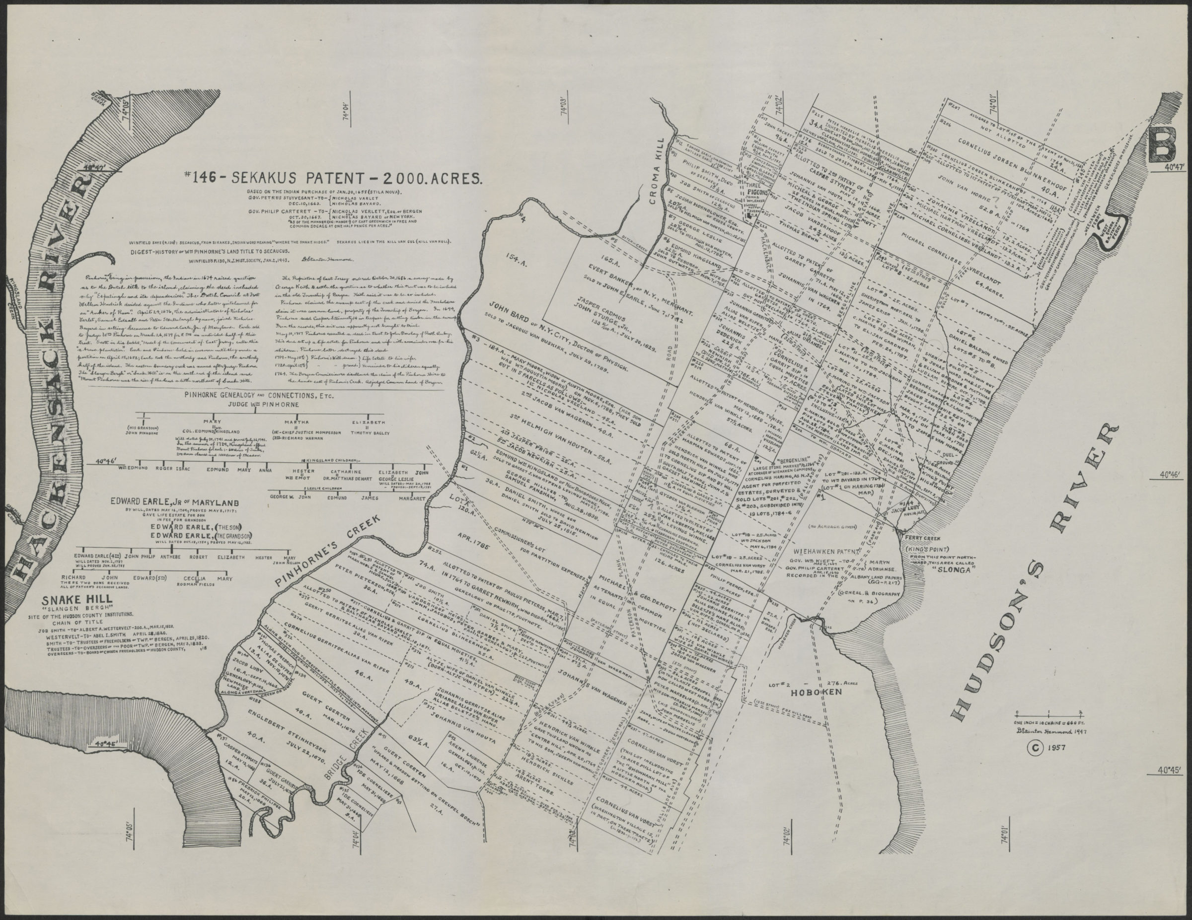
Map shows the Secaucus patent, which covers area between the Hudson River and Hackensack River in modern-day Secaucus, Hoboken and Weehawken, New Jersey. Shows Secaucus patent between the Hackensack River and Pinhorne’s Creek and Cromakill Creek, and landowners for the land between Pinhorne’s Creek and Cromakill Creek and the Hudson River. Includes text detailing land transactions and genealogical charts for Pinhorne family and the Earle family. On lower right: “D. Hammond Stanton, 1947, ©1957.”
Map area shown
Genre
Cadastral mapsRelation
Full catalog recordSize
44 × 56 cmDownload
Low Resolution Image
Creator
Hammond, D. Stanton,Publisher
Brooklyn Historical SocietyCitation
# 146: Sekakus patent: 2000 acres: based on the Indian purchase of Jan. 30, 1658 (Stila Nova); [1957; 1957], Map Collection, NJ-17th-19th century(1957).Fl; Brooklyn Historical Society.Scale
Scale 1:792. 1 in to 66 fLoading zoom image...