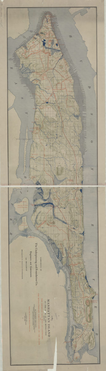
1783 Manhattan Island at the close of the Revolution: showing the American city with its landmarks and the Revolutionary fortifictions on the island: by Townsend Mac Coun [ca. 1909]
Map No. Rev. War-1783 (1909).Fl
Historical military topographic map. Also shows roads of 1783, streams, wetlands and shore land filled since 1783. Shows relief by shading. Split, lightly soiled, mounted on cloth. Probably based on the Viele map cited below as well as the work of John Randel. “Complements of the Underpinning and Foundation Co….” M006237
Subjects
Places
Map area shown
Genre
Historical mapsRelation
Full catalog recordSize
32 × 123 cmDownload
Low Resolution Image
Creator
MacCoun, Townsend,Publisher
Brooklyn Historical SocietyCitation
1783 Manhattan Island at the close of the Revolution: showing the American city with its landmarks and the Revolutionary fortifictions on the island: by Townsend Mac Coun; [ca. 1909], Map Collection, Rev. War-1783 (1909).Fl; Brooklyn Historical Society.Scale
Scale [ca. 1:20,000]Loading zoom image...