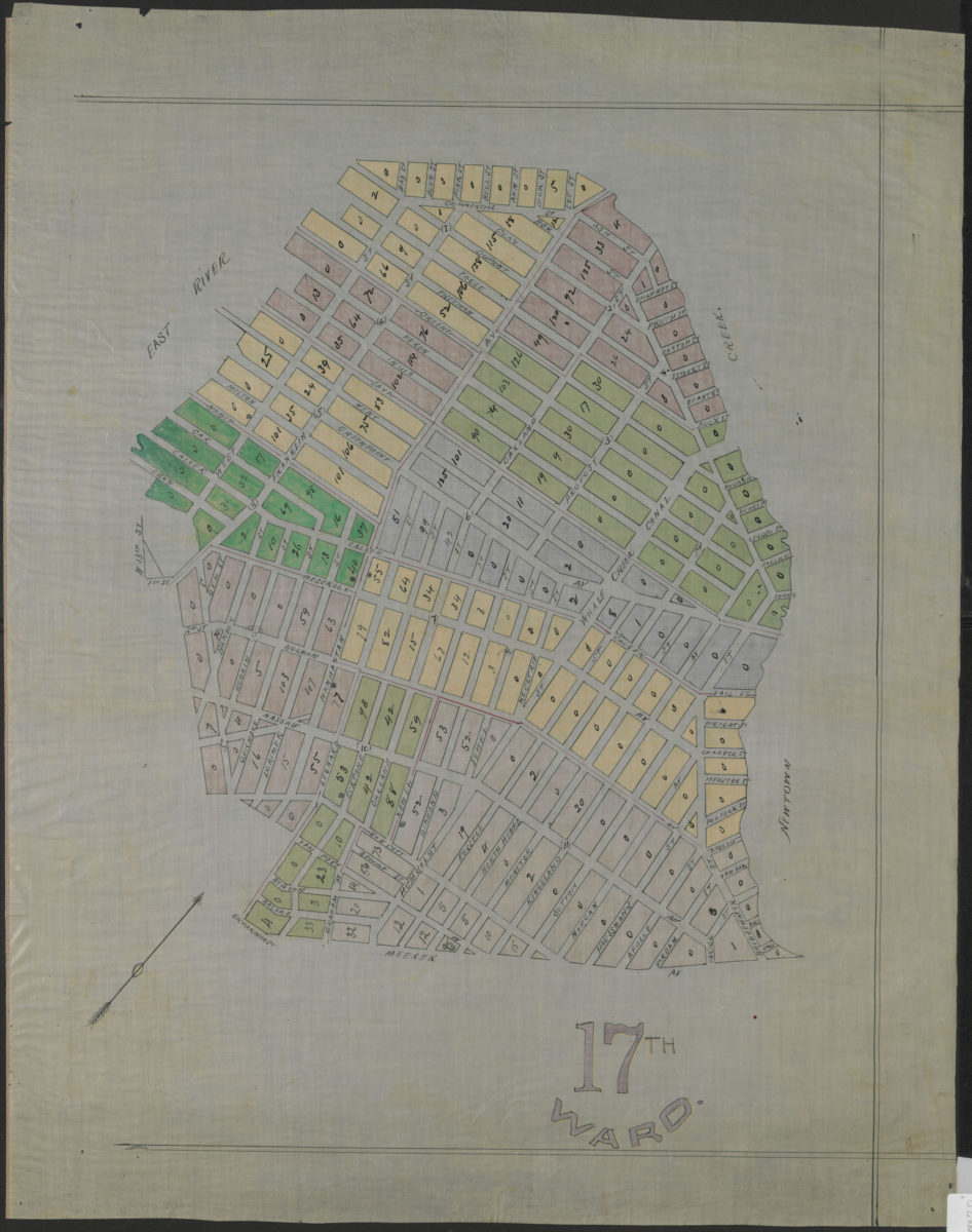
17th Ward [1883]
Map No. B A-[1883?].Fl
Political map covering area in modern-day Greenpoint and Williamsburg. Oriented with north to the upper right.
Subjects
Places
Map area shown
Genre
Manuscript mapsRelation
Full catalog recordSize
61 × 51 cmDownload
Low Resolution Image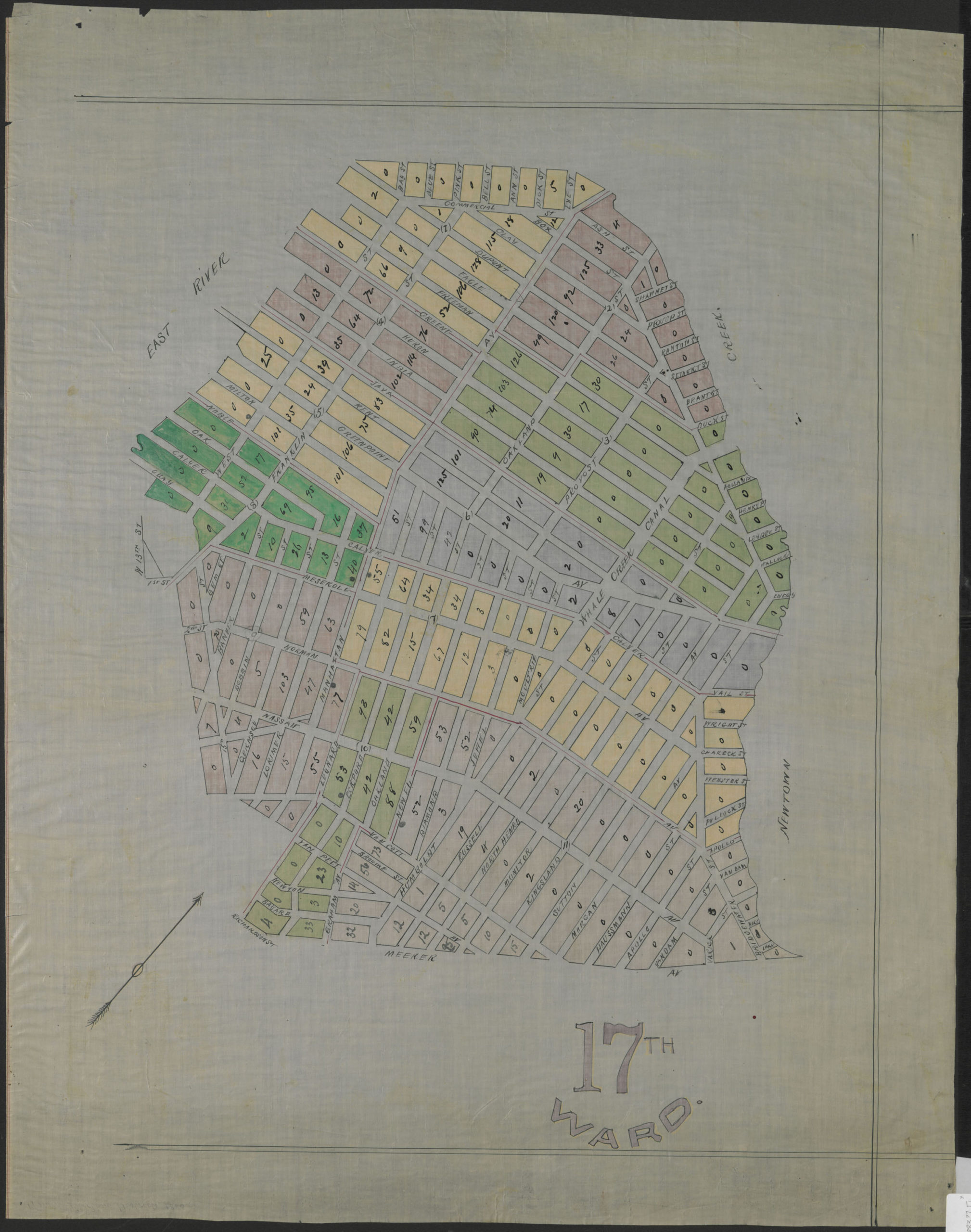
Creator
Publisher
Brooklyn Historical SocietyCitation
17th Ward; [1883], Map Collection, B A-[1883?].Fl; Brooklyn Historical Society.Scale
Scale not givenLoading zoom image...