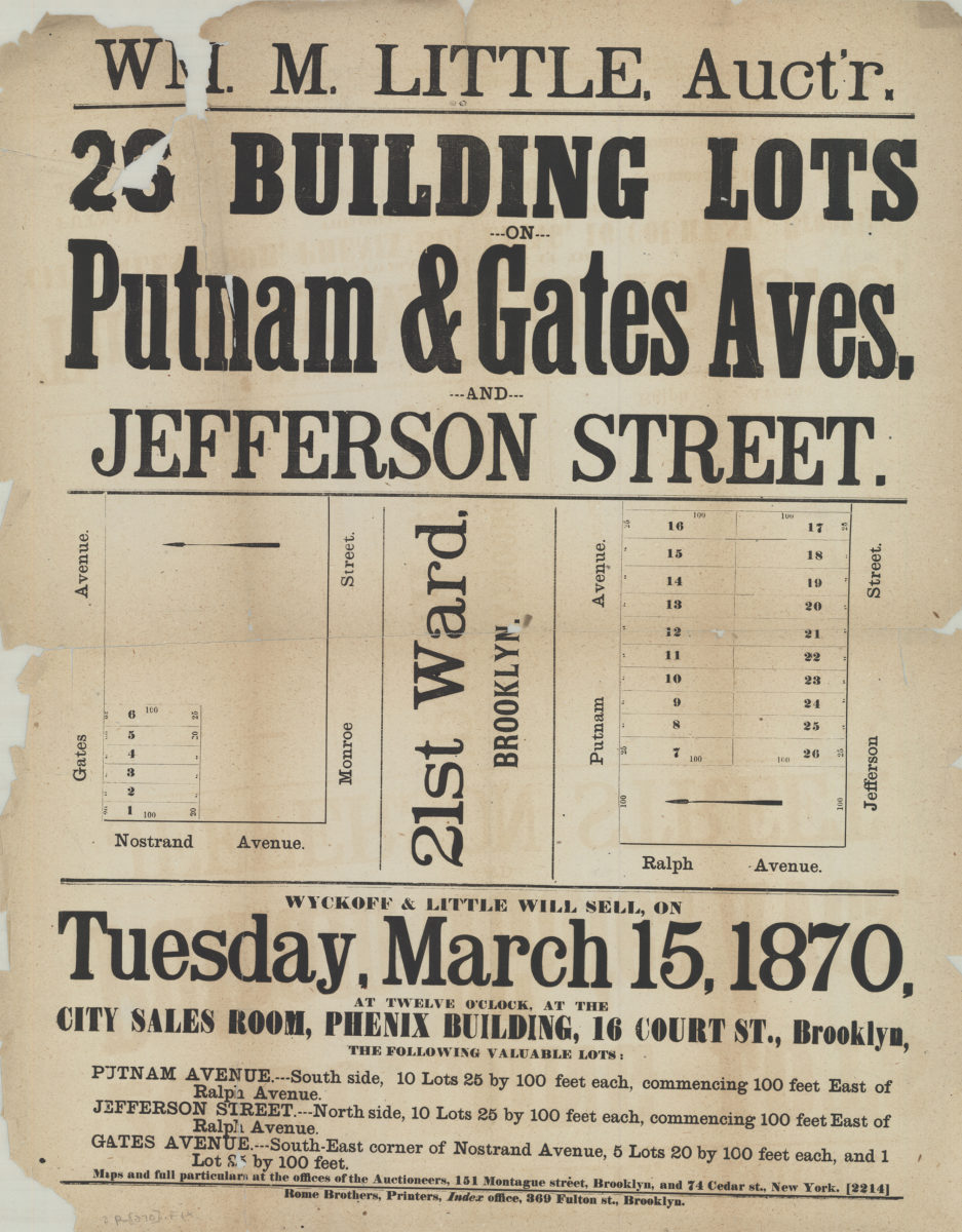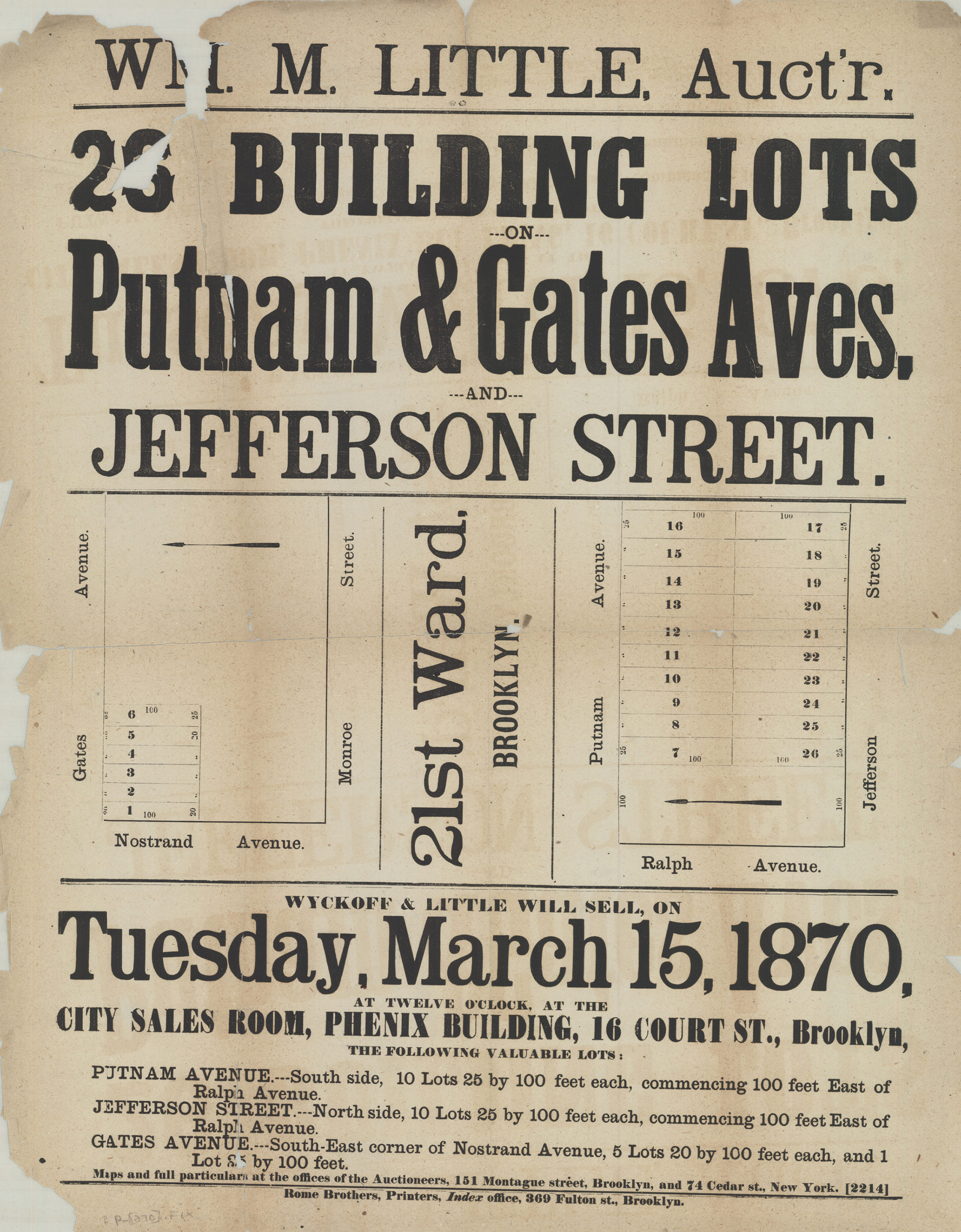
26 building lots on Putnam & Gates Aves. and Jefferson Street [1870]
Map No. B P-[1870].Fl
Maps cover Nostrand Ave. and Gates Ave. at Monroe St. and Putnam Ave. and Jefferson St. at Ralph Ave. (modern-day Bedford-Stuyvesant).
Map area shown
Relation
Full catalog recordSize
61 × 48 cmDownload
Low Resolution Image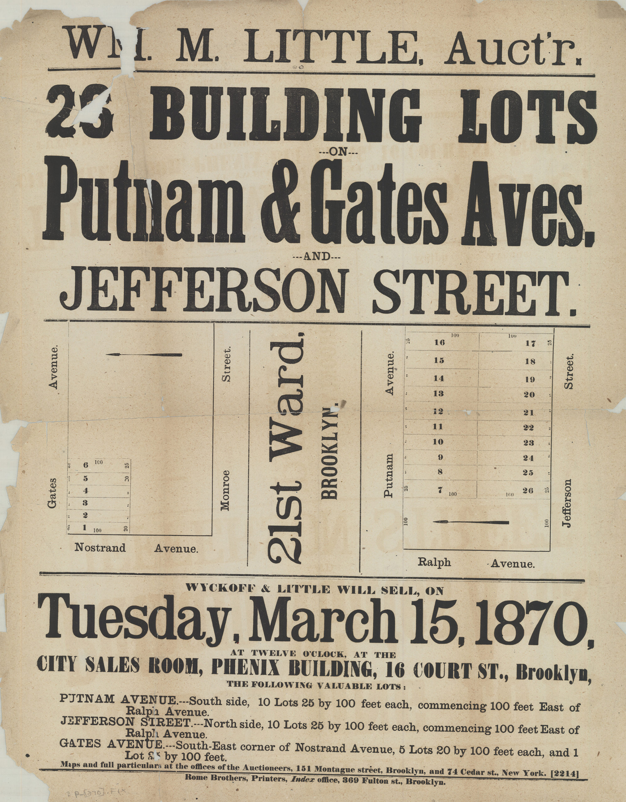
Creator
Rome & Co. (Brooklyn, New York, N.Y.),Publisher
Brooklyn Historical SocietyCitation
26 building lots on Putnam & Gates Aves. and Jefferson Street; [1870], Map Collection, B P-[1870].Fl; Brooklyn Historical Society.Scale
Scales differLoading zoom image...