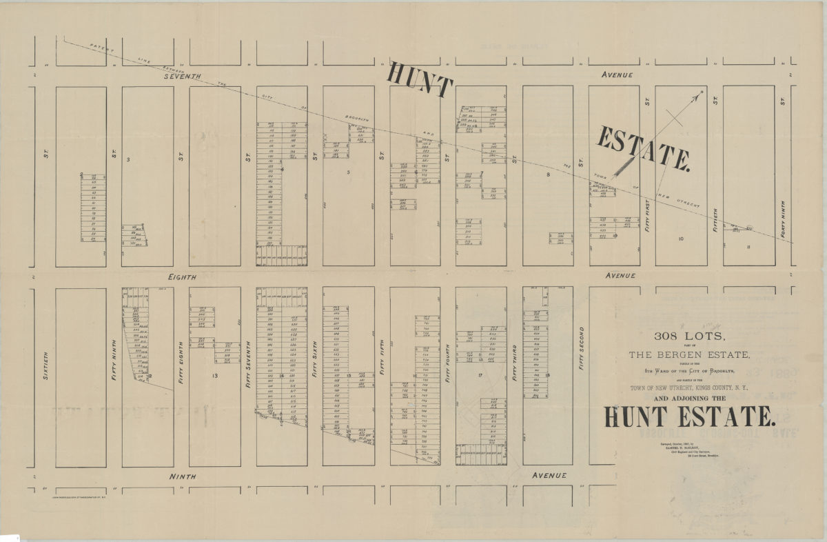
308 lots, part of the Bergen Estate, partly in the 8th Ward of the city of Brooklyn, and partly in the town of New Utrecht, Kings County, N.Y., and adjoining the Hunt Estate: surveyed, October 1887, by Samuel H. McElroy, civil engineer [1889]
Map No. B P-[1889?].Fl.Folio
Cadastral map covering area bounded by 7th Ave., 60th St., 9th Ave., and 49th St. (modern-day Borough Park). Shows property (including lot numbers and dimensions). Oriented with north to the upper right. On recto: Location map, ill., and text.
Map area shown
Genre
Cadastral mapsRelation
Full catalog recordSize
67 × 103 cmDownload
Low Resolution Image
Creator
McElroy, Samuel,Publisher
Brooklyn Historical SocietyCitation
308 lots, part of the Bergen Estate, partly in the 8th Ward of the city of Brooklyn, and partly in the town of New Utrecht, Kings County, N.Y., and adjoining the Hunt Estate: surveyed, October 1887, by Samuel H. McElroy, civil engineer; [1889], Map Collection, B P-[1889?].Fl.Folio; Brooklyn Historical Society.Scale
Scale not givenLoading zoom image...