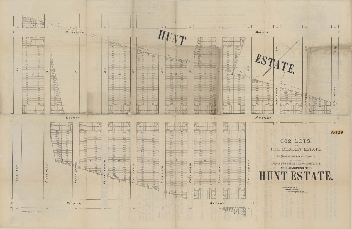
932 lots, part of the Bergen Estate, partly in the 8th Ward of the city of Brooklyn, and partly in the town of New Utrecht, Kings County, N.Y., and adjoining the Hunt Estate: surveyed, October 1887, by Samuel H. McElroy [1888]
Map No. B P-[1888]a.Fl
Cadastral map covering area north from 9th Ave. to 7th Ave. and east from 60th St. to 49th St. (modern-day Sunset Park). Shows property (including block numbers, lot numbers, and dimensions), and names of landowners. Oriented with north to the upper right. On verso: Text, ill., and inset map of Brooklyn showing subway and ferry lines.
Map area shown
Genre
Cadastral mapsRelation
Full catalog recordSize
66 × 102 cmDownload
Low Resolution Image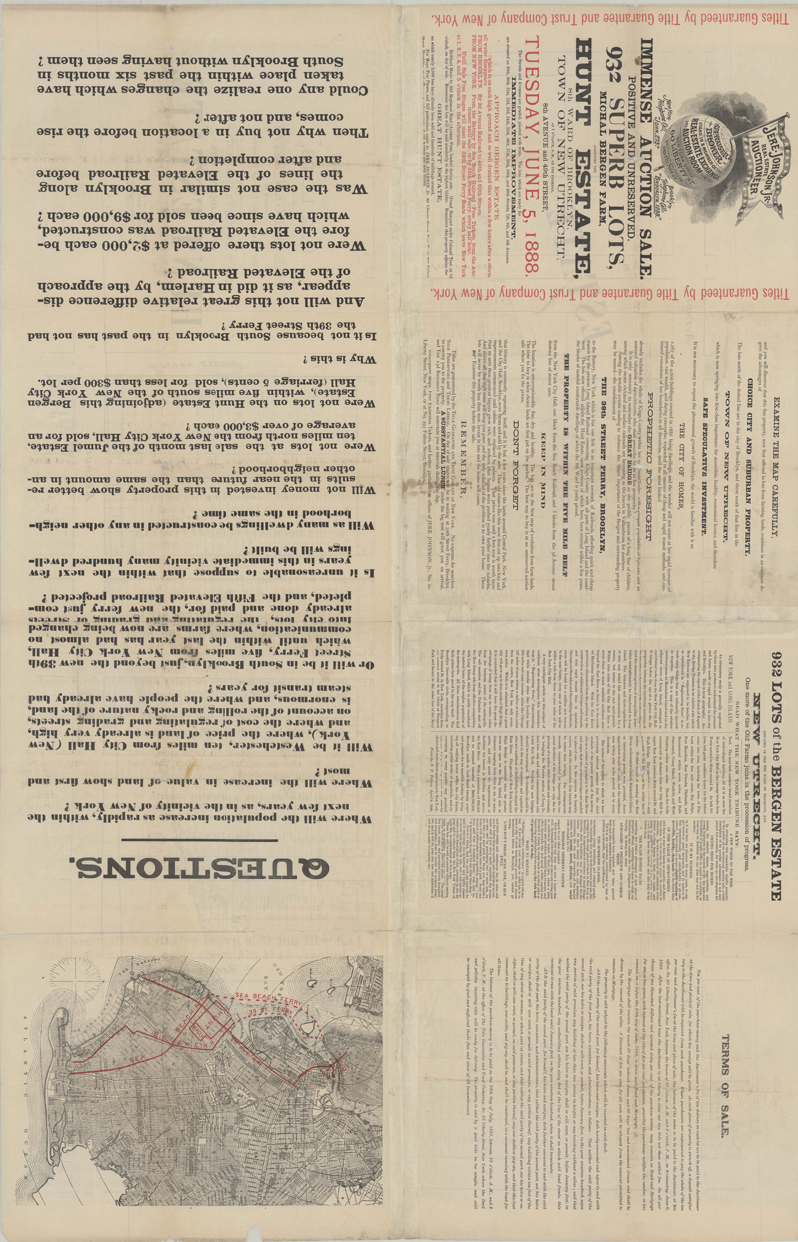
Creator
McElroy, Samuel,Publisher
Brooklyn Historical SocietyCitation
932 lots, part of the Bergen Estate, partly in the 8th Ward of the city of Brooklyn, and partly in the town of New Utrecht, Kings County, N.Y., and adjoining the Hunt Estate: surveyed, October 1887, by Samuel H. McElroy; [1888], Map Collection, B P-[1888]a.Fl; Brooklyn Historical Society.Scale
Scale not givenLoading zoom image...