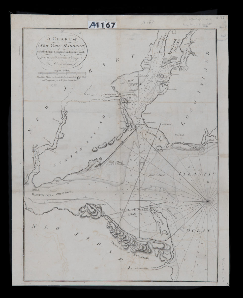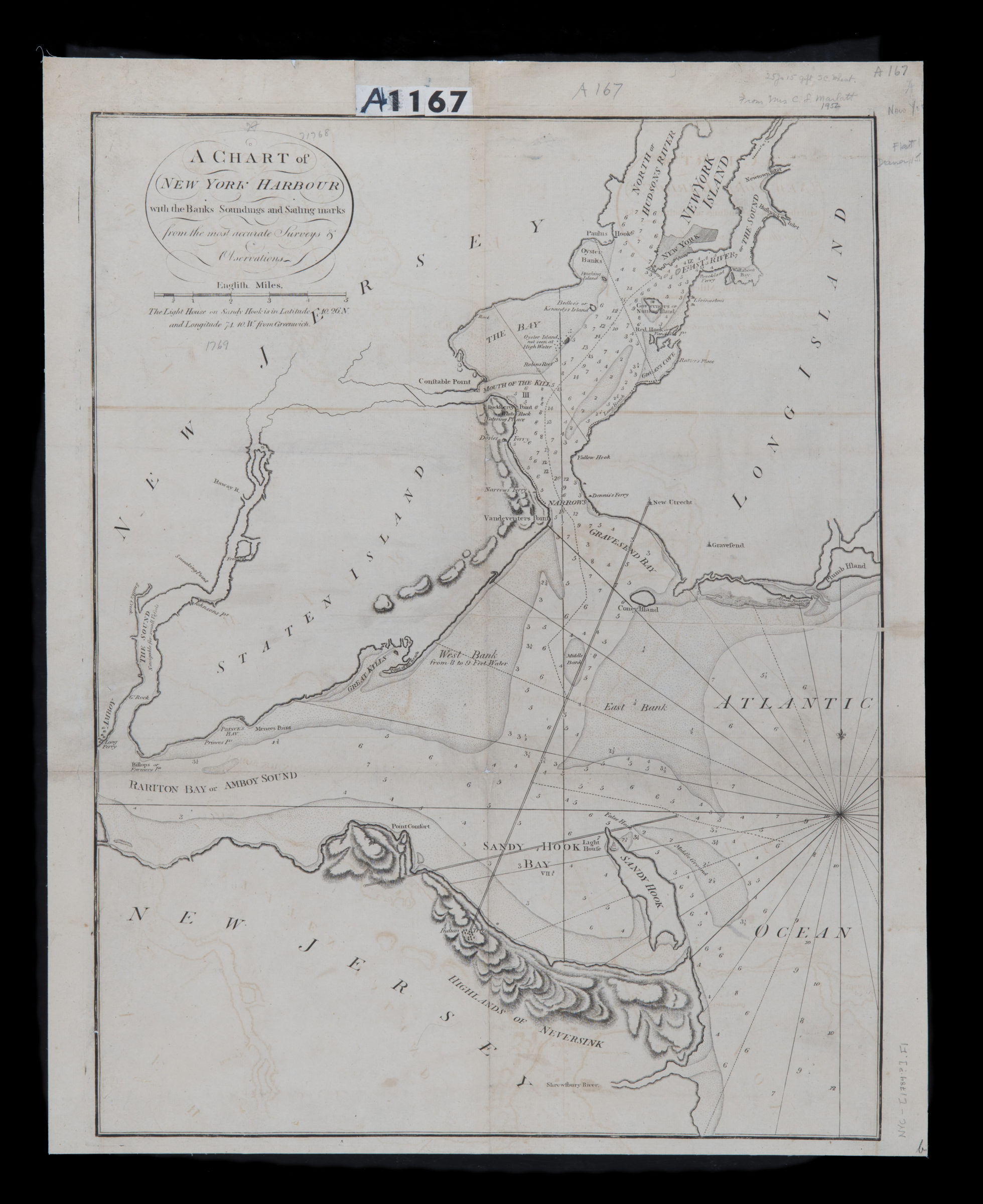
A chart of New York Harbour: with the banks, soundings and sailing marks from the most accurate surveys & observations [1784]
Map No. NYC-[1784?].Fl.RA
Nautical chart. Also covers Staten Island and portions of Manhattan, Long Island, and New Jersey. Relief shown by hachures. Depths shown by gradient tints and soundings. Includes note.
Map area shown
Relation
Full catalog recordSize
60 × 46 cmDownload
Low Resolution Image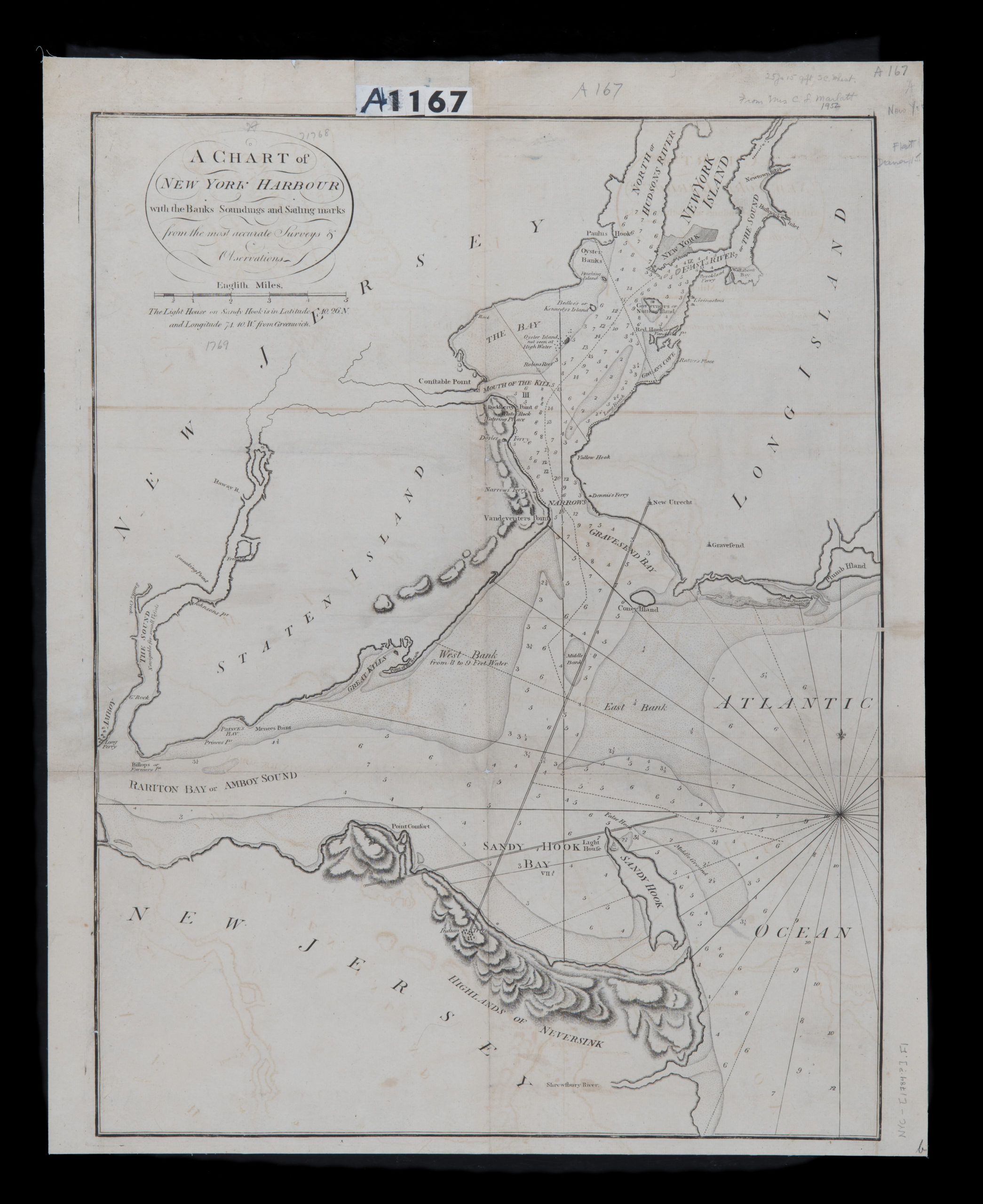
Creator
Publisher
Brooklyn Historical SocietyCitation
A chart of New York Harbour: with the banks, soundings and sailing marks from the most accurate surveys & observations; [1784], Map Collection, NYC-[1784?].Fl.RA; Brooklyn Historical Society.Scale
Scale [ca. 1:72,500]Loading zoom image...