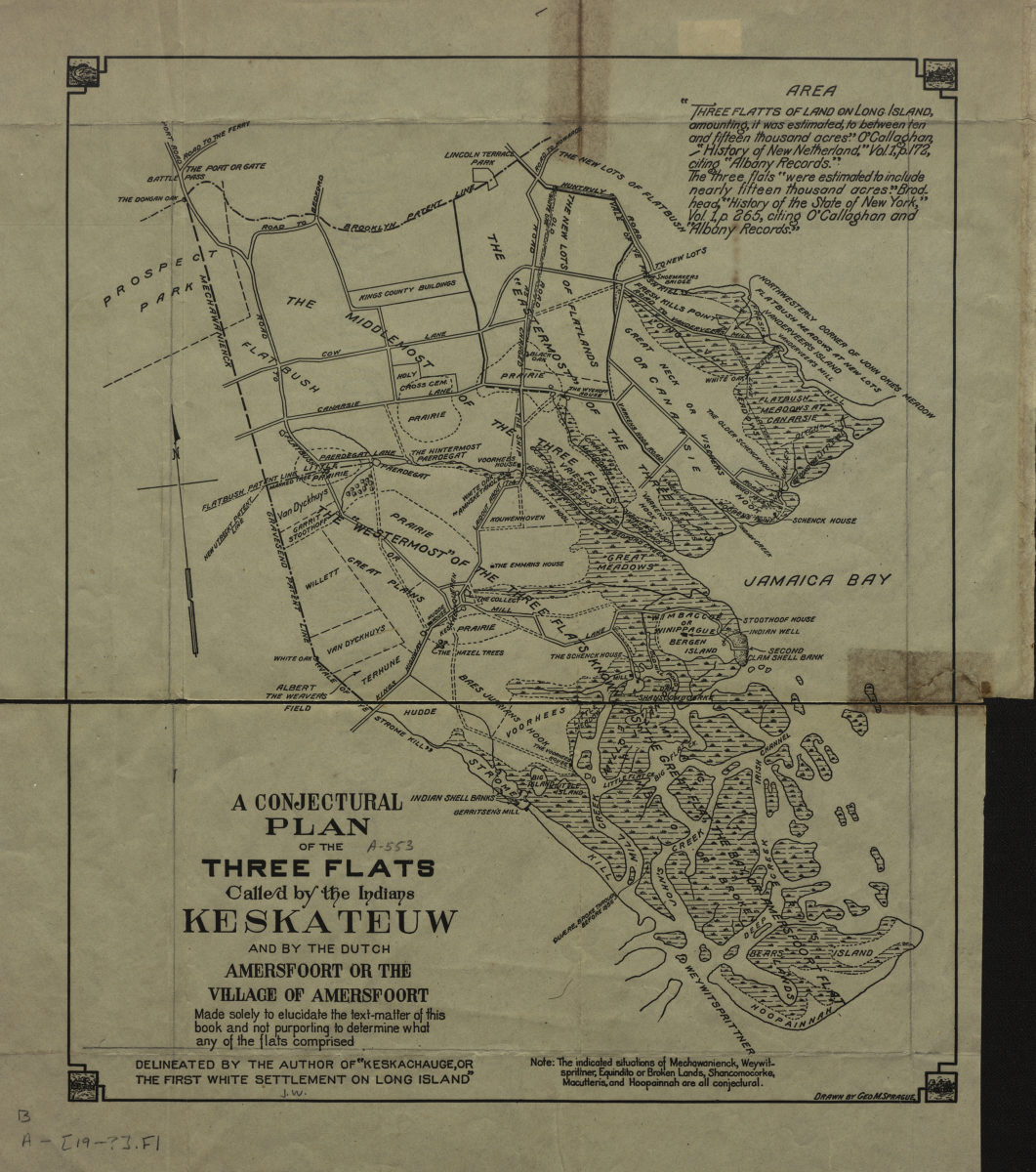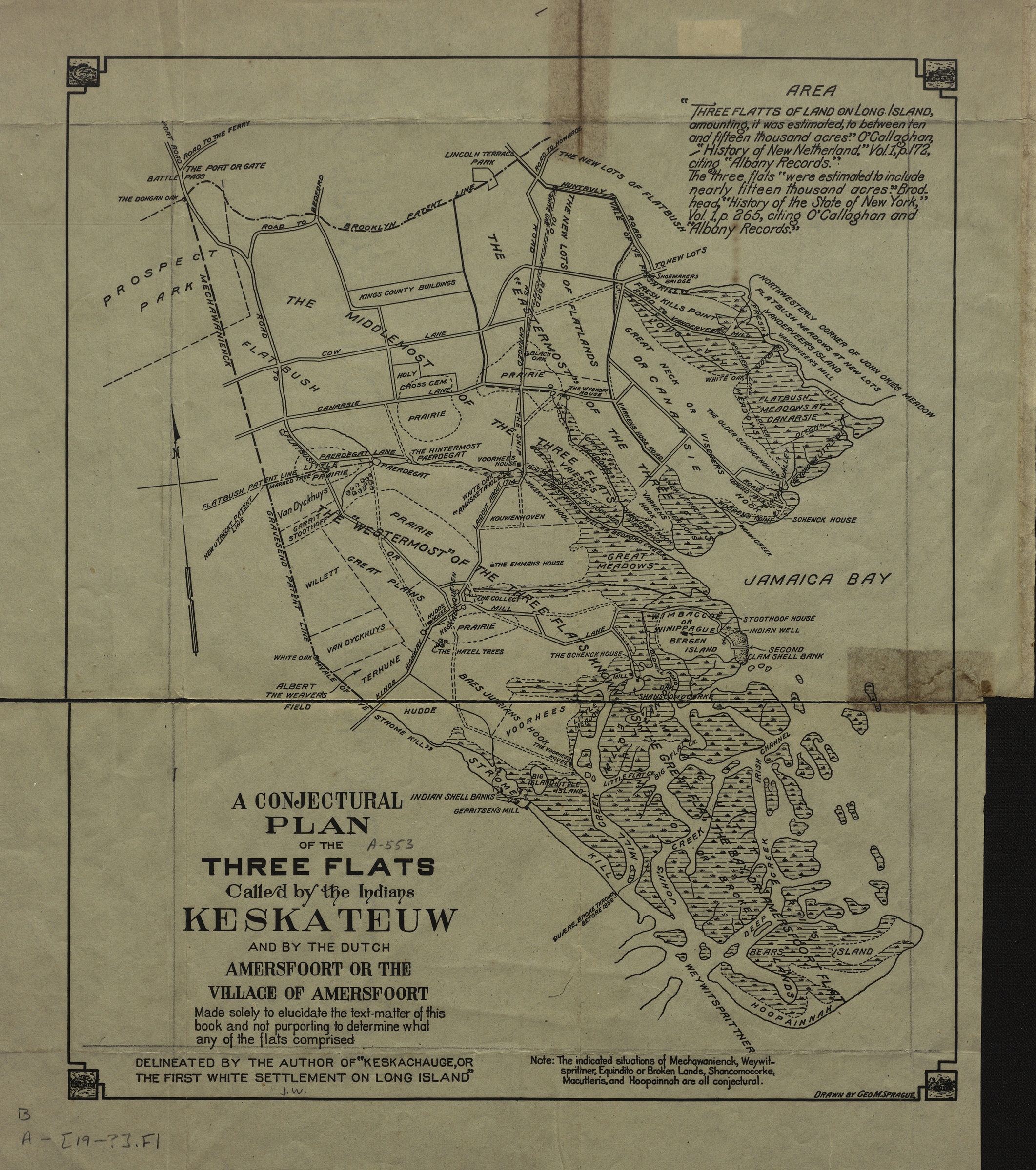
A conjectural plan of the three flats called by the Indians Keskateuw and by the Dutch Amersfort or the Village of Amersfort: made solely to elucidate the text-matter of this book and not purporting to determine what any of the flats comprised [1924; 1924]
Map No. B A-[19--?].Fl
Conjectural plan of historical geography in modern-day neighborhoods of Flatlands, Marine Park, Mill Basin, Bergen Beach, Canarsie and East Flatbush. Detached from: Keskachauge, or The first while settlement on Long Island / Frederick Van Wyck. New York : G.P. Putnam & Sons, 1924. “Note: the indicated situations of Mechawanienck, Weywitsprittner, Equindito or Broken Lands, Shancomocorke, Macutteris, and Hoopainnah are all conjectural.”
Subjects
Places
Map area shown
Genre
Historical mapsRelation
Full catalog recordSize
33 × 28 cmDownload
Low Resolution Image
Creator
Van Wyck, Frederick,Publisher
Brooklyn Historical SocietyCitation
A conjectural plan of the three flats called by the Indians Keskateuw and by the Dutch Amersfort or the Village of Amersfort: made solely to elucidate the text-matter of this book and not purporting to determine what any of the flats comprised; [1924; 1924], Map Collection, B A-[19--?].Fl; Brooklyn Historical Society.Scale
Scale not givenLoading zoom image...