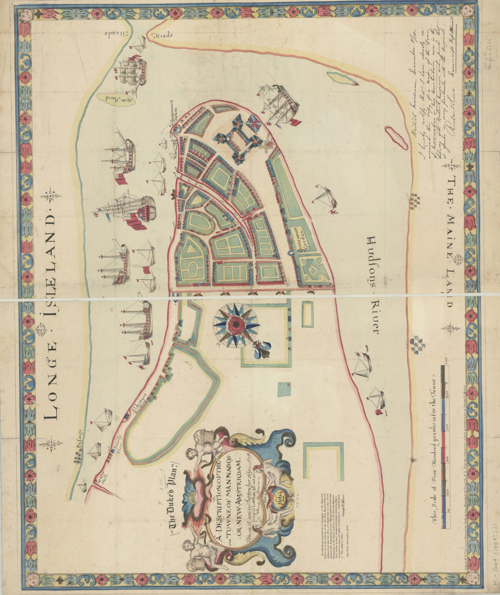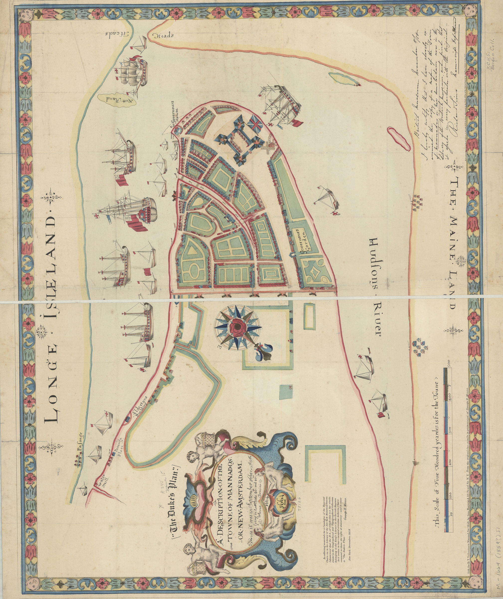
A description of the towne of Mannados or New Amsterdam: as it was in September 1661 : lying in lattitude 40 de. and 40 m. : anno domini 1664 [1859]
Map No. M-1664 (1859?).Fl;M-1664 (1859?).Fl c.3;M-1664 (1859?).Fl c.2
Facsimile of manuscript pictorial map covering Lower Manhattan. Shows structures and fortifications. Ships and houses shown pictorially. “Reproduced in fac-simile by Henry Dunreath Tyler, 46 Wall St., N.Y.”–Lower left. Oriented with north to the lower left. “E.C. Bridgman, Maps, N.Y.”–Lower right. “Lith. for D.T. Valentine’s Manual for 1859, by Geo. Hayward.”–Lower left. Includes decorative border and cartouche, notes, and ill. BHS has 3 copies.
Map area shown
Genre
Pictorial mapsRelation
Full catalog recordSize
55 × 70 cmDownload
Low Resolution Image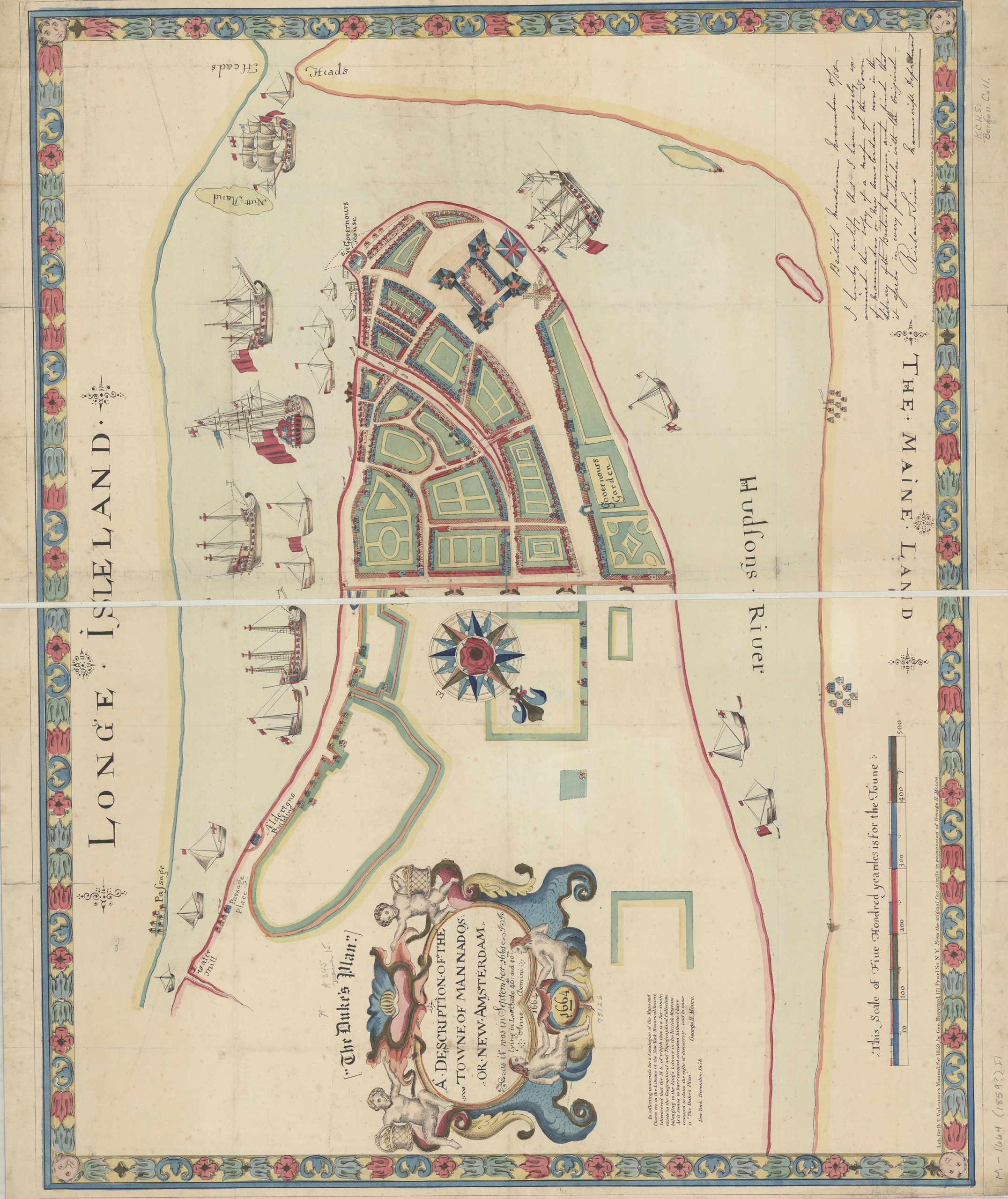
Creator
Hayward, George; Valentine, D. T.; Tyler, Henry D.; Bridgman, E. C.,Publisher
Brooklyn Historical SocietyCitation
A description of the towne of Mannados or New Amsterdam: as it was in September 1661 : lying in lattitude 40 de. and 40 m. : anno domini 1664; [1859], Map Collection, M-1664 (1859?).Fl;M-1664 (1859?).Fl c.3;M-1664 (1859?).Fl c.2; Brooklyn Historical Society.Scale
Scale [ca. 1:2,323]Loading zoom image...