
A draught of New York from the Hook to New York Town: by Mark Tiddeman [1773-1780]
Map No. NYC-[177-?].Fl.RA
Nautical chart. Covers area east from Amboy to Jamaica Bay and north from the Shrewsbury River to Harlem. Settlements shown pictorially. Relief shown by hachures. Depths shown by bathymetric tints and soundings. Plate 1, state 3 according to Verner. Appears in: The English pilot. The fourth book. Eds. 1773 to 1780. M008077.
Map area shown
Relation
Full catalog recordSize
45 × 57 cmDownload
Low Resolution Image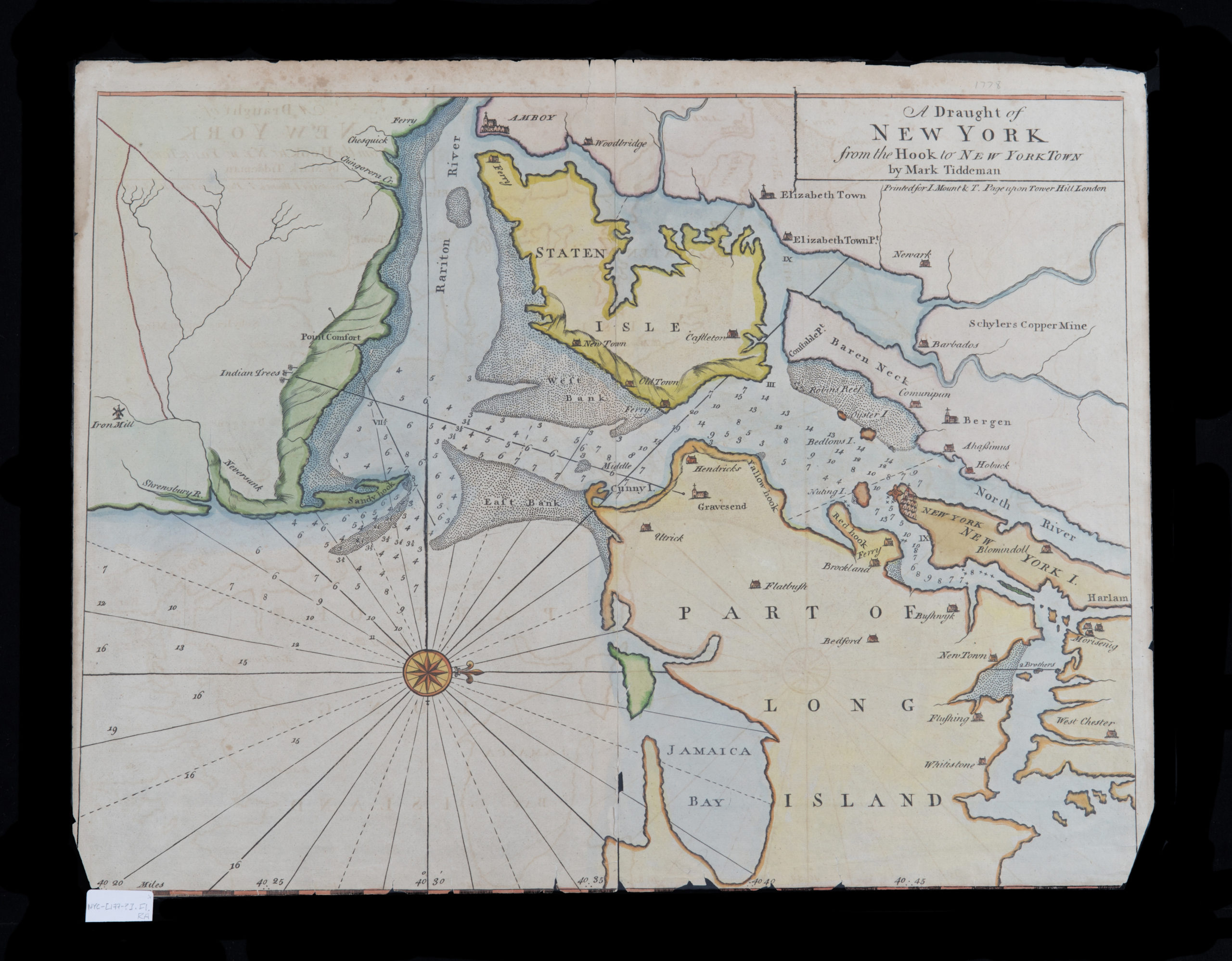
Creator
Tiddeman, Mark,Publisher
Brooklyn Historical SocietyCitation
A draught of New York from the Hook to New York Town: by Mark Tiddeman; [1773-1780], Map Collection, NYC-[177-?].Fl.RA; Brooklyn Historical Society.Scale
Scale [ca. 1:100,000]Loading zoom image... 