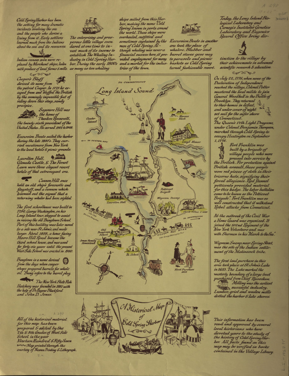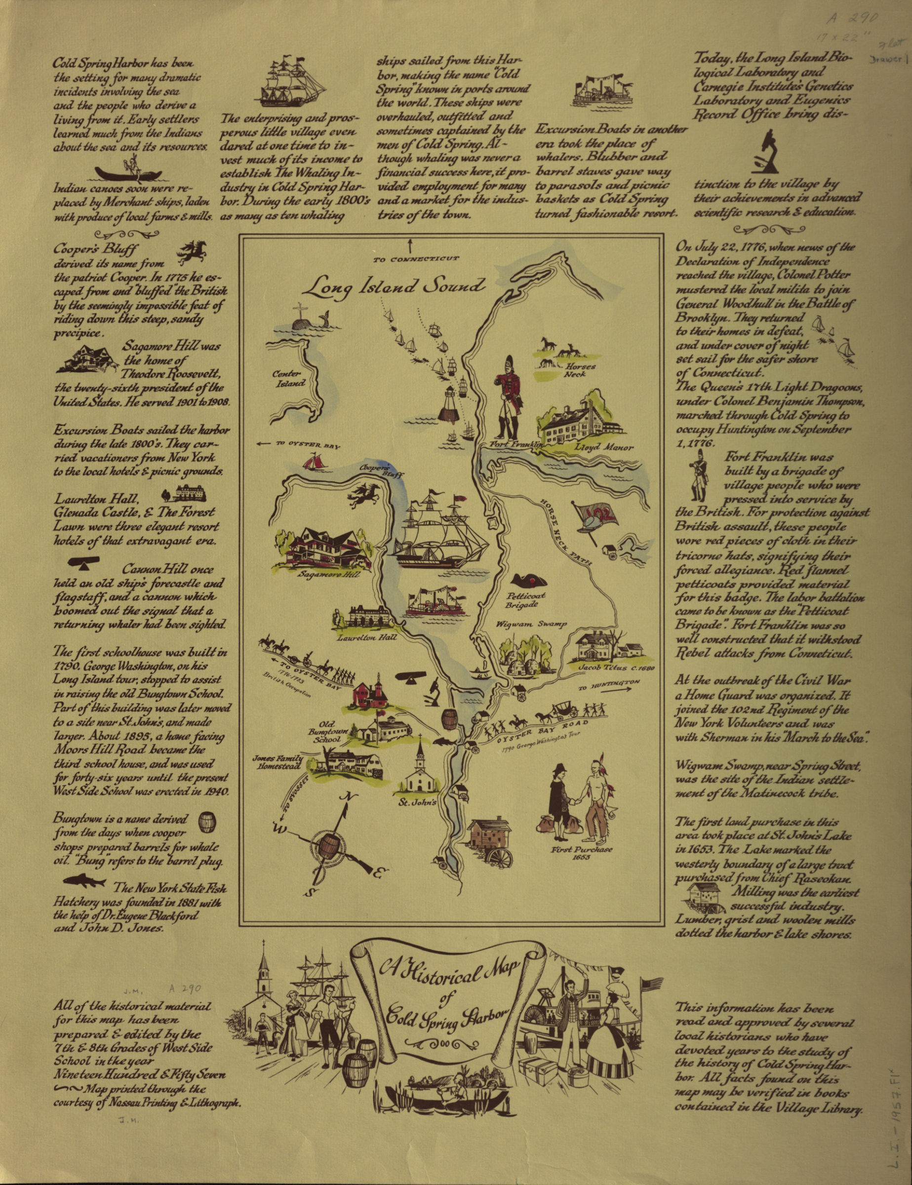
A historical map of Cold Spring Harbor 1957
Map No. L.I.-1957.Fl
Pictorial map covering the area of Cold Spring Harbor. Shows places of historical interest. “Prepared & edited by the 7th and 8th grades of West Side School ….” Includes text.
Map area shown
Relation
Full catalog recordSize
56 × 44 cmDownload
Low Resolution Image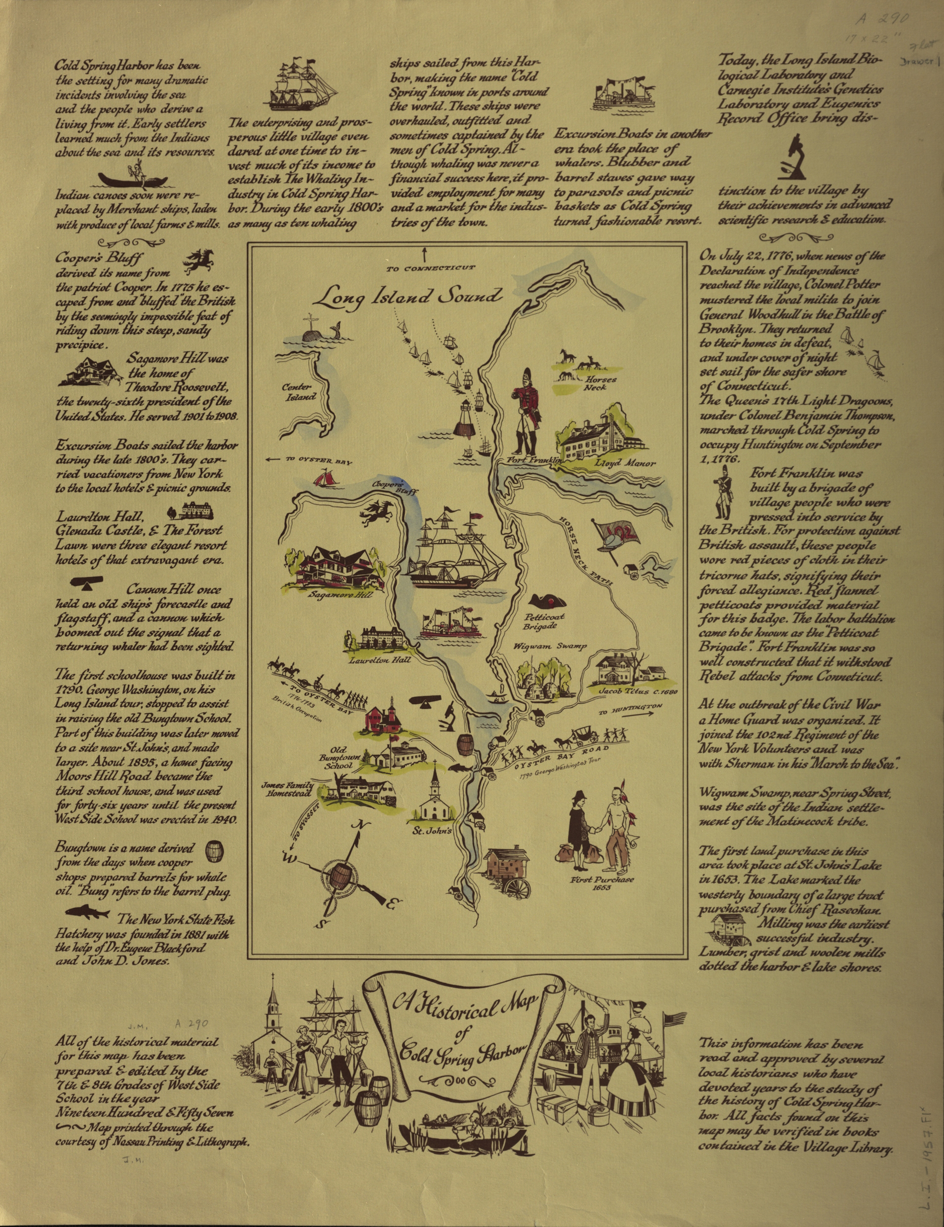
Creator
Publisher
Brooklyn Historical SocietyCitation
A historical map of Cold Spring Harbor; 1957, Map Collection, L.I.-1957.Fl; Brooklyn Historical Society.Scale
Scale not givenLoading zoom image...