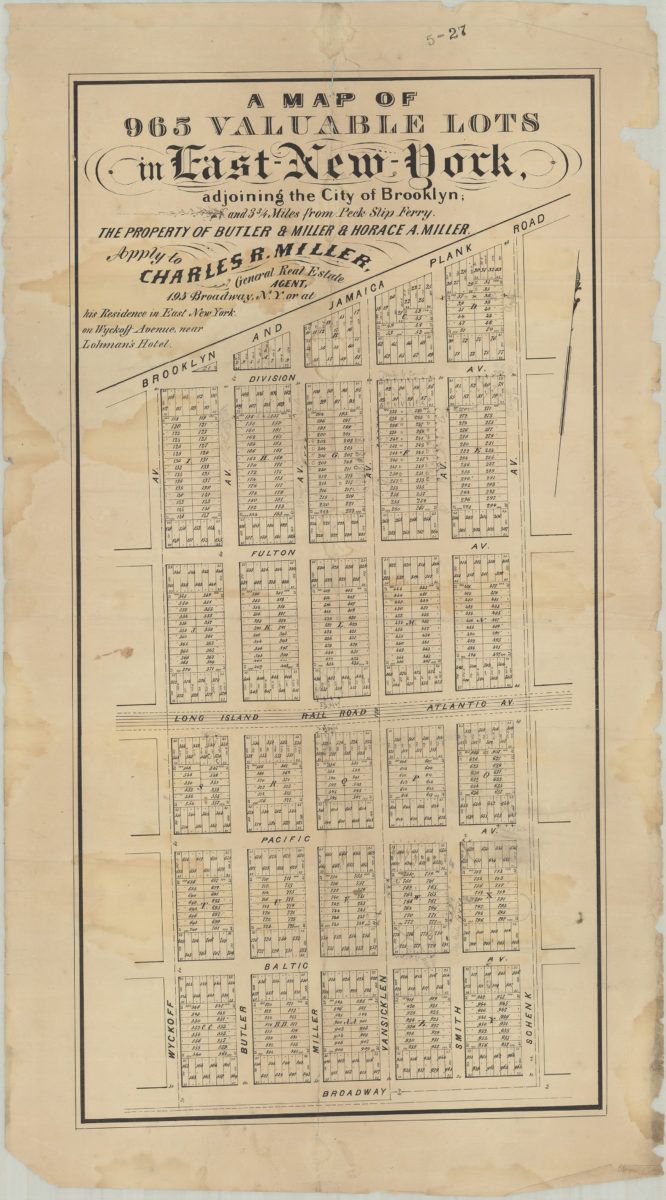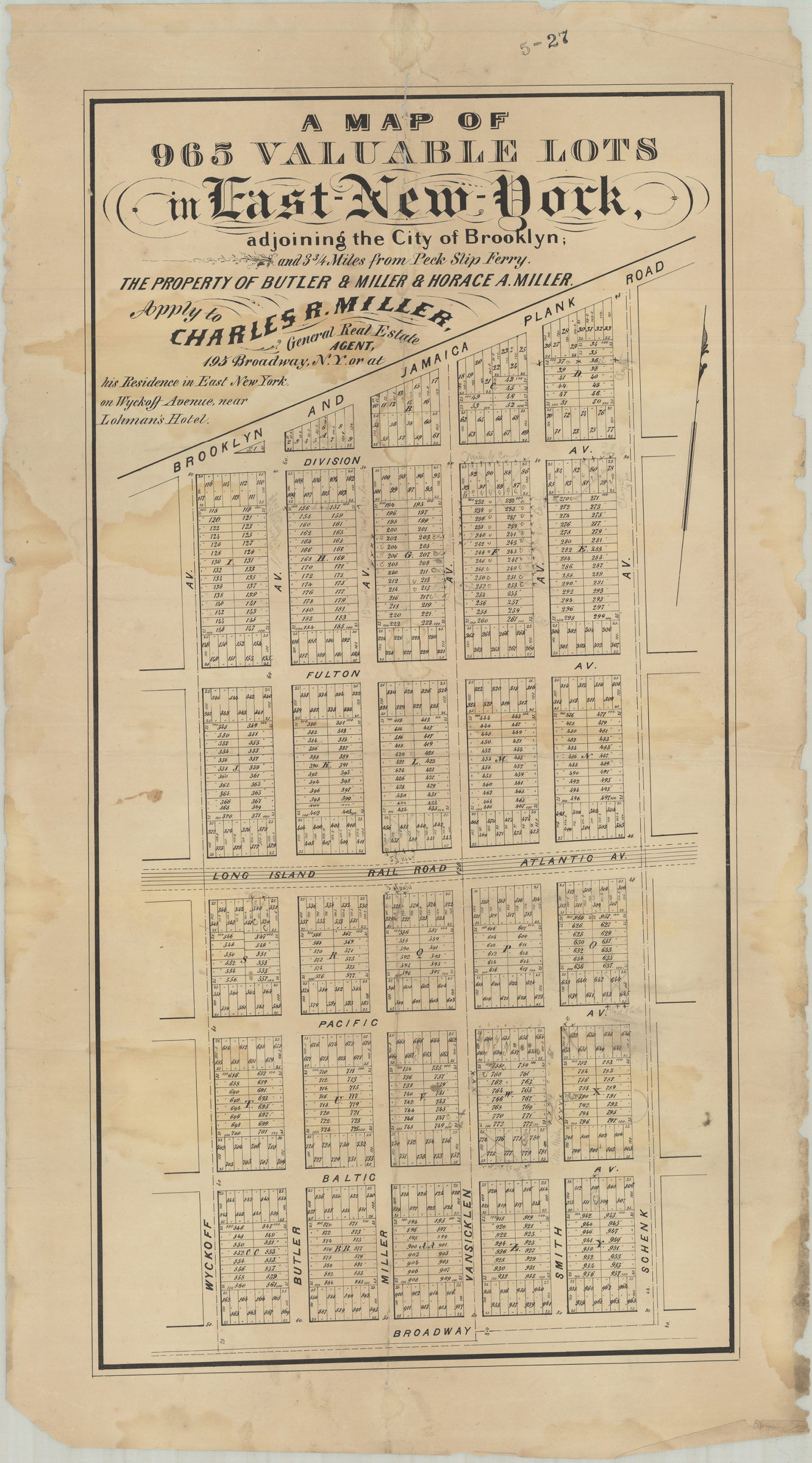
A map of 965 valuable lots in East New York, adjoining the city of Brooklyn and 3 3/4 miles from Peck Slip Ferry, the property of Butler & Miller & Horace A. Miller [189?]
Map No. B P-[189-?]f.Fl
Cadastral map covering area bounded by Wyckoff Ave., Broadway Ave., Schenk Ave., and the Brooklyn and Jamaica Plank Rd. Shows property (including lot numbers and dimensions), and the Long Island Railroad. Includes text. BHS has 2 copies.
Map area shown
Genre
Cadastral mapsRelation
Full catalog recordSize
62 × 31 cmDownload
Low Resolution Image
Creator
Publisher
Brooklyn Historical SocietyCitation
A map of 965 valuable lots in East New York, adjoining the city of Brooklyn and 3 3/4 miles from Peck Slip Ferry, the property of Butler & Miller & Horace A. Miller; [189?], Map Collection, B P-[189-?]f.Fl; Brooklyn Historical Society.Scale
Scale not givenLoading zoom image...