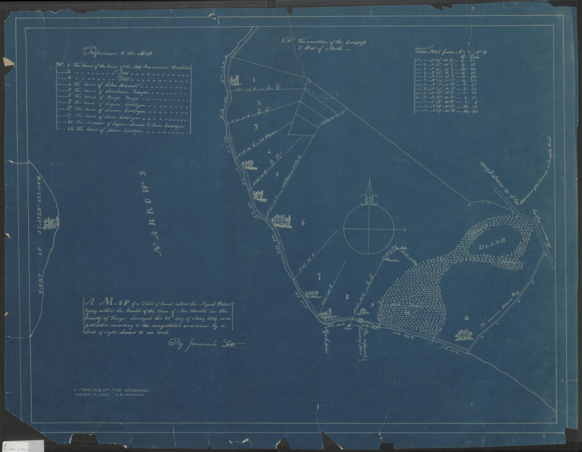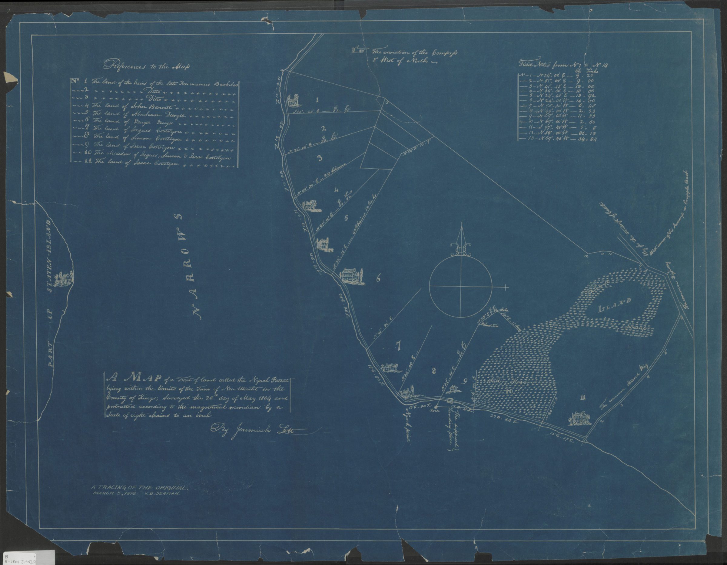
A map of a tract of land called the Nyash Patent, lying within the limits of the town of New Utrecht in the county of Kings, surveyed the 26th day of May 1804 and protracted according to the magnetical meridian by a scale of eight chains to an inch [1918]
Map No. B A-1804 (1918).R
Covers area in modern-day Bay Ridge also covers portion of eastern Staten Island. Shows homes, salt meadows, and swamps. Relief shown pictorially. “A tracing of the original, March 5 1918, V.B. Seaman”–Lower left corner. Includes notes and index.
Map area shown
Genre
MapRelation
Full catalog recordSize
53 × 70 cmDownload
Low Resolution Image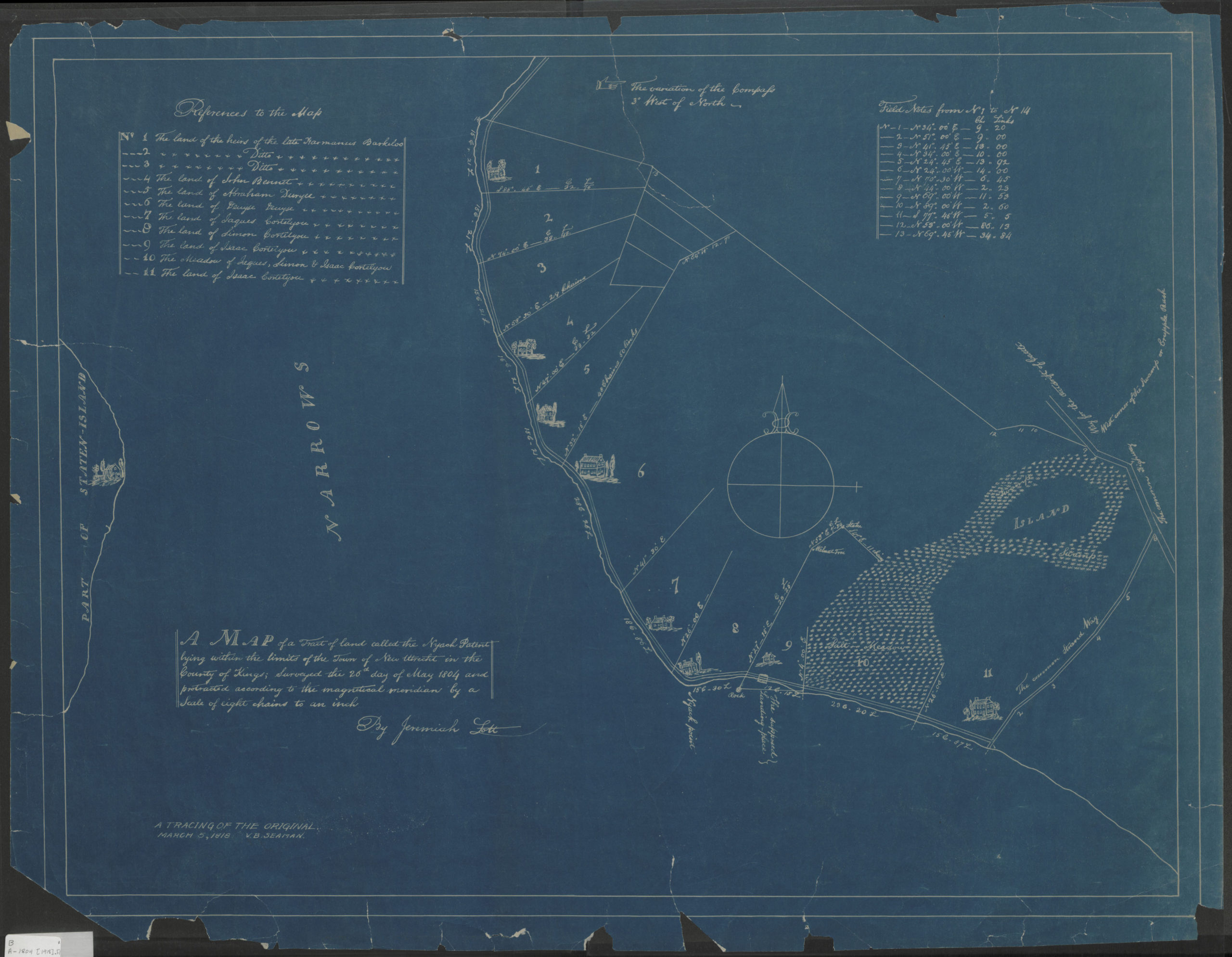
Creator
Lott, Jeremiah,Publisher
Brooklyn Historical SocietyCitation
A map of a tract of land called the Nyash Patent, lying within the limits of the town of New Utrecht in the county of Kings, surveyed the 26th day of May 1804 and protracted according to the magnetical meridian by a scale of eight chains to an inch; [1918], Map Collection, B A-1804 (1918).R; Brooklyn Historical Society.Scale
Scale [1:6,336] 1 in to 8Loading zoom image...