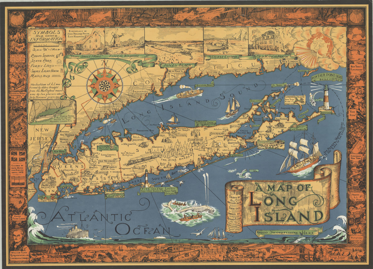
A map of Long Island: drawn by Courtland Smith, from data compiled by Richard Foster [ca. 1961]
Map No. L.I.-1961.Fl
Pictorial map covering Manhattan, Brooklyn, Queens, and portions of New Jersey and Connecticut. Shows points of interest and features of Long Island. Earlier copyright: 1933. Includes key, “Diagram showing how far the two stages of ice advance covered L.I.”, ill., decorative cartouche, and border illustrated with people and events of interest in Long Island’s history.
Places
Map area shown
Genre
Pictorial mapsRelation
Full catalog recordSize
51 × 69 cmDownload
Low Resolution Image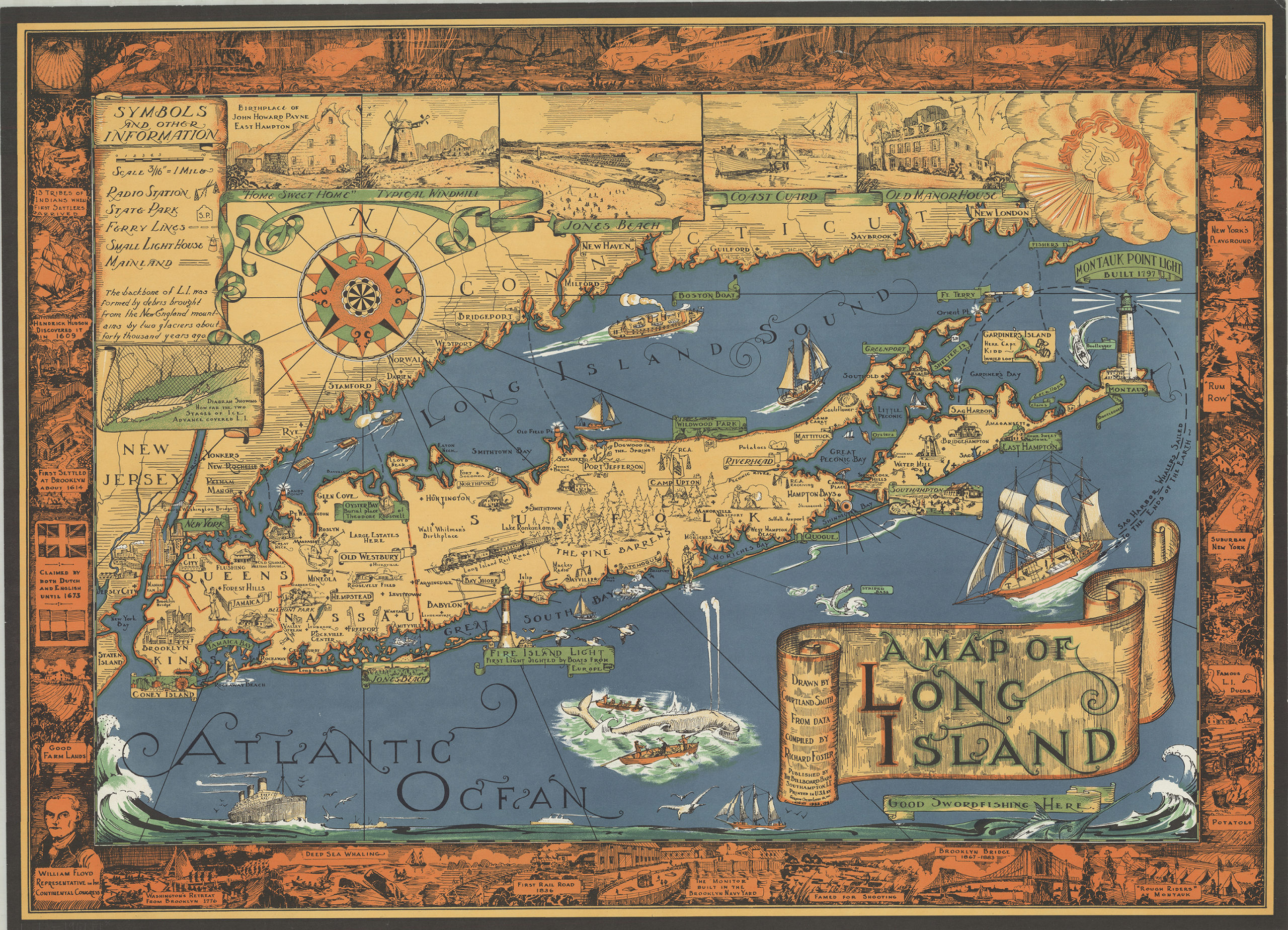
Creator
Smith, Courtland,Publisher
Brooklyn Historical SocietyCitation
A map of Long Island: drawn by Courtland Smith, from data compiled by Richard Foster; [ca. 1961], Map Collection, L.I.-1961.Fl; Brooklyn Historical Society.Scale
Scale [1:337,920] 3/16 inLoading zoom image...