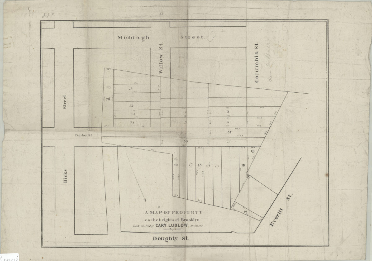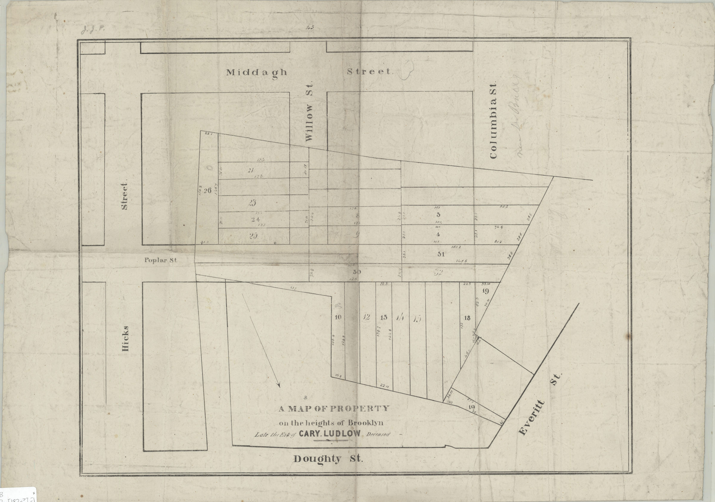
A map of property on the heights of Brooklyn, late the est[ate] of Cary Ludlow, deceased [182?]
Map No. B P-[182-?].Fl
Cadastral map covering area east from Everitt St. to Hicks St. and north from Middagh St. to Doughty St. Shows property (including lot numbers and dimensions). Oriented with north to the lower right. “45”–Upper center margin. BHS copy annotated in gray pencil.
Map area shown
Genre
Cadastral mapsRelation
Full catalog recordSize
35 × 45 cmDownload
Low Resolution Image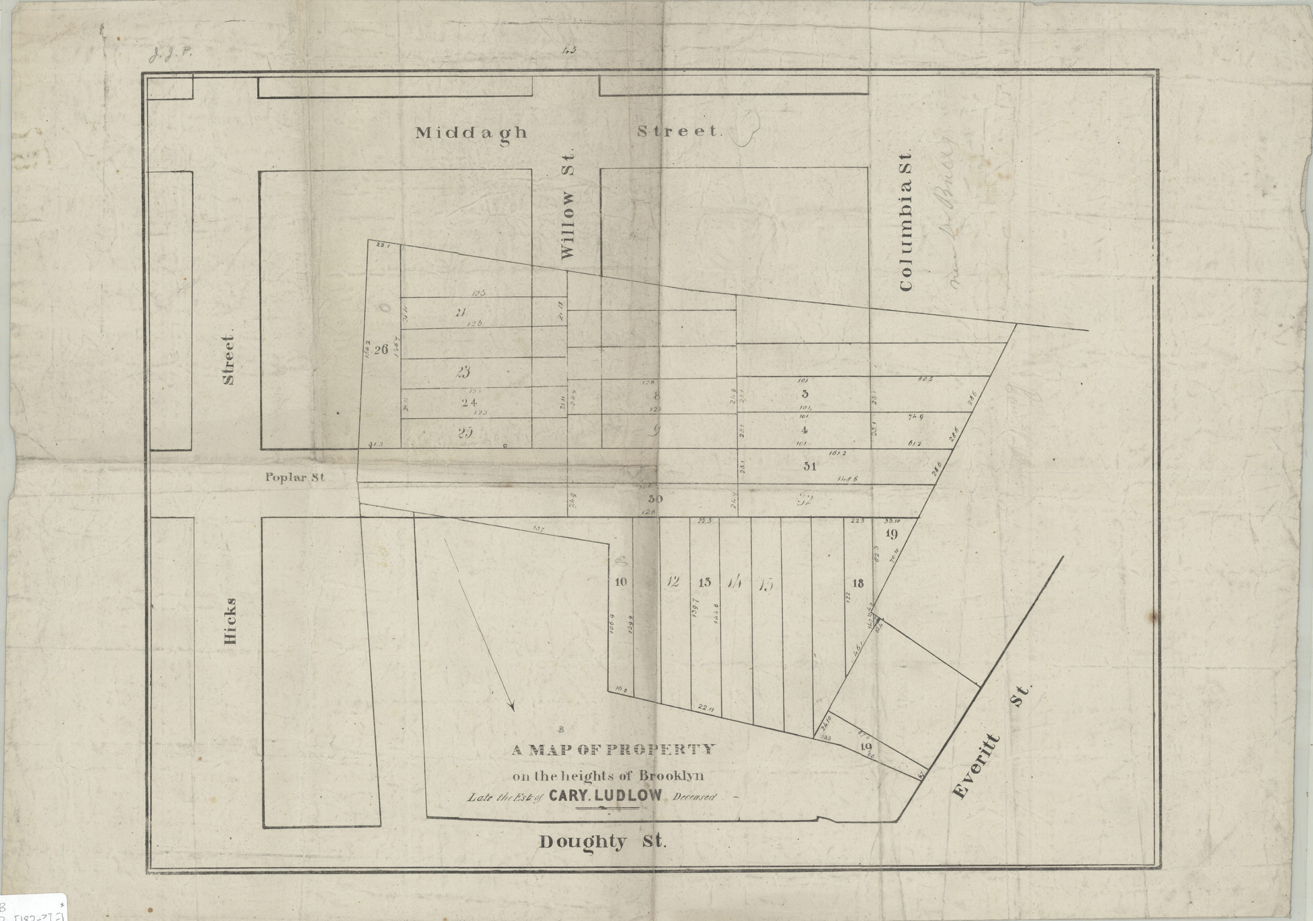
Creator
Publisher
Brooklyn Historical SocietyCitation
A map of property on the heights of Brooklyn, late the est[ate] of Cary Ludlow, deceased; [182?], Map Collection, B P-[182-?].Fl; Brooklyn Historical Society.Scale
Scale not givenLoading zoom image...