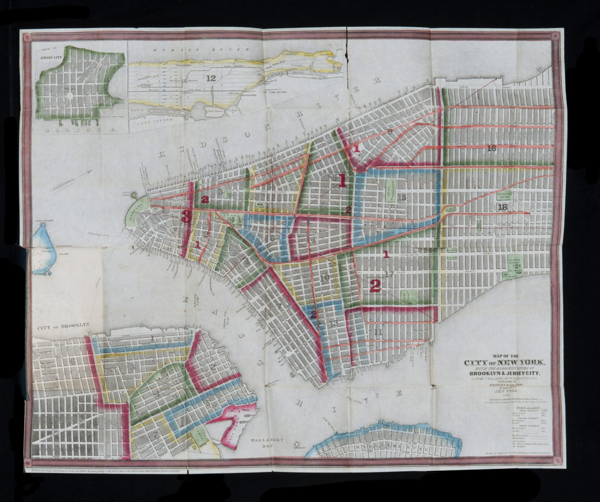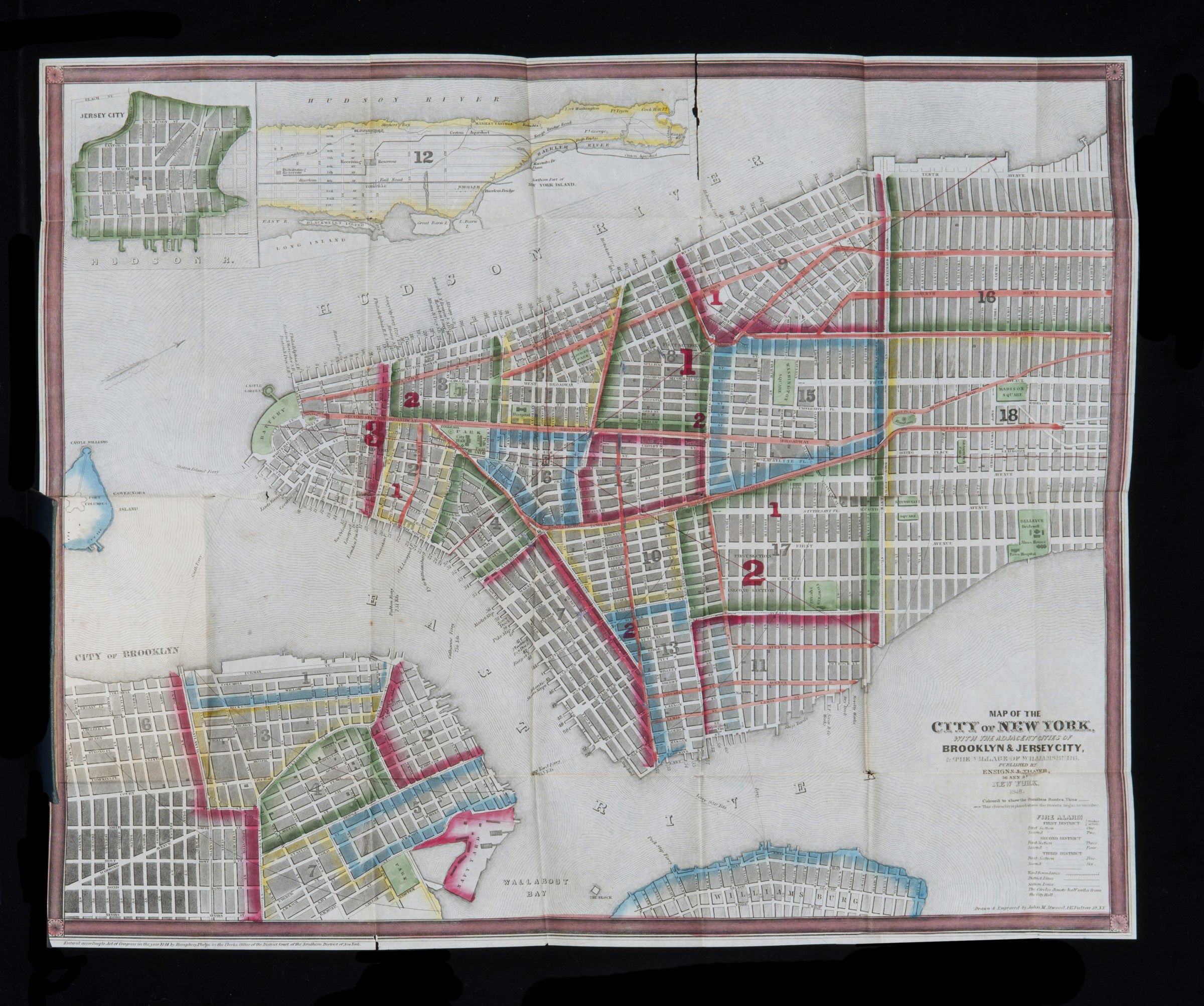
A map of the city and county of New York, with the adjacent cities of Brooklyn and Jersey City and the village of Williamsburg: with a street directory of the city of New York 1848
Covers Manhattan north to 32nd St. as well as from 41st St. north to Kings Bridge also covers Brooklyn north from Sackett St. to the Navy Yard and east to Nevins St. Covers Blackwell’s Island, Great Barn Island, and portions of Williamsburg, southern Queens, L.[Little] Barn Island, Governors Island, and Jersey City. Shows wards, districts, fire districts, the number of fire bells for each district, distances from City Hall, slips (including names of docking lines), piers, and ferry lines. Oriented with north to the upper right. “Entered according to Act of Congress in the year 1844 by Humphrey Phelps in the Clerks Office of the District Court of the Southern District of New York.” Street directory dated 1848. Includes key, decorative border, index to piers, and inset continuation map of Harlem and northern Manhattan. Map (41 x 51 cm., folded to 14 x 9 cm.) is mounted to inside back cover. Drawn and engraved by John M. Atwood.
Map area shown
Genre
MapRelation
Full catalog recordSize
41 × 51 cmDownload
Low Resolution Image
Creator
Atwood, John M.,Publisher
Brooklyn Historical SocietyCitation
A map of the city and county of New York, with the adjacent cities of Brooklyn and Jersey City and the village of Williamsburg: with a street directory of the city of New York; 1848, Map Collection, NYC-1848a.Folded; Brooklyn Historical Society.Scale
Scale not given