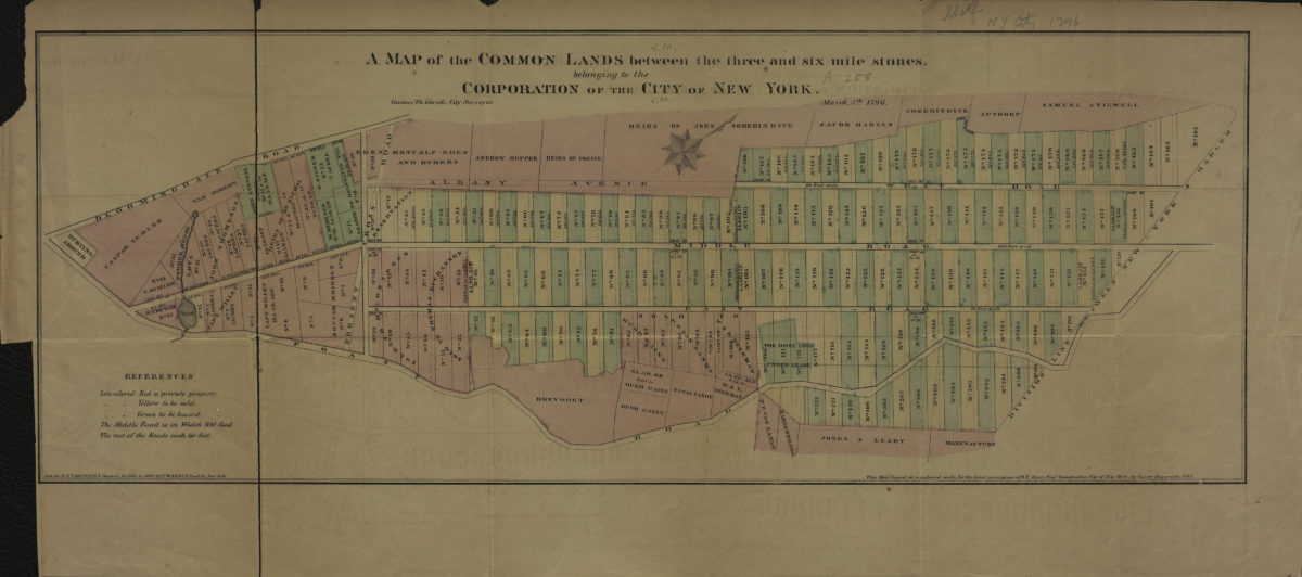
A map of the common lands between the three and six mile stones, belonging to the corporation of the city of New York: Casimer Th. Goerck, city surveyor [1861]
Map No. M-1796 (1861).Fl
Cadastral map covering the area later bounded by 23rd and 93rd St., 1st and 8th Ave., Manhattan. Shows property lot numbers and dimensions, sold and leased lots, and names of property owners. Facsimile of ms. map. “March 5th, 1796.” Oriented with north toward the upper right. “This Map Copied on a reduced scale by the kind permission of R.T. Haws, Esqr., Comptroller, City of New-York by George Hayward, 1861.” “Lith. for D.T. Valentine’s Manual, for 1861 by Geo. Hayward.” Includes note.
Map area shown
Relation
Full catalog recordSize
18 × 49 cmDownload
Low Resolution Image
Creator
Goerck, Casimir Th.,Publisher
Brooklyn Historical SocietyCitation
A map of the common lands between the three and six mile stones, belonging to the corporation of the city of New York: Casimer Th. Goerck, city surveyor; [1861], Map Collection, M-1796 (1861).Fl; Brooklyn Historical Society.Scale
Scale [ca. 1:12,500]Loading zoom image...