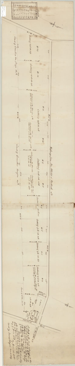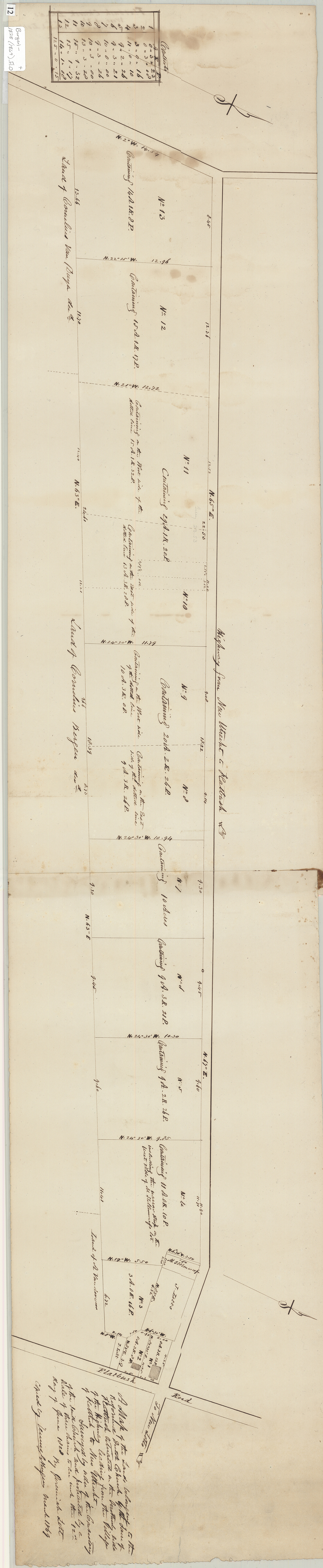

A map of the land belonging to the Reformed Dutch Church by the … [text illegible] of Flatbush, situated in the southerly side of the highway leading from the village of Flatbush to New Utrecht: 12th day of June 1828: March 1869
Map No. Bergen-1828 (1869).Fl.O
Cadastral map covering area in modern-day Flatbush and Prospect Park South. Shows property (including acreages and buildings), and names of landowners. Oriented with north to the upper right. Includes chart and notes.
Subjects
Places
Map area shown
Relation
Full catalog recordSize
26 × 125 cmDownload
Low Resolution ImageCreator
Lott, Jeremiah; Bergen, Teunis G., Lott, Jeremiah; Bergen, Teunis G.,Publisher
Brooklyn Historical Society, Brooklyn Historical SocietyCitation
A map of the land belonging to the Reformed Dutch Church by the … [text illegible] of Flatbush, situated in the southerly side of the highway leading from the village of Flatbush to New Utrecht: 12th day of June 1828:; March 1869, Map Collection, Bergen-1828 (1869).Fl.O; Brooklyn Historical Society.Scale
Scale [1:2,376] 1 in to 3Loading zoom image...