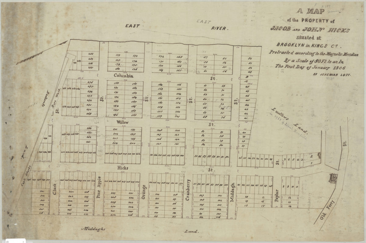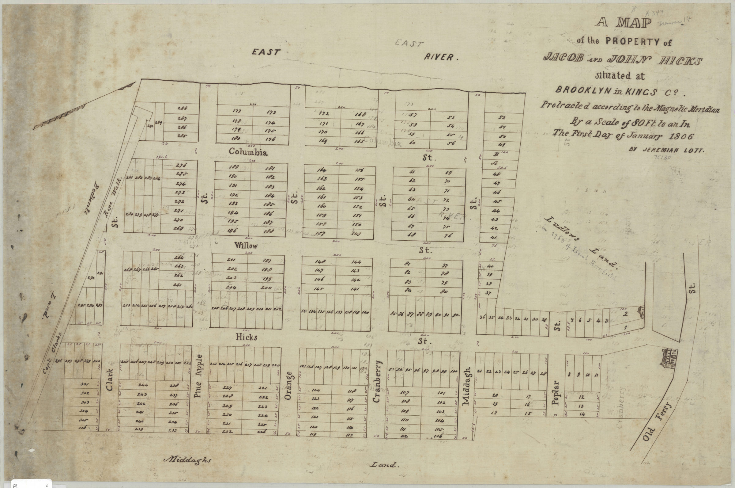
A map of the property of Jacob and John Hicks, situated at Brooklyn in Kings Co.: protracted according to the magnetic meridian by a scale of 80 ft. to an in., the first day of January 1806: by Jeremiah Lott January 1, 1806
Map No. B P-1806.Fl
Cadastral map covering area north from Clark St. to Old Ferry St. and west from approximately Hicks St. to the East River (modern-day Brooklyn Heights). Shows property (including lot numbers and dimensions), and names of landowners. Relief shown pictorially. Oriented with north to right.
Map area shown
Relation
Full catalog recordSize
41 × 62 cmDownload
Low Resolution Image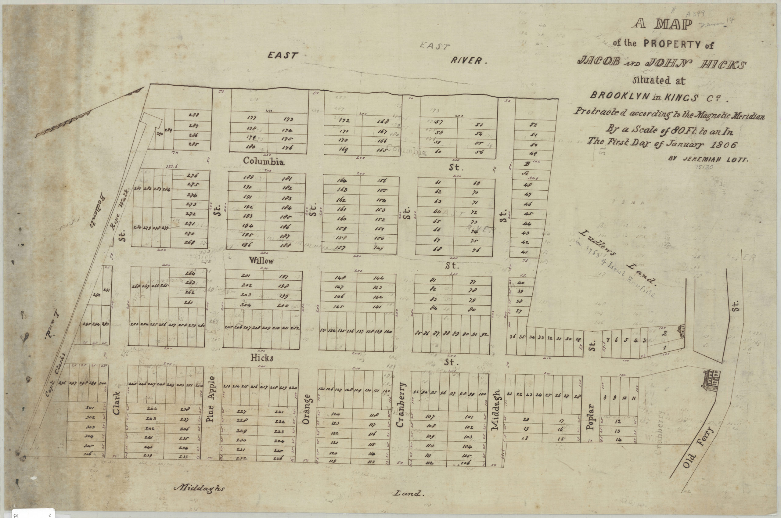
Creator
Lott, Jeremiah,Publisher
Brooklyn Historical SocietyCitation
A map of the property of Jacob and John Hicks, situated at Brooklyn in Kings Co.: protracted according to the magnetic meridian by a scale of 80 ft. to an in., the first day of January 1806: by Jeremiah Lott; January 1, 1806, Map Collection, B P-1806.Fl; Brooklyn Historical Society.Scale
Scale [1:960] 1 in to 80Loading zoom image...