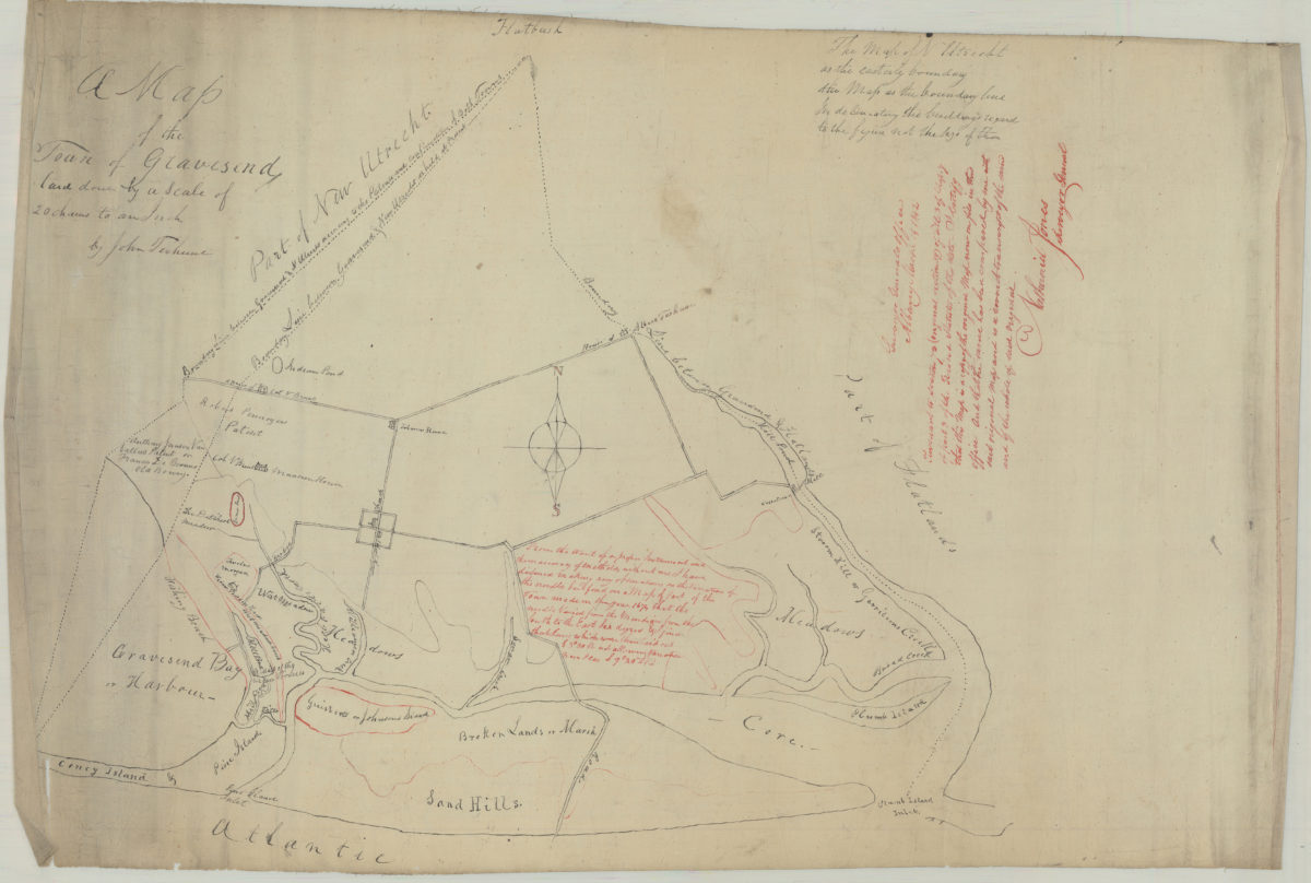
A map of the town of Gravesend: by John Terhune March 14, 1842
Map No. B P-1842.Fl
Cadastral map showing land patents, names of landowners, buildings, and landscape details. Base map is copy of an undated manuscript map includes annotations from Nathaniel Jones not found on original. “… this map is a copy of the original Map now on file in this office … Nathaniel Jones, Surveyor General.”
Map area shown
Relation
Full catalog recordSize
49 × 72 cmDownload
Low Resolution Image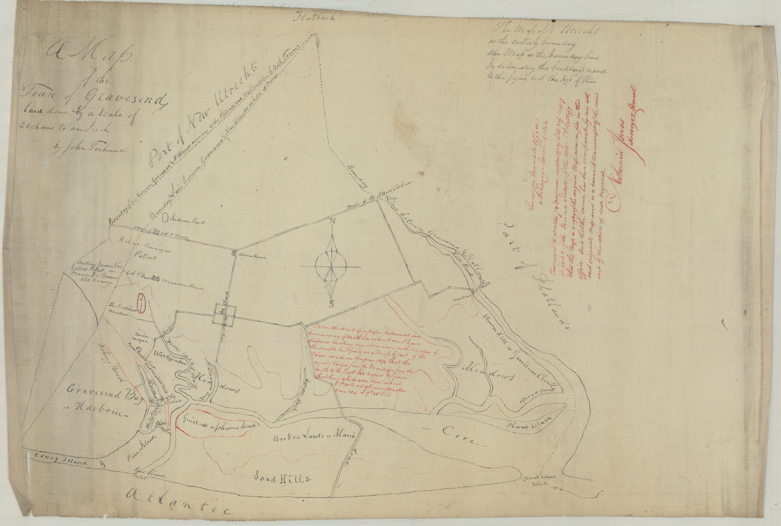
Creator
Terhune, John,Publisher
Brooklyn Historical SocietyCitation
A map of the town of Gravesend: by John Terhune; March 14, 1842, Map Collection, B P-1842.Fl; Brooklyn Historical Society.Scale
Scale [15,840] 1 in 20 chLoading zoom image...