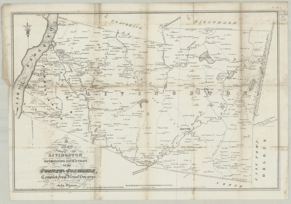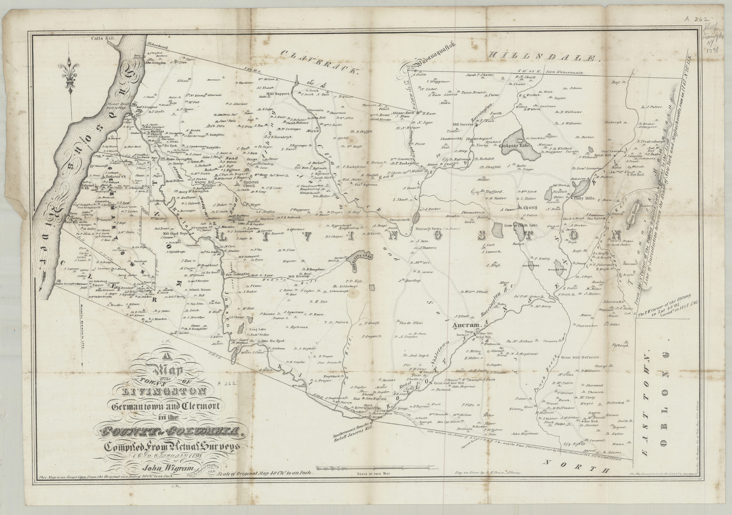
A map of the town’s of Livingston, Germantown, and Clermont in the County of Columbia: compiled from actual surveys in January 1798: [drawn by] John Wigram ; cop. by David Vaughan 1850
Map No. NYS-1798 (1850).Fl
General-content regional map of 3 towns (townships) in N.Y. State showing rural buildings and householders’ names. Also gives orientation data for the segment lines of the township boundaries. Relief shown by hachures. Does not show real property or cadastral data. “This map is an exact copy from the original on a scale of 80 ch’s to an inch.” “Scale of original map 40 ch’s to an inch.” “This map executed for the Doc. His. of St. of N.Y. by directions of the Hon. Ch’s Morgan, Sec. of State, May 1850, Albany.” N-YHS copy mounted on verso of “Quarantine chart of New York Harbor, 1873.”
Map area shown
Genre
Historical mapsRelation
Full catalog recordSize
40 × 57 cmDownload
Low Resolution Image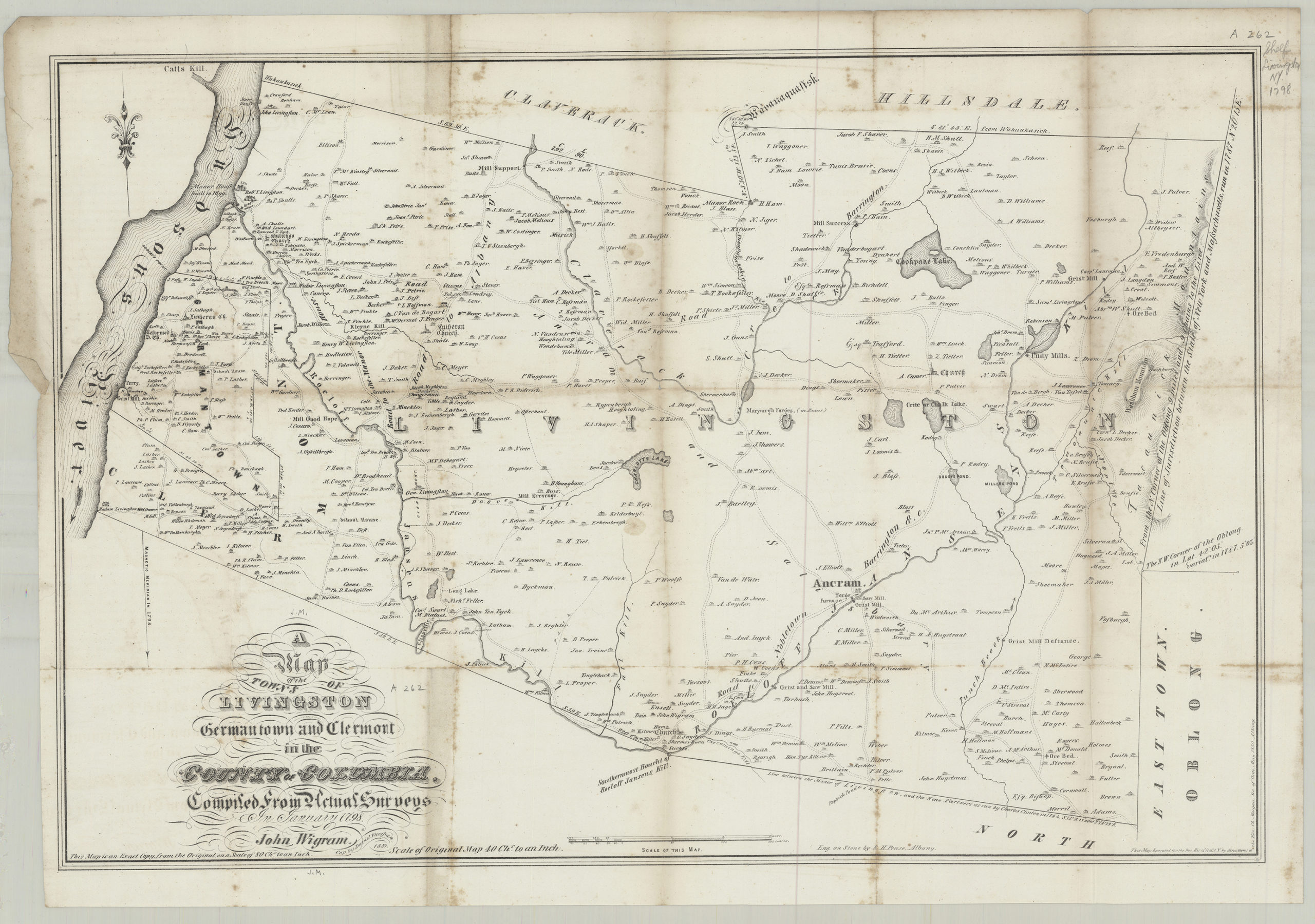
Creator
Wigram, John,Publisher
Brooklyn Historical SocietyCitation
A map of the town’s of Livingston, Germantown, and Clermont in the County of Columbia: compiled from actual surveys in January 1798: [drawn by] John Wigram ; cop. by David Vaughan; 1850, Map Collection, NYS-1798 (1850).Fl; Brooklyn Historical Society.Scale
Scale not givenLoading zoom image...