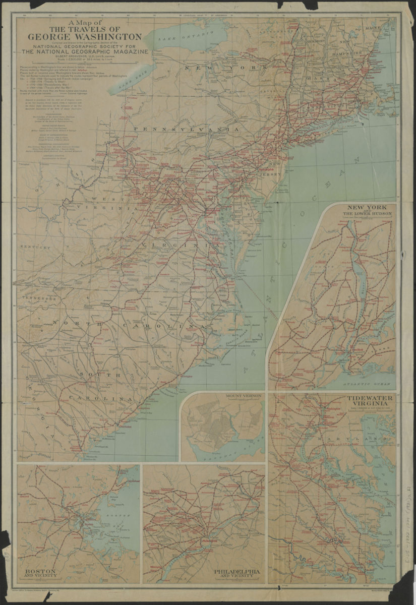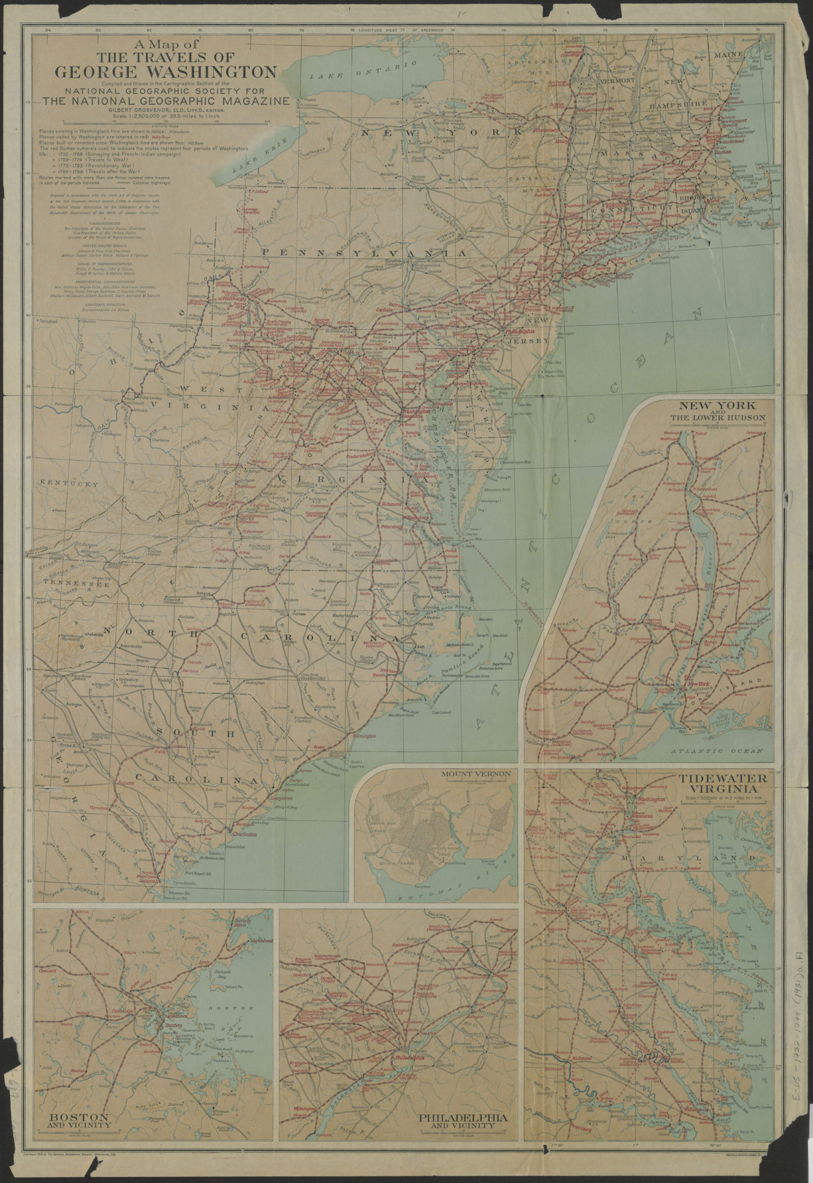
A map of the travels of George Washington: compiled and drawn in the Cartographic Section of the National Geographic Society for the National Geographic Magazine [ca. 1931]
Covers Eastern United States west from the Cumberland Gap, and north from Savannah, Georgia to Brunswick, Maine. Shows colonial highways, and travels of George Washington during the French and Indian Campaign, the Revolutionary War, after the Revolutionary War, and to the West. Relief shown by hachures. “Prepared in accordance with the Joint Act of Congress known as the 71st Congress, Second Session, S.3398, in cooperation with the United States Commission for the Celebration of the Two Hundredth Anniversary of the Birth of George Washington.” Includes key, and 5 insets. Insets: New York and the lower Hudson (Scale [ca. 1:312,580]) — Tidewater Virginia (Scale 1:900,000) — Mount Vernon (Scale [ca. 1:84,480]) — Philadelphia and vicinity (Scale [ca. 1:614,400]) — Boston and vicinity (Scale [ca. 1:312,580]). BHS has 3 copies.
Map area shown
Genre
Historical mapsRelation
Full catalog recordSize
73 × 51 cmDownload
Low Resolution Image
Creator
National Geographic Society (U.S.).; Cartographic Section,Publisher
Brooklyn Historical SocietyCitation
A map of the travels of George Washington: compiled and drawn in the Cartographic Section of the National Geographic Society for the National Geographic Magazine; [ca. 1931], Map Collection, E-US-1732-1799 (1931); Brooklyn Historical Society.Scale
Scale 1:2,500,000. 1 in t