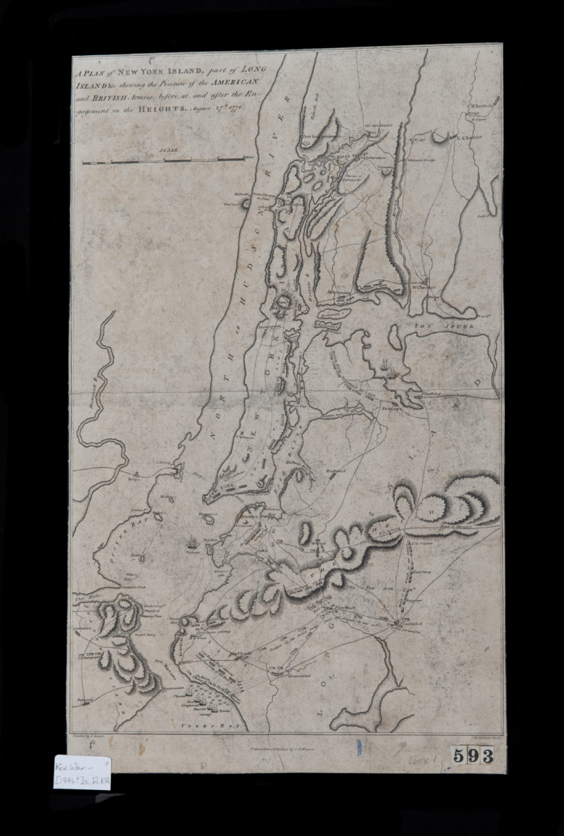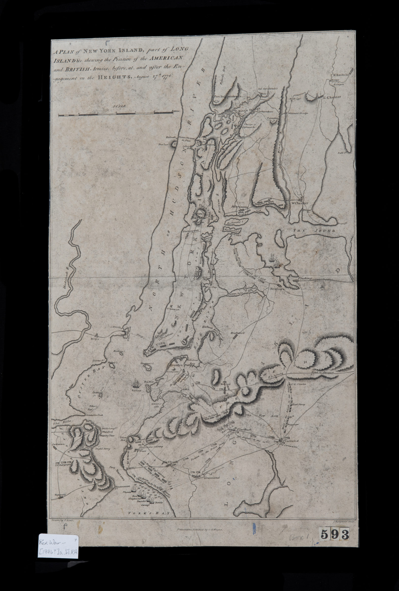
A plan of New York Island, part of Long Island &c., shewing the position of the American and British armies before, at, and after the Engagement on the Heights, August 27th, 1776: drawn by S. Lewis [1776]
Map No. Rev. War-[1776?]a.Fl.RA
Covers Brooklyn north from the Narrows to Greenpoint and east to approximately New Lots. Also covers Manhattan and portions of Queens, the Bronx, Staten Island, and New Jersey. Relief shown by hachures. Ships shown pictorially. “J.H. Seymour sculp.”–Lower right margin.
Map area shown
Relation
Full catalog recordSize
41 × 26 cmDownload
Low Resolution Image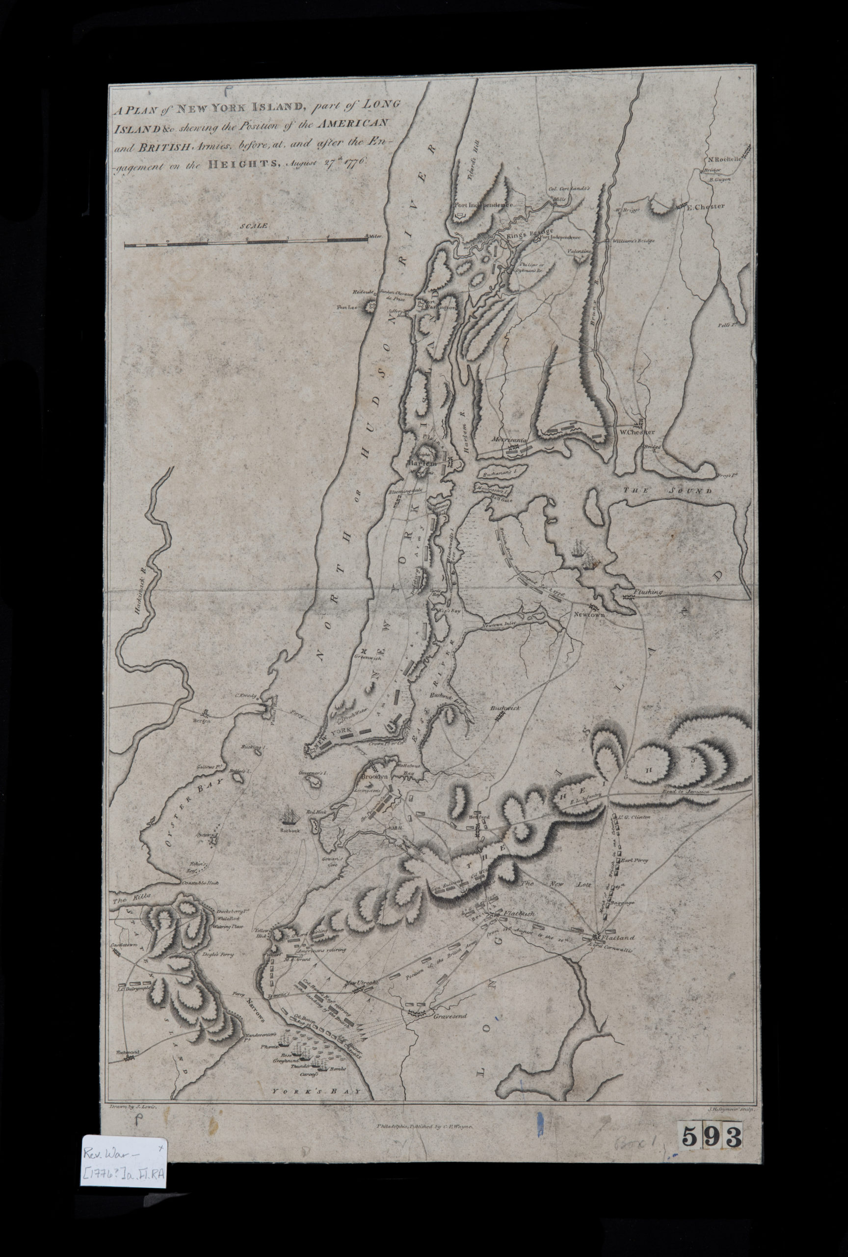
Creator
Lewis, Samuel,Publisher
Brooklyn Historical SocietyCitation
A plan of New York Island, part of Long Island &c., shewing the position of the American and British armies before, at, and after the Engagement on the Heights, August 27th, 1776: drawn by S. Lewis; [1776], Map Collection, Rev. War-[1776?]a.Fl.RA; Brooklyn Historical Society.Scale
Scale [ca. 1:98,423]Loading zoom image...